Category:Bolton-by-Bowland
Jump to navigation
Jump to search
English: Bolton-by-Bowland is a village and civil parish in the Ribble Valley district of Lancashire, England. Prior to 1974 the village was part of Bowland Rural District in the West Riding of Yorkshire.

village and civil parish in Lancashire, England _Aug2005.jpg) | |||||
| Upload media | |||||
| Instance of | |||||
|---|---|---|---|---|---|
| Location | Ribble Valley, Lancashire, North West England, England | ||||
| official website | |||||
 | |||||
Subcategories
This category has the following 5 subcategories, out of 5 total.
Media in category "Bolton-by-Bowland"
The following 200 files are in this category, out of 339 total.
(previous page) (next page)-
 A bend in the road - geograph.org.uk - 4667267.jpg 4,592 × 3,056; 6.69 MB
-
 A gate with a view of Pendle Hill - geograph.org.uk - 4647353.jpg 4,592 × 3,056; 6.24 MB
-
 A meander of Skirden Beck - geograph.org.uk - 4221256.jpg 800 × 600; 161 KB
-
 A mix of grazers - geograph.org.uk - 4221386.jpg 640 × 480; 93 KB
-
 A pheasant - geograph.org.uk - 4646888.jpg 4,314 × 2,614; 5.01 MB
-
 A pheasant on a gate - geograph.org.uk - 4651385.jpg 2,984 × 2,178; 3.28 MB
-

-
 A shady corner, Bolton by Bowland - geograph.org.uk - 1376337.jpg 640 × 480; 184 KB
-
 A temporary store for baled hay - geograph.org.uk - 4646153.jpg 4,585 × 2,584; 7.94 MB
-

-
 Access Lane from Lower Gill - geograph.org.uk - 3057014.jpg 4,320 × 3,240; 3.72 MB
-
 Access to Alder House - geograph.org.uk - 3299338.jpg 4,320 × 3,240; 4.05 MB
-
 Access to Scott Laithe - geograph.org.uk - 3308139.jpg 4,320 × 3,240; 3.56 MB
-

-
 Anna Lane Head - geograph.org.uk - 4667212.jpg 3,997 × 2,494; 6 MB
-
 Approaching Hungrill - geograph.org.uk - 3299291.jpg 4,320 × 3,240; 3.56 MB
-
 At least the horse has his eye on the road - geograph.org.uk - 4621317.jpg 4,411 × 2,931; 7.86 MB
-
 Awaiting baling - geograph.org.uk - 4605636.jpg 4,592 × 3,056; 6.22 MB
-
 B6478 at Brock Thorn - geograph.org.uk - 4247658.jpg 640 × 481; 34 KB
-
 Bales in a field by Clough Wood - geograph.org.uk - 4648050.jpg 4,284 × 2,597; 7.84 MB
-
 Barn conversion, Brock Thorn - geograph.org.uk - 5140071.jpg 640 × 480; 68 KB
-
 Barn, Raygill Moss - geograph.org.uk - 5870723.jpg 640 × 480; 52 KB
-
 Base of Cross - geograph.org.uk - 2454761.jpg 4,000 × 3,000; 4.75 MB
-
 Bay Gate - geograph.org.uk - 4648066.jpg 3,813 × 2,528; 7.86 MB
-
 Beside the Ribble - geograph.org.uk - 2308889.jpg 1,600 × 1,198; 444 KB
-
 Between Hungrill and Wycongill Farm - geograph.org.uk - 3299106.jpg 4,320 × 3,240; 4.76 MB
-
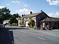
 Bolton by Bowland - geograph.org.uk - 868109.jpg 640 × 480; 87 KB
-

-
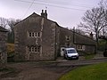
 Bolton Hall Farm - geograph.org.uk - 1102583.jpg 640 × 480; 90 KB
-
 Bolton Park - geograph.org.uk - 3300535.jpg 4,320 × 3,240; 4.7 MB
-
 Bolton-by-Bowland primary school and school house - geograph.org.uk - 5922658.jpg 5,075 × 3,813; 5.45 MB
-
 Bolton-by-Bowland Telephone Exchange, Lancs - geograph.org.uk - 5565200.jpg 2,592 × 1,944; 1.4 MB
-
 Bolton-by-Bowland Village Green - geograph.org.uk - 1919430.jpg 640 × 480; 190 KB
-

-
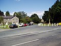
 Bolton-By-Bowland, Lancashire (NeilClifton) Aug2005.jpg 640 × 480; 100 KB
-
 Bolton-by-Bowland, Pendlewood View - geograph.org.uk - 3015792.jpg 3,456 × 2,304; 3.32 MB
-
 Bolton-by-Bowland, Signpost restored - geograph.org.uk - 2491001.jpg 3,264 × 2,448; 5.58 MB
-
 Bolton-by-Bowland, Stump Cross Cottage - geograph.org.uk - 3015785.jpg 3,456 × 2,304; 3.19 MB
-
 Bond Beck - geograph.org.uk - 4605888.jpg 4,592 × 3,056; 7.79 MB
-
 Born stubborn - geograph.org.uk - 4604024.jpg 4,067 × 2,652; 7.72 MB
-
 Bow Laithe - geograph.org.uk - 5133252.jpg 640 × 480; 75 KB
-

-
 Bridge over Bond Beck on the B6478, Bolton by Bowland - geograph.org.uk - 5869368.jpg 2,000 × 1,500; 1.25 MB
-

-

-
 Broken Footbridge over Hell Syke - geograph.org.uk - 3300216.jpg 4,320 × 3,240; 4.93 MB
-
 Building north of Monubent Head - geograph.org.uk - 1924961.jpg 640 × 480; 164 KB
-
 Butcher's Laithe leading to Far Knotts - geograph.org.uk - 4674005.jpg 4,592 × 3,056; 7.77 MB
-
 Butter Fields - geograph.org.uk - 2382640.jpg 640 × 480; 151 KB
-
 Cattle and field - geograph.org.uk - 4647392.jpg 4,592 × 2,047; 6.55 MB
-
 Cattle near Bolton by Bowland - geograph.org.uk - 4549965.jpg 1,024 × 768; 890 KB
-
 Close up, Elizabeth II postbox, Closes Hall Lodge - geograph.org.uk - 5871243.jpg 1,649 × 2,839; 1.06 MB
-
 Close up, Elizabeth II postbox, Forest Becks - geograph.org.uk - 5134980.jpg 1,318 × 2,527; 678 KB
-
 Closes Hall Lodge - geograph.org.uk - 2274740.jpg 2,592 × 1,944; 1.57 MB
-
 Closes Hall Lodge - geograph.org.uk - 5871249.jpg 3,405 × 2,297; 1.58 MB
-
 Coach and Horses - Bolton by Bowland - geograph.org.uk - 2802378.jpg 1,000 × 669; 264 KB
-

-
 Collapsed footbridge on path from Butter Fields to Beckfoot - geograph.org.uk - 5869376.jpg 2,000 × 1,500; 1.31 MB
-
 Copy Nook in Holden - geograph.org.uk - 4833784.jpg 1,500 × 979; 133 KB
-
 Corgill - geograph.org.uk - 4647986.jpg 4,044 × 2,026; 4.95 MB
-
 Cottages at Bolton by Bowland - geograph.org.uk - 2622263.jpg 4,000 × 3,000; 5.78 MB
-
 Cottages in Holden - geograph.org.uk - 3066297.jpg 4,000 × 3,000; 5.24 MB
-
 Cottages, Bolton-by-Bowland - geograph.org.uk - 5923723.jpg 4,809 × 3,167; 4.31 MB
-
 Cottages, Bolton-by-Bowland - geograph.org.uk - 5923748.jpg 5,690 × 4,000; 6.84 MB
-
 Cottages, Gisburn Road, Bolton-by-Bowland - geograph.org.uk - 5922648.jpg 4,941 × 3,709; 5.75 MB
-

-
 Cow House Hill - geograph.org.uk - 2622277.jpg 3,480 × 2,510; 4.44 MB
-
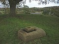
 Cross base, Bolton-by-Bolton.jpg 1,024 × 768; 881 KB
-

-
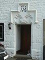
 Door and Royal arms, St Peter and St Paul's church - geograph.org.uk - 5922618.jpg 3,424 × 4,574; 3.9 MB
-
-
 Driveway to Spring Head Farm - geograph.org.uk - 3298290.jpg 4,320 × 3,240; 4.25 MB
-
 Elizabeth II postbox, Closes Hall Lodge - geograph.org.uk - 5871244.jpg 3,058 × 2,221; 1.56 MB
-
 Elizabeth II postbox, Forest Becks - geograph.org.uk - 5134977.jpg 2,145 × 1,849; 809 KB
-
 Entrance drive to Wycongill Farm - geograph.org.uk - 2555223.jpg 640 × 426; 330 KB
-
 Entrance to Bolton Hall drive - geograph.org.uk - 5922630.jpg 4,730 × 3,547; 4.51 MB
-
 Entrance to Bolton Hall Farm - geograph.org.uk - 2308899.jpg 1,600 × 1,198; 729 KB
-
 Entrance to Holden Clough Nursery - geograph.org.uk - 2555226.jpg 640 × 426; 310 KB
-
 Entrance to Holden Clough Nursery 1 - geograph.org.uk - 3426716.jpg 1,024 × 768; 346 KB
-
 Entrance to Holden Clough Nursery 2 - geograph.org.uk - 3426724.jpg 1,024 × 768; 321 KB
-
 Entrance to King Henry Mews - geograph.org.uk - 1924827.jpg 640 × 480; 195 KB
-
 Entrance to King Henry Mews - geograph.org.uk - 2308917.jpg 1,600 × 1,198; 692 KB
-
 Eorest Becks Bridge and cottages - geograph.org.uk - 4247496.jpg 640 × 481; 43 KB
-
 Farm access tracks, Monubent - geograph.org.uk - 1941800.jpg 640 × 480; 53 KB
-
 Farm buildings at Fooden - geograph.org.uk - 2274756.jpg 2,592 × 1,944; 1.3 MB
-
 Farm buildings, Bolton Peel - geograph.org.uk - 5133256.jpg 640 × 480; 64 KB
-
 Farm entrance to The Veepings - geograph.org.uk - 2555235.jpg 640 × 426; 269 KB
-
 Farm track entrance near Anna Lane Head - geograph.org.uk - 2555230.jpg 640 × 426; 259 KB
-
 Farm track to Lower Heights - geograph.org.uk - 2555245.jpg 640 × 426; 263 KB
-
 Farmhouse at Fooden-geograph.org.uk-2274763.jpg 2,592 × 1,944; 1.36 MB
-
 Field adjacent Lower Monubent Farm - geograph.org.uk - 1941769.jpg 640 × 480; 74 KB
-
 Field entrance off the B6478 - geograph.org.uk - 5140068.jpg 640 × 480; 78 KB
-
 Field gate south-west of Raygill Moss - geograph.org.uk - 2274751.jpg 2,592 × 1,944; 1.61 MB
-
 Field shed at Bolton-by-Bowland, Lancashire.jpg 640 × 480; 154 KB
-
 Fingerpost sign, Bolton-by-Bowland - geograph.org.uk - 5923572.jpg 5,045 × 3,621; 5.09 MB
-
 Font, St Peter and St Paul's church, Bolton-by-Bowland - geograph.org.uk - 5921282.jpg 4,000 × 4,773; 5.05 MB
-
 Footbridge across Skirden Beck - geograph.org.uk - 5003502.jpg 4,000 × 3,000; 3.93 MB
-
 Footbridge at Butter Fields, Bolton by Bowland - geograph.org.uk - 5869365.jpg 2,000 × 1,470; 1.3 MB
-
 Footbridge over Holden Beck - geograph.org.uk - 4221268.jpg 640 × 480; 151 KB
-
 Footbridge over Holden Beck near Bolton Peel Farm - geograph.org.uk - 2308751.jpg 1,600 × 1,198; 821 KB
-
 Footbridge over Skirden Beck - geograph.org.uk - 3300528.jpg 4,320 × 3,240; 4.82 MB
-
 Footpath above Cow House Hill - geograph.org.uk - 4221220.jpg 800 × 600; 136 KB
-
 Footpath in Bolton Close Plantation - geograph.org.uk - 4221202.jpg 640 × 480; 162 KB
-
 Footpath south from Skirden Bridge - geograph.org.uk - 4221241.jpg 640 × 480; 102 KB
-
 Footpath through newly-planted woodland - geograph.org.uk - 4221271.jpg 640 × 480; 128 KB
-
 Ford and footbridge at Skirden Beck - geograph.org.uk - 4549963.jpg 1,024 × 768; 778 KB
-
 Ford and footbridge over Skirden Beck - geograph.org.uk - 2308767.jpg 1,600 × 1,198; 672 KB
-
 Ford at Skirden Beck - geograph.org.uk - 4549962.jpg 1,024 × 768; 876 KB
-
 Ford on the Holden Beck - geograph.org.uk - 4039242.jpg 3,872 × 2,592; 4.74 MB
-
 Ford on the Holden Beck - geograph.org.uk - 4606740.jpg 1,084 × 725; 410 KB
-
 Ford on the Skirden Beck - geograph.org.uk - 4606734.jpg 1,084 × 725; 420 KB
-
 Forest Becks Bridge - geograph.org.uk - 533828.jpg 640 × 480; 211 KB
-
 Forest Becks Brow - geograph.org.uk - 3298339.jpg 4,320 × 3,240; 3.26 MB
-
 Forest Becks Brow to Wigglesworth - geograph.org.uk - 4833816.jpg 1,500 × 999; 319 KB
-
 Former post office, Bolton by Bowland - geograph.org.uk - 1376268.jpg 640 × 468; 106 KB
-
 Freshly baled - geograph.org.uk - 4605610.jpg 4,462 × 2,882; 7.9 MB
-
 Gate on a footpath - geograph.org.uk - 4549950.jpg 1,024 × 768; 733 KB
-
 Gateway to Boococks - geograph.org.uk - 2382662.jpg 640 × 480; 109 KB
-
 Gisburn Road at Moorfield Plantation - geograph.org.uk - 4246634.jpg 640 × 481; 93 KB
-
 Gisburn Road near Raygill Moss - geograph.org.uk - 4246633.jpg 640 × 480; 74 KB
-

-
 Gisburn Road west of Raygill Moss - geograph.org.uk - 1924964.jpg 640 × 480; 160 KB
-
 Gisburn Road, Bolton-by-Bowland - geograph.org.uk - 1924833.jpg 640 × 480; 189 KB
-
 Gisburn Road, Bolton-by-Bowland - geograph.org.uk - 1924844.jpg 640 × 480; 162 KB
-
 Gisburn Road, Raygill Moss - geograph.org.uk - 5870726.jpg 640 × 496; 71 KB
-
 Grassland beside Stable Wood - geograph.org.uk - 5871255.jpg 640 × 480; 91 KB
-
 Grassland towards Admiral's Wood - geograph.org.uk - 5870727.jpg 640 × 480; 89 KB
-
 Grassland, Raygill Moss - geograph.org.uk - 5870724.jpg 640 × 480; 46 KB
-
 Grazing near Brock Thorn - geograph.org.uk - 5140077.jpg 640 × 480; 59 KB
-
 Grazing near Holden - geograph.org.uk - 5133264.jpg 640 × 480; 54 KB
-
 Grazing near Holden - geograph.org.uk - 5133269.jpg 640 × 480; 78 KB
-
 Grazing near New Laithe - geograph.org.uk - 5134070.jpg 640 × 480; 57 KB
-
 Grazing sheep at Alder House Farm - geograph.org.uk - 4667132.jpg 4,592 × 3,056; 7.08 MB
-
 Grazing, Bolton Peel - geograph.org.uk - 5133255.jpg 640 × 480; 80 KB
-
 Grazing, Bolton-by-Bowland - geograph.org.uk - 5134058.jpg 640 × 480; 53 KB
-
 Grazing, Forest Becks - geograph.org.uk - 5134067.jpg 640 × 480; 60 KB
-
 Grazing, Monubent Head - geograph.org.uk - 5871262.jpg 640 × 480; 67 KB
-
 Hatchment, St Peter and St Paul's church, Bolton-by-Bowland - geograph.org.uk - 5921342.jpg 4,214 × 3,330; 3.78 MB
-
 Hatchment, St Peter and St Paul's church, Bolton-by-Bowland - geograph.org.uk - 5921356.jpg 4,579 × 3,834; 4.04 MB
-
 Hatchment, St Peter and St Paul's church, Bolton-by-Bowland - geograph.org.uk - 5922602.jpg 4,386 × 3,744; 3.91 MB
-
 Heading north east, Bow Laithe - geograph.org.uk - 5133253.jpg 640 × 480; 57 KB
-
 Heading north east, Forest Becks - geograph.org.uk - 5134068.jpg 640 × 480; 70 KB
-
 Heading north towards Wigglesworth - geograph.org.uk - 5134059.jpg 640 × 480; 97 KB
-
 Heading north west, Bolton Peel - geograph.org.uk - 5133260.jpg 640 × 480; 70 KB
-
 Hellifield Road - geograph.org.uk - 1941791.jpg 640 × 480; 117 KB
-
 Hellifield Road - geograph.org.uk - 3298269.jpg 4,320 × 3,240; 4.13 MB
-
 Hellifield Road - geograph.org.uk - 5871258.jpg 640 × 480; 119 KB
-
 Hellifield Road - geograph.org.uk - 5871304.jpg 640 × 480; 80 KB
-
 Hellifield Road near Poor Parts - geograph.org.uk - 4646088.jpg 4,187 × 2,787; 6.94 MB
-
 Hellifield Road north of Monubent Head - geograph.org.uk - 1924962.jpg 640 × 480; 163 KB
-
 Holden Beck - geograph.org.uk - 4584312.jpg 4,360 × 2,981; 7.71 MB
-
 Holden Chapel - geograph.org.uk - 3066291.jpg 4,000 × 3,000; 4.96 MB
-
 Holden Clough - geograph.org.uk - 5600055.jpg 640 × 480; 469 KB
-
 Holden Lane - geograph.org.uk - 2393824.jpg 640 × 480; 154 KB
-
 Holden Lane - geograph.org.uk - 3940589.jpg 4,320 × 3,240; 4.74 MB
-
 Holden Lane - geograph.org.uk - 5600056.jpg 640 × 480; 411 KB
-
 Holden Lane at Westmoor - geograph.org.uk - 4667172.jpg 4,238 × 2,515; 5.82 MB
-
 Holden Lane outside Greaves Farm looking North - geograph.org.uk - 3299430.jpg 4,320 × 3,240; 5.65 MB
-
 Holden Lane outside Greaves Farm looking South - geograph.org.uk - 3299417.jpg 4,320 × 3,240; 3.39 MB
-
 Holden village - geograph.org.uk - 3066301.jpg 4,000 × 3,000; 6.64 MB
-
 House, Forest Becks - geograph.org.uk - 5134062.jpg 640 × 480; 80 KB
-

-
 Kirk Beck Bridge, Bolton-by-Bowland - geograph.org.uk - 1924863.jpg 640 × 480; 162 KB
-

-
 Knotts - geograph.org.uk - 2382652.jpg 640 × 480; 144 KB
-

-
 KX100 Telephone Box in Bolton-by-Bowland - geograph.org.uk - 5565137.jpg 1,944 × 2,592; 937 KB
-
 Lane bends by Oaktree Nursery - geograph.org.uk - 4247450.jpg 640 × 481; 54 KB
-
 Lane junction west of Howgill's - geograph.org.uk - 4247437.jpg 640 × 480; 55 KB
-
 Lane south of Middle Flass Lodge - geograph.org.uk - 4247519.jpg 640 × 481; 77 KB
-
 Ling Hill Farm - geograph.org.uk - 4668832.jpg 4,352 × 2,256; 7.84 MB
-
 Looking down Skirden Beck... - geograph.org.uk - 5923757.jpg 6,000 × 4,000; 7.28 MB
-
 Lower Copy Nook Farm - geograph.org.uk - 5133265.jpg 640 × 480; 47 KB
-
 Lower Monubent Farm - geograph.org.uk - 1941762.jpg 640 × 480; 86 KB
-
 Lower Monubent Farm Cottage - geograph.org.uk - 1941775.jpg 640 × 480; 80 KB
-
-
 Minor road towards Wigglesworth - geograph.org.uk - 5134056.jpg 640 × 480; 60 KB
-
 Minor road towards Wigglesworth - geograph.org.uk - 5134071.jpg 640 × 480; 110 KB
-
 Minor road, Forest Becks - geograph.org.uk - 5134982.jpg 2,606 × 1,745; 1.07 MB
-
 Modern Barn near Forest Becks - geograph.org.uk - 3298322.jpg 4,320 × 3,240; 3.59 MB
-
 Monubent Head - geograph.org.uk - 5871299.jpg 640 × 480; 51 KB
-
 Monubent Lane (track) - geograph.org.uk - 4647060.jpg 4,592 × 3,056; 6.15 MB
-
 Monubent Lane (track) - geograph.org.uk - 4651401.jpg 3,492 × 2,290; 7.45 MB
-
 Monubent Lane - geograph.org.uk - 2274734.jpg 2,592 × 1,944; 1.69 MB
-
 Monubent Lane - geograph.org.uk - 2274737.jpg 2,592 × 1,944; 1.6 MB
-
 New restaurant Holden Clough Nursery - geograph.org.uk - 3426733.jpg 1,024 × 768; 320 KB
-

-
 Nos 21 23, Main Street, Bolton-by-Bowland (geograph 1790643).jpg 640 × 480; 104 KB
-
 Nos 9&11, Main Street, Bolton-by-Bowland (geograph 1790697).jpg 630 × 472; 125 KB
-

-
 Oaktree Nursery - geograph.org.uk - 4647088.jpg 4,016 × 2,672; 7.85 MB
-
 Old Direction Sign - Signpost (geograph 6096220).jpg 478 × 640; 361 KB
-

-
 Old Wayside Cross (geograph 6558883).jpg 960 × 720; 142 KB
-
 Ordnance Survey Cut Mark - geograph.org.uk - 4679176.jpg 4,000 × 3,000; 3.49 MB
-
 Ordnance Survey Cut Mark - geograph.org.uk - 4679212.jpg 4,000 × 3,000; 4.48 MB
-
 Ordnance Survey Cut Mark - geograph.org.uk - 4679246.jpg 4,000 × 3,000; 4.3 MB
-
 Ordnance Survey Cut Mark - geograph.org.uk - 4707442.jpg 4,000 × 3,000; 3.17 MB
-
 Ordnance Survey Cut Mark - geograph.org.uk - 4707478.jpg 4,000 × 3,000; 3.65 MB
-
 Ordnance Survey Cut Mark - geograph.org.uk - 5003493.jpg 4,000 × 3,000; 4.64 MB


_-_geograph.org.uk_-_4647060.jpg)
_-_geograph.org.uk_-_4651401.jpg)


.jpg)
.jpg)


.jpg)

.jpg)


