Category:Boldron
Jump to navigation
Jump to search
English: Boldron is a village in the Pennines of England, situated close to Barnard Castle. It was historically located in the North Riding of Yorkshire, but along with the rest of the former Startforth Rural District it was transferred to County Durham for administrative and ceremonial purposes on 1 April 1974, under the provisions of the Local Government Act 1972.

village in the United Kingdom  | |||||
| Upload media | |||||
| Instance of | |||||
|---|---|---|---|---|---|
| Location | County Durham, North East England, England | ||||
 | |||||
Media in category "Boldron"
The following 122 files are in this category, out of 122 total.
-
 A67 towards Bowes - geograph.org.uk - 4731775.jpg 640 × 403; 43 KB
-
 A67 towards Bowes - geograph.org.uk - 4731783.jpg 640 × 480; 62 KB
-
 Approaching Smart Gill Farm - geograph.org.uk - 5441700.jpg 5,184 × 3,456; 6.48 MB
-
 Ash Trees on field boundary east of Cottage Farm - geograph.org.uk - 2237598.jpg 4,320 × 3,240; 5.37 MB
-
 Ash Trees on field boundary on Cottage Farm - geograph.org.uk - 2237510.jpg 4,320 × 3,240; 5.77 MB
-
 Aurora Borealis from Boldron - geograph.org.uk - 1190216.jpg 640 × 427; 17 KB
-
 Autumn maple at the Manor House - geograph.org.uk - 2182788.jpg 4,160 × 3,120; 2.12 MB
-
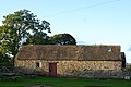
 Barn and pasture, Boldron - geograph.org.uk - 2809006.jpg 640 × 427; 119 KB
-
 Barn conversion east of Boldron village - geograph.org.uk - 1626553.jpg 640 × 427; 110 KB
-
 Birch windbreak - geograph.org.uk - 1737036.jpg 640 × 500; 122 KB
-
 Blades Field Farm - geograph.org.uk - 6345468.jpg 2,703 × 779; 538 KB
-
 Boldron House and Newton Cottage - geograph.org.uk - 1737969.jpg 640 × 420; 113 KB
-
 Boldron Lane - geograph.org.uk - 2184085.jpg 3,240 × 3,840; 1.97 MB
-
 Boldron Primitive Methodist Chapel - geograph.org.uk - 1639963.jpg 640 × 420; 98 KB
-
 Boldron Quoits store - geograph.org.uk - 1190236.jpg 640 × 427; 77 KB
-
 Boldron village - geograph.org.uk - 5258234.jpg 640 × 480; 267 KB
-
 Boldron Village Hall - geograph.org.uk - 1639954.jpg 640 × 520; 113 KB
-
 Boldron village well - geograph.org.uk - 1640112.jpg 640 × 460; 126 KB
-
 Boldron's tiny Post Office - geograph.org.uk - 1190234.jpg 640 × 427; 51 KB
-
 Bowes Gate Cottages - geograph.org.uk - 6345470.jpg 1,794 × 1,065; 633 KB
-
 Bridge carrying the A67 - geograph.org.uk - 5604941.jpg 1,499 × 761; 993 KB
-
 Buildings at North Field Farm - geograph.org.uk - 5441683.jpg 5,184 × 3,456; 6.5 MB
-
 Christmas day on Boldron village green - geograph.org.uk - 1640004.jpg 640 × 460; 120 KB
-
 Clapper stile on the Boldron Well walk - geograph.org.uk - 1671202.jpg 512 × 640; 118 KB
-
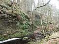 Cliff on banks of Deepdale Beck - geograph.org.uk - 6272540.jpg 1,024 × 768; 284 KB
-
 Cottage at South Thornberry - geograph.org.uk - 5258153.jpg 640 × 480; 272 KB
-
 Course of a disused railway - geograph.org.uk - 4731776.jpg 640 × 480; 67 KB
-
 Dawn alpenglow on field barn - geograph.org.uk - 1627043.jpg 640 × 450; 109 KB
-
 Decaying hedge - geograph.org.uk - 1715089.jpg 640 × 512; 116 KB
-
 Deciduous trees on southern slope above Deepdale Beck - geograph.org.uk - 3880040.jpg 1,500 × 1,125; 2.02 MB
-
 Deepdale Beck - geograph.org.uk - 4050220.jpg 4,608 × 3,456; 6.72 MB
-
 Deepdale ford - geograph.org.uk - 6272426.jpg 1,024 × 768; 310 KB
-
 Deepdale viaduct footings - geograph.org.uk - 6272441.jpg 1,024 × 768; 352 KB
-

-
 Dicey bend - geograph.org.uk - 1651145.jpg 640 × 500; 123 KB
-
 Farm road at Thornberry - geograph.org.uk - 5258152.jpg 640 × 480; 258 KB
-
 Farmhouse at North Field - geograph.org.uk - 5441692.jpg 5,184 × 3,456; 6.06 MB
-
 Field barn behind Cottage Farm - geograph.org.uk - 1640123.jpg 640 × 460; 115 KB
-
 Field slopes to Thorsgill Beck - geograph.org.uk - 1671226.jpg 640 × 480; 111 KB
-
 Field with lone tree and farm storage facility - geograph.org.uk - 5604408.jpg 1,499 × 1,089; 1.21 MB
-
 Footpath south from Boldron - geograph.org.uk - 1639982.jpg 640 × 560; 133 KB
-

-
 Footpath towards Linden Lea - geograph.org.uk - 1765142.jpg 2,205 × 2,880; 1.69 MB
-
 Front meadow, Manor House, Boldron - geograph.org.uk - 2186562.jpg 4,160 × 2,600; 1.66 MB
-
 Gate rapidly becoming sticks - geograph.org.uk - 2187051.jpg 4,320 × 3,240; 2.2 MB
-
 Grazing above Rutherford Bridge - geograph.org.uk - 872074.jpg 640 × 427; 79 KB
-
 Grazing near South Thornberry - geograph.org.uk - 4731779.jpg 640 × 480; 53 KB
-
 Grazing off the A67 - geograph.org.uk - 4731771.jpg 640 × 480; 56 KB
-
 Hazardous bridge - geograph.org.uk - 1651128.jpg 640 × 550; 136 KB
-
 Heading north from Boldron - geograph.org.uk - 4731991.jpg 640 × 480; 104 KB
-
 Hedge and trees north of Boldron - geograph.org.uk - 1670845.jpg 640 × 500; 109 KB
-
 Hedge on West View Farm - geograph.org.uk - 1719214.jpg 640 × 512; 114 KB
-
 Hedgerow oak in winter sun, North Bitts - geograph.org.uk - 2231410.jpg 4,320 × 3,240; 1.77 MB
-
 Hilltop Cottage - geograph.org.uk - 1736917.jpg 640 × 400; 103 KB
-
 Isolated tree - geograph.org.uk - 1713699.jpg 512 × 640; 110 KB
-
 Low Thornberry looms in the mist - geograph.org.uk - 1558056.jpg 640 × 480; 61 KB
-
 Meanders on Thorsgill Beck - geograph.org.uk - 5258217.jpg 640 × 480; 351 KB
-
 Moonlit New Year above Boldron - geograph.org.uk - 1640843.jpg 640 × 427; 104 KB
-
 New track surface east of Boldron - geograph.org.uk - 1671300.jpg 640 × 480; 110 KB
-
 North Thornberry Farm - geograph.org.uk - 5258154.jpg 640 × 480; 283 KB
-
 North Thornberry Farm - geograph.org.uk - 5441325.jpg 5,184 × 3,456; 5.41 MB
-
 Old field boundary east of Boldron - geograph.org.uk - 2231392.jpg 3,840 × 2,880; 1.11 MB
-
 Old hawthorns and derelict field barn - geograph.org.uk - 1639951.jpg 640 × 550; 111 KB
-
 Outbuildings at North Field Farm - geograph.org.uk - 5441332.jpg 5,184 × 3,456; 6.29 MB
-
 Pastures near North Thornberry Farm - geograph.org.uk - 5441322.jpg 5,184 × 3,456; 6.97 MB
-
 Post box at road junction - geograph.org.uk - 5604936.jpg 1,500 × 1,125; 2.28 MB
-
 Rainbow Over Barnard Castle - geograph.org.uk - 302376.jpg 640 × 480; 49 KB
-
 Rauli in the snow, Boldron - geograph.org.uk - 2184220.jpg 3,240 × 4,320; 2.07 MB
-
 Red Alder - geograph.org.uk - 1639988.jpg 420 × 640; 137 KB
-
 Remains of the Stainmore Railway - geograph.org.uk - 5258215.jpg 640 × 480; 236 KB
-
 Restored field barn - geograph.org.uk - 1558080.jpg 640 × 520; 97 KB
-
 Ridge and Furrow in meadow east of Boldron - geograph.org.uk - 2237499.jpg 4,320 × 3,240; 5.61 MB
-
 Rigg and Furrow north of Boldron - geograph.org.uk - 1670825.jpg 640 × 470; 105 KB
-
 Sheep and cattle in field - geograph.org.uk - 5115027.jpg 1,500 × 881; 956 KB
-
 Sheep foraging in the snow - geograph.org.uk - 1719249.jpg 576 × 640; 117 KB
-
 Sheep still foraging in the snow - geograph.org.uk - 2180880.jpg 2,800 × 3,200; 1.35 MB
-

-
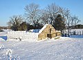
 Smartgill farm - geograph.org.uk - 1558061.jpg 640 × 512; 114 KB
-
 South-facing slope above Thorsgill Beck - geograph.org.uk - 1671243.jpg 640 × 480; 106 KB
-
 "Footpath" off the Stang road - geograph.org.uk - 365559.jpg 640 × 480; 63 KB
-
 Stewardship strip - geograph.org.uk - 1715111.jpg 640 × 480; 117 KB
-
 Stile, Boldron circular walk - geograph.org.uk - 1715061.jpg 640 × 480; 114 KB
-
 Stone Barn between North Thornberry and North Field - geograph.org.uk - 5441328.jpg 5,184 × 3,456; 7.66 MB
-
 Sunrise on the snowy fields of Boldron - geograph.org.uk - 2184051.jpg 3,240 × 4,320; 1.99 MB
-
 Sunrise over Boldron fields - geograph.org.uk - 1626578.jpg 432 × 640; 125 KB
-
 The council ruined our loipe ^ - geograph.org.uk - 2180951.jpg 4,320 × 3,240; 5.43 MB
-
 The George and Dragon Inn, Boldron - geograph.org.uk - 4731986.jpg 640 × 480; 65 KB
-
 Thornberry Lane - geograph.org.uk - 4731782.jpg 640 × 480; 76 KB
-
 Thornberry Lane - geograph.org.uk - 5258155.jpg 640 × 480; 314 KB
-
 Thorsgill Beck passes under West Lane - geograph.org.uk - 1719266.jpg 480 × 640; 114 KB
-
 Too much snow for first footing^ - geograph.org.uk - 1640884.jpg 640 × 432; 125 KB
-
 Tough times for palm trees - geograph.org.uk - 1660369.jpg 512 × 640; 116 KB
-
 Trackbed, in Spring Wood - geograph.org.uk - 656595.jpg 640 × 480; 128 KB
-
 Tree silhouetted in radiation fog - geograph.org.uk - 1190257.jpg 640 × 427; 42 KB
-
 Trees on old field boundary west of Boldron Lane - geograph.org.uk - 2184067.jpg 3,840 × 2,400; 1.35 MB
-
 View towards Deepdale Wood - geograph.org.uk - 5441736.jpg 5,184 × 3,456; 4.23 MB
-
 West Lane, Boldron - geograph.org.uk - 4731990.jpg 640 × 480; 74 KB
-
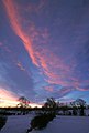
 Winter sunrise over east Boldron - geograph.org.uk - 5713686.jpg 3,840 × 2,820; 2.62 MB
-
 Wintry dawn Boldron - geograph.org.uk - 1627055.jpg 640 × 430; 109 KB
-
 Woodland triangle - geograph.org.uk - 1652931.jpg 640 × 510; 119 KB
-
 A heavy hoar frost coats the trees - geograph.org.uk - 1189972.jpg 640 × 480; 82 KB
-
 Access Lane from Pecknell Wood - geograph.org.uk - 1516428.jpg 640 × 480; 108 KB
-
 Across the Rigg - geograph.org.uk - 713648.jpg 640 × 480; 98 KB
-
 Beside Towlerhill Wood - geograph.org.uk - 1513442.jpg 640 × 480; 112 KB
-
 Bridge and falls on Deepdale Beck - geograph.org.uk - 713666.jpg 640 × 480; 132 KB
-
 Cairn on Arndale Hill - geograph.org.uk - 697386.jpg 640 × 480; 101 KB
-
 Cutting Near Catt Castle - geograph.org.uk - 656501.jpg 640 × 480; 100 KB
-
 Entrance to Bowes Limestone Quarry - geograph.org.uk - 267682.jpg 640 × 480; 218 KB
-
 Gate and road to West Charity Farm - geograph.org.uk - 481955.jpg 640 × 480; 95 KB
-
 GlaxoSmithKline works - geograph.org.uk - 590333.jpg 640 × 427; 57 KB
-
 Grouse Butts by Rowantree Gill - geograph.org.uk - 769838.jpg 640 × 480; 72 KB
-
 Grouse Butts on Arnside Hill - geograph.org.uk - 697601.jpg 640 × 480; 59 KB
-
 Looking over to Gilmonby Moor. - geograph.org.uk - 401900.jpg 640 × 480; 62 KB
-
 Low Thornberry gate - geograph.org.uk - 401498.jpg 640 × 480; 110 KB
-
 Nabb Farm from Crag Hill - geograph.org.uk - 656254.jpg 640 × 359; 33 KB
-
 North Eastern Railway Sign - geograph.org.uk - 656483.jpg 480 × 640; 129 KB
-
 Ox Pasture Farm. - geograph.org.uk - 153023.jpg 640 × 479; 142 KB
-
 Sheep - geograph.org.uk - 267684.jpg 640 × 480; 203 KB
-
 Smartgill Farm - geograph.org.uk - 417803.jpg 640 × 480; 89 KB
-
 Stang Foot - geograph.org.uk - 365521.jpg 640 × 480; 67 KB
-
 Track to High Crag - geograph.org.uk - 656248.jpg 640 × 480; 80 KB
-
 View over to North Field - geograph.org.uk - 401504.jpg 640 × 480; 98 KB


