Category:Bodies of water in the London Borough of Wandsworth
Jump to navigation
Jump to search

Subcategories
This category has the following 4 subcategories, out of 4 total.
Media in category "Bodies of water in the London Borough of Wandsworth"
The following 49 files are in this category, out of 49 total.
-

-

-
 Battersea Reach - geograph.org.uk - 286956.jpg 640 × 460; 48 KB
-
 Bell Lane Creek (River Wandle) - geograph.org.uk - 2101692.jpg 640 × 430; 145 KB
-
 Bell Lane Creek (River Wandle) - geograph.org.uk - 2101875.jpg 640 × 430; 151 KB
-
 Bell Lane Creek - geograph.org.uk - 3609848.jpg 640 × 469; 68 KB
-

-
 Beverley Brook - geograph.org.uk - 2106060.jpg 640 × 410; 120 KB
-
 Beverley Brook - geograph.org.uk - 2568935.jpg 640 × 430; 136 KB
-
 Beverley Brook - geograph.org.uk - 2708267.jpg 1,000 × 1,333; 410 KB
-
 Beverley Brook by Palewell Common - geograph.org.uk - 2148213.jpg 1,024 × 771; 405 KB
-
 Beverley Brook by Palewell Common, in snow - geograph.org.uk - 2203180.jpg 1,024 × 768; 403 KB
-
 Beverley Brook Recreational Ground - geograph.org.uk - 3416975.jpg 4,288 × 3,216; 5.18 MB
-
 Beverley Brook, Putney - geograph.org.uk - 3416788.jpg 4,288 × 3,216; 7.17 MB
-
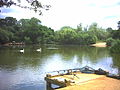
 Ducks on Mount Pond - geograph.org.uk - 1439542.jpg 640 × 480; 83 KB
-
 Elm Quay Court - geograph.org.uk - 812100.jpg 640 × 480; 66 KB
-
 Fishing lake, Tooting Bec Common - geograph.org.uk - 26182.jpg 640 × 480; 95 KB
-
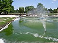
 Fountain Lake - geograph.org.uk - 1440499.jpg 640 × 480; 82 KB
-
 Fountain Lake - geograph.org.uk - 1440501.jpg 640 × 480; 83 KB
-
 Fountain Lake - geograph.org.uk - 1440503.jpg 640 × 480; 64 KB
-
 Fountain Lake - geograph.org.uk - 1440505.jpg 640 × 480; 91 KB
-
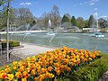
 Fountain Lake, Battersea Park - geograph.org.uk - 237839.jpg 640 × 480; 104 KB
-
 Fountain Lake, Battersea Park - geograph.org.uk - 4950277.jpg 4,608 × 3,456; 4.72 MB
-
 Fountain, Compass House, Wandsworth - geograph.org.uk - 773934.jpg 455 × 640; 81 KB
-
 Heath Pond, Putney Heath - geograph.org.uk - 3284192.jpg 4,288 × 3,216; 5.88 MB
-
 High Tide near Putney - geograph.org.uk - 306742.jpg 640 × 480; 75 KB
-
 Hurlingham Reach - geograph.org.uk - 262347.jpg 640 × 480; 97 KB
-
 Lake on Wandsworth Common - geograph.org.uk - 4418186.jpg 3,844 × 3,000; 2.29 MB
-
 Mount Pond, Clapham Common - geograph.org.uk - 1278274.jpg 2,590 × 1,554; 1.99 MB
-
 Pond on Wandsworth Common - geograph.org.uk - 4418184.jpg 3,704 × 2,764; 1.84 MB
-
 Pond, Tooting Common - geograph.org.uk - 2931698.jpg 640 × 480; 97 KB
-
 Queens Mere - geograph.org.uk - 74843.jpg 640 × 480; 158 KB
-
 River Thames at Wandsworth (2) - geograph.org.uk - 825401.jpg 640 × 480; 53 KB
-
 River Wandle, Strathville Rd, SW18 - geograph.org.uk - 61017.jpg 640 × 480; 115 KB
-
 Rope on the Foreshore - geograph.org.uk - 793642.jpg 436 × 640; 284 KB
-
 Sunken Boats in the River Wandle - geograph.org.uk - 1577362.jpg 640 × 480; 65 KB
-
 The Fishing Pier and Island, Mount Pond, Clapham Common - geograph.org.uk - 1393875.jpg 3,190 × 2,392; 1.25 MB
-
 The island on Mount Pond, Clapham Common - geograph.org.uk - 1393871.jpg 3,264 × 2,448; 1.41 MB
-
 The Lake in springtime - Tooting Common - geograph.org.uk - 5325611.jpg 4,945 × 3,779; 6.74 MB
-
 The Old Yachting Pond, Tooting Graveney Common - geograph.org.uk - 4169339.jpg 4,000 × 3,000; 4.34 MB
-
 The Thames at Putney - geograph.org.uk - 120491.jpg 640 × 480; 38 KB
-
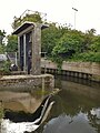 Tidal bell and weir on the river Wandle in Wandsworth, London, at Bell Lane Creek.jpg 3,456 × 4,608; 3.13 MB
-
 Tidal bell in Wandsworth, at Bell Lane Creek on the river Wandle 01.jpg 4,608 × 3,456; 3.74 MB
-
 Tidal bell in Wandsworth, at Bell Lane Creek.jpg 3,456 × 4,608; 2.67 MB
-
 Tooting Common - geograph.org.uk - 5628448.jpg 1,280 × 960; 518 KB
-
 Trees by the Mount Pond, Clapham Common - geograph.org.uk - 1278279.jpg 2,114 × 1,586; 629 KB
-
 Wandsworth Common pond at sunset - geograph.org.uk - 6324116.jpg 5,202 × 3,465; 4.8 MB
-
 Wandsworth Common pond, looking northwards - geograph.org.uk - 6324123.jpg 5,202 × 3,465; 3.1 MB
-
 Wooded island on Mount Pond - geograph.org.uk - 1439544.jpg 640 × 480; 96 KB


_-_geograph.org.uk_-_2101692.jpg)
_-_geograph.org.uk_-_2101875.jpg)


_-_geograph.org.uk_-_825401.jpg)


