Category:Bobbingworth
Jump to navigation
Jump to search
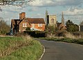
English: Bobbingworth is a village and civil parish in Essex, England. It is located about 3 km (2 miles) northwest of Chipping Ongar and is 18 km (11 miles) west from the county town of Chelmsford. The village is in the district of Epping Forest and the parliamentary constituency of Brentwood & Ongar. According to the 2001 census it had a population of 279. Bobbingworth covers an area of 2,595 acres. The village lies off of the A414.
village in Essex, England, UK  | |||||
| Upload media | |||||
| Instance of | |||||
|---|---|---|---|---|---|
| Location | Epping Forest, Essex, East of England, England | ||||
| Said to be the same as | Bobbingworth (Wikimedia duplicated page, civil parish) | ||||
 | |||||
Subcategories
This category has the following 3 subcategories, out of 3 total.
B
- Bobbingworth in June 2015 (31 F)
S
Media in category "Bobbingworth"
The following 141 files are in this category, out of 141 total.
-
 Bridge Road entry to Moreton village, Essex, England.jpg 5,378 × 3,570; 10.92 MB
-

-

-
 A414 looking east - geograph.org.uk - 3506037.jpg 640 × 480; 88 KB
-
 Abandoned cottages, North Weald - geograph.org.uk - 3506085.jpg 640 × 480; 87 KB
-
 Animal shelter - geograph.org.uk - 3496290.jpg 640 × 480; 104 KB
-
 Approaching bridge near Greensted Green - geograph.org.uk - 3996117.jpg 1,600 × 1,064; 256 KB
-
 Ashlyns Farm - geograph.org.uk - 5473681.jpg 640 × 430; 73 KB
-
 Ashlyns Lane - geograph.org.uk - 4789618.jpg 640 × 480; 170 KB
-
 Ashlyns Lane - geograph.org.uk - 4789646.jpg 640 × 480; 144 KB
-
 Blake Hall Road - geograph.org.uk - 3496584.jpg 640 × 480; 105 KB
-
 Blake Hall Road - geograph.org.uk - 6165715.jpg 1,920 × 1,280; 1.69 MB
-
 Blake Hall Road - geograph.org.uk - 763457.jpg 640 × 480; 75 KB
-
 Blake Hall Road at the junction of Epping Road - geograph.org.uk - 2926817.jpg 1,600 × 1,200; 500 KB
-
 Blake Hall Road, Bobbingworth, near Ongar - geograph.org.uk - 6243311.jpg 1,024 × 768; 175 KB
-
 Blake Hall Road, Greensted Green - geograph.org.uk - 6163544.jpg 1,920 × 1,280; 1.01 MB
-
 Blake Hall Road, near Ongar - geograph.org.uk - 6241586.jpg 1,024 × 768; 212 KB
-
-
 Bobbingworth church - geograph.org.uk - 3497928.jpg 640 × 480; 104 KB
-
 Bobbingworth church - geograph.org.uk - 4789387.jpg 640 × 480; 130 KB
-
 Bobbingworth Mill - geograph.org.uk - 5298836.jpg 4,000 × 3,000; 2.96 MB
-
 Bobbingworth village sign - geograph.org.uk - 4685094.jpg 4,320 × 3,240; 3.93 MB
-
 Bobbingworth village sign, close-up - geograph.org.uk - 4685100.jpg 4,320 × 3,240; 3.62 MB
-
 Bobbingworth, Abandoned cottages - geograph.org.uk - 4515729.jpg 640 × 480; 80 KB
-

-
 Bobbingworth, Essex, England - Bovinger village sign.JPG 3,648 × 5,472; 12.16 MB
-
 Bobbingworth, Essex, England - field off Gainsthorpe Road 01.JPG 5,472 × 3,648; 14.08 MB
-
 Bobbingworth, Essex, England - field off Gainsthorpe Road 02.JPG 5,472 × 3,648; 12.22 MB
-
 Bobbingworth, Essex, England - field off Gainsthorpe Road 03.JPG 5,472 × 3,648; 11 MB
-
 Bobbingworth, Essex, England - field off Gainsthorpe Road 04.JPG 3,648 × 5,472; 15.77 MB
-
 Bobbingworth, Essex, England - field off Gainsthorpe Road 05.JPG 5,472 × 3,648; 13.21 MB
-

-

-

-

-

-
 Bobbingworth, Route of Roman Road - geograph.org.uk - 4515669.jpg 640 × 480; 103 KB
-
 Bovinger Bus Shelter - geograph.org.uk - 177970.jpg 640 × 492; 48 KB
-
 Bovinger Lodge - geograph.org.uk - 3498005.jpg 640 × 480; 83 KB
-
 Brick bridge (Grade II 18th-century) from the east, at Moreton village, Essex, England.jpg 5,472 × 3,648; 15.44 MB
-
 Brick bridge (Grade II 18th-century), at Moreton village, Essex, England.jpg 5,472 × 3,456; 11.47 MB
-
 Bridge House Farm near Ongar, Essex - geograph.org.uk - 78197.jpg 640 × 480; 63 KB
-
 Bridge over Cripsey Brook - geograph.org.uk - 4789649.jpg 640 × 480; 196 KB
-
 Cottages, Bobbingworth Mill - geograph.org.uk - 3496157.jpg 640 × 480; 80 KB
-
 Cripsey Brook - geograph.org.uk - 3498732.jpg 640 × 480; 187 KB
-
 Cripsey Brook at Moreton Bridge - geograph.org.uk - 3496356.jpg 640 × 480; 164 KB
-
 Crossroads on A414 - geograph.org.uk - 4789606.jpg 640 × 428; 82 KB
-
 Dewley Wood, Blake Hall, Essex - geograph.org.uk - 79873.jpg 640 × 480; 131 KB
-

-

-

-

-

-

-
 Epping Road at the junction of Penson's Lane - geograph.org.uk - 2926816.jpg 1,600 × 1,200; 519 KB
-
 Epping Road from Penson's Lane - geograph.org.uk - 2926814.jpg 1,600 × 1,200; 502 KB
-
 Farmland north of Greensted Green - geograph.org.uk - 4237602.jpg 640 × 480; 76 KB
-
 Farmland south-west of Ackingford Bridge - geograph.org.uk - 4442859.jpg 1,024 × 768; 117 KB
-
 Farmland south-west of Bilsdens - geograph.org.uk - 4442878.jpg 1,024 × 768; 182 KB
-
 Field by Epping Road, Ongar - geograph.org.uk - 5610467.jpg 2,048 × 1,536; 1.11 MB
-
 Field Margin and Station Bridge House - geograph.org.uk - 5949545.jpg 678 × 1,024; 256 KB
-
 Fields by Blake Hall Road - geograph.org.uk - 2926818.jpg 1,600 × 1,200; 491 KB
-
 Footpath to Greensted - geograph.org.uk - 5379425.jpg 4,000 × 3,000; 4.74 MB
-
 Footpath to Moreton Rd - geograph.org.uk - 5949580.jpg 1,024 × 678; 184 KB
-
 Gate and ditch near Ongar - geograph.org.uk - 6243373.jpg 1,024 × 768; 265 KB
-
 Herrenhaus Blake Hall.JPG 2,272 × 1,704; 873 KB
-
 In Bobbingworth churchyard - geograph.org.uk - 4789372.jpg 640 × 480; 152 KB
-
 In Bobbingworth churchyard - geograph.org.uk - 4789379.jpg 640 × 480; 200 KB
-
 In Bobbingworth churchyard - geograph.org.uk - 4789383.jpg 640 × 480; 166 KB
-
 Lodge to Blake Hall - geograph.org.uk - 4685077.jpg 4,320 × 3,240; 3.97 MB
-
 Looking along Penson's Lane - geograph.org.uk - 5379412.jpg 4,000 × 3,000; 4.61 MB
-
 Lower Bobbingworth Green - geograph.org.uk - 642064.jpg 640 × 480; 76 KB
-
 Manx Loaghtan Sheep - geograph.org.uk - 5473691.jpg 640 × 424; 93 KB
-
 Moreton Bridge - geograph.org.uk - 4121938.jpg 3,872 × 2,592; 3.99 MB
-
 Moreton bridge - geograph.org.uk - 4201804.jpg 4,320 × 3,240; 5.04 MB
-
 Moreton Bridge - geograph.org.uk - 4789888.jpg 640 × 480; 208 KB
-
 Moreton Bridge - geograph.org.uk - 6033084.jpg 1,600 × 1,067; 467 KB
-
 Moreton Bridge and Bridge Road - geograph.org.uk - 4789881.jpg 640 × 480; 160 KB
-
 Moreton Bridge ^2 - geograph.org.uk - 4121960.jpg 3,872 × 2,592; 4.42 MB
-
 Moreton Bridge ^3 - geograph.org.uk - 4121981.jpg 3,872 × 2,592; 3.2 MB
-
 Moreton Road at Bovinger - geograph.org.uk - 1019887.jpg 640 × 480; 57 KB
-
 Moreton Road, near Ongar - geograph.org.uk - 6243380.jpg 1,024 × 768; 188 KB
-
 Moreton Road, near Ongar - geograph.org.uk - 6243383.jpg 1,024 × 768; 202 KB
-
 Moreton Road, near Ongar - geograph.org.uk - 6243390.jpg 1,024 × 768; 204 KB
-
 Mown verge, Moreton Road - geograph.org.uk - 4789233.jpg 640 × 480; 129 KB
-
 Mown verge, Moreton Road - geograph.org.uk - 4789242.jpg 640 × 480; 121 KB
-
 Muggins farm house, Bobbingworth - geograph.org.uk - 4201778.jpg 4,320 × 3,240; 3.79 MB
-
 Old school, Bobbingworth - geograph.org.uk - 3496148.jpg 640 × 480; 107 KB
-
 Paddocks at Ashlyns - geograph.org.uk - 4789634.jpg 640 × 480; 126 KB
-
 Path by Cripsey Brook - geograph.org.uk - 4789668.jpg 640 × 480; 141 KB
-
 Path ^ Pasture - geograph.org.uk - 4915494.jpg 640 × 424; 63 KB
-
 Penson's Lane - geograph.org.uk - 5379422.jpg 4,000 × 3,000; 4.66 MB
-
 Penson's Lane - geograph.org.uk - 5949565.jpg 678 × 1,024; 169 KB
-
 Penson's Lane, High Ongar - geograph.org.uk - 2926815.jpg 1,600 × 1,200; 501 KB
-
 Remains of Ongar radio station - geograph.org.uk - 3506125.jpg 640 × 480; 90 KB
-
 Road junction near Bobbingworth, Essex - geograph.org.uk - 6243354.jpg 1,024 × 768; 182 KB
-
 Road junction near Ongar - geograph.org.uk - 6241591.jpg 1,024 × 768; 164 KB
-
 Road junction near Ongar - geograph.org.uk - 6243363.jpg 1,024 × 768; 258 KB
-
 Road junction, Bobbingworth, near Ongar - geograph.org.uk - 6243321.jpg 1,024 × 768; 240 KB
-
 Sharp bend on Moreton Road - geograph.org.uk - 4789348.jpg 640 × 480; 110 KB
-
 St Germain, Bobbingworth - geograph.org.uk - 4685466.jpg 4,320 × 3,240; 3.99 MB
-
 St Germain, Bobbingworth - geograph.org.uk - 4685471.jpg 4,320 × 3,240; 3.54 MB
-
 St. Germain's Church, Bobbingworth, near Ongar - geograph.org.uk - 6243334.jpg 1,024 × 768; 193 KB
-
 Table tombs, St Germain Bobbingworth - geograph.org.uk - 4685500.jpg 4,320 × 3,240; 4.39 MB
-
 The entrance to Blakes golf club, Tylers Green - geograph.org.uk - 2926821.jpg 1,600 × 1,200; 560 KB
-

-
 The Essex Way, Greensted - geograph.org.uk - 282619.jpg 640 × 433; 106 KB
-
 The junction of Blake Hall Road and Epping Road - geograph.org.uk - 2926819.jpg 1,600 × 1,200; 522 KB
-
 The route of Cripsey Brook - geograph.org.uk - 4442853.jpg 1,024 × 768; 106 KB
-
 The Travel Lodge. - geograph.org.uk - 1422772.jpg 640 × 425; 74 KB
-
 The Travelodge and Little Chef, North Weald - geograph.org.uk - 2926820.jpg 1,600 × 1,200; 511 KB
-
 Track crossing farmland east of Ongar Park Hall - geograph.org.uk - 4443098.jpg 779 × 1,024; 135 KB
-
 Track from Dolman's Spring to Bilsdens - geograph.org.uk - 4442892.jpg 1,024 × 768; 196 KB
-
 Trees along Blake Hall Road - geograph.org.uk - 6165285.jpg 1,848 × 1,162; 2.01 MB
-

-
 View east from Blake Hall Road, late October - geograph.org.uk - 4722884.jpg 1,024 × 737; 174 KB
-
 View From the Epping Ongar Railway - geograph.org.uk - 5006810.jpg 4,000 × 2,666; 7.75 MB
-

-

-

-

-

-

-
 View of Bridge Road winding through Moreton - geograph.org.uk - 4121999.jpg 3,872 × 2,592; 3.47 MB
-
 View of Bridge Road winding through Moreton ^2 - geograph.org.uk - 4122008.jpg 3,872 × 2,592; 3.38 MB
-

-
 View of houses on Church Lane from Moreton Bridge - geograph.org.uk - 4121972.jpg 3,872 × 2,592; 1.4 MB
-
 View of houses on Gould Close from Moreton Bridge - geograph.org.uk - 4122022.jpg 3,872 × 2,592; 3.23 MB
-

-
 View of the White Hart Inn from Moreton Bridge - geograph.org.uk - 4121977.jpg 3,872 × 2,592; 2.3 MB
-
 View of the White Hart Inn from Moreton Bridge ^2 - geograph.org.uk - 4121989.jpg 3,872 × 2,592; 2.48 MB
-
 View over Ongar Park Hall from the Epping to Ongar Railway - geograph.org.uk - 5364748.jpg 3,872 × 2,592; 2.27 MB
-
 View over Ongar Park Hall from the Epping to Ongar Railway - geograph.org.uk - 5364757.jpg 3,872 × 2,592; 2.69 MB
-
 Village sign at Bobbingworth, near Ongar - geograph.org.uk - 6243343.jpg 1,024 × 768; 302 KB
-
 Wooded cutting, east of Blake Hall Station - geograph.org.uk - 4442903.jpg 1,024 × 768; 219 KB
-
 Course of Roman Road near Bovinger - geograph.org.uk - 177971.jpg 480 × 640; 98 KB
-
 East from Blake Hall - geograph.org.uk - 177979.jpg 480 × 640; 136 KB
-
 Farm Gate, Moreton Road, Ongar, Essex - geograph.org.uk - 78202.jpg 640 × 480; 97 KB
-
 Lower Bobbingworth Green, Essex - geograph.org.uk - 79875.jpg 640 × 480; 103 KB
-
 Poplar Trees, Bobbingworth, Essex - geograph.org.uk - 80057.jpg 640 × 480; 153 KB
-
 The 'A414' at Bobbingworth, Essex - geograph.org.uk - 78191.jpg 640 × 480; 138 KB


_from_the_east,_at_Moreton_village,_Essex,_England.jpg)
,_at_Moreton_village,_Essex,_England.jpg)


