Category:Block diagrams (cartography) in French
Jump to navigation
Jump to search
Media in category "Block diagrams (cartography) in French"
The following 24 files are in this category, out of 24 total.
-
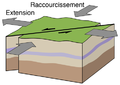
 Block diagram continental crust structure FR.png 8,357 × 4,461; 3.34 MB
-
 Cascadia earthquake sources fr.png 580 × 575; 55 KB
-
 FailleDecrochement.png 450 × 320; 46 KB
-
 FailleNorm.png 420 × 320; 39 KB
-
 FaillInv.png 420 × 320; 44 KB
-
 Fault-Horst-Graben-fr.svg 534 × 274; 19 KB
-
 Geoscope2.jpg 1,096 × 616; 297 KB
-
 Hawaiian Eruption-fr.svg 1,100 × 1,100; 124 KB
-
 Meander-fr.svg 692 × 344; 21 KB
-
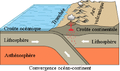 Oceanic-continental convergence Fig21oceancont (french).png 450 × 265; 108 KB
-
 Paysage glaciaire.svg 388 × 230; 70 KB
-
 Pelean Eruption-fr.svg 1,100 × 1,100; 280 KB
-
 Phreatic Eruption-fr.svg 1,100 × 1,100; 156 KB
-
 Phreatomagmatic Eruption-fr.svg 1,100 × 1,100; 174 KB
-
 Plinian Eruption-fr.svg 1,100 × 1,100; 159 KB
-
 Receding glacier-fr.svg 1,200 × 562; 265 KB
-
 SchémaLégendéGlacier.JPG 660 × 432; 44 KB
-
 Strombolian Eruption-fr.svg 1,100 × 1,100; 128 KB
-
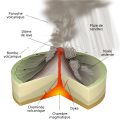
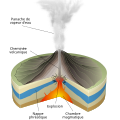
 Structure volcano-fr.svg 512 × 345; 216 KB
-
 Subglacial Eruption-fr.svg 1,100 × 1,100; 122 KB
-
 Submarine Eruption-fr.svg 1,100 × 1,100; 168 KB
-
 Surtseyan Eruption-fr.svg 1,100 × 1,100; 186 KB
-
 Vulcanian Eruption-fr.svg 1,100 × 1,100; 152 KB
-
 Water Cycle - fr.svg 800 × 379; 106 KB


.png)


