Category:Bletchley and Fenny Stratford
Jump to navigation
Jump to search
English: Bletchley and Fenny Stratford is a civil parish with a town council, in Milton Keynes, Buckinghamshire, England. It was formed in 2001 from the unparished area of Milton Keynes, and according to the 2001 census had a population of 13,971.
town and civil parish in Milton Keynes, Buckinghamshire, United Kingdom  | |||||
| Upload media | |||||
| Instance of | |||||
|---|---|---|---|---|---|
| Named after | |||||
| Location | City of Milton Keynes, Buckinghamshire, South East England, England | ||||
 | |||||
Subcategories
This category has the following 4 subcategories, out of 4 total.
Media in category "Bletchley and Fenny Stratford"
The following 200 files are in this category, out of 349 total.
(previous page) (next page)-
 "Pendolino" Train North of Bletchley - geograph.org.uk - 2395048.jpg 640 × 480; 111 KB
-
 ' heads up', Stephenson House, Bletchley - geograph.org.uk - 2331073.jpg 800 × 534; 402 KB
-
 A choice of restaurants - geograph.org.uk - 5409890.jpg 800 × 600; 84 KB
-
 A flowering railway embankment - geograph.org.uk - 2741088.jpg 640 × 430; 91 KB
-
 A large, wet, empty car park - geograph.org.uk - 5409891.jpg 800 × 440; 74 KB
-
 A Parade of Shops, Queensway, Bletchley - geograph.org.uk - 2328454.jpg 800 × 534; 425 KB
-
 A421 bridge over A5 - geograph.org.uk - 5646952.jpg 640 × 428; 93 KB
-
 A5 - geograph.org.uk - 3879728.jpg 640 × 430; 59 KB
-
 A5 - geograph.org.uk - 4916954.jpg 640 × 309; 34 KB
-
 A5 northbound - geograph.org.uk - 5646896.jpg 640 × 428; 92 KB
-
 A5 northbound - geograph.org.uk - 5646944.jpg 640 × 428; 100 KB
-
 A5, Milton Keynes - geograph.org.uk - 2855776.jpg 640 × 365; 38 KB
-
 Abandoned parcels van at Bletchley Depot - geograph.org.uk - 2788103.jpg 1,024 × 683; 190 KB
-
 An avenue of Poplars - geograph.org.uk - 6293961.jpg 1,200 × 1,600; 667 KB
-
 Another Empty Shop, Queensway, Bletchley - geograph.org.uk - 2328425.jpg 800 × 534; 505 KB
-
 Approaching the roundabout at the end of Watling Street - geograph.org.uk - 2882193.jpg 1,600 × 1,200; 587 KB
-
 Approaching the roundabout entering Milton Keynes - geograph.org.uk - 2882373.jpg 1,600 × 1,200; 551 KB
-
 ASDA Store - geograph.org.uk - 2283536.jpg 800 × 562; 460 KB
-
 ASDA Store - geograph.org.uk - 2283541.jpg 800 × 562; 523 KB
-
 ASDA superstore in Bletchley - geograph.org.uk - 1317458.jpg 640 × 427; 53 KB
-
 ASDA superstore in Bletchley - geograph.org.uk - 1317462.jpg 640 × 427; 58 KB
-
 ASDA Walmart Supercentre, Milton Keynes - geograph.org.uk - 3969747.jpg 3,072 × 1,728; 1.56 MB
-
 Auckland Park Industrial estate - geograph.org.uk - 2862765.jpg 640 × 427; 97 KB
-
 Aylesbury Street in Fenny Stratford - geograph.org.uk - 4752041.jpg 800 × 508; 90 KB
-
 Aylesbury Vale , River Ouzel - geograph.org.uk - 5732816.jpg 6,000 × 4,000; 7.07 MB
-
 B4034 - Saxon Street - geograph.org.uk - 2674269.jpg 640 × 426; 39 KB
-

-
-
 Bletchley - Milton Keynes dot.png 417 × 599; 122 KB
-
 Bletchley depot with London Midland train - geograph.org.uk - 4263733.jpg 1,600 × 575; 204 KB
-

-

-
-
 Bletchley Leisure Centre - geograph.org.uk - 1809261.jpg 640 × 480; 151 KB
-
 Bletchley Leisure Centre - geograph.org.uk - 1809265.jpg 640 × 480; 194 KB
-

-
 Bletchley Post Office in Queensway - geograph.org.uk - 2420901.jpg 798 × 532; 527 KB
-
 Bletchley Post Office, Queensway - geograph.org.uk - 2420886.jpg 798 × 532; 581 KB
-

-
 Bletchley railway station, Buckinghamshire - geograph.org.uk - 3379632.jpg 1,024 × 648; 148 KB
-
 Bletchley Sidings - geograph.org.uk - 2855785.jpg 640 × 430; 64 KB
-
 Bletchley Sidings - geograph.org.uk - 3628819.jpg 640 × 430; 68 KB
-
 Bletchley Sidings - geograph.org.uk - 3628821.jpg 640 × 430; 68 KB
-
 Bletchley Sidings - geograph.org.uk - 3628822.jpg 640 × 430; 75 KB
-
 Bletchley Sidings - geograph.org.uk - 3879735.jpg 640 × 341; 63 KB
-
 Bletchley Sidings - geograph.org.uk - 3879739.jpg 640 × 409; 72 KB
-
 Bletchley Sidings - geograph.org.uk - 4916968.jpg 640 × 426; 67 KB
-
 Bletchley Sidings - geograph.org.uk - 4916971.jpg 640 × 426; 62 KB
-
 Bletchley Sidings - geograph.org.uk - 4916977.jpg 640 × 367; 52 KB
-
 Bletchley Sidings - geograph.org.uk - 4916979.jpg 640 × 426; 59 KB
-
 Bletchley, Queensway - geograph.org.uk - 5111948.jpg 640 × 427; 415 KB
-
 Blue Lagoon Nature Reserve - geograph.org.uk - 1927502.jpg 640 × 480; 343 KB
-
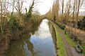
 Boats moored along the Grand Union Canal - geograph.org.uk - 4751566.jpg 800 × 593; 133 KB
-
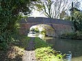
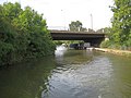
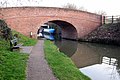 Bridge (99) over the Grand Union - geograph.org.uk - 2863776.jpg 640 × 427; 91 KB
-
 Bridge 92A, Grand Junction Canal - geograph.org.uk - 2668203.jpg 4,000 × 3,000; 4.77 MB
-
 Bridge 93, Grand Junction Canal - geograph.org.uk - 2668196.jpg 4,000 × 3,000; 5.09 MB
-
 Bridge 93A, Grand Junction Canal - geograph.org.uk - 2668041.jpg 4,000 × 3,000; 4.89 MB
-
 Bridge 94, Grand Junction Canal - geograph.org.uk - 2668032.jpg 4,000 × 3,000; 5.13 MB
-
 Bridge 95, Grand Junction Canal - geograph.org.uk - 2626651.jpg 1,600 × 1,200; 499 KB
-
 Bridge 95A, Grand Junction Canal - geograph.org.uk - 2626645.jpg 1,600 × 1,200; 502 KB
-
 Bridge 96, Grand Junction Canal - geograph.org.uk - 2626643.jpg 1,600 × 1,200; 484 KB
-
 Bridge 96A, Grand Junction Canal - geograph.org.uk - 2668230.jpg 4,000 × 3,000; 5.14 MB
-
 Bridge 97, Grand Junction Canal - geograph.org.uk - 2626638.jpg 1,600 × 1,200; 462 KB
-
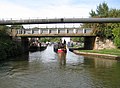
 Bridge 97, Grand Union Canal - geograph.org.uk - 6324705.jpg 1,280 × 851; 311 KB
-
 Bridge 98 - geograph.org.uk - 2070017.jpg 640 × 470; 133 KB
-
 Bridge 98, Grand Junction Canal - geograph.org.uk - 2702546.jpg 4,000 × 3,000; 5.15 MB
-
 Bridge 98A - geograph.org.uk - 2863779.jpg 640 × 431; 66 KB
-
 Bridge 98A, Grand Junction Canal - geograph.org.uk - 2702550.jpg 4,000 × 3,000; 5.1 MB
-
 Bridge 99, Grand Junction Canal - geograph.org.uk - 2702188.jpg 4,000 × 3,000; 5.12 MB
-

-
 Bridge No 97 on the Grand Union Canal - geograph.org.uk - 4751632.jpg 800 × 573; 151 KB
-

-
 Bus Stop, Princes Way, Bletchley - geograph.org.uk - 2426959.jpg 798 × 532; 366 KB
-
 By the West Coast Main Line - geograph.org.uk - 3879775.jpg 640 × 430; 90 KB
-
 C.D.M.K., Stanier Square, Bletchley - geograph.org.uk - 2331035.jpg 800 × 534; 446 KB
-
 Cambridge Street, Bletchley - geograph.org.uk - 2426909.jpg 798 × 532; 430 KB
-
 Canal at Water Eaton - geograph.org.uk - 2070009.jpg 640 × 360; 54 KB
-
 Canal from bridge 97 - geograph.org.uk - 2866788.jpg 640 × 428; 76 KB
-
 Captain Ridley's Shooting Party on Queensway - geograph.org.uk - 6250226.jpg 2,700 × 1,979; 410 KB
-
-
 Cash Converters, Queensway, Bletchley - geograph.org.uk - 2328443.jpg 800 × 534; 499 KB
-
 Causeway through the rushes - geograph.org.uk - 2863757.jpg 1,600 × 1,068; 571 KB
-
 Cleaning Elizabeth Square, Queensway - geograph.org.uk - 2420950.jpg 798 × 532; 534 KB
-
 Community Orchard - geograph.org.uk - 2866772.jpg 1,600 × 1,069; 466 KB
-
 Community orchard - geograph.org.uk - 2952940.jpg 2,560 × 1,920; 1,014 KB
-

-

-
 Dobbies Garden Centre, Milton Keynes - geograph.org.uk - 3969754.jpg 3,072 × 1,728; 1.63 MB
-

-
 Drayton Road through the trees - geograph.org.uk - 2855794.jpg 640 × 430; 62 KB
-
 Dropshort Farm buildings - geograph.org.uk - 2866796.jpg 1,600 × 1,068; 540 KB
-
 Eaton Leys Farm - geograph.org.uk - 2952932.jpg 2,560 × 1,920; 1,008 KB
-
 Elizabeth Square, Queensway, Bletchley - geograph.org.uk - 2509456.jpg 800 × 533; 517 KB
-
 Enigma Tavern - geograph.org.uk - 2862800.jpg 640 × 428; 69 KB
-

-

-
 Fabric World, Queensway, Bletchley - geograph.org.uk - 2328431.jpg 800 × 534; 503 KB
-
 Fenny Lock Pumphouse - geograph.org.uk - 2756007.jpg 856 × 1,280; 201 KB
-
 Fenny Stratford Lock - geograph.org.uk - 2756002.jpg 1,280 × 856; 182 KB
-
 Fenny Stratford Lock - geograph.org.uk - 2756020.jpg 1,280 × 856; 143 KB
-
 Fenny Stratford lock - geograph.org.uk - 4111833.jpg 1,024 × 768; 264 KB
-
 Fenny Stratford Lock - geograph.org.uk - 6323974.jpg 1,280 × 851; 372 KB
-
 Fenny Stratford Lock 22 grand Union Canal - geograph.org.uk - 3754849.jpg 2,013 × 1,316; 688 KB
-
 Fenny Stratford Lock 22 grand Union Canal - geograph.org.uk - 3754854.jpg 2,025 × 1,340; 750 KB
-
 Fenny Stratford railway station - geograph.org.uk - 3386225.jpg 1,024 × 768; 228 KB
-
 Fenny Stratford Swing Bridge - geograph.org.uk - 6323961.jpg 1,280 × 851; 353 KB
-
-

-
-

-
 Fenny Stratford, The cemetery chapel - geograph.org.uk - 1845987.jpg 640 × 480; 66 KB
-

-
 Fenny Stratford, The Swan Hotel - geograph.org.uk - 1851104.jpg 640 × 469; 67 KB
-

-
 Footbridge - geograph.org.uk - 2070006.jpg 640 × 389; 90 KB
-
 Footbridge in the Mount Farm Park - geograph.org.uk - 2862783.jpg 480 × 640; 100 KB
-
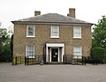
 Former Urban District Council Offices, 263 Queensway, Bletchley, Buckinghamshire.jpg 2,698 × 2,024; 839 KB
-
 Gate along the towpath - geograph.org.uk - 4751600.jpg 800 × 600; 195 KB
-
 Gauging station on the Ouzel - geograph.org.uk - 2863782.jpg 640 × 427; 118 KB
-
 Granby Mosque - geograph.org.uk - 208291.jpg 640 × 480; 114 KB
-
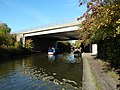
 Grand Union Canal - geograph.org.uk - 4111842.jpg 1,024 × 768; 326 KB
-
 Grand Union Canal - geograph.org.uk - 4359477.jpg 1,024 × 683; 284 KB
-
 Grand Union Canal from under bridge 99 - geograph.org.uk - 6324541.jpg 1,280 × 851; 387 KB
-
 Grand Union Canal Walk - geograph.org.uk - 5628011.jpg 640 × 480; 70 KB
-
 Grand Union Canal Walk - geograph.org.uk - 5628013.jpg 640 × 480; 81 KB
-
 Grand Union Canal Walk - geograph.org.uk - 5628271.jpg 640 × 480; 71 KB
-
 Grand Union Canal Walk - geograph.org.uk - 5628281.jpg 640 × 480; 95 KB
-
 Grand Union Canal, Bridge Number 92A - geograph.org.uk - 3685914.jpg 640 × 480; 74 KB
-
 Grand Union Canal, Bridge Number 93 - geograph.org.uk - 3685926.jpg 640 × 480; 81 KB
-
 Grand Union Canal, Bridge Number 93A - geograph.org.uk - 3686037.jpg 640 × 480; 72 KB
-
 Grand Union Canal, Bridge Number 94 - geograph.org.uk - 3686088.jpg 640 × 480; 79 KB
-
 Grand Union Canal, Bridge Number 95A - geograph.org.uk - 3686399.jpg 640 × 470; 78 KB
-
 Grand Union Canal, Bridge Number 96 - geograph.org.uk - 3686431.jpg 640 × 475; 72 KB
-
 Grand Union Canal, Bridge Number 96A - geograph.org.uk - 3686525.jpg 640 × 480; 80 KB
-
 Grand Union Canal, Bridge Number 97 - geograph.org.uk - 3686716.jpg 640 × 480; 77 KB
-
 Grand Union Canal, Bridge Number 98 - geograph.org.uk - 3686760.jpg 640 × 480; 93 KB
-
 Grand Union Canal, Bridge Number 98A - geograph.org.uk - 3686818.jpg 640 × 480; 73 KB
-
 Grand Union Canal, Bridge Number 99 - geograph.org.uk - 3686885.jpg 640 × 480; 100 KB
-
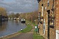 Grand Union Canal, Fenny Stratford - geograph.org.uk - 2755277.jpg 1,280 × 856; 163 KB
-
 Grand Union Canal, Fenny Stratford - geograph.org.uk - 2756015.jpg 1,280 × 856; 138 KB
-
 Grand Union Canal, Fenny Stratford - geograph.org.uk - 2756278.jpg 1,280 × 856; 124 KB
-
 Grand Union Canal, Fenny Stratford - geograph.org.uk - 2759041.jpg 1,280 × 856; 195 KB
-

-

-

-

-

-

-
 Grand Union Canal, Water Eaton - geograph.org.uk - 6324712.jpg 1,280 × 851; 305 KB
-
 Grass lane divider on the A5 roundabout Fenny Stratford - geograph.org.uk - 2882487.jpg 1,600 × 1,200; 490 KB
-
 Half time at Stadium MK in Milton Keynes - geograph.org.uk - 5641084.jpg 3,902 × 2,927; 2.46 MB
-
 Heron next to the Grand Union Canal - geograph.org.uk - 4750793.jpg 719 × 800; 124 KB
-
-
 High Street Fenny Stratford - geograph.org.uk - 2882177.jpg 1,600 × 1,200; 544 KB
-
 Hilton Hotel at Stadium MK - Milton Keynes - geograph.org.uk - 3887389.jpg 2,848 × 2,136; 3.03 MB
-

-
 HSBC Bank, Queensway, Bletchley - geograph.org.uk - 2326170.jpg 800 × 534; 447 KB
-

-
 Industrial unit in Milton Keynes - geograph.org.uk - 3879727.jpg 640 × 374; 65 KB
-
 Lakeview Lodge care home - geograph.org.uk - 5642457.jpg 1,600 × 1,200; 539 KB
-
 Leisure Centre redevelopment, Bletchley - geograph.org.uk - 2426934.jpg 798 × 532; 385 KB
-
 Lift bridge Number 96A - geograph.org.uk - 4751610.jpg 800 × 600; 112 KB
-
-

-
 Lock 22, Grand Junction Canal - Fenny Lock - geograph.org.uk - 2626648.jpg 1,600 × 1,200; 485 KB
-

-
 Lomond Drive in Water Eaton - geograph.org.uk - 4999443.jpg 800 × 546; 129 KB
-
 Lomond Drive, Bletchley - geograph.org.uk - 1927507.jpg 640 × 480; 370 KB
-
 Manor Road in Fenny Stratford - geograph.org.uk - 4752029.jpg 800 × 629; 167 KB
-
 Marsh, Elizabeth Square, Queensway - geograph.org.uk - 2420938.jpg 798 × 532; 539 KB
-
 Matalan, Watling Street Fenny Stratford - geograph.org.uk - 2882184.jpg 1,600 × 1,200; 568 KB
-
 Milestone - geograph.org.uk - 5380971.jpg 1,024 × 768; 252 KB
-
 Milestone 39 - geograph.org.uk - 4797520.jpg 1,000 × 758; 222 KB
-
 Milestone 40 - geograph.org.uk - 4797523.jpg 1,000 × 717; 355 KB
-
 Milton Keynes , JD Sports - geograph.org.uk - 5733023.jpg 6,000 × 4,000; 6.02 MB
-
 Milton Keynes , MK1 Shopping Park - geograph.org.uk - 6113647.jpg 3,648 × 2,736; 2.14 MB
-
 Milton Keynes , Restaurants - geograph.org.uk - 5733024.jpg 6,000 × 4,000; 5.78 MB
-
 Milton Keynes , Shops - geograph.org.uk - 5733022.jpg 6,000 × 4,000; 5.72 MB
-
 Milton Keynes , Stadium MK - geograph.org.uk - 5733017.jpg 4,527 × 3,396; 7.39 MB
-
 Milton Keynes , Stadium MK - geograph.org.uk - 5733019.jpg 6,000 × 4,000; 6.1 MB
-
 Milton Keynes , Stadium MK - geograph.org.uk - 5733020.jpg 6,000 × 4,000; 6.78 MB
-
 Milton Keynes , Stadium MK - geograph.org.uk - 5733021.jpg 5,697 × 3,798; 6.6 MB
-

-
 Milton Keynes , The A4146 - geograph.org.uk - 5732829.jpg 6,000 × 4,000; 6.79 MB
-
 Milton Keynes , The A5 - geograph.org.uk - 5732831.jpg 5,803 × 3,869; 5.75 MB
-
 Milton Keynes , The A5 - geograph.org.uk - 5732834.jpg 6,000 × 4,000; 5.7 MB
-
 Milton Keynes , The A5 - geograph.org.uk - 5733029.jpg 6,000 × 4,000; 6.1 MB
-
 Milton Keynes , The A5 - geograph.org.uk - 5733030.jpg 6,000 × 4,000; 7.01 MB
-
 Milton Keynes , The A5 - geograph.org.uk - 5733032.jpg 5,733 × 3,822; 7.87 MB
-
 Milton Keynes , The A5 - geograph.org.uk - 5733033.jpg 6,000 × 4,000; 5.91 MB
-
 Milton Keynes - geograph.org.uk - 5048647.jpg 640 × 480; 592 KB
-

-

-
 Milton Keynes, Mount Farm Park Lake - geograph.org.uk - 1846203.jpg 640 × 480; 80 KB
-
 Milton Keynes, Mount Farm Park Lake - geograph.org.uk - 1846213.jpg 640 × 480; 53 KB
-
 Milton Keynes, West Coast Main Line - geograph.org.uk - 1846280.jpg 640 × 489; 93 KB
-
 Milton Keynes, West Coast Main Line - geograph.org.uk - 1846365.jpg 640 × 460; 75 KB
-
 MiltonKeynes Bletchley NCR51.png 800 × 800; 505 KB
-

-
 MK Dons 9 - 11 Peterborough United - geograph.org.uk - 5641089.jpg 3,940 × 2,955; 2.06 MB


_over_the_Grand_Union_-_geograph.org.uk_-_2863776.jpg)


_-_geograph.org.uk_-_3686166.jpg)
_-_geograph.org.uk_-_3686189.jpg)


