Category:Blank SVG maps of European regions
Jump to navigation
Jump to search
Media in category "Blank SVG maps of European regions"
The following 23 files are in this category, out of 23 total.
-
 Balkan 1a.svg 2,050 × 1,213; 41 KB
-
 Blanc map Westcentral Europe.svg 1,889 × 2,109; 762 KB
-
 Blank Map of Aegean Sea.svg 447 × 365; 277 KB
-
 Blank map of north-east Europe.svg 975 × 1,076; 240 KB
-
 Blank map of South Europe and North Africa.svg 2,050 × 1,213; 324 KB
-
 Blank map Western Europe with rivers.svg 1,042 × 893; 264 KB
-
 Blank map Western Europe without borders atelier graphique colors.svg 2,571 × 2,186; 115 KB
-
 BlankMap-CIS.svg 1,115 × 764; 140 KB
-
 BlankMap-GreaterEurope.svg 1,320 × 430; 493 KB
-
 BLR-LTU-POL-RUS.svg 440 × 407; 310 KB
-
 Central and Western Europe blank map.svg 840 × 693; 857 KB
-
 Corfu topographic map-blank.svg 2,100 × 2,345; 2.29 MB
-
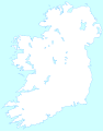
 Blank Ireland.svg 908 × 1,159; 81 KB
-
 Blankireland.svg 908 × 1,160; 27 KB
-
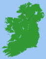 Ireland.svg 2,200 × 2,800; 204 KB
-
 Map Greco-Persian Wars-blank.svg 993 × 794; 3.12 MB
-
 Mediterranean Sea political map-blank.svg 2,046 × 1,496; 1.06 MB
-
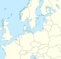 Northern and Central Europe 2 location map.svg 520 × 500; 1.84 MB
-
 Northern and Central Europe location map.svg 400 × 500; 1.84 MB
-
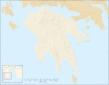 Peloponnese map shaded relief-blank.svg 2,611 × 2,044; 2.84 MB
-
 Peloponnese relief map-blank.svg 2,611 × 2,044; 1.97 MB
-
 Southeast Europe.svg 354 × 326; 457 KB
-
 United Kingdom and North-West France.svg 270 × 482; 58 KB


