Category:Blanchland
Jump to navigation
Jump to search
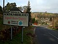
English: Blanchland is a village and civil parish in the county of Northumberland, England, right on the County Durham boundary with picturesque houses, set against a backdrop of deep woods and open moors.
village and civil parish in Northumberland, England  | |||||
| Upload media | |||||
| Instance of | |||||
|---|---|---|---|---|---|
| Location | Northumberland, North East England, England | ||||
| Located in or next to body of water | |||||
 | |||||
Subcategories
This category has the following 7 subcategories, out of 7 total.
B
- Blanchland War Memorial (3 F)
C
- The Carriers' Way (28 F)
L
- The Lord Crewe Arms Hotel (7 F)
M
N
- Newbiggin, Northumberland (4 F)
P
- Pennypie House (4 F)
S
- Shildon Cornish Engine House (12 F)
Media in category "Blanchland"
The following 200 files are in this category, out of 687 total.
(previous page) (next page)-
 10 The Square, Blanchland - geograph.org.uk - 4767385.jpg 2,816 × 1,880; 1.81 MB
-
 2nd currick on Hill 402 - geograph.org.uk - 4432830.jpg 640 × 480; 85 KB
-
 9 The Square, Blanchland - geograph.org.uk - 4767392.jpg 2,816 × 1,880; 1.94 MB
-
 A slice of Blanchland village life, 2014 - geograph.org.uk - 4094948.jpg 4,000 × 3,000; 1.57 MB
-
 Abbey Cottage, Blanchland - geograph.org.uk - 4763801.jpg 2,725 × 1,743; 1.42 MB
-
 Abbey Gatehouse in Blanchland - geograph.org.uk - 2560900.jpg 640 × 483; 53 KB
-
 Abbey Gatehouse, Blanchland - geograph.org.uk - 1859830.jpg 1,024 × 768; 195 KB
-
 Abbey Gatehouse, Blanchland - geograph.org.uk - 4763821.jpg 2,781 × 1,833; 1.35 MB
-
 Abbey Gatehouse, Blanchland - geograph.org.uk - 4892976.jpg 640 × 480; 51 KB
-
 Abbey View, Blanchland - geograph.org.uk - 4209422.jpg 1,024 × 768; 243 KB
-
 Across valley of Reeding Burn to Birkside - geograph.org.uk - 6377603.jpg 2,000 × 1,027; 1.52 MB
-
 Acton Burn - geograph.org.uk - 282225.jpg 640 × 480; 111 KB
-
 Acton Burn - geograph.org.uk - 944619.jpg 640 × 427; 65 KB
-
 Acton Cleugh - geograph.org.uk - 3132845.jpg 1,500 × 996; 1.51 MB
-
 Acton Cleugh - geograph.org.uk - 4893221.jpg 640 × 504; 162 KB
-
 Acton Cottage, Blanchland - geograph.org.uk - 1859772.jpg 1,024 × 768; 288 KB
-
 Acton Cottage, Blanchland - geograph.org.uk - 4209391.jpg 1,024 × 768; 264 KB
-
 Acton Farm - geograph.org.uk - 4095000.jpg 1,024 × 768; 243 KB
-
 Acton Farm from the south - geograph.org.uk - 4184315.jpg 1,024 × 768; 310 KB
-
 Acton Fell (2) - geograph.org.uk - 2856830.jpg 640 × 480; 91 KB
-
 Acton Fell - geograph.org.uk - 2567462.jpg 640 × 480; 98 KB
-
 Acton Fell - geograph.org.uk - 2567746.jpg 640 × 480; 116 KB
-
 Acton Fell - geograph.org.uk - 2859516.jpg 640 × 480; 74 KB
-
 Acton Fell - geograph.org.uk - 3257981.jpg 640 × 480; 85 KB
-
 Acton Fell above Acton Cleugh - geograph.org.uk - 2859532.jpg 640 × 480; 97 KB
-
 Acton Fell above High Actonmill - geograph.org.uk - 2859505.jpg 640 × 480; 100 KB
-
 Acton Fell and Acton Cleugh - geograph.org.uk - 2859508.jpg 640 × 480; 98 KB
-

-

-

-

-

-

-

-

-

-
 Acton Fell around Red Braes - geograph.org.uk - 2859549.jpg 640 × 480; 95 KB
-
 Acton Fell around Slatequarry Cleugh - geograph.org.uk - 3257987.jpg 640 × 480; 81 KB
-

-

-

-
 Acton Fell around the Duck Pools - geograph.org.uk - 2856854.jpg 640 × 480; 95 KB
-
 Acton Fell near Actoncleugh Head - geograph.org.uk - 2856840.jpg 640 × 480; 81 KB
-
 Acton Fell north of Potter Burn - geograph.org.uk - 2859493.jpg 640 × 480; 104 KB
-
 Acton Fell north of Ravens Crags - geograph.org.uk - 2859488.jpg 640 × 480; 104 KB
-
 Acton Fell north of Ravens Crags - geograph.org.uk - 2859551.jpg 640 × 480; 76 KB
-
 Acton Fell south of Actoncleugh Head - geograph.org.uk - 2859309.jpg 640 × 480; 95 KB
-
 Acton Fell south of Archers Fold - geograph.org.uk - 2859496.jpg 640 × 480; 106 KB
-
 Acton Fell southwest of Archers Fold - geograph.org.uk - 2859484.jpg 640 × 480; 106 KB
-
 Acton Fell west of Actoncleugh Head - geograph.org.uk - 2856862.jpg 640 × 480; 90 KB
-
 Acton Fell west of Black Hill - geograph.org.uk - 2856848.jpg 640 × 480; 98 KB
-
 Actoncleugh Head - geograph.org.uk - 2567479.jpg 640 × 480; 92 KB
-
 Actoncleugh Head - geograph.org.uk - 2856836.jpg 640 × 480; 83 KB
-
 Actoncleugh Head - geograph.org.uk - 2856858.jpg 640 × 480; 90 KB
-
 Actoncleugh Head - geograph.org.uk - 2859294.jpg 640 × 480; 85 KB
-
 Actoncleugh Head - geograph.org.uk - 2859315.jpg 640 × 480; 104 KB
-
 Actoncleugh Head - geograph.org.uk - 2859321.jpg 640 × 480; 89 KB
-
 Alanshields Farmhouse - geograph.org.uk - 182771.jpg 640 × 480; 70 KB
-
 Archers Fold (2) - geograph.org.uk - 2859471.jpg 640 × 480; 102 KB
-
 Archers Fold - geograph.org.uk - 2567579.jpg 640 × 480; 108 KB
-
 B6306 beside High Birks Plantation - geograph.org.uk - 4892944.jpg 640 × 480; 82 KB
-
 B6306, Blanchland Moor - geograph.org.uk - 4892903.jpg 640 × 480; 44 KB
-
 Barn off Park Bank (B6306) - geograph.org.uk - 4892934.jpg 640 × 480; 48 KB
-
 Bay Bridge - geograph.org.uk - 5648573.jpg 1,024 × 768; 301 KB
-
 Baybridge - geograph.org.uk - 2164176.jpg 2,000 × 1,500; 3.15 MB
-
 Baybridge - geograph.org.uk - 5721583.jpg 640 × 480; 54 KB
-
 Baybridge - geograph.org.uk - 5721595.jpg 640 × 480; 81 KB
-
 Baybridge cottages (formerly Miners' Arms) - geograph.org.uk - 5648532.jpg 1,024 × 768; 282 KB
-
 Baybridge from the east - geograph.org.uk - 907225.jpg 640 × 480; 72 KB
-
 Baybridge Methodist Chapel (geograph 5648502).jpg 1,024 × 768; 259 KB
-
 Baybridge picnic site - geograph.org.uk - 2684343.jpg 640 × 480; 108 KB
-

-
 Beldon Burn at Beldon Shields - geograph.org.uk - 5214357.jpg 5,312 × 2,988; 3.64 MB
-
 Beldon Cleugh - geograph.org.uk - 2683677.jpg 640 × 480; 111 KB
-
 Beldon Cleugh - geograph.org.uk - 4438228.jpg 640 × 480; 104 KB
-
 Beldon Cleugh - geograph.org.uk - 4440059.jpg 640 × 480; 113 KB
-
 Beldon Cleugh - geograph.org.uk - 5573348.jpg 640 × 480; 85 KB
-
 Beldon Cleugh - geograph.org.uk - 6223834.jpg 1,024 × 768; 289 KB
-
 Beldon Shield Mine - geograph.org.uk - 4232731.jpg 640 × 853; 719 KB
-
 Beldon Side - geograph.org.uk - 1140386.jpg 640 × 378; 69 KB
-
 Beldon Side - geograph.org.uk - 2332290.jpg 640 × 480; 86 KB
-
 Beldon Side - geograph.org.uk - 2332381.jpg 640 × 480; 71 KB
-
 Beldon Side - geograph.org.uk - 3814625.jpg 640 × 480; 73 KB
-

-
 Birkside Fell (2) - geograph.org.uk - 2849778.jpg 640 × 480; 74 KB
-
 Birkside Fell (3) - geograph.org.uk - 510802.jpg 640 × 480; 80 KB
-
 Birkside Fell (4) - geograph.org.uk - 510811.jpg 640 × 480; 80 KB
-
 Birkside Fell (5) - geograph.org.uk - 1731290.jpg 640 × 480; 76 KB
-
 Birkside Fell - geograph.org.uk - 2847149.jpg 640 × 480; 83 KB
-
 Birkside Fell - geograph.org.uk - 2849772.jpg 640 × 480; 82 KB
-
 Birkside Fell - geograph.org.uk - 3333844.jpg 4,000 × 3,000; 2.72 MB
-
 Birkside Fell - geograph.org.uk - 3587509.jpg 640 × 478; 69 KB
-

-

-

-

-

-
 Birkside Fell north of Newbiggin - geograph.org.uk - 2847123.jpg 640 × 480; 81 KB
-

-
 Birkside Fell west of Pennypie House - geograph.org.uk - 2847133.jpg 640 × 480; 94 KB
-
 Black Hill - geograph.org.uk - 2859481.jpg 640 × 480; 106 KB
-
 Black Hill - geograph.org.uk - 2859522.jpg 640 × 480; 81 KB
-
 Blackburn Head Hut - geograph.org.uk - 6378356.jpg 2,000 × 1,197; 1.7 MB
-
 Blanchland - Doorway, Lord Crewe Arms - geograph.org.uk - 6010673.jpg 5,184 × 2,920; 6.73 MB
-
 Blanchland - geograph.org.uk - 3333873.jpg 4,000 × 3,000; 4.89 MB
-
 Blanchland - geograph.org.uk - 3471443.jpg 800 × 505; 114 KB
-
 Blanchland - telephone box - geograph.org.uk - 6010677.jpg 5,184 × 2,920; 6.62 MB
-
 Blanchland - village square - geograph.org.uk - 6010671.jpg 5,184 × 2,920; 5.03 MB
-
 Blanchland Abbey site, Northumberland.jpg 4,623 × 2,599; 2.26 MB
-
 Blanchland and lucky with the weather - geograph.org.uk - 5721587.jpg 2,048 × 1,536; 873 KB
-
 Blanchland bridge - geograph.org.uk - 4764126.jpg 2,760 × 1,797; 2.04 MB
-
 Blanchland Bridge - geograph.org.uk - 5177231.jpg 4,000 × 3,000; 3.9 MB
-
 Blanchland buildings - geograph.org.uk - 1003909.jpg 640 × 223; 64 KB
-
 Blanchland centre - geograph.org.uk - 762726.jpg 640 × 399; 77 KB
-
 Blanchland from Derwent Bridge - geograph.org.uk - 4209453.jpg 1,024 × 768; 195 KB
-
 Blanchland Post Office - geograph.org.uk - 2409820.jpg 2,592 × 1,944; 1.52 MB
-
 Blanchland Post Office - geograph.org.uk - 267160.jpg 480 × 640; 80 KB
-
 Blanchland Roofs - geograph.org.uk - 1003930.jpg 640 × 349; 107 KB
-
 Blanchland south of the Square - geograph.org.uk - 4209451.jpg 1,024 × 768; 264 KB
-
 Blanchland village square. - geograph.org.uk - 4233614.jpg 640 × 480; 58 KB
-
 Blanchland, 1967 - geograph.org.uk - 3307041.jpg 640 × 353; 76 KB
-
 Blanchland, Northumberland.jpg 2,460 × 1,846; 670 KB
-
 Blooming heather on Round Hill - geograph.org.uk - 5506750.jpg 1,500 × 991; 1.14 MB
-
 Bog wood across the Derwent valley. - geograph.org.uk - 4233617.jpg 640 × 393; 53 KB
-

-
 Bridge over the River Derwent at Blanchland - geograph.org.uk - 2884235.jpg 3,264 × 2,448; 1.35 MB
-
 Bridleway on Birkside Fell - geograph.org.uk - 2683802.jpg 640 × 480; 108 KB
-
 Bridleway on Birkside Fell - geograph.org.uk - 5467004.jpg 640 × 480; 100 KB
-
 Bridleway on Birkside Fell - geograph.org.uk - 5467014.jpg 640 × 480; 111 KB
-
 Bridleway on Birkside Moor - geograph.org.uk - 2684334.jpg 640 × 480; 121 KB
-
 Bronze Age Ring Cairn, Birkside Fell - geograph.org.uk - 5648409.jpg 1,024 × 768; 258 KB
-
 Building beside path at Shildon - geograph.org.uk - 5122324.jpg 1,500 × 1,125; 1.93 MB
-
 Bulbeck Common (2) - geograph.org.uk - 1731272.jpg 640 × 480; 66 KB
-
 Bulbeck Common - geograph.org.uk - 2847137.jpg 640 × 480; 95 KB
-
 Bulbeck Common - geograph.org.uk - 2847143.jpg 640 × 480; 88 KB
-
 Bulbeck Common - geograph.org.uk - 2849768.jpg 640 × 480; 92 KB
-
 Bulbeck Common - geograph.org.uk - 2849797.jpg 640 × 480; 96 KB
-
 Bulbeck Common - geograph.org.uk - 2862796.jpg 640 × 480; 88 KB
-
 Bulbeck Common above Long Lee (2) - geograph.org.uk - 2850417.jpg 640 × 480; 88 KB
-
 Bulbeck Common above Long Lee - geograph.org.uk - 2850415.jpg 640 × 480; 75 KB
-
 Bulbeck Common below Haugh Edge - geograph.org.uk - 2847109.jpg 640 × 480; 84 KB
-
 Bulbeck Common below Haugh Edge - geograph.org.uk - 2849848.jpg 640 × 480; 87 KB
-

-
 Bulbeck Common south of Haugh Edge - geograph.org.uk - 2847131.jpg 640 × 480; 93 KB
-
 Bulbeck Common south of Haugh Edge - geograph.org.uk - 2849850.jpg 640 × 480; 81 KB
-

-

-

-

-
 Bulbeck Common west of Stony Hills - geograph.org.uk - 2847154.jpg 640 × 480; 94 KB
-
 Burntshieldhaugh Fell (2) - geograph.org.uk - 2862793.jpg 640 × 480; 77 KB
-
 Burntshieldhaugh Fell - geograph.org.uk - 2567286.jpg 640 × 480; 77 KB
-
 Burntshieldhaugh Fell - geograph.org.uk - 2862790.jpg 640 × 480; 73 KB
-

-

-

-

-
 Byre and hayloft, Blanchland - geograph.org.uk - 4764037.jpg 2,816 × 1,880; 1.63 MB
-
 Carrier's Way - geograph.org.uk - 2683753.jpg 640 × 480; 103 KB
-
 Carrier's Way on Bulbeck Common - geograph.org.uk - 3359280.jpg 640 × 480; 72 KB
-
 Carriers' Way, Birkside Fell - geograph.org.uk - 1146550.jpg 640 × 480; 92 KB
-
 Castleberry Sike - geograph.org.uk - 2683681.jpg 640 × 480; 109 KB
-
 Cheese press weight, Blanchland, Northumbria.jpg 1,828 × 2,279; 1.1 MB
-
 Clap Shaw, Blanchland - geograph.org.uk - 5648621.jpg 1,024 × 765; 244 KB
-
 Clear-felling above Beldon Cleugh - geograph.org.uk - 4438245.jpg 640 × 480; 70 KB
-
-

-
-
 Cleugh on War Law - geograph.org.uk - 2567455.jpg 640 × 480; 102 KB
-
 Conifer Plantation with Bracken - geograph.org.uk - 1933967.jpg 1,500 × 802; 1.91 MB
-
 Converted farm buildings at Cowbyers - geograph.org.uk - 2884279.jpg 3,264 × 2,448; 1.41 MB
-
 Converted farm buildings, Cowbyers - geograph.org.uk - 4892940.jpg 640 × 404; 54 KB
-
 Cottages at Baybridge - geograph.org.uk - 5780236.jpg 2,592 × 1,944; 1.64 MB
-
 Cottages at Shildon - geograph.org.uk - 5471571.jpg 720 × 540; 109 KB
-
 Cottages in Blanchland - geograph.org.uk - 2571318.jpg 640 × 480; 117 KB
-
 Cottages in the village square - geograph.org.uk - 3470357.jpg 800 × 533; 95 KB
-
 Cowbyers Fell (2) - geograph.org.uk - 2847157.jpg 640 × 480; 105 KB
-
 Cowbyers Fell (2) - geograph.org.uk - 2860816.jpg 640 × 480; 89 KB
-
 Cowbyers Fell (3) - geograph.org.uk - 2847159.jpg 640 × 480; 109 KB
-
 Cowbyers Fell (3) - geograph.org.uk - 2860821.jpg 640 × 480; 88 KB
-
 Cowbyers Fell (4) - geograph.org.uk - 2860823.jpg 640 × 480; 86 KB
-
 Cowbyers Fell - geograph.org.uk - 2567173.jpg 640 × 480; 100 KB
-
 Cowbyers Fell - geograph.org.uk - 2860809.jpg 640 × 480; 84 KB
-
 Cowbyers Fell - geograph.org.uk - 2860901.jpg 640 × 480; 74 KB
-

-
 Cowbyers Fell west of Acton Dean - geograph.org.uk - 2860911.jpg 640 × 480; 83 KB
-

-

-
 Dean Rigg (2) - geograph.org.uk - 2860866.jpg 640 × 480; 94 KB
-
 Dean Rigg (3) - geograph.org.uk - 2860877.jpg 640 × 480; 91 KB
-
 Dean Rigg - geograph.org.uk - 2567842.jpg 640 × 480; 96 KB
-
 Dean Rigg - geograph.org.uk - 2567868.jpg 640 × 480; 108 KB
-
 Dean Rigg and Cowbyers Fell - geograph.org.uk - 2860841.jpg 640 × 480; 80 KB
-
 Derwent Reservoir Nature Reserve - geograph.org.uk - 6336365.jpg 640 × 480; 111 KB
-
 Derwent Reservoir south of Tod Hill - geograph.org.uk - 4184325.jpg 1,024 × 768; 280 KB
-
 Disused mine next to Beldon burn - geograph.org.uk - 5213392.jpg 5,312 × 2,988; 5.92 MB
-
 Disused mine next to Beldon burn - geograph.org.uk - 5213499.jpg 5,312 × 2,988; 6.19 MB
-

-

-
 Disused mine shaft on Pennypie Fell - geograph.org.uk - 2567937.jpg 640 × 480; 79 KB


_-_geograph.org.uk_-_2856830.jpg)


_-_geograph.org.uk_-_2856090.jpg)
_-_geograph.org.uk_-_2856832.jpg)


_-_geograph.org.uk_-_2859471.jpg)


_-_geograph.org.uk_-_4892934.jpg)


_-_geograph.org.uk_-_5648532.jpg)

.jpg)


_-_geograph.org.uk_-_2849778.jpg)
_-_geograph.org.uk_-_510802.jpg)
_-_geograph.org.uk_-_510811.jpg)
_-_geograph.org.uk_-_1731290.jpg)


_-_geograph.org.uk_-_1731272.jpg)


_-_geograph.org.uk_-_2850417.jpg)


_-_geograph.org.uk_-_2862793.jpg)


_-_geograph.org.uk_-_2850405.jpg)
_-_geograph.org.uk_-_2850408.jpg)
_-_geograph.org.uk_-_2850414.jpg)


_-_geograph.org.uk_-_2847157.jpg)
_-_geograph.org.uk_-_2860816.jpg)
_-_geograph.org.uk_-_2847159.jpg)
_-_geograph.org.uk_-_2860821.jpg)
_-_geograph.org.uk_-_2860823.jpg)


_-_geograph.org.uk_-_2860866.jpg)
_-_geograph.org.uk_-_2860877.jpg)


_-_geograph.org.uk_-_4438160.jpg)