Category:Blackthorn, Oxfordshire
Jump to navigation
Jump to search
village and civil parish in Cherwell district, Oxfordshire, England, UK  | |||||
| Upload media | |||||
| Instance of | |||||
|---|---|---|---|---|---|
| Location | Cherwell, Oxfordshire, South East England, England | ||||
| Population |
| ||||
| Area |
| ||||
| official website | |||||
 | |||||

English: Images relating to Blackthorn, Oxfordshire, England. For more information see the Wikipedia article Blackthorn, Oxfordshire.
Media in category "Blackthorn, Oxfordshire"
The following 80 files are in this category, out of 80 total.
-

-
 A41 near Stone Pits Farm - geograph.org.uk - 2836068.jpg 640 × 481; 56 KB
-
 A41 towards Aylesbury - geograph.org.uk - 5638016.jpg 640 × 428; 114 KB
-
 A41 towards Aylesbury - geograph.org.uk - 5638104.jpg 640 × 428; 95 KB
-
 Bentley Design at Symmetry Park, Bicester - geograph.org.uk - 6057367.jpg 1,920 × 1,280; 1,015 KB
-
 Bentley Design at Symmetry Park, Bicester - geograph.org.uk - 6177207.jpg 1,866 × 1,192; 1.3 MB
-
 Blackthorn Bridge over the A41 - geograph.org.uk - 3389611.jpg 1,500 × 1,000; 144 KB
-
 Blackthorn East Mill (geograph 4112372).jpg 472 × 640; 84 KB
-
 Blackthorn Hill - geograph.org.uk - 6271458.jpg 5,388 × 3,531; 2.31 MB
-
 Blackthorn map.png 640 × 660; 89 KB
-
 Blackthorn map.svg 848 × 805; 306 KB
-
 Blackthorn railway bridge from A41 - geograph.org.uk - 2214258.jpg 640 × 449; 53 KB
-
 Blackthorn Road - geograph.org.uk - 4873217.jpg 2,048 × 1,536; 1.42 MB
-
 Blackthorn Road - geograph.org.uk - 4873219.jpg 2,048 × 1,536; 1.41 MB
-
 Blackthorn Road crossing a stream - geograph.org.uk - 4873221.jpg 2,046 × 1,534; 1.22 MB
-
 Blackthorn Road south of Launton - geograph.org.uk - 4873220.jpg 2,048 × 1,536; 888 KB
-
 Blackthorn Village Sign - geograph.org.uk - 6271472.jpg 5,173 × 3,181; 1.97 MB
-
 Blackthorn.jpg 640 × 427; 125 KB
-
 Bridleway to Ploughley Road - geograph.org.uk - 2177540.jpg 640 × 480; 74 KB
-
 Car boot sale at Peter's Paddock - geograph.org.uk - 1912403.jpg 1,600 × 1,200; 955 KB
-
 Church Leys Field - geograph.org.uk - 6272681.jpg 5,146 × 3,441; 1.46 MB
-
 Crossing A41 - geograph.org.uk - 2737825.jpg 640 × 480; 105 KB
-
 Cutter's Bridge - geograph.org.uk - 2181213.jpg 640 × 480; 74 KB
-
 Elm Tree Close, Blackthorn - geograph.org.uk - 5215645.jpg 640 × 480; 146 KB
-
 Field and tree near Blackthorn - geograph.org.uk - 5215636.jpg 640 × 480; 165 KB
-
 Field by the Chiltern Main Line - geograph.org.uk - 4521014.jpg 640 × 426; 35 KB
-
 Field next to Peter's Paddock - geograph.org.uk - 2449110.jpg 1,500 × 1,000; 153 KB
-
 Flooding by the River Ray - geograph.org.uk - 3372470.jpg 640 × 430; 36 KB
-
 Footpath to Station Road - geograph.org.uk - 2177555.jpg 640 × 480; 73 KB
-
 House Building, Ambrosden - geograph.org.uk - 6272700.jpg 4,798 × 3,487; 1.9 MB
-
 Inquisitive sheep - geograph.org.uk - 254931.jpg 639 × 428; 156 KB
-
 Leaving Blackthorn through White Gates - geograph.org.uk - 6282385.jpg 5,307 × 3,321; 2.63 MB
-
 Line to Bicester - geograph.org.uk - 2177584.jpg 640 × 480; 89 KB
-
 Looking across a field towards Arncott - geograph.org.uk - 2449099.jpg 1,500 × 1,000; 140 KB
-
 Looking across a field towards Arncott - geograph.org.uk - 2449104.jpg 1,500 × 1,000; 210 KB
-
 Looking across the River Ray - geograph.org.uk - 2492820.jpg 1,500 × 984; 330 KB
-
 Low bridge on A41 - geograph.org.uk - 5215649.jpg 640 × 428; 141 KB
-
 Mill House Farm - geograph.org.uk - 4112379.jpg 640 × 480; 89 KB
-
 Mill House Farm on the A41 - geograph.org.uk - 4873223.jpg 2,008 × 1,480; 845 KB
-
 Railway bridge on the A41, Blackthorn - geograph.org.uk - 6176450.jpg 1,836 × 1,138; 1.11 MB
-
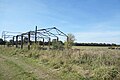 Remains of a Barn - geograph.org.uk - 6271451.jpg 5,472 × 3,648; 3.02 MB
-
 Road to Launton - geograph.org.uk - 2177578.jpg 640 × 480; 74 KB
-
 Sheep grazing - geograph.org.uk - 3372453.jpg 640 × 335; 29 KB
-
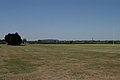 Sports Ground - geograph.org.uk - 204261.jpg 640 × 427; 97 KB
-
 Station Road, Blackthorn - geograph.org.uk - 6271493.jpg 4,897 × 2,868; 1.65 MB
-
 Thame Road at the junction of the B4011 - geograph.org.uk - 4871747.jpg 2,048 × 1,536; 1.5 MB
-
 Thame Road, Blackthorn - geograph.org.uk - 6271497.jpg 4,216 × 2,830; 1.41 MB
-
 The A41 - geograph.org.uk - 3372455.jpg 640 × 531; 43 KB
-
 The A41 at the junction of Blackthorn Road - geograph.org.uk - 4872434.jpg 2,048 × 1,536; 1.41 MB
-
 The A41 at the junction of Blackthorn Road - geograph.org.uk - 4872436.jpg 2,048 × 1,536; 1.51 MB
-
 The A41 between Ambrosden and Blackthorn - geograph.org.uk - 6183156.jpg 1,887 × 1,257; 1.17 MB
-
 The A41 near Stone Pits Farm - geograph.org.uk - 3965909.jpg 1,500 × 790; 129 KB
-
 The A41 to Aylesbury - geograph.org.uk - 3389613.jpg 1,500 × 1,000; 175 KB
-
 The A41 to Aylesbury - geograph.org.uk - 3965916.jpg 1,500 × 999; 173 KB
-
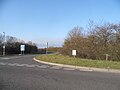
 The B4011 at the turnoff to Ambrosden - geograph.org.uk - 4871735.jpg 2,048 × 1,536; 1.48 MB
-
 The Corner of Bluebell Road - geograph.org.uk - 6272708.jpg 5,230 × 3,275; 1.82 MB
-
 The entrance to Symmetry Park Bicester - geograph.org.uk - 6177216.jpg 1,920 × 1,280; 1.1 MB
-
 The former Rose ^ Crown - geograph.org.uk - 3447617.jpg 1,500 × 1,000; 296 KB
-
 The lane from Piddington to the A41 - geograph.org.uk - 715744.jpg 640 × 480; 122 KB
-
 The River Ray at Blackthorn - geograph.org.uk - 2492828.jpg 1,500 × 1,000; 262 KB
-
 The road to Marsh Gibbon - geograph.org.uk - 4186096.jpg 1,500 × 999; 133 KB
-
 The road to Marsh Gibbon passes Essex Cottages - geograph.org.uk - 4186094.jpg 1,500 × 999; 138 KB
-
 Track off Blackthorn Road - geograph.org.uk - 4873218.jpg 1,982 × 1,444; 1.51 MB
-
 Trees by the River Ray - geograph.org.uk - 2449102.jpg 1,500 × 1,000; 160 KB
-
 Trees by the River Ray in Peter's Paddock - geograph.org.uk - 2449111.jpg 1,500 × 1,000; 160 KB
-
 Weir Pond - geograph.org.uk - 2177560.jpg 640 × 480; 91 KB
-
 Weir Pond in a Dry Summer - geograph.org.uk - 6271478.jpg 4,842 × 3,648; 3.16 MB
-
 Bridge and boundary post - geograph.org.uk - 468867.jpg 640 × 480; 140 KB
-
 Busy lane, winter evening - geograph.org.uk - 303823.jpg 640 × 367; 45 KB
-
 Chiltern Line Train - geograph.org.uk - 254925.jpg 639 × 428; 156 KB
-
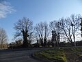
 County boundary - geograph.org.uk - 468869.jpg 480 × 640; 122 KB
-
 Cows after Milking - geograph.org.uk - 255642.jpg 640 × 421; 124 KB
-
 Farm Buildings - geograph.org.uk - 255626.jpg 639 × 428; 161 KB
-
 Farm buildings at sunset - geograph.org.uk - 303794.jpg 640 × 301; 41 KB
-
 Feeding Trough - geograph.org.uk - 255636.jpg 639 × 428; 180 KB
-
 Field next to Furze Grounds Farm - geograph.org.uk - 303814.jpg 640 × 333; 55 KB
-

-
 Manor Barn Blackthorn - geograph.org.uk - 204230.jpg 640 × 427; 136 KB
-
 New farmhouse - geograph.org.uk - 303785.jpg 640 × 480; 70 KB
-
 The Road to Piddington - geograph.org.uk - 254934.jpg 639 × 428; 191 KB


.jpg)


