Category:Blaby (village)
Jump to navigation
Jump to search
English: Blaby is a village in central Leicestershire, England, some five miles south of Leicester city centre. It has population of around 6,240 (2001 figures), and its proximity to the city causes it to form part of the Leicester Urban Area. (→Blaby)
Français : Blaby est un village et une paroisse civile du Leicestershire, en Angleterre. Il est situé dans le district de Blaby, à environ . (→Blaby)
Italiano: Blaby è un paese di 6.240 abitanti della contea del Leicestershire, in Inghilterra. (→Blaby)
Norsk bokmål: Blaby er en landsby i det engelske grevskapet Leicestershire om lag 8 km sør for Leicester sentrum (og nesten nøyaktig i sentrum av grevskapet) med en befolkning på ca. 6240 (tall fra 2001). (→Blaby)
Polski: Blaby – wieś w Anglii, w hrabstwie Leicestershire, w dystrykcie Blaby. Leży 8 km na południe od miasta Leicester i 138 km na północny zachód od Londynu. (→Blaby)
Română: Blaby este un oraș și un district ne-metropolitan situat în comitatul Leicestershire, regiunea East Midlands, Anglia. Districtul are o populație de 92.500 locuitori din care 6.240 locuiesc în orașul propriu zis Blaby. (→Blaby)
Svenska: Blaby är en by och en civil parish i Blaby i Leicestershire i England. Orten har 6194 invånare (2011). Byn nämndes i Domedagsboken (Domesday Book) år 1086, och kallades då Bladi. (→Blaby)

village and civil parish in Leicestershire, UK  Le bureau de poste de Blaby | |||||
| Upload media | |||||
| Instance of | |||||
|---|---|---|---|---|---|
| Location | Blaby, Leicestershire, East Midlands, England | ||||
| Said to be the same as | Blaby (Wikimedia duplicated page, civil parish) | ||||
| official website | |||||
 | |||||
Subcategories
This category has the following 3 subcategories, out of 3 total.
B
- All Saints Church, Blaby (8 F)
- Blaby War Memorial (1 F)
P
Media in category "Blaby (village)"
The following 155 files are in this category, out of 155 total.
-

-
 A hazard at Blaby Golf Centre - geograph.org.uk - 4965597.jpg 1,920 × 1,080; 634 KB
-
 A426 Blaby By-Pass - geograph.org.uk - 2875651.jpg 2,619 × 1,914; 1.9 MB
-
 All Saints Church - geograph.org.uk - 4486388.jpg 800 × 600; 122 KB
-
 All Saints Parish Church, Blaby - geograph.org.uk - 5273074.jpg 612 × 800; 113 KB
-
 Bagnall fireless locomotive 2370 - geograph.org.uk - 2173190.jpg 800 × 531; 95 KB
-
 Ye Olde Bakers Arms, Blaby. - geograph.org.uk - 403490.jpg 640 × 480; 146 KB
-
 Blaby Black Horse Pub - geograph.org.uk - 2897839.jpg 640 × 480; 148 KB
-
 Blaby Bulls Head Pub - geograph.org.uk - 2766788.jpg 640 × 480; 109 KB
-
 Blaby George Pub - geograph.org.uk - 2766805.jpg 640 × 480; 89 KB
-
 Blaby Hall - geograph.org.uk - 2297314.jpg 640 × 480; 134 KB
-
 Blaby Mill - geograph.org.uk - 5175631.jpg 800 × 508; 125 KB
-
 Blaby Mill near Leicester - geograph.org.uk - 814862.jpg 640 × 471; 65 KB
-
 Blaby Mill stables and horse livery yard - geograph.org.uk - 5379413.jpg 800 × 556; 140 KB
-
 Blaby Post Office.JPG 2,551 × 1,470; 692 KB
-
 Blaby railway station.jpg 640 × 354; 114 KB
-
 Blaby Tom Thumb Pub - geograph.org.uk - 2766824.jpg 640 × 480; 102 KB
-
 Blaby village free public car park - geograph.org.uk - 125049.jpg 640 × 480; 72 KB
-
 Blaby village sign along Winchester Road - geograph.org.uk - 3675058.jpg 1,600 × 1,081; 518 KB
-
 Blaby-Cross Street - geograph.org.uk - 2294356.jpg 640 × 508; 66 KB
-
 Blaby-Hall Farm - geograph.org.uk - 2293671.jpg 640 × 480; 64 KB
-
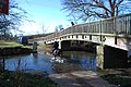
 Blaby-Leicester Road Bridge - geograph.org.uk - 2296934.jpg 640 × 480; 65 KB
-
 Blaby-Mill Lane - geograph.org.uk - 2294386.jpg 640 × 480; 138 KB
-
 Blaby-The Bulls Head - geograph.org.uk - 2302860.jpg 640 × 480; 68 KB
-
 Blaby-The George Public House - geograph.org.uk - 2295235.jpg 640 × 480; 56 KB
-
 Blaby-Ye Olde Bakers Arms - geograph.org.uk - 2297323.jpg 640 × 480; 105 KB
-
 Bridleway from Blaby to Countesthorpe - geograph.org.uk - 5248280.jpg 2,000 × 1,500; 639 KB
-
 Bridleway to Foston - geograph.org.uk - 4965616.jpg 1,920 × 1,080; 690 KB
-
 Bridleway to Hospital Lane in Blaby - geograph.org.uk - 5532411.jpg 800 × 598; 134 KB
-

-

-
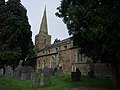 Church of All Saints, Blaby - geograph.org.uk - 2573100.jpg 4,000 × 3,000; 2.82 MB
-
 Church Street in Blaby - geograph.org.uk - 5273065.jpg 680 × 800; 189 KB
-
 Corrugated iron building, Blaby - geograph.org.uk - 4449070.jpg 640 × 426; 37 KB
-
 Cottage at Hall Farm, Blaby - geograph.org.uk - 5273056.jpg 800 × 584; 163 KB
-
 Cottage on Wigston Road - geograph.org.uk - 3157238.jpg 640 × 480; 61 KB
-
 Countesthorpe Road - geograph.org.uk - 3912119.jpg 640 × 480; 67 KB
-
 Crow Mills Way - geograph.org.uk - 3909363.jpg 1,600 × 1,207; 728 KB
-
 Cuttings Farm, Hospital Lane - geograph.org.uk - 3203745.jpg 640 × 543; 92 KB
-
 Cycle Route 6 about to cross the River Sence - geograph.org.uk - 2837653.jpg 4,000 × 3,000; 4.63 MB
-
 Cycle Route 6 crossing the Blaby Bypass - geograph.org.uk - 2837629.jpg 4,000 × 3,000; 4.55 MB
-
 Cycle Route 6 entering Blaby along Winchester Road - geograph.org.uk - 2573067.jpg 4,000 × 3,000; 2.86 MB
-
 Cycle Route 6 on the outskirts of Blaby - geograph.org.uk - 2573083.jpg 4,000 × 3,000; 2.87 MB
-

-
 Darley Road, Blaby - geograph.org.uk - 3567626.jpg 640 × 480; 69 KB
-
 Duck Pond Grove Road Blaby - geograph.org.uk - 1074004.jpg 480 × 640; 133 KB
-
 Entrance to Blaby shopping centre - geograph.org.uk - 5697070.jpg 480 × 640; 78 KB
-
 Entrance to Westfield Park - geograph.org.uk - 1074169.jpg 640 × 480; 106 KB
-
 Ex Railway Rolling Stock Blaby - geograph.org.uk - 1074145.jpg 640 × 480; 80 KB
-

-
 Farmland south of Whetstone - geograph.org.uk - 2422288.jpg 2,277 × 1,707; 1.57 MB
-
 Farmland west of Countesthorpe Road - geograph.org.uk - 3912118.jpg 640 × 480; 78 KB
-
 Field and a Steam Locomotive - geograph.org.uk - 2173192.jpg 800 × 531; 71 KB
-
 Field and footpath near Blaby - geograph.org.uk - 4964768.jpg 1,920 × 1,080; 669 KB
-
 Field Entrance - geograph.org.uk - 1072594.jpg 640 × 480; 76 KB
-
 Fields near Willow Farm - geograph.org.uk - 3820356.jpg 640 × 480; 52 KB
-
 Flooding near the River Sence - geograph.org.uk - 5639396.jpg 800 × 510; 131 KB
-
 Footbridge across the River Sence - geograph.org.uk - 3909134.jpg 1,600 × 1,115; 548 KB
-
 Footbridge across the River Sence - geograph.org.uk - 5273090.jpg 800 × 561; 199 KB
-
 Footbridge across the River Sence - geograph.org.uk - 5379293.jpg 800 × 581; 144 KB
-

-
 Footbridge on footpath, Blaby - geograph.org.uk - 1259365.jpg 640 × 480; 125 KB
-
 Footbridge over River Sence near Blaby - geograph.org.uk - 4964754.jpg 1,920 × 1,080; 634 KB
-

-
 Footpath to Blaby - geograph.org.uk - 2422254.jpg 2,423 × 2,850; 2.69 MB
-
 Footpath to Little Glen Road in Glen Parva - geograph.org.uk - 3909183.jpg 1,600 × 1,200; 671 KB
-
 Footpath to Park Road in Blaby - geograph.org.uk - 2422259.jpg 2,424 × 2,518; 2.59 MB
-
 Footpath, Blaby - geograph.org.uk - 1259364.jpg 480 × 640; 118 KB
-
 Ford on the River Sence, Blaby - geograph.org.uk - 2812206.jpg 3,872 × 2,592; 2.39 MB
-
 Fox ^ Tiger in Blaby - geograph.org.uk - 5273046.jpg 800 × 534; 104 KB
-

-
 Glen Ford across the River Sence - geograph.org.uk - 5639406.jpg 800 × 727; 199 KB
-
 Golf In The Frost Blaby - geograph.org.uk - 1072537.jpg 640 × 480; 84 KB
-
 Gravestones at the Mill Lane Cemetery - geograph.org.uk - 5532320.jpg 800 × 688; 195 KB
-
 Green Space And Path Near Cranmer Close - geograph.org.uk - 1074152.jpg 480 × 640; 102 KB
-
 Guthlaxton Trail towards Glen Parva - geograph.org.uk - 3924572.jpg 1,600 × 1,200; 463 KB
-

-
 Hall Farm along Church Street, Blaby - geograph.org.uk - 5273080.jpg 800 × 536; 121 KB
-
 Horse paddocks near Blaby Mill - geograph.org.uk - 5379387.jpg 800 × 633; 129 KB
-
 Horses next to the Guthlaxton Trail - geograph.org.uk - 6408156.jpg 800 × 545; 145 KB
-

-
 Ice house, Bouskell Park, Blaby - geograph.org.uk - 1288097.jpg 640 × 480; 95 KB
-
 Information board at Crow Mills Way - geograph.org.uk - 3909312.jpg 1,600 × 1,153; 505 KB
-
 Irony On The Footpath Blaby - geograph.org.uk - 1074161.jpg 480 × 640; 178 KB
-
 Leicester Lions Rugby Ground Blaby - geograph.org.uk - 1072477.jpg 480 × 640; 61 KB
-
 Leicestershire Scout HQ Blaby - geograph.org.uk - 1072569.jpg 640 × 480; 88 KB
-
 Lime Grove, Blaby - geograph.org.uk - 4965601.jpg 1,920 × 1,080; 585 KB
-
 Lutterworth Road towards Whetstone - geograph.org.uk - 2422283.jpg 3,148 × 2,143; 3.17 MB
-
 Mill Lane Cemetery, Blaby - geograph.org.uk - 2573092.jpg 4,000 × 3,000; 2.87 MB
-
 Mill Lane in Blaby - geograph.org.uk - 5379319.jpg 800 × 548; 131 KB
-
 Mill Lane near Blaby Hill - geograph.org.uk - 5637650.jpg 800 × 541; 164 KB
-
 North along Countesthorpe Road - geograph.org.uk - 2885233.jpg 1,020 × 782; 329 KB
-
 North along Countesthorpe Road - geograph.org.uk - 2885253.jpg 2,429 × 2,353; 2.11 MB
-
 Northfield Park - geograph.org.uk - 3157314.jpg 640 × 480; 60 KB
-
 Old chapel at the Mill Lane Cemetery - geograph.org.uk - 5532334.jpg 800 × 788; 168 KB
-
 Parish Church Centre, Blaby - geograph.org.uk - 3157235.jpg 640 × 480; 108 KB
-
 Park Road in Blaby - geograph.org.uk - 2422266.jpg 3,242 × 2,156; 2.43 MB
-
 Port Hill viewed from Crow Mills Way - geograph.org.uk - 3909383.jpg 1,600 × 1,259; 644 KB
-
 Post boxes along Winchester Avenue in Blaby - geograph.org.uk - 3924616.jpg 1,600 × 1,221; 358 KB
-

-

-
 Pylon by the River Sence - geograph.org.uk - 4442362.jpg 640 × 424; 45 KB
-
 Railway bridge over the A426 - geograph.org.uk - 3157320.jpg 640 × 349; 50 KB
-

-
 River Sence - geograph.org.uk - 3912122.jpg 640 × 480; 131 KB
-
 River Sence at Glen Parva - geograph.org.uk - 5273171.jpg 800 × 550; 181 KB
-
 Roundabout, A426 - geograph.org.uk - 4449062.jpg 640 × 426; 61 KB
-
 Scout HQ Blaby - geograph.org.uk - 1072581.jpg 640 × 480; 77 KB
-

-
 Steam locomotive in a field - geograph.org.uk - 3157329.jpg 640 × 464; 56 KB
-
 Steps at Crow Mills Way nature area - geograph.org.uk - 3909348.jpg 1,600 × 1,284; 707 KB
-
 Terraced housing - geograph.org.uk - 481650.jpg 640 × 463; 144 KB
-
 The Black Horse, Blaby - geograph.org.uk - 3157247.jpg 640 × 465; 41 KB
-
 The Dog ^ Gun and the A426, Lutterworth Road - geograph.org.uk - 5258943.jpg 2,000 × 1,500; 221 KB
-
 The former Tom Thumb in Blaby - geograph.org.uk - 6271073.jpg 800 × 418; 66 KB
-
 The Fox ^ Tiger, Blaby - geograph.org.uk - 3157228.jpg 1,600 × 1,002; 230 KB
-
 The George Public House, Blaby - geograph.org.uk - 481630.jpg 640 × 430; 82 KB
-
 The River Sence near Blaby Mill - geograph.org.uk - 5379432.jpg 800 × 600; 204 KB
-
 The Tom Thumb - geograph.org.uk - 509375.jpg 640 × 412; 96 KB
-
 The Tom Thumb, Blaby - geograph.org.uk - 3567621.jpg 640 × 480; 63 KB
-
 Tom Thumb in Blaby - geograph.org.uk - 5273007.jpg 800 × 430; 89 KB
-
 Towards Blaby Lutterworth Road - geograph.org.uk - 1074221.jpg 640 × 480; 84 KB
-
 Underpass beneath the Blaby Bypass - geograph.org.uk - 2422242.jpg 3,264 × 2,448; 2.33 MB
-
 Unusual Decorations Blaby - geograph.org.uk - 1072506.jpg 640 × 480; 89 KB
-
 View along Winchester Road, Blaby - geograph.org.uk - 509536.jpg 640 × 460; 123 KB
-
 View from Crow Mills Way - geograph.org.uk - 3909321.jpg 1,600 × 1,161; 599 KB
-
 War Memorial in Northfield Park, Blaby - geograph.org.uk - 4964738.jpg 1,920 × 1,080; 660 KB
-
 Western Drive, Blaby - geograph.org.uk - 481642.jpg 539 × 640; 91 KB
-
 Westfield Park Blaby - geograph.org.uk - 1074207.jpg 640 × 480; 84 KB
-
 Whetstone Cooperative Store - geograph.org.uk - 2431890.jpg 640 × 442; 50 KB
-
 Wigston Road, Blaby - geograph.org.uk - 3157242.jpg 640 × 480; 49 KB
-
 Winchester Road, Blaby - geograph.org.uk - 509525.jpg 640 × 475; 128 KB
-
 Winchester Road, Countesthorpe - geograph.org.uk - 3911293.jpg 640 × 480; 55 KB
-
 Ye Olde Bakers Arms, Blaby - geograph.org.uk - 3157232.jpg 640 × 480; 79 KB
-
 Abandoned Allotments Blaby - geograph.org.uk - 1072617.jpg 640 × 480; 104 KB
-
 Blaby - geograph.org.uk - 481628.jpg 640 × 455; 88 KB
-
 Blaby Methodist Church - geograph.org.uk - 229456.jpg 640 × 386; 49 KB
-
 Blaby Village centre - geograph.org.uk - 125055.jpg 640 × 480; 82 KB
-
 Congregational Church Blaby - geograph.org.uk - 229455.jpg 640 × 560; 89 KB
-
 Countesthorpe Road near Leicester - geograph.org.uk - 401122.jpg 640 × 525; 132 KB
-
 Gated road - geograph.org.uk - 481658.jpg 640 × 534; 133 KB
-

-
 Leicester Road, Blaby - geograph.org.uk - 481634.jpg 487 × 640; 102 KB
-
 Lichfield Drive, Blaby - geograph.org.uk - 230074.jpg 640 × 427; 115 KB
-
 Lutterworth Road view to north - geograph.org.uk - 229453.jpg 640 × 424; 66 KB
-
 Mini roundabout in Blaby - geograph.org.uk - 481624.jpg 620 × 640; 112 KB
-
 Mini roundabout in Blaby - geograph.org.uk - 481645.jpg 640 × 446; 120 KB
-
 Public Footpath - geograph.org.uk - 509344.jpg 480 × 640; 129 KB
-
 Public footpath by Blaby golf course - geograph.org.uk - 230070.jpg 640 × 427; 121 KB
-
 Railway bridge, Blaby - geograph.org.uk - 481619.jpg 640 × 467; 105 KB
-
 Southway, Blaby - geograph.org.uk - 509551.jpg 640 × 460; 101 KB
-
 Sycamore Street, Blaby - geograph.org.uk - 481652.jpg 640 × 625; 130 KB
-
 The Bulls Head Public House, Blaby - geograph.org.uk - 481635.jpg 640 × 558; 99 KB
-
 Winchester Road, Blaby - geograph.org.uk - 230067.jpg 640 × 427; 81 KB
-
 Woodland near Ice House - geograph.org.uk - 5179.jpg 640 × 480; 77 KB


