Category:Bishop's Nympton
Jump to navigation
Jump to search
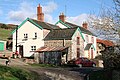
English: Bishop's Nympton is a village and civil parish in the North Devon district of Devon, England, about three miles east of South Molton. According to the 2001 census it had population of 932.
village in United Kingdom  | |||||
| Upload media | |||||
| Instance of | |||||
|---|---|---|---|---|---|
| Location | North Devon, Devon, South West England, England | ||||
 | |||||
Subcategories
This category has the following 4 subcategories, out of 4 total.
Media in category "Bishop's Nympton"
The following 200 files are in this category, out of 848 total.
(previous page) (next page)-
 ' Station House' at Bishop's Nympton ^ Molland - geograph.org.uk - 6142547.jpg 1,024 × 768; 181 KB
-
 A disused railway track passing over River Yeo Bridge - geograph.org.uk - 3877651.jpg 6,000 × 4,000; 4.02 MB
-
 A disused railway track passing over River Yeo Bridge - geograph.org.uk - 3877653.jpg 6,000 × 4,000; 5.27 MB
-
 A footbridge over the river Mole near Grilstone - geograph.org.uk - 3824917.jpg 6,000 × 4,000; 4.47 MB
-
 A plaque on Bishmill Bridge on the river Yeo - geograph.org.uk - 3877789.jpg 6,000 × 4,000; 4.08 MB
-
 A very long farm building at Hilltown - geograph.org.uk - 6117970.jpg 1,600 × 1,066; 562 KB
-
 A361 east of Bishmill Gate - geograph.org.uk - 5284031.jpg 2,932 × 1,724; 1,024 KB
-
 A361 northwest bound - geograph.org.uk - 3125650.jpg 640 × 480; 72 KB
-
 A361 northwest bound - geograph.org.uk - 3125658.jpg 640 × 480; 54 KB
-
 A361 northwest bound - geograph.org.uk - 3125664.jpg 640 × 480; 61 KB
-
 A361 northwest bound - geograph.org.uk - 3125674.jpg 640 × 444; 59 KB
-
 A361 northwest bound - geograph.org.uk - 3125678.jpg 640 × 460; 64 KB
-
 A361 northwest bound - geograph.org.uk - 3125696.jpg 640 × 480; 64 KB
-
 A361 northwest bound - geograph.org.uk - 3125730.jpg 640 × 480; 62 KB
-
 A361 northwest bound - geograph.org.uk - 3125735.jpg 640 × 480; 65 KB
-
 A361 northwest bound - geograph.org.uk - 3125742.jpg 640 × 480; 52 KB
-
 A361 northwest bound - geograph.org.uk - 3125759.jpg 640 × 455; 45 KB
-
 A361 northwest bound - geograph.org.uk - 3125770.jpg 640 × 480; 54 KB
-
 A361 northwest bound - geograph.org.uk - 3125780.jpg 640 × 480; 50 KB
-
 A361 northwest bound - geograph.org.uk - 3125795.jpg 640 × 480; 64 KB
-
 A361 northwest bound - geograph.org.uk - 3125801.jpg 640 × 480; 57 KB
-
 A361 northwest bound - geograph.org.uk - 3125835.jpg 640 × 454; 68 KB
-
 A361 southeast bound - geograph.org.uk - 3335954.jpg 640 × 436; 46 KB
-
 A361 southeast bound - geograph.org.uk - 3336213.jpg 640 × 421; 51 KB
-
 A361 southeast bound - geograph.org.uk - 3336229.jpg 640 × 480; 61 KB
-
 A361 southeast bound - geograph.org.uk - 3336244.jpg 640 × 480; 72 KB
-
 A361 southeast bound - geograph.org.uk - 3336252.jpg 640 × 480; 55 KB
-
 A361 southeast bound - geograph.org.uk - 3336259.jpg 640 × 480; 43 KB
-
 A361 southeast bound - geograph.org.uk - 3336264.jpg 640 × 480; 53 KB
-
 A361 southeast bound - geograph.org.uk - 3336276.jpg 640 × 447; 59 KB
-
 A361 southeast bound - geograph.org.uk - 3336282.jpg 640 × 480; 45 KB
-
 A361 southeast bound, Bishmill Gate - geograph.org.uk - 3335968.jpg 640 × 480; 59 KB
-
 A361 southeast bound, Bishmill Gate - geograph.org.uk - 3336210.jpg 640 × 480; 64 KB
-
 A361 southeastbound - geograph.org.uk - 3335967.jpg 640 × 480; 51 KB
-
 A361 viaduct near Ash Mill - geograph.org.uk - 3466310.jpg 640 × 464; 80 KB
-
 Access to Blastridge Hill - geograph.org.uk - 6318736.jpg 1,024 × 768; 351 KB
-
 Aller Hill - geograph.org.uk - 3777588.jpg 1,536 × 1,152; 1.45 MB
-

-

-

-
 Angel Hill Cross, Bishop's Nympton - geograph.org.uk - 5246386.jpg 1,878 × 2,938; 727 KB
-
 Approaching Crosse Farm - geograph.org.uk - 5283150.jpg 3,072 × 2,048; 1.76 MB
-
 Approaching Crosse Farm - geograph.org.uk - 6318531.jpg 1,024 × 768; 271 KB
-
 Approaching Grilstone Bridge - geograph.org.uk - 5283627.jpg 2,045 × 2,779; 1.54 MB
-
 Approaching Rawstone Bridge - geograph.org.uk - 5284045.jpg 3,072 × 2,048; 1.66 MB
-
 Approaching Reach - geograph.org.uk - 6144753.jpg 1,024 × 768; 221 KB
-
 Approaching Whitechapel - geograph.org.uk - 1009426.jpg 640 × 480; 121 KB
-
 Arable field near Avercombe - geograph.org.uk - 5245141.jpg 3,072 × 2,048; 1.31 MB
-
 Arable field near Radley - geograph.org.uk - 5283256.jpg 3,072 × 2,048; 1.66 MB
-
 Arms Keates OfBishopsNympton Devon.svg 578 × 666; 73 KB
-
 Array of solar panels, Johnstone Moors - geograph.org.uk - 3969060.jpg 1,024 × 768; 111 KB
-
 Ash Mill , Country Lane - geograph.org.uk - 4635225.jpg 4,288 × 2,848; 6.39 MB
-
 Ash Mill , Road - geograph.org.uk - 4635221.jpg 4,288 × 2,848; 6.15 MB
-
 B3137 at New Bridge - geograph.org.uk - 3704893.jpg 1,920 × 2,260; 640 KB
-
 B3137 north of Alswear - geograph.org.uk - 3689610.jpg 1,920 × 1,192; 378 KB
-
 B3227 at Gorton - geograph.org.uk - 5283980.jpg 3,072 × 2,048; 1.86 MB
-
 B3227 at Port Lane - geograph.org.uk - 5288315.jpg 3,072 × 2,048; 1.4 MB
-
 B3227 in evening sun - geograph.org.uk - 5079342.jpg 1,354 × 787; 179 KB
-
 B3227 near Kerscott Farm - geograph.org.uk - 5288407.jpg 3,034 × 1,981; 1.35 MB
-
 B3227 near Kipscott Barton - geograph.org.uk - 5288461.jpg 2,842 × 1,256; 923 KB
-
 B3227 near Little Kerscott - geograph.org.uk - 5288349.jpg 2,983 × 1,646; 1.61 MB
-
 Back road to South Molton - geograph.org.uk - 6318535.jpg 1,024 × 768; 252 KB
-
 Bare trees at the turnings for North and South Hayne - geograph.org.uk - 3778199.jpg 1,536 × 1,152; 1.13 MB
-
 Barley near Pincombe Corner - geograph.org.uk - 5246108.jpg 3,064 × 1,754; 1.27 MB
-
 Barn at Great Avercombe - geograph.org.uk - 6316140.jpg 1,024 × 821; 157 KB
-
 Barns at East Avercombe - geograph.org.uk - 5086785.jpg 2,531 × 1,436; 956 KB
-
 Beacon at Silcombe Cross - geograph.org.uk - 301450.jpg 480 × 640; 104 KB
-
 Bend in the road near South Port - geograph.org.uk - 6233073.jpg 1,024 × 768; 266 KB
-
 Bend on Folly Lane - geograph.org.uk - 3968542.jpg 1,024 × 768; 234 KB
-
 Bicknor Bridge on the river Mole - geograph.org.uk - 3852599.jpg 5,811 × 3,874; 6.51 MB
-
 Bicknor Bridge on the river Mole - geograph.org.uk - 3852603.jpg 6,000 × 4,000; 4.11 MB
-
 Bicknor Bridge on the river Mole as seen from downstream - geograph.org.uk - 3852616.jpg 6,000 × 4,000; 4.19 MB
-
 Bicknor Bridge on the river Mole as seen from upstream - geograph.org.uk - 3852610.jpg 6,000 × 4,000; 4.16 MB
-
 Bicknor Bridge on the river Mole as seen from upstream - geograph.org.uk - 3852622.jpg 5,811 × 3,874; 4.06 MB
-
 Bish Mill , Grassy Field ^ Pylons - geograph.org.uk - 4636582.jpg 4,288 × 2,848; 5.05 MB
-
 Bish Mill , The B3227 - geograph.org.uk - 4636579.jpg 4,288 × 2,848; 5.96 MB
-
 Bish Mill , The B3227 - geograph.org.uk - 4636588.jpg 4,288 × 2,848; 6.03 MB
-
 Bish Mill , The B3227 - geograph.org.uk - 4636596.jpg 4,288 × 2,848; 6.26 MB
-
 Bish Mill , The B3227 - geograph.org.uk - 4636600.jpg 4,288 × 2,848; 5.41 MB
-
 Bish Mill , The B3227 - geograph.org.uk - 4636605.jpg 4,288 × 2,848; 6.19 MB
-
 Bish Mill , The B3227 - geograph.org.uk - 4636618.jpg 4,288 × 2,848; 6.81 MB
-
 Bish Mill , The Mill - geograph.org.uk - 4636604.jpg 4,288 × 2,848; 5.89 MB
-
 Bish Mill , The Mill Inn - geograph.org.uk - 4636623.jpg 4,288 × 2,848; 5.26 MB
-
 Bish Mill , The River Yeo - geograph.org.uk - 4636593.jpg 2,848 × 4,288; 6.49 MB
-
 Bishmill Gate - geograph.org.uk - 5284021.jpg 2,976 × 1,892; 965 KB
-
 Bishop's Nympton (geograph 5246421).jpg 1,869 × 2,332; 765 KB
-
 Bishop's Nympton , Cemetery - geograph.org.uk - 4635262.jpg 4,288 × 2,848; 5.98 MB
-
 Bishop's Nympton , East Hollacombe - geograph.org.uk - 4635263.jpg 4,288 × 2,848; 5.83 MB
-
 Bishop's Nympton , Glebeland Villas - geograph.org.uk - 4636742.jpg 4,288 × 2,848; 5.08 MB
-
 Bishop's Nympton , Little Copse - geograph.org.uk - 4636733.jpg 4,288 × 2,848; 3.99 MB
-
 Bishop's Nympton , Park View - geograph.org.uk - 4636725.jpg 4,288 × 2,848; 4.11 MB
-
 Bishop's Nympton , Park View - geograph.org.uk - 4636729.jpg 4,288 × 2,848; 4.69 MB
-
 Bishop's Nympton , Park Villas - geograph.org.uk - 4635279.jpg 4,288 × 2,848; 6.13 MB
-
 Bishop's Nympton , Park Villas - geograph.org.uk - 4635281.jpg 4,288 × 2,848; 7.55 MB
-
 Bishop's Nympton , Park Villas - geograph.org.uk - 4635287.jpg 4,089 × 2,716; 7.17 MB
-
 Bishop's Nympton , Parsonage Hill - geograph.org.uk - 4632954.jpg 4,288 × 2,848; 6.04 MB
-
 Bishop's Nympton , Parsonage Hill - geograph.org.uk - 4636735.jpg 4,288 × 2,848; 5.71 MB
-
 Bishop's Nympton , Parsonage Hill - geograph.org.uk - 4636736.jpg 3,558 × 2,363; 5.05 MB
-
 Bishop's Nympton , Road - geograph.org.uk - 4635264.jpg 4,288 × 2,848; 5.51 MB
-
 Bishop's Nympton , Small Lane - geograph.org.uk - 4635267.jpg 4,288 × 2,848; 7.86 MB
-
 Bishop's Nympton , Village Road - geograph.org.uk - 4636721.jpg 4,288 × 2,848; 4.61 MB
-
 Bishop's Nympton , Village Road - geograph.org.uk - 4636730.jpg 4,288 × 2,848; 4.22 MB
-
 Bishop's Nympton , Village Scenery - geograph.org.uk - 4635289.jpg 4,288 × 2,848; 6.31 MB
-
 Bishop's Nympton , West Street - geograph.org.uk - 4635277.jpg 4,288 × 2,848; 7.82 MB
-
 Bishop's Nympton - geograph.org.uk - 5246727.jpg 2,817 × 1,620; 712 KB
-
 Bishop's Nympton Primary School - geograph.org.uk - 6232764.jpg 1,024 × 768; 166 KB
-
 Bishop's Nympton, barns at Higher Week - geograph.org.uk - 393642.jpg 640 × 427; 178 KB
-
 Bishop's Nympton, barns at Reach - geograph.org.uk - 320024.jpg 640 × 427; 164 KB
-
 Bishop's Nympton, Bish Mill - geograph.org.uk - 320031.jpg 640 × 427; 233 KB
-
-
 Bishop's Nympton, Combsland New Cross - geograph.org.uk - 320014.jpg 640 × 427; 162 KB
-
-
 Bishop's Nympton, Crosse - geograph.org.uk - 406361.jpg 640 × 427; 244 KB
-
 Bishop's Nympton, Drewstone Moors - geograph.org.uk - 320042.jpg 640 × 427; 179 KB
-
 Bishop's Nympton, edge of Week Wood - geograph.org.uk - 393639.jpg 640 × 427; 250 KB
-

-

-

-
 Bishop's Nympton, Little Kerscott - geograph.org.uk - 393560.jpg 640 × 427; 171 KB
-
 Bishop's Nympton, Mornacott - geograph.org.uk - 320028.jpg 640 × 427; 265 KB
-
 Bishop's Nympton, near Combsland Cross - geograph.org.uk - 320013.jpg 640 × 427; 126 KB
-
 Bishop's Nympton, near Mornacott Bridge - geograph.org.uk - 320015.jpg 640 × 427; 265 KB
-
 Bishop's Nympton, near Veraby - geograph.org.uk - 320021.jpg 640 × 427; 191 KB
-
 Bishop's Nympton, near Westwood - geograph.org.uk - 406357.jpg 640 × 427; 161 KB
-
 Bishop's Nympton, nearing South Port - geograph.org.uk - 382207.jpg 640 × 427; 148 KB
-
 Bishop's Nympton, On Gorton Hill - geograph.org.uk - 320035.jpg 640 × 427; 214 KB
-
 Bishop's Nympton, Onahill Farm - geograph.org.uk - 320030.jpg 640 × 427; 209 KB
-
 Bishop's Nympton, Reach - geograph.org.uk - 320025.jpg 640 × 427; 208 KB
-

-

-
 Bishop's Nympton, towards Barton - geograph.org.uk - 406354.jpg 640 × 427; 157 KB
-
 Bishop's Nympton, towards Blastridge Hill - geograph.org.uk - 406364.jpg 640 × 427; 146 KB
-
 Bishop's Nympton, towards South Molton - geograph.org.uk - 320036.jpg 640 × 427; 205 KB
-
 Bishop's Nympton, towards the B3227 - geograph.org.uk - 382212.jpg 640 × 427; 147 KB
-

-
 Bishop's Nympton, two roads - geograph.org.uk - 393564.jpg 640 × 427; 206 KB
-
 Bishop's Nympton, village street - geograph.org.uk - 252938.jpg 640 × 427; 170 KB
-
 Bishop's Nympton, Woodside Garage - geograph.org.uk - 320010.jpg 640 × 427; 179 KB
-
 Bishops Nympton - cemetery - geograph.org.uk - 252941.jpg 640 × 427; 216 KB
-
 Bishops Nympton - Cottage - geograph.org.uk - 1403404.jpg 640 × 428; 86 KB
-
 Bishops Nympton - decayed barn - geograph.org.uk - 406373.jpg 640 × 427; 226 KB
-
 Bishops Nympton Parish Hall - geograph.org.uk - 5247176.jpg 3,060 × 1,539; 874 KB
-
 Board School, Newton, Bishops Nympton, Devon.JPG 2,816 × 2,112; 1.45 MB
-
 Bridge End road junction - geograph.org.uk - 6117959.jpg 1,600 × 1,066; 923 KB
-
 Bridge on Aller Hill - geograph.org.uk - 3777591.jpg 1,536 × 1,152; 1.74 MB
-
 Bridge over former railway, Drewstone - geograph.org.uk - 6196131.jpg 4,288 × 2,848; 2.15 MB
-
 Bridgeend Cross - geograph.org.uk - 3438264.jpg 479 × 640; 183 KB
-
 Buildings around the former station - geograph.org.uk - 5290554.jpg 3,072 × 1,868; 1.43 MB
-
 Bullaford Gate, a fork in the road - geograph.org.uk - 3778261.jpg 1,536 × 1,152; 1.14 MB
-
 Bungalow on Burwell Lane - geograph.org.uk - 3970892.jpg 1,024 × 779; 168 KB
-
 Capitol Farm, Bishop's Nympton - geograph.org.uk - 5248198.jpg 3,059 × 1,787; 1.2 MB
-
 Cattle grazing above Crooked Oak Valley - geograph.org.uk - 6314992.jpg 1,024 × 768; 202 KB
-
 Cattle pasture by the Yeo - geograph.org.uk - 5284007.jpg 3,072 × 2,048; 1.4 MB
-
 Cattle west of Port - geograph.org.uk - 5246091.jpg 3,045 × 1,907; 1.53 MB
-
 Cemetery on outskirts of Bishops Nympton - geograph.org.uk - 82005.jpg 425 × 640; 103 KB
-
 Cereal crop near Rawstone - geograph.org.uk - 6195882.jpg 4,288 × 2,848; 2.08 MB
-
 Cereal crop near Rawstone - geograph.org.uk - 6195916.jpg 4,288 × 2,848; 2.35 MB
-
 Combsland Cross - geograph.org.uk - 3778207.jpg 1,536 × 1,152; 1.04 MB
-
 Combsland Cross - geograph.org.uk - 6117979.jpg 1,600 × 1,200; 813 KB
-
 Combsland Cross - geograph.org.uk - 6145033.jpg 1,024 × 757; 156 KB
-

-
 Communications Mast - geograph.org.uk - 4455510.jpg 2,400 × 1,600; 778 KB
-
 Communications mast beside Folly Lane - geograph.org.uk - 3777504.jpg 1,536 × 1,152; 1.23 MB
-
 Communications mast by Folly Lane - geograph.org.uk - 3777490.jpg 1,152 × 1,536; 969 KB
-

-
 Copse beside B3227 near Kerscott - geograph.org.uk - 3778221.jpg 1,536 × 1,152; 1.17 MB
-
 Corner of South Haine plantation - geograph.org.uk - 81924.jpg 640 × 481; 88 KB
-
 Cottage extension near East Hayne - geograph.org.uk - 6145005.jpg 1,024 × 788; 161 KB
-
 Cottage on Aller Hill - geograph.org.uk - 6144650.jpg 1,024 × 788; 162 KB
-
 Cottage on Whitechapel Lane - geograph.org.uk - 6144323.jpg 1,024 × 768; 251 KB
-
 Crooked Oak valley - geograph.org.uk - 5086787.jpg 2,664 × 1,475; 998 KB
-
 Crooked Oak valley - geograph.org.uk - 5245135.jpg 3,072 × 2,048; 1.58 MB
-
 Crooked Oak valley - geograph.org.uk - 5245166.jpg 3,072 × 2,048; 1.84 MB
-
 Cross farmhouse (geograph 5078893).jpg 3,072 × 2,048; 1.17 MB
-
 Crosse Cottage, Bishop's Nympton (geograph 5247073).jpg 3,072 × 2,048; 883 KB
-
 Crosse Farm - geograph.org.uk - 6318527.jpg 1,024 × 768; 232 KB
-
 Dismantled railway line near Veraby - geograph.org.uk - 5288204.jpg 2,597 × 1,397; 560 KB
-
 Drewstone Bridge - geograph.org.uk - 3969093.jpg 1,024 × 768; 263 KB
-
 Drewstone Bridge - geograph.org.uk - 6143935.jpg 1,024 × 768; 262 KB
-
 Drewstone Moors - geograph.org.uk - 6195245.jpg 4,288 × 2,848; 2.59 MB
-
 Drewstone Moors - geograph.org.uk - 6195577.jpg 4,288 × 2,848; 2.48 MB
-
 Drewstone Moors and Whitechapel - geograph.org.uk - 3777583.jpg 1,536 × 1,152; 1.09 MB
-
 Drewstone Park Cottage - geograph.org.uk - 3969107.jpg 1,024 × 768; 144 KB
-
 Drewstone pasture - geograph.org.uk - 1009443.jpg 640 × 480; 95 KB
-
 Driveway, Whitechapel Manor - geograph.org.uk - 6144312.jpg 1,024 × 768; 288 KB
-
 East Avercombe - geograph.org.uk - 5086784.jpg 1,442 × 891; 301 KB
-
 East View, Bishop's Nympton - geograph.org.uk - 5246922.jpg 3,072 × 2,048; 828 KB
-
 East View, Bishop's Nympton - geograph.org.uk - 6232748.jpg 1,024 × 768; 136 KB
-
 Eating the hedge on Aller Hill - geograph.org.uk - 6144640.jpg 1,024 × 760; 277 KB
-
 Entrance to Westbridge Park - geograph.org.uk - 5284157.jpg 3,072 × 2,048; 1.43 MB
-
 Ewe posing near Slough in Devon - geograph.org.uk - 750646.jpg 522 × 640; 82 KB
-
 Exit from the North Devon Link road, to the B3227 - geograph.org.uk - 2594024.jpg 4,320 × 3,240; 4.1 MB
-
 Farm at Waddington Cross - geograph.org.uk - 2829710.jpg 800 × 600; 322 KB
-
 Farm building, East Avercombe - geograph.org.uk - 5086431.jpg 3,072 × 2,048; 1.74 MB
-
 Farm buildings at Grilstone - geograph.org.uk - 5078926.jpg 2,585 × 1,749; 926 KB
-

-
 Farm entrance, Wester Bullaford - geograph.org.uk - 1032113.jpg 640 × 480; 75 KB
-
 Farmhouse, Reach - geograph.org.uk - 6144748.jpg 1,024 × 781; 140 KB
-
 Farmland above Aller - geograph.org.uk - 973174.jpg 640 × 427; 78 KB
-
 Farmland by the B3227 - geograph.org.uk - 5288320.jpg 2,905 × 1,697; 1.3 MB


.jpg)


.jpg)
.jpg)


