Category:Birtley, Tyne and Wear
Jump to navigation
Jump to search
English: Birtley is an area in the Metropolitan Borough of Gateshead, in Tyne and Wear, England. It is situated to the south of Gateshead town and is physically linked to Chester-le-Street across the County boundary in County Durham. Until 1974, Birtley and the adjoining areas of Barley Mow, Vigo and Portobello were part of the old Chester-le-Street Rural District. Since 1974, these neighbouring areas have been considered part of 'greater' Birtley. Birtley was a civil parish with a parish council (which also covered the adjoining neighbourhoods) until April 1, 2006 after a local referendum agreed to abolish it. The former parish has a population of 11,377.

town in Tyne and Wear, UK  | |||||
| Upload media | |||||
| Instance of |
| ||||
|---|---|---|---|---|---|
| Location | Gateshead, Tyne and Wear, North East England, England | ||||
 | |||||
Subcategories
This category has the following 3 subcategories, out of 3 total.
B
- Birtley railway station (2 F)
W
- Washington Services (4 F)
Media in category "Birtley, Tyne and Wear"
The following 32 files are in this category, out of 32 total.
-
 A Bit of the Angel - geograph.org.uk - 971919.jpg 640 × 481; 59 KB
-
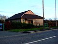
 Barley Mow - geograph.org.uk - 61351.jpg 640 × 480; 123 KB
-
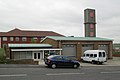
 Birtley Crematorium - geograph.org.uk - 637440.jpg 640 × 480; 75 KB
-
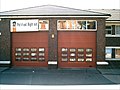
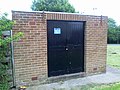
 Birtley fire station - geograph.org.uk - 288149.jpg 640 × 427; 180 KB
-
 Birtley Fire Station 2 - t and w.jpg 2,592 × 1,944; 668 KB
-
 Birtley old fire station - geograph.org.uk - 1393259.jpg 640 × 427; 185 KB
-
 C2C at Birtley - geograph.org.uk - 129201.jpg 640 × 480; 106 KB
-
 Children's playground off the A167 - geograph.org.uk - 3441015.jpg 640 × 480; 103 KB
-
 Church on Station Lane, Birtley - geograph.org.uk - 3441046.jpg 640 × 480; 81 KB
-
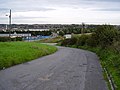
 Durham Road (A167) - geograph.org.uk - 3441017.jpg 640 × 480; 71 KB
-
 Durham Road (A167), Birtley - geograph.org.uk - 3441025.jpg 640 × 480; 74 KB
-
 Durham Road (A167), Birtley - geograph.org.uk - 3441035.jpg 640 × 480; 79 KB
-
 East Coast Main Line heading south - geograph.org.uk - 3441050.jpg 640 × 480; 86 KB
-
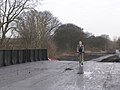
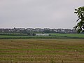
 Entering County Durham - geograph.org.uk - 3441052.jpg 640 × 480; 69 KB
-

-
 Gas governor, Kentmere - geograph.org.uk - 3535366.jpg 640 × 480; 88 KB
-
 Kingdom Hall, Birtley - geograph.org.uk - 613594.jpg 640 × 480; 68 KB
-
 Komatsu Plant, Durham Road, Birtley - geograph.org.uk - 3557404.jpg 4,447 × 2,609; 3.39 MB
-
-
 Scout Hut Ouston - geograph.org.uk - 241234.jpg 640 × 480; 72 KB
-
 Service station on Durham Road - geograph.org.uk - 3441022.jpg 640 × 480; 72 KB
-
 Site of Durham Turnpike station.jpg 1,644 × 866; 252 KB
-
 Site of Vigo station (Tyne and Wear).jpg 1,651 × 871; 369 KB
-

-

-
 Supermarket on Durham Road - geograph.org.uk - 3441023.jpg 640 × 480; 69 KB
-

-
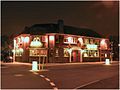
 The William IV pub, Birtley - geograph.org.uk - 3441018.jpg 640 × 480; 68 KB
-
 War Memorial Garden, Birtley - geograph.org.uk - 1925600.jpg 1,500 × 972; 1.99 MB
-
 War Memorial Garden, Birtley - geograph.org.uk - 3441027.jpg 640 × 480; 116 KB
-
 Birtley Methodist Church - geograph.org.uk - 613599.jpg 640 × 480; 70 KB
-
 Three Bridges - geograph.org.uk - 221061.jpg 640 × 480; 85 KB


_-_geograph.org.uk_-_3441017.jpg)
,_Birtley_-_geograph.org.uk_-_3441025.jpg)
,_Birtley_-_geograph.org.uk_-_3441035.jpg)


.jpg)


,_Birtley_-_geograph.org.uk_-_3441040.jpg)


