Category:Binnenwatersloot 32, Delft
Jump to navigation
Jump to search
| Object location | | View all coordinates using: OpenStreetMap |
|---|
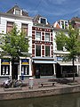
listed building in Delft, South Holland, the Netherlands  | |||||
| Upload media | |||||
| Instance of | |||||
|---|---|---|---|---|---|
| Location | Delft, South Holland, Netherlands | ||||
| Located on street |
| ||||
| Heritage designation |
| ||||
 | |||||
|
This is a category about rijksmonument number 11722
|
Media in category "Binnenwatersloot 32, Delft"
The following 2 files are in this category, out of 2 total.
-
 Delft - Binnenwatersloot 24.jpg 1,944 × 2,592; 1.66 MB
-
 Delft Binnenwatersloot 32.jpg 4,008 × 6,008; 17.31 MB
