Category:Binegar
Jump to navigation
Jump to search
Main Wikipedia article: Binegar.
village and civil parish in Somerset, United Kingdom  | |||||
| Upload media | |||||
| Instance of | |||||
|---|---|---|---|---|---|
| Location | Mendip, Somerset, South West England, England | ||||
| Said to be the same as | Binegar (Wikimedia duplicated page, civil parish) | ||||
 | |||||
Subcategories
This category has the following 2 subcategories, out of 2 total.
B
- Binegar railway station (2 F)
T
Media in category "Binegar"
The following 83 files are in this category, out of 83 total.
-

-

-

-

-

-

-

-
 2011 , At the bottom of Binegar Bottom - geograph.org.uk - 2323463.jpg 3,527 × 2,628; 5.33 MB
-
 2011 , Beautiful Binegar Bottom - geograph.org.uk - 2323445.jpg 3,442 × 2,346; 4.02 MB
-
 A box right by the bridge - geograph.org.uk - 6069525.jpg 3,296 × 2,472; 3.29 MB
-
 A colourful vane - geograph.org.uk - 6067370.jpg 3,296 × 2,472; 3.25 MB
-
 A face at the pub window - geograph.org.uk - 6069651.jpg 2,472 × 3,296; 3.11 MB
-
 A holy halo^ - geograph.org.uk - 6067382.jpg 2,472 × 3,296; 3.45 MB
-
 A memorial tree beside the Memorial Hall - geograph.org.uk - 6067357.jpg 3,296 × 2,472; 3.54 MB
-
 A natural way to stop the walkers - geograph.org.uk - 6069588.jpg 3,296 × 2,472; 3.29 MB
-
 A new lychgate - geograph.org.uk - 6067393.jpg 3,296 × 2,472; 3.64 MB
-
 A seat by the farm - geograph.org.uk - 6066612.jpg 3,296 × 2,472; 3.48 MB
-
 A37 - geograph.org.uk - 346484.jpg 640 × 480; 98 KB
-
 A37 at Marchant's Hill - geograph.org.uk - 5817373.jpg 1,024 × 693; 121 KB
-
 A37 in Gurney Slade - geograph.org.uk - 5817359.jpg 1,024 × 685; 116 KB
-
 A37 northbound - geograph.org.uk - 3033462.jpg 640 × 444; 98 KB
-
 An avenue on Cock Hill - geograph.org.uk - 6069595.jpg 2,472 × 3,296; 3.24 MB
-
 An open door says 'come in' - geograph.org.uk - 6069586.jpg 2,472 × 3,296; 3.36 MB
-
 Being swallowed by rising greenery - geograph.org.uk - 6067408.jpg 2,472 × 3,296; 3.88 MB
-
 Between Tape Lane and Stock Hill - geograph.org.uk - 137594.jpg 640 × 480; 132 KB
-
 Beware of blasting^ - geograph.org.uk - 6067420.jpg 3,296 × 2,472; 3.39 MB
-
 Binegar benchmark on the bridge - geograph.org.uk - 6067312.jpg 2,472 × 3,296; 3.33 MB
-
 Binegar pillbox - geograph.org.uk - 6069517.jpg 3,296 × 2,472; 3.78 MB
-
 Binegar play area - geograph.org.uk - 6069562.jpg 3,296 × 2,472; 3.52 MB
-
 Binegar's communications centre - geograph.org.uk - 6067415.jpg 3,296 × 2,472; 3.6 MB
-
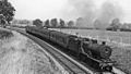
 Binegar's lost railway - geograph.org.uk - 6067315.jpg 3,296 × 2,472; 3.22 MB
-
 Bronze age round barrow - geograph.org.uk - 180094.jpg 640 × 480; 85 KB
-
 Bronze age round barrows - geograph.org.uk - 179185.jpg 640 × 480; 96 KB
-
 Building works and a bench in Binegar - geograph.org.uk - 4966407.jpg 640 × 479; 168 KB
-
 Church of the Holy Trinity, Binegar - geograph.org.uk - 6069668.jpg 3,296 × 2,472; 3.53 MB
-
 Collections at 12-00 - geograph.org.uk - 6067416.jpg 3,296 × 2,472; 3.49 MB
-
 Development site - geograph.org.uk - 4094249.jpg 640 × 480; 98 KB
-

-
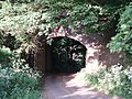 Disused railway bridge - geograph.org.uk - 185567.jpg 640 × 480; 147 KB
-
 East window and altar - geograph.org.uk - 6069688.jpg 2,472 × 3,296; 3.74 MB
-
 Entrance to Holy Trinity - geograph.org.uk - 6067379.jpg 2,472 × 3,296; 3.56 MB
-
 Fields at Portway Bridge - geograph.org.uk - 3249815.jpg 640 × 480; 66 KB
-
 Historic housing on Binegar Green - geograph.org.uk - 6067332.jpg 3,296 × 2,472; 3.54 MB
-
 Holy Trinity benchmark - geograph.org.uk - 6067320.jpg 3,296 × 2,472; 3.38 MB
-
 Holy Trinity's interior - geograph.org.uk - 6069672.jpg 2,472 × 3,296; 3.23 MB
-
 Inside the Binegar pillbox - geograph.org.uk - 6069528.jpg 3,296 × 2,472; 3.39 MB
-
 Jubilee notice board - geograph.org.uk - 6069654.jpg 2,472 × 3,296; 3.34 MB
-
 Marchant's Hill - geograph.org.uk - 5055826.jpg 1,600 × 1,281; 695 KB
-
 Masbury Summit 2121861 732ab59f.jpg 1,024 × 578; 306 KB
-
 New house - geograph.org.uk - 4094251.jpg 640 × 480; 88 KB
-
 New over the old - geograph.org.uk - 6066616.jpg 3,296 × 2,472; 3.63 MB
-
 North to Stock Hill - geograph.org.uk - 1253862.jpg 640 × 484; 202 KB
-
 North west from Station Road - geograph.org.uk - 1254283.jpg 640 × 495; 104 KB
-
 Not so open to walkers - geograph.org.uk - 6067401.jpg 3,296 × 2,472; 3.62 MB
-
 Not taking inflation into account - geograph.org.uk - 6067404.jpg 3,296 × 2,472; 3.37 MB
-

-
 Old Toll House, Old Down - geograph.org.uk - 6115165.jpg 800 × 585; 220 KB
-
 Ornate light fitting in Holy Trinity - geograph.org.uk - 6069682.jpg 3,296 × 2,472; 3.33 MB
-
 School's out in Binegar - geograph.org.uk - 6069553.jpg 3,296 × 2,472; 3.53 MB
-

-
 Tellis Lane, Binegar - geograph.org.uk - 1254339.jpg 640 × 521; 181 KB
-
 Terrace of houses at the north end of Gurney Slade - geograph.org.uk - 5473513.jpg 1,600 × 1,280; 684 KB
-
 The George Inn - geograph.org.uk - 2869992.jpg 640 × 477; 89 KB
-
 The George Inn, Gurney Slade - geograph.org.uk - 5055834.jpg 1,600 × 1,066; 638 KB
-
 The George, Gurney Slade - geograph.org.uk - 6069640.jpg 3,296 × 2,472; 3.36 MB
-
 The Horse and Jockey - geograph.org.uk - 6066614.jpg 3,296 × 2,472; 3.59 MB
-
 The Memorial Hall - geograph.org.uk - 6066625.jpg 3,296 × 2,472; 3.67 MB
-
 The old memorial hall sign - geograph.org.uk - 6069679.jpg 3,296 × 2,472; 2.77 MB
-
 The old schoolmaster's house in Tellis Lane - geograph.org.uk - 6067368.jpg 3,296 × 2,472; 3.54 MB
-
 The quarry entrance in Tape Lane - geograph.org.uk - 6069605.jpg 2,472 × 3,296; 3.48 MB
-
 The Quarry Levy helping the local community - geograph.org.uk - 6069582.jpg 2,472 × 3,296; 3.41 MB
-
 The school on the corner, Binegar - geograph.org.uk - 1217459.jpg 640 × 528; 160 KB
-
 The south porch of Holy Trinity - geograph.org.uk - 6067319.jpg 3,296 × 2,472; 3.4 MB
-
 To the old railway station - geograph.org.uk - 6066619.jpg 3,296 × 2,472; 3.61 MB
-
 Turner's Court Lane - geograph.org.uk - 6069536.jpg 3,296 × 2,472; 3.59 MB
-
 Disused railway bridge - geograph.org.uk - 185606.jpg 640 × 480; 141 KB
-
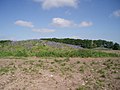
 Highwood - geograph.org.uk - 346423.jpg 640 × 480; 92 KB
-
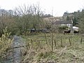
 Houses near Binegar - geograph.org.uk - 346493.jpg 640 × 480; 83 KB
-
 Lorry Park - geograph.org.uk - 346409.jpg 640 × 480; 81 KB
-
 Old Railway Bridge - geograph.org.uk - 346480.jpg 640 × 480; 140 KB
-
 Roman Road - geograph.org.uk - 346414.jpg 640 × 480; 104 KB
-
 Turners Court Farm - geograph.org.uk - 346402.jpg 640 × 480; 116 KB
-
 Whitnell Farm - geograph.org.uk - 346400.jpg 640 × 480; 124 KB


.jpg)


_-_geograph.org.uk_-_1545548.jpg)


