Category:Billinghay
Jump to navigation
Jump to search
English: Billinghay is a village and civil parish in the North Kesteven district of Lincolnshire, England, about ten miles north-east of Sleaford. According to the 2001 census the parish had a population of 1,808. The village lies along the B1189 road (for Walcott) near the junction with the A153. Just south of the village towards Sleaford is North Kyme.
village and civil parish in North Kesteven, Lincolnshire, United Kingdom  | |||||
| Upload media | |||||
| Instance of | |||||
|---|---|---|---|---|---|
| Location | North Kesteven, Lincolnshire, East Midlands, England | ||||
| Said to be the same as | Billinghay (Wikimedia duplicated page, civil parish) | ||||
 | |||||
Subcategories
This category has the following 3 subcategories, out of 3 total.
B
- Billinghay Skirth (10 F)
- Billinghay War Memorial (1 F)
Media in category "Billinghay"
The following 172 files are in this category, out of 172 total.
-
 A bend in the A153 - geograph.org.uk - 4354708.jpg 640 × 480; 80 KB
-
 A153 into Billinghay - geograph.org.uk - 4354678.jpg 640 × 480; 60 KB
-
 A153 towards Horncastle - geograph.org.uk - 4354711.jpg 640 × 480; 62 KB
-
 A153 towards Tattershall - geograph.org.uk - 4354706.jpg 640 × 480; 67 KB
-
 A153 westbound - geograph.org.uk - 3530296.jpg 1,930 × 1,146; 1.38 MB
-
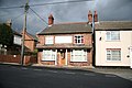
 Airey Houses in Billinghay - geograph.org.uk - 3501012.jpg 640 × 427; 72 KB
-
 Barn in Skirth Road, Billinghay - geograph.org.uk - 3122499.jpg 640 × 427; 50 KB
-
 Barn in Skirth Road, Billinghay - geograph.org.uk - 3122534.jpg 640 × 427; 78 KB
-
 Base of an old windmill as a garden room at Billinghay - geograph.org.uk - 6261224.jpg 4,608 × 3,072; 5.97 MB
-
 Billinghay Dales Head - geograph.org.uk - 4354703.jpg 640 × 480; 51 KB
-
 Billinghay Fen - geograph.org.uk - 4650517.jpg 640 × 480; 49 KB
-
 Billinghay Field - geograph.org.uk - 4650529.jpg 640 × 480; 71 KB
-

-
 Billinghay Skirth - geograph.org.uk - 4418195.jpg 1,024 × 768; 144 KB
-
 Billinghay St. Michael and All Angels church - geograph.org.uk - 5798437.jpg 3,456 × 2,592; 3.7 MB
-
 Billinghay village scene - geograph.org.uk - 1525967.jpg 640 × 509; 87 KB
-
 Billinghay War Memorial - geograph.org.uk - 5798431.jpg 3,456 × 2,592; 3.82 MB
-
 Billinghay water tower - geograph.org.uk - 3212375.jpg 2,056 × 3,088; 896 KB
-
 Billinghay Water Tower - geograph.org.uk - 81334.jpg 427 × 640; 85 KB
-
 Billinghay windmill, Lincolnshire-geograph.org-3505996.jpg 640 × 427; 88 KB
-
 Billinghay, old school location - geograph.org.uk - 4751443.jpg 1,280 × 960; 234 KB
-
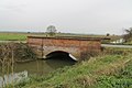
 Bridge and pipe bridge over the New Cut - geograph.org.uk - 6405010.jpg 1,024 × 768; 201 KB
-
 Bridge over drain at The Sprites - geograph.org.uk - 3212249.jpg 3,088 × 2,056; 1.28 MB
-
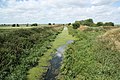
 Bridge over New Cut (drain) - geograph.org.uk - 4650536.jpg 640 × 480; 52 KB
-
 Bridge Street - geograph.org.uk - 1004953.jpg 640 × 427; 62 KB
-
 Bridge Street, Billinghay - geograph.org.uk - 1525981.jpg 640 × 405; 59 KB
-
 Bungalow on Tattershall Road - geograph.org.uk - 4354687.jpg 640 × 480; 76 KB
-

-
 Car Dyke - geograph.org.uk - 4354674.jpg 640 × 480; 103 KB
-
 Car Dyke near Billinghay - geograph.org.uk - 6309454.jpg 4,608 × 3,456; 4.54 MB
-
 Causeway Bridge - geograph.org.uk - 1386106.jpg 640 × 426; 102 KB
-
 Causeway Bridge over Digby Dam Drain - geograph.org.uk - 3213951.jpg 3,088 × 2,056; 1.51 MB
-
 Crossroads near Billinghay - geograph.org.uk - 2562944.jpg 1,280 × 960; 385 KB
-
 Daffodils by the New Cut - geograph.org.uk - 6405970.jpg 1,024 × 768; 169 KB
-
 Digby Dam - geograph.org.uk - 1386100.jpg 640 × 426; 98 KB
-
 Digby Dam Drain looking east - geograph.org.uk - 3505943.jpg 640 × 427; 56 KB
-
 Digby Dam Drain looking west - geograph.org.uk - 3505954.jpg 640 × 427; 58 KB
-
 Drain alongside First Hurn Drove - geograph.org.uk - 6377379.jpg 1,024 × 768; 234 KB
-

-
 Drain near Billinghay - geograph.org.uk - 4434641.jpg 1,024 × 768; 173 KB
-
 Drain off Labour in Vain Drove - geograph.org.uk - 4354691.jpg 640 × 480; 68 KB
-
 Drain off Twenty Foot Bank - geograph.org.uk - 4354712.jpg 640 × 480; 76 KB
-
 Drain off Twenty Foot Bank - geograph.org.uk - 4358592.jpg 640 × 480; 65 KB
-
 Drain off Twenty Foot Bank - geograph.org.uk - 5259553.jpg 4,800 × 3,112; 7.57 MB
-
 Drain off Twenty Foot Bank - geograph.org.uk - 5259559.jpg 4,756 × 2,970; 7.59 MB
-
 Drain on Billinghay Dales - geograph.org.uk - 2020267.jpg 640 × 480; 93 KB
-
 Drain, Billinghay Fields - geograph.org.uk - 6405972.jpg 1,024 × 768; 164 KB
-
 Drain, Walcott Fen - geograph.org.uk - 4650339.jpg 640 × 480; 55 KB
-
 Drove Farm, Twelve Foot Bank - geograph.org.uk - 2014927.jpg 640 × 480; 43 KB
-
 Far Hurn Drove - geograph.org.uk - 2563746.jpg 1,280 × 960; 277 KB
-
 Farm buildings, Glasshouse Farm - geograph.org.uk - 4354707.jpg 640 × 480; 55 KB
-
 Farm buildings, Key's Farm - geograph.org.uk - 4358594.jpg 640 × 480; 64 KB
-
 Farmland off Billinghay Dales Head - geograph.org.uk - 4354702.jpg 640 × 480; 63 KB
-
 Farmland off Tattershall Road - geograph.org.uk - 4354689.jpg 640 × 480; 52 KB
-
 Farmland towards Billinghay Skirth - geograph.org.uk - 4354704.jpg 640 × 480; 57 KB
-
 Farmland, Billinghay Fen - geograph.org.uk - 4650512.jpg 640 × 480; 63 KB
-
 Fen-path - geograph.org.uk - 259397.jpg 640 × 480; 110 KB
-
 Fields towards Ruston's farm - geograph.org.uk - 2020280.jpg 640 × 480; 89 KB
-

-
 Flat farmland off the A153 - geograph.org.uk - 4354709.jpg 640 × 480; 83 KB
-
 Flat farmland off Twenty Foot Bank - geograph.org.uk - 4358598.jpg 640 × 480; 68 KB
-
 Flat farmland west of Parson Drove - geograph.org.uk - 4650341.jpg 640 × 480; 56 KB
-
 Flat farmland, Billinghay Dales - geograph.org.uk - 4358590.jpg 640 × 480; 65 KB
-
 Flooded Car Dyke Roman Canal, Billinghay - geograph.org.uk - 3271065.jpg 2,198 × 1,442; 2.24 MB
-
 Footpath signpost, Billinghay Fields - geograph.org.uk - 6405974.jpg 1,024 × 768; 124 KB
-

-
 From Digby Fen - geograph.org.uk - 166517.jpg 640 × 427; 46 KB
-
 Garage in Billinghay - geograph.org.uk - 4354683.jpg 640 × 480; 48 KB
-
 Green Drove - geograph.org.uk - 4650519.jpg 640 × 480; 53 KB
-
 Greenhouses and Shed - geograph.org.uk - 235249.jpg 640 × 480; 108 KB
-
 High Street, Billinghay - geograph.org.uk - 2239450.jpg 800 × 600; 263 KB
-

-
 House near dyke, Billinghay - geograph.org.uk - 4354677.jpg 640 × 480; 71 KB
-
 House on Mill Lane - geograph.org.uk - 4650533.jpg 640 × 439; 47 KB
-
 House on Parson Drove - geograph.org.uk - 4650342.jpg 640 × 480; 43 KB
-
 Houses on Walcott Road - geograph.org.uk - 4650521.jpg 640 × 480; 55 KB
-

-
 Ivy Cottage - geograph.org.uk - 4358600.jpg 640 × 480; 65 KB
-
 Junction of Twenty Foot Bank on A153 - geograph.org.uk - 3532139.jpg 2,179 × 1,279; 1.49 MB
-
 Kyme View - geograph.org.uk - 392297.jpg 640 × 480; 68 KB
-
 Labour in Vain Drove - geograph.org.uk - 4354694.jpg 640 × 480; 64 KB
-
 Labour in Vain Drove, Billinghay - geograph.org.uk - 5259540.jpg 4,888 × 3,114; 6.14 MB
-
 Lay By Cottage - geograph.org.uk - 1422877.jpg 640 × 426; 71 KB
-
 Mill Lane - geograph.org.uk - 4650532.jpg 640 × 480; 61 KB
-
 Mill Lane - geograph.org.uk - 4650534.jpg 640 × 480; 50 KB
-
 Mill Lane and the Fire Station - geograph.org.uk - 3505983.jpg 640 × 427; 55 KB
-
 Mill Lane Junction - geograph.org.uk - 2014842.jpg 640 × 480; 69 KB
-
 New Cut and isolated barn - geograph.org.uk - 6405008.jpg 1,024 × 768; 147 KB
-

-
 New Cut Drain near Billinghay - geograph.org.uk - 3212256.jpg 3,088 × 2,056; 1.28 MB
-
 New Drain at Billinghay Dales - geograph.org.uk - 2563719.jpg 1,280 × 960; 449 KB
-
 North Kyme Common - geograph.org.uk - 4354669.jpg 640 × 480; 75 KB
-
 North Kyme Drove - geograph.org.uk - 4354672.jpg 640 × 480; 59 KB
-
 Old Butcher's Arms - geograph.org.uk - 1004994.jpg 640 × 427; 62 KB
-
 Old Dam - geograph.org.uk - 4434616.jpg 1,024 × 768; 198 KB
-
 Old postbox - geograph.org.uk - 678951.jpg 427 × 640; 111 KB
-

-
 On Digby Fen - geograph.org.uk - 166521.jpg 640 × 427; 63 KB
-
 Ordnance Survey Cut Mark - geograph.org.uk - 5482753.jpg 640 × 376; 117 KB
-
 Parson Drove - geograph.org.uk - 4650340.jpg 640 × 480; 51 KB
-
 Parson Drove - geograph.org.uk - 4650343.jpg 640 × 480; 52 KB
-
 Parson Drove, Billinghay - geograph.org.uk - 6377405.jpg 1,024 × 768; 215 KB
-
 Passing place on Twenty Foot Bank - geograph.org.uk - 4358601.jpg 640 × 480; 54 KB
-
 Poplar farm on Williamson's Drove - geograph.org.uk - 2563828.jpg 1,280 × 960; 264 KB
-
 Princess Square, Billinghay - geograph.org.uk - 4650522.jpg 640 × 427; 47 KB
-
 Pumping station, Dales Head Dike - geograph.org.uk - 6377365.jpg 1,024 × 768; 185 KB
-
 Rain stops play - geograph.org.uk - 1907447.jpg 1,280 × 1,024; 304 KB
-
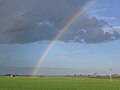 Rainbow over Digby Fen - geograph.org.uk - 4732732.jpg 1,024 × 769; 65 KB
-
 Road junction next to church - geograph.org.uk - 2458279.jpg 640 × 480; 88 KB
-
 Road to Dale Head farm - geograph.org.uk - 2563699.jpg 1,280 × 960; 435 KB
-
 Sugar beet waiting to be transported - geograph.org.uk - 6377373.jpg 1,024 × 768; 179 KB
-

-
 Tattershall Road (A153) - geograph.org.uk - 4354688.jpg 640 × 480; 61 KB
-
 The Carrs, Billinghay - geograph.org.uk - 420976.jpg 640 × 427; 123 KB
-
 The Coach ^ Horses, Billinghay - geograph.org.uk - 4354681.jpg 640 × 387; 52 KB
-
 The Golden Cross, Billinghay - geograph.org.uk - 4354685.jpg 640 × 432; 53 KB
-
 The New Cut at The Sprites - geograph.org.uk - 6405965.jpg 1,024 × 768; 188 KB
-
 Timber-drying kilns, Billinghay Sawmills - geograph.org.uk - 421001.jpg 640 × 427; 142 KB
-
 Todhill Drain - geograph.org.uk - 1278484.jpg 640 × 426; 90 KB
-
 Todhill Drain off Parson Drove - geograph.org.uk - 3213940.jpg 3,088 × 2,056; 1.32 MB
-
 Track and drain at The Sprites - geograph.org.uk - 3210864.jpg 3,088 × 2,056; 1.11 MB
-
 Track to Dale Head Farm - geograph.org.uk - 4434074.jpg 1,024 × 768; 128 KB
-
 Track to Home Farm - geograph.org.uk - 390933.jpg 640 × 394; 40 KB
-
 Track to Home Farm - geograph.org.uk - 6405966.jpg 1,024 × 768; 157 KB
-
 Tranmar - geograph.org.uk - 1422882.jpg 640 × 426; 88 KB
-
 Twelve Foot Bank - geograph.org.uk - 4354671.jpg 640 × 480; 63 KB
-
 Twenty Foot Bank - geograph.org.uk - 4354714.jpg 640 × 480; 48 KB
-
 Twenty Foot Bank - geograph.org.uk - 4358597.jpg 640 × 480; 36 KB
-
 Twenty Foot Drain - geograph.org.uk - 4358604.jpg 640 × 480; 60 KB
-

-
 View over Billinghay Dales - geograph.org.uk - 4434038.jpg 1,024 × 768; 135 KB
-
 Walcott Hollows - geograph.org.uk - 420953.jpg 640 × 427; 163 KB
-
 Walcott Road (B1189) - geograph.org.uk - 4650524.jpg 640 × 480; 58 KB
-
 Walcott Road (B1189), Billinghay - geograph.org.uk - 4650528.jpg 640 × 480; 53 KB
-
 Water tower at Billinghay - geograph.org.uk - 6405023.jpg 1,024 × 768; 143 KB
-

-
 Williamson's Drove - geograph.org.uk - 1278478.jpg 640 × 426; 69 KB
-
 Williamson's Drove - geograph.org.uk - 3506643.jpg 640 × 427; 57 KB
-
 Williamson's Drove - geograph.org.uk - 4650515.jpg 640 × 480; 69 KB
-
 Williamson's Drove - geograph.org.uk - 6377408.jpg 1,024 × 768; 198 KB
-
 Windmill den in Skirth Road - geograph.org.uk - 3122557.jpg 640 × 427; 105 KB
-
 Yard in Williamson's Drove - geograph.org.uk - 3506674.jpg 640 × 427; 64 KB
-
 Ye Cross Keys Inn - geograph.org.uk - 678934.jpg 640 × 427; 61 KB
-
 Billinghay Dales - geograph.org.uk - 1422880.jpg 640 × 426; 63 KB
-
 Billinghay Dales - geograph.org.uk - 422694.jpg 640 × 421; 130 KB
-
 Billinghay Hurn - geograph.org.uk - 419870.jpg 640 × 427; 161 KB
-
 Billinghay Parish Office - geograph.org.uk - 700251.jpg 427 × 640; 79 KB
-
 Birthplace of the Flat Earth Society^ - geograph.org.uk - 421010.jpg 640 × 427; 143 KB
-
 Caravan site essentials - geograph.org.uk - 734108.jpg 436 × 640; 247 KB
-
 Chicken and Chips - geograph.org.uk - 418604.jpg 640 × 427; 115 KB
-
 Coach and Horses Public House - geograph.org.uk - 94258.jpg 640 × 494; 65 KB
-
 Farm buildings at Walcott Hurn. - geograph.org.uk - 418325.jpg 640 × 427; 125 KB
-
 Farm implement shed, Billinghay Dales - geograph.org.uk - 422691.jpg 640 × 427; 134 KB
-
 Farmland at Billinghay Dales - geograph.org.uk - 418601.jpg 640 × 418; 211 KB
-
 Houghton House, Timberland ,Lincoln - geograph.org.uk - 440184.jpg 640 × 480; 153 KB
-

-
 Labour in Vain Drove, Billinghay - geograph.org.uk - 418314.jpg 640 × 427; 114 KB
-
 New Cut Drain - geograph.org.uk - 166515.jpg 640 × 427; 72 KB
-
 Old Road and Post Box - geograph.org.uk - 235247.jpg 640 × 427; 75 KB
-
 Parson Drove at Walcott Fen - geograph.org.uk - 420989.jpg 640 × 427; 138 KB
-
 Road junction on Walcott Fen - geograph.org.uk - 418289.jpg 640 × 415; 120 KB
-
 Roadside drain - geograph.org.uk - 390929.jpg 640 × 480; 61 KB
-
 The Smithy - geograph.org.uk - 678944.jpg 640 × 427; 63 KB
-
 Timberland farmland - geograph.org.uk - 694997.jpg 640 × 427; 80 KB
-
 Timberland hedgeline - geograph.org.uk - 695003.jpg 640 × 427; 101 KB
-
 Tree Surgeon - geograph.org.uk - 392305.jpg 480 × 640; 92 KB
-
 Twelve Foot Bank - geograph.org.uk - 392308.jpg 640 × 480; 52 KB
-
 Twelve Foot Drain - geograph.org.uk - 392301.jpg 640 × 480; 52 KB
-
 Walcott Fen at Parson Drove - geograph.org.uk - 420986.jpg 640 × 427; 125 KB
-
 Walcott Fen looking to Williamson's Drove - geograph.org.uk - 421004.jpg 640 × 427; 168 KB
-
 Walcott Hurn - the end of the road - geograph.org.uk - 418292.jpg 640 × 427; 141 KB
-
 Windbreak on Billinghay Fen - geograph.org.uk - 420995.jpg 640 × 427; 156 KB


_-_geograph.org.uk_-_4650536.jpg)


,_Billinghay_-_geograph.org.uk_-_4650526.jpg)


_-_geograph.org.uk_-_4354688.jpg)


_-_geograph.org.uk_-_4650524.jpg)
,_Billinghay_-_geograph.org.uk_-_4650528.jpg)


