Category:Beverley Brook
Jump to navigation
Jump to search
watercourse in United Kingdom   | |||||
| Upload media | |||||
| Instance of | |||||
|---|---|---|---|---|---|
| Location | London Borough of Merton, Greater London, London, England | ||||
| Length |
| ||||
| Elevation above sea level |
| ||||
| Tributary |
| ||||
 | |||||
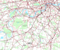
Beverley Brook is a English large stream (increasingly dubbed a 'river') as one of few of its size kept clean and above ground in London, 14.3 km long in south and south-west London. It rises at Cuddington Recreation Park in Worcester Park, flows alongside land that is mostly suburban or playing fields at Motspur Park, New Malden, Wimbledon Common, Richmond Park and Barnes. It then joins the River Thames west of Putney Embankment at Barn Elms.
Subcategories
This category has the following 6 subcategories, out of 6 total.
- Beverley Brook Walk (23 F)
*
- Beverley Brook in Richmond Park (48 F)
Media in category "Beverley Brook"
This category contains only the following file.
-
 Beverley Brook and Pyl Brook.png 970 × 811; 436 KB