Category:Betteshanger
Jump to navigation
Jump to search
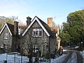
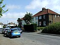
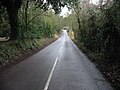
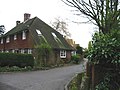
English: Betteshanger is a village near Deal in East Kent, England. It gave its name to the largest of the four chief collieries of the Kent coalfield.
village in Kent, United Kingdom  | |||||
| Upload media | |||||
| Instance of | |||||
|---|---|---|---|---|---|
| Location | Northbourne, Dover, Kent, South East England, England | ||||
 | |||||
Subcategories
This category has the following 4 subcategories, out of 4 total.
Media in category "Betteshanger"
The following 41 files are in this category, out of 41 total.
-
 Access road in Betteshanger Community Park - geograph.org.uk - 2364066.jpg 3,072 × 2,304; 1.68 MB
-
 Access road to Betteshanger Business Park - geograph.org.uk - 2363979.jpg 3,072 × 2,304; 1.77 MB
-
 Betteshanger Community park. - geograph.org.uk - 315819.jpg 640 × 480; 232 KB
-
 Betteshanger Community Park.jpg 640 × 480; 122 KB
-
 Bridleways, Betteshanger - geograph.org.uk - 5587812.jpg 640 × 480; 181 KB
-
 Broad Lane, Betteshanger - geograph.org.uk - 4521321.jpg 2,272 × 1,704; 859 KB
-
 Broad Lane, Betteshanger - geograph.org.uk - 4521325.jpg 2,272 × 1,704; 680 KB
-
 Burnt Barn Cottages - geograph.org.uk - 2366115.jpg 3,072 × 2,304; 1.88 MB
-

-
 Circular Road, Betteshanger - geograph.org.uk - 4521332.jpg 2,272 × 1,704; 706 KB
-
 Circular Road, Betteshanger - geograph.org.uk - 4521335.jpg 2,272 × 1,704; 815 KB
-
 Colliers Way, Betteshanger - geograph.org.uk - 4521347.jpg 2,272 × 1,704; 744 KB
-
 Commemorative stone, Betteshanger Community Park - geograph.org.uk - 4521341.jpg 2,272 × 1,704; 1.34 MB
-
 Cricket Pavilion, Eastry cricket ground - geograph.org.uk - 303675.jpg 640 × 480; 248 KB
-
 Field west of Church Road, Betteshanger - geograph.org.uk - 5587716.jpg 640 × 480; 110 KB
-
 Footpath towards Sheep Wash, Betteshanger - geograph.org.uk - 659579.jpg 640 × 480; 209 KB
-

-
 Lower Lodge - geograph.org.uk - 2850803.jpg 640 × 480; 149 KB
-
 Lower Lodge Cottage - geograph.org.uk - 2220548.jpg 3,072 × 2,304; 2.26 MB
-
 May's Cottage - geograph.org.uk - 2366124.jpg 3,072 × 2,304; 2.13 MB
-
 Miner's Way in Betteshanger - geograph.org.uk - 2364038.jpg 3,072 × 2,304; 2.03 MB
-
 North Way, Betteshanger - geograph.org.uk - 4521328.jpg 2,272 × 1,704; 804 KB
-
 Road junction for Betteshanger church - geograph.org.uk - 660150.jpg 618 × 459; 236 KB
-
 Steps in Betteshanger Community Park - geograph.org.uk - 2364042.jpg 3,072 × 2,304; 2.66 MB
-
 Updown House amongst the trees - geograph.org.uk - 678029.jpg 640 × 480; 220 KB
-
 View across the fields near Betteshanger - geograph.org.uk - 659577.jpg 640 × 480; 192 KB
-

-
 View along country road near Betteshanger - geograph.org.uk - 659574.jpg 640 × 480; 210 KB
-

-

-

-
 Footpath junction - geograph.org.uk - 659586.jpg 640 × 480; 200 KB
-
-
 House at the edge of Sangrado's Wood. - geograph.org.uk - 303695.jpg 640 × 480; 151 KB
-

-
 Lane at Western edge of Sangrado's Wood. - geograph.org.uk - 303701.jpg 640 × 480; 156 KB
-

-

-

-

-
 Tree covered lane. - geograph.org.uk - 304363.jpg 625 × 450; 258 KB


