Category:Betchworth
Jump to navigation
Jump to search
village and civil parish in the Mole Valley district of Surrey, England  | |||||
| Upload media | |||||
| Instance of | |||||
|---|---|---|---|---|---|
| Location | Mole Valley, Surrey, South East England, England | ||||
| Significant event |
| ||||
| Population |
| ||||
| Area |
| ||||
 | |||||
English: Betchworth is a village and civil parish in the Mole Valley district of Surrey, England. The village lies on the north bank of the River Mole, off the A25 road, about three miles (5 km) east of Dorking and three miles (5 km) west of Reigate. The village lay within the Reigate hundred.
Subcategories
This category has the following 14 subcategories, out of 14 total.
B
- Betchworth Bridge (4 F)
- Betchworth Castle (14 F)
- Betchworth Gospel Hall (10 F)
- Betchworth railway station (41 F)
- Betchworth War Memorial (5 F)
- Broome Park, Surrey (3 F)
- Bushbury, Surrey (1 F)
D
- The Dolphin, Betchworth (9 F)
H
- Hartsfield Manor (9 F)
- Betchworth House, Surrey (8 F)
M
O
- The Old House, Betchworth (2 F)
V
Media in category "Betchworth"
The following 200 files are in this category, out of 341 total.
(previous page) (next page)-
 1 - 3 Church Street - geograph.org.uk - 1833664.jpg 640 × 426; 140 KB
-
 1 - 3 Church Street - geograph.org.uk - 3544462.jpg 800 × 530; 580 KB
-
 1 - 3 Church Street - geograph.org.uk - 3544470.jpg 800 × 530; 613 KB
-
 A country crossroads - geograph.org.uk - 4451589.jpg 4,608 × 3,456; 5.83 MB
-
 A shed within a shed - geograph.org.uk - 1939655.jpg 640 × 428; 104 KB
-

-
 Across the River Mole - geograph.org.uk - 2214484.jpg 640 × 425; 81 KB
-
 Across the River Mole - geograph.org.uk - 2214779.jpg 640 × 425; 61 KB
-
 Along Station Road at dusk - geograph.org.uk - 5200414.jpg 2,048 × 1,536; 1.51 MB
-
 Autumn colours off the North Downs Way - geograph.org.uk - 3208458.jpg 2,048 × 1,536; 867 KB
-
 B2032 - geograph.org.uk - 5141478.jpg 640 × 426; 90 KB
-
 B2032 at Betchworth Crossing - geograph.org.uk - 5345201.jpg 640 × 426; 80 KB
-
 Bend on Snowerhill Road, Betchworth - geograph.org.uk - 4178441.jpg 2,418 × 1,375; 1.42 MB
-
 Betchworth , Coombe Cottages - geograph.org.uk - 6194489.jpg 682 × 1,024; 671 KB
-
 Betchworth Avenue by W Monk RE, in the Art Journal page 67.jpg 1,199 × 1,800; 828 KB
-
 Betchworth Bridge, Snowerhill Road, Betchworth (July 2013).JPG 2,592 × 1,944; 1.69 MB
-
 Betchworth Burial Ground - geograph.org.uk - 5905330.jpg 2,560 × 1,440; 1.49 MB
-
 Betchworth Fingerposts (geograph 3017403).jpg 3,216 × 4,288; 3.61 MB
-
 Betchworth forge (detail) - geograph.org.uk - 2222729.jpg 1,024 × 681; 118 KB
-
 Betchworth Forge (geograph 6499039).jpg 1,024 × 684; 219 KB
-
 Betchworth Forge, The Street, Betchworth (NHLE Code 1190667) (July 2013).JPG 2,000 × 1,800; 1.13 MB
-
 Betchworth Garden Centre - geograph.org.uk - 1805224.jpg 640 × 431; 90 KB
-
 Betchworth Gospel Hall - geograph.org.uk - 2109412.jpg 640 × 480; 134 KB
-
 Betchworth Gospel Hall - geograph.org.uk - 3253474.jpg 640 × 425; 359 KB
-
 Betchworth Jubilee Beacon - geograph.org.uk - 3139468.jpg 640 × 425; 326 KB
-
 Betchworth Jubilee Beacon - geograph.org.uk - 3139478.jpg 425 × 640; 275 KB
-
 Betchworth Jubilee Beacon - geograph.org.uk - 3139491.jpg 640 × 425; 270 KB
-
 Betchworth Level Crossing - geograph.org.uk - 3274705.jpg 640 × 480; 178 KB
-
 Betchworth Lime Avenue.jpg 4,000 × 2,667; 4.58 MB
-
 Betchworth old station building - geograph.org.uk - 2221764.jpg 1,600 × 1,200; 657 KB
-
 Betchworth Parish Map - geograph.org.uk - 3017539.jpg 3,966 × 1,930; 2.6 MB
-
 Betchworth Park, view north.jpg 4,000 × 2,141; 2.2 MB
-
 Betchworth Park, view towards Box Hill.jpg 4,000 × 2,667; 2.82 MB
-
 Betchworth Post Office - geograph.org.uk - 28972.jpg 640 × 480; 137 KB
-
 Betchworth Post Office - geograph.org.uk - 3017381.jpg 3,216 × 4,288; 3.72 MB
-
 Betchworth Quarry kiln - geograph.org.uk - 4048408.jpg 530 × 800; 619 KB
-
 Betchworth Quarry kiln - geograph.org.uk - 4048410.jpg 530 × 800; 653 KB
-
 Betchworth Quarry kiln - geograph.org.uk - 4048416.jpg 800 × 530; 646 KB
-
 Betchworth Quarry kiln - geograph.org.uk - 4048561.jpg 800 × 530; 543 KB
-
 Betchworth Quarry kiln - geograph.org.uk - 4048569.jpg 800 × 530; 456 KB
-
 Betchworth Quarry kilns - geograph.org.uk - 4048445.jpg 530 × 800; 533 KB
-
 Betchworth railway station, Surrey - geograph.org.uk - 5100493.jpg 1,600 × 1,200; 332 KB
-
 Betchworth railway station, Surrey - geograph.org.uk - 5100499.jpg 1,600 × 1,200; 538 KB
-
 Betchworth Roundabout - geograph.org.uk - 316089.jpg 640 × 459; 108 KB
-
 Betchworth Station - geograph.org.uk - 5141479.jpg 640 × 426; 87 KB
-
 Betchworth Station - geograph.org.uk - 5200405.jpg 2,048 × 1,536; 1.62 MB
-
 Betchworth Station - geograph.org.uk - 5200647.jpg 2,048 × 1,536; 1.53 MB
-
 Betchworth Station - geograph.org.uk - 5345203.jpg 640 × 411; 107 KB
-
 Betchworth Station - geograph.org.uk - 5345210.jpg 640 × 426; 94 KB
-
 Betchworth Station building - geograph.org.uk - 4413640.jpg 640 × 427; 80 KB
-

-
 Betchworth Station, looking eastwards - geograph.org.uk - 5704633.jpg 5,202 × 3,465; 5.55 MB
-
 Betchworth Station. Reading train departing - geograph.org.uk - 5704628.jpg 5,202 × 3,465; 4.85 MB
-
 Betchworth, Church Street, old barn, decaying - geograph.org.uk - 2222730.jpg 1,024 × 681; 288 KB
-
 Betchworth, Open barns - geograph.org.uk - 4542626.jpg 4,608 × 3,456; 6.41 MB
-
 Betchworth, Pillbox by the river Mole near Rice Bridge.jpg 3,000 × 1,995; 2.79 MB
-
 Betchworth, Post Office and stores - geograph.org.uk - 3590792.jpg 2,664 × 1,984; 3.46 MB
-
 Betchworth, second Pillbox by the river Mole near Rice Bridge.jpg 3,000 × 1,995; 3.07 MB
-
 Betchworth, St. Michael's Church - geograph.org.uk - 4542619.jpg 4,608 × 3,456; 6.08 MB
-
 Betchworth, Surrey - geograph.org.uk - 514578.jpg 640 × 513; 77 KB
-
 Betchworth, Surrey - geograph.org.uk - 517229.jpg 640 × 427; 107 KB
-
 Bike shelter, Betchworth Station - geograph.org.uk - 5345206.jpg 640 × 383; 99 KB
-
 Bovey Cottage - geograph.org.uk - 1829615.jpg 640 × 426; 99 KB
-
 Bridge over the Railway - geograph.org.uk - 316064.jpg 480 × 640; 121 KB
-
 Bridge over the River Mole, Betchworth - geograph.org.uk - 2784757.jpg 1,600 × 1,200; 535 KB
-
 Bridleway in Highridge Wood - geograph.org.uk - 5770466.jpg 640 × 428; 196 KB
-
 Bridleway towards Strood Green - geograph.org.uk - 5770480.jpg 640 × 428; 157 KB
-
 Brockham 2007 - panoramio (1).jpg 2,048 × 1,536; 702 KB
-
 Brockham 2007 - panoramio (2).jpg 2,048 × 1,536; 695 KB
-
 Brockham 2007 - panoramio.jpg 2,048 × 1,536; 633 KB
-
 Brockham Hills, North Downs - geograph.org.uk - 3017107.jpg 4,288 × 3,216; 3.66 MB
-
 Brockhamhurst Road - geograph.org.uk - 2543814.jpg 640 × 480; 194 KB
-
 Brockhamhurst Road, passing High Ridge Wood - geograph.org.uk - 3699785.jpg 768 × 1,024; 241 KB
-
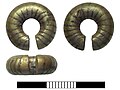 Bronze Age, Gold penannular ring (FindID 646848).jpg 1,408 × 1,059; 470 KB
-
 Broome Park Ice House - geograph.org.uk - 549243.jpg 640 × 480; 153 KB
-
 Buckland and Reigate Heath Windmill - geograph.org.uk - 3017267.jpg 4,288 × 3,216; 3.17 MB
-
 Bushbury Farm - geograph.org.uk - 1806861.jpg 640 × 426; 75 KB
-
 Bushbury Farm - geograph.org.uk - 4451568.jpg 4,608 × 3,456; 6.15 MB
-
 Bushbury Farm - geograph.org.uk - 5208679.jpg 2,048 × 1,536; 1.09 MB
-
 Bushbury Farm - geograph.org.uk - 5208690.jpg 2,048 × 1,536; 1.09 MB
-
 Bushbury, Park Pale Lane - geograph.org.uk - 4451549.jpg 4,608 × 3,456; 6.2 MB
-
 Carriage drive to Oakwood House - geograph.org.uk - 855217.jpg 640 × 427; 146 KB
-
 Caution - man at work^ - geograph.org.uk - 2274701.jpg 3,565 × 2,592; 3.28 MB
-

-
 Church Street - geograph.org.uk - 3545986.jpg 800 × 530; 484 KB
-
 Combe Head on the Brockham Hills - geograph.org.uk - 3017114.jpg 4,288 × 3,216; 3.73 MB
-
 Conifer plantation, High Ridge Wood - geograph.org.uk - 3691412.jpg 768 × 1,024; 265 KB
-
 Cottage north of Gadbrook Road - geograph.org.uk - 1938916.jpg 640 × 428; 108 KB
-
 Cranmer Cottage, Pebblehill Road - geograph.org.uk - 5704640.jpg 5,202 × 3,465; 5.04 MB
-
 Crest, gates to Wonham Manor - geograph.org.uk - 3447017.jpg 640 × 424; 473 KB
-

-
 Crossways, High Ridge Wood - geograph.org.uk - 1956801.jpg 640 × 428; 162 KB
-
 Dairy cattle near Gadbrook Farm - geograph.org.uk - 676281.jpg 640 × 480; 110 KB
-
 Decrepitude at Bushbury Farm - geograph.org.uk - 5770680.jpg 640 × 428; 128 KB
-
 Deer Park - geograph.org.uk - 3447027.jpg 640 × 424; 252 KB
-
 Dillon Cottage & Old Mill Cottage (geograph 6499033).jpg 1,024 × 684; 187 KB
-
 Dillon Cottage and Old Mill Cottage - geograph.org.uk - 3544293.jpg 800 × 530; 461 KB
-
 Diverted footpath 460, Betchworth - geograph.org.uk - 2173253.jpg 640 × 480; 118 KB
-
 Dolphin in Bloom - geograph.org.uk - 3017477.jpg 4,288 × 3,216; 3.56 MB
-
 Downland by Betchworth Station - geograph.org.uk - 3017301.jpg 4,288 × 3,216; 3.87 MB
-
 Edge of Riding's Copse - geograph.org.uk - 2211318.jpg 425 × 640; 103 KB
-
 Elm Cottage, Elm Villas and Roffeys - geograph.org.uk - 1829553.jpg 640 × 426; 87 KB
-
 Entrance to Little Abbot's farm - geograph.org.uk - 2785072.jpg 1,600 × 1,200; 632 KB
-
 Entrance to Little Abbot's farm - geograph.org.uk - 2785077.jpg 1,600 × 1,200; 514 KB
-
 Entrance to Snowerhill Farm, Betchworth - geograph.org.uk - 2785059.jpg 1,600 × 1,200; 594 KB
-
 Farm wagon by Bushbury Lane - geograph.org.uk - 5208636.jpg 2,048 × 1,536; 1.47 MB
-
 Farm wagon by Bushbury Lane - geograph.org.uk - 5208640.jpg 2,048 × 1,536; 1.47 MB
-
 Farming equipment, Bushbury Farm - geograph.org.uk - 1956822.jpg 640 × 428; 113 KB
-
 Farmland below the North Downs - geograph.org.uk - 4799585.jpg 640 × 426; 61 KB
-
 Field by Brockhamhurst Road, Blackbrook - geograph.org.uk - 4177703.jpg 2,560 × 1,920; 1.35 MB
-
 Field by Brockhamhurst Road, Blackbrook - geograph.org.uk - 4177714.jpg 2,560 × 1,920; 2.13 MB
-
 Field by Bushbury Lane - geograph.org.uk - 5210485.jpg 2,048 × 1,536; 997 KB
-
 Field by Roothill Lane - geograph.org.uk - 5210531.jpg 2,048 × 1,536; 1.47 MB
-
 Field water trough - geograph.org.uk - 869904.jpg 640 × 427; 137 KB
-
 Field with distant horse - geograph.org.uk - 5774724.jpg 640 × 428; 138 KB
-
 Fields by Bushbury Lane - geograph.org.uk - 5210530.jpg 2,048 × 1,536; 1.54 MB
-
 Fields by Snowerhill Farm entrance - geograph.org.uk - 2785064.jpg 1,600 × 1,200; 538 KB
-
 Fields by Snowerhill Farm entrance - geograph.org.uk - 2785068.jpg 1,600 × 1,200; 538 KB
-
 Flagg House, Old Road - geograph.org.uk - 871034.jpg 640 × 427; 89 KB
-
 Footbridge over The River Mole - geograph.org.uk - 529890.jpg 640 × 480; 150 KB
-
 Footbridge, Betchworth - geograph.org.uk - 3017370.jpg 4,288 × 3,216; 3.95 MB
-

-
 Footpath off Snowerhill Road - geograph.org.uk - 2211356.jpg 640 × 425; 68 KB
-
 Footpath south of Boxhill Road - geograph.org.uk - 2265849.jpg 640 × 426; 119 KB
-
 Footpath through Dendy's Wood - geograph.org.uk - 1938966.jpg 640 × 428; 152 KB
-
 Footpath Through Wheat Field - geograph.org.uk - 3017251.jpg 3,216 × 4,288; 3.7 MB
-
 Forge Cottage and Betchworth Forge - geograph.org.uk - 3955314.jpg 800 × 530; 544 KB
-
 Former Betchworth Quarry workshops - geograph.org.uk - 4048555.jpg 800 × 530; 525 KB
-
 Franks - geograph.org.uk - 2228652.jpg 640 × 425; 91 KB
-
 Fraser Down - geograph.org.uk - 1351643.jpg 640 × 426; 114 KB
-
 Fraser Down - geograph.org.uk - 1351647.jpg 640 × 426; 112 KB
-
 Fraser Down - geograph.org.uk - 1351655.jpg 640 × 441; 121 KB
-
 Fraser Down - geograph.org.uk - 1351668.jpg 640 × 426; 101 KB
-
 Fraser Down - geograph.org.uk - 1351677.jpg 640 × 426; 114 KB
-
 Fraser Down - geograph.org.uk - 1351682.jpg 640 × 426; 95 KB
-
 Fungi on a conifer stump - geograph.org.uk - 3699759.jpg 779 × 1,024; 273 KB
-
 Furniture Workshop, Betchworth - geograph.org.uk - 549293.jpg 640 × 480; 104 KB
-
 Gadbrook House - geograph.org.uk - 1854607.jpg 640 × 426; 91 KB
-
 Gadbrook House - side view - geograph.org.uk - 1938932.jpg 640 × 428; 119 KB
-
 Gate on track south of The Field House - geograph.org.uk - 5774961.jpg 640 × 428; 154 KB
-
 Going, going, gone^ - geograph.org.uk - 2215273.jpg 436 × 640; 93 KB
-
 Great Brockhamhurst Farm - geograph.org.uk - 1887184.jpg 640 × 426; 104 KB
-
 Great Brockhamhurst Farmhouse - geograph.org.uk - 1956888.jpg 640 × 428; 159 KB
-
 Greensand Way Between Brockham and Betchworth - geograph.org.uk - 3017572.jpg 4,288 × 3,216; 3.73 MB
-
 Greensand Way, Betchworth - geograph.org.uk - 3017567.jpg 4,288 × 3,216; 3.55 MB
-
 Hartsfield Manor Lodge, Sandy Lane, Betchworth (July 2013).JPG 2,400 × 1,800; 1.24 MB
-
 Hay field near The Field House - geograph.org.uk - 5774953.jpg 640 × 428; 102 KB
-
 HDR Floods (12555494373).jpg 4,128 × 2,322; 13.9 MB
-
 Highridge Wood - geograph.org.uk - 2543813.jpg 640 × 480; 172 KB
-
 Holmecroft - geograph.org.uk - 5345196.jpg 640 × 426; 74 KB
-
 Home Farm Close, Betchworth - geograph.org.uk - 2784463.jpg 1,600 × 1,200; 559 KB
-
 Horses by Root Hill Farm - geograph.org.uk - 5210533.jpg 2,048 × 1,536; 1.45 MB
-
 House on Trumpets Hill Road, Betchworth - geograph.org.uk - 4797270.jpg 2,304 × 1,728; 768 KB
-
 In a cutting, North Downs Line - geograph.org.uk - 5141474.jpg 640 × 474; 102 KB
-
 Inside Broome Park Ice House - geograph.org.uk - 549246.jpg 480 × 640; 100 KB
-
 James Gordon Moir.jpg 800 × 944; 145 KB
-
 Kiln Lane, Betchworth - geograph.org.uk - 4176973.jpg 2,440 × 1,750; 1.13 MB
-
 Knights Garden Centre, Betchworth - geograph.org.uk - 856069.jpg 640 × 280; 46 KB
-
 Level crossing by Betchworth station platform - geograph.org.uk - 2221766.jpg 1,600 × 1,200; 554 KB
-
 Level Crossing, Betchworth, Surrey - geograph.org.uk - 2278237.jpg 2,794 × 1,871; 3.41 MB
-

-
 Looking through railway bridge BTH3 328A - geograph.org.uk - 5773942.jpg 640 × 428; 178 KB
-
 Lych Gate, Church of St Michael (geograph 6499113).jpg 1,024 × 684; 276 KB
-
 Lychgate to St Michael's Church - geograph.org.uk - 4408580.jpg 530 × 800; 464 KB
-
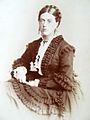 Mary Twynam Jaffrey.jpg 800 × 1,071; 194 KB
-
 Middle Street south of Brockham - geograph.org.uk - 5226607.jpg 2,048 × 1,536; 1.29 MB
-
 Mobile phone mast and bridge - geograph.org.uk - 2228704.jpg 640 × 425; 94 KB
-
 Morden Grange - geograph.org.uk - 2225809.jpg 640 × 425; 100 KB
-
 More Place (geograph 6498958).jpg 685 × 1,024; 235 KB
-
 More Place Cottages (geograph 6498949).jpg 1,024 × 684; 194 KB
-
 Muddy field at Bushbury Farm - geograph.org.uk - 5208698.jpg 4,608 × 3,456; 5.09 MB
-

-
 North Downs Way - geograph.org.uk - 2155781.jpg 425 × 640; 166 KB
-
 North Downs Way, Betchworth Hills - geograph.org.uk - 3017218.jpg 4,288 × 3,216; 3.69 MB
-
 Nos. 6-8 New Cottages - geograph.org.uk - 868771.jpg 640 × 427; 111 KB
-
 Off Gadbrook Road, Orchard Cottage - geograph.org.uk - 4538666.jpg 4,608 × 3,456; 6.27 MB
-
 Old chaff cutter, Bushbury Farm - geograph.org.uk - 5770692.jpg 640 × 428; 158 KB
-
 Old chaff cutter, Bushbury Farm - geograph.org.uk - 5770748.jpg 640 × 428; 159 KB
-

-

-
 Old Cottages, Betchworth - geograph.org.uk - 3017498.jpg 4,288 × 3,216; 3.6 MB
-
 Old Reigate Road, Betchworth - geograph.org.uk - 4177637.jpg 2,400 × 1,682; 1 MB
-
 One Man Band at the Cowpie Country Show May 2013 - geograph.org.uk - 3461732.jpg 1,600 × 1,200; 705 KB
-
 Orchard Cottage - geograph.org.uk - 1854665.jpg 640 × 426; 95 KB
-
 Parkpale Cottages - geograph.org.uk - 1806878.jpg 640 × 426; 85 KB
-
 Parkpale Lane - geograph.org.uk - 1806890.jpg 640 × 426; 110 KB
-
 Parkpale Lane - geograph.org.uk - 1806898.jpg 640 × 426; 102 KB
-
 Parkpale Lane, Bushbury - geograph.org.uk - 5208629.jpg 2,048 × 1,536; 1.49 MB
-
 Parkpale Lane, Bushbury - geograph.org.uk - 5208923.jpg 4,608 × 3,456; 4.92 MB
-
 Parkpale Lane, Bushbury - geograph.org.uk - 5210477.jpg 4,608 × 3,456; 7.13 MB
-
 Parkpale Lane, Bushbury - geograph.org.uk - 5210481.jpg 4,608 × 3,456; 6.93 MB
-
 Path alongside Pebblehill Road - geograph.org.uk - 5704659.jpg 5,202 × 3,465; 4.02 MB
-
 Path at the margin of High Ridge Wood - geograph.org.uk - 3691593.jpg 751 × 1,024; 224 KB
-
 Path in Highridge Wood - geograph.org.uk - 5770427.jpg 640 × 428; 192 KB
-
 Path in Highridge Wood - geograph.org.uk - 5770442.jpg 640 × 428; 201 KB
-
 Path junction - geograph.org.uk - 5774928.jpg 640 × 428; 138 KB
-
 Path junction - geograph.org.uk - 5774939.jpg 640 × 428; 135 KB
-
 Paths in Highridge Wood - geograph.org.uk - 5770423.jpg 640 × 428; 198 KB
-
 Pebble Hill Road - Steep Hill 16^ - geograph.org.uk - 1428861.jpg 640 × 400; 105 KB
-
 Pilgrims Way Cottages - geograph.org.uk - 2227595.jpg 640 × 425; 73 KB


.JPG)

.jpg)
_-_geograph.org.uk_-_2222729.jpg)
.jpg)
_(July_2013).JPG)


.jpg)
.jpg)


.jpg)


.jpg)


.JPG)

.jpg)


.jpg)


.jpg)
.jpg)


