Category:Bestwood Village
Jump to navigation
Jump to search
village in United Kingdom  | |||||
| Upload media | |||||
| Instance of | |||||
|---|---|---|---|---|---|
| Location |
| ||||
 | |||||
Subcategories
This category has the following 6 subcategories, out of 6 total.
B
- Bestwood Pumping Station (14 F)
- Bestwood War Memorial (1 F)
- Butlers Hill NET stop (3 F)
Media in category "Bestwood Village"
The following 200 files are in this category, out of 256 total.
(previous page) (next page)-
 A cut above the usual bench - geograph.org.uk - 5349748.jpg 1,024 × 768; 162 KB
-
 A much-needed shower. - geograph.org.uk - 1952809.jpg 1,280 × 854; 511 KB
-
 A view across the rooftops, Killarney Park - geograph.org.uk - 5349699.jpg 1,024 × 768; 175 KB
-
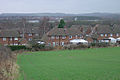
 A wet April morning in Bestwood Colliery Village - geograph.org.uk - 3925125.jpg 1,200 × 743; 854 KB
-
 A60 at Tophouse Farm - geograph.org.uk - 1952909.jpg 1,280 × 854; 263 KB
-
 Alexandra Lodges - geograph.org.uk - 5662943.jpg 4,608 × 3,456; 4.35 MB
-
 Alexandra Lodges Bestwood - geograph.org.uk - 5662920.jpg 4,608 × 3,456; 3.3 MB
-
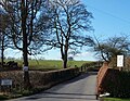
 Arnold Road - geograph.org.uk - 1206596.jpg 640 × 479; 79 KB
-
 Beckhampton Road, Bestwood Park estate - geograph.org.uk - 3418680.jpg 1,024 × 768; 159 KB
-
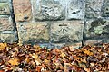
 Benchmark on wall bounding ^1 Pedmore Valley - geograph.org.uk - 5651501.jpg 1,024 × 683; 322 KB
-
 Benchmark on wall of Beckhampton Road - geograph.org.uk - 5651497.jpg 1,024 × 683; 291 KB
-
 Benchmark on wall of ^516 Arnold Road - geograph.org.uk - 5653028.jpg 1,024 × 683; 290 KB
-
 Benchmark on wall pier of Edwards Lane - geograph.org.uk - 5652398.jpg 1,024 × 683; 312 KB
-
 Benchmark on ^117 Stevenholme Crescent - geograph.org.uk - 5641943.jpg 653 × 1,024; 205 KB
-
 Benchmark on ^3 Landcroft Crescent - geograph.org.uk - 5652402.jpg 683 × 1,024; 256 KB
-
 Benchmark on ^56 Carnwood Road - geograph.org.uk - 5652639.jpg 654 × 1,024; 262 KB
-
 Benchmark on ^57 Stevenholme Crescent - geograph.org.uk - 5646871.jpg 683 × 1,024; 171 KB
-

-

-
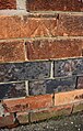
 Bestwood - Bestwood Hotel - brickwork detail - geograph.org.uk - 3700473.jpg 1,168 × 1,600; 536 KB
-
 Bestwood - Bestwood Hotel - geograph.org.uk - 3700470.jpg 1,600 × 1,185; 587 KB
-
 Bestwood - bottom of St Albans Road - geograph.org.uk - 3700451.jpg 1,600 × 1,193; 536 KB
-
 Bestwood - colliery winding wheel - geograph.org.uk - 3700449.jpg 712 × 1,024; 190 KB
-
 Bestwood - former BICC offices.jpg 1,600 × 1,245; 548 KB
-
 Bestwood - mid-terrace houses on Park Road - geograph.org.uk - 3700458.jpg 1,600 × 1,198; 669 KB
-
 Bestwood Big Wood - geograph.org.uk - 5662906.jpg 4,608 × 3,456; 4.77 MB
-
 Bestwood Big Wood - geograph.org.uk - 5662910.jpg 4,608 × 3,456; 4.78 MB
-
 Bestwood Big Wood - geograph.org.uk - 5662915.jpg 4,608 × 3,456; 3.98 MB
-
 Bestwood Big Wood - geograph.org.uk - 5662917.jpg 4,608 × 3,456; 4.54 MB
-
 Bestwood Big Wood - geograph.org.uk - 5662930.jpg 4,608 × 3,456; 5.89 MB
-
 Bestwood Colliery - top of the shaft - geograph.org.uk - 3367607.jpg 640 × 427; 90 KB
-
 Bestwood Colliery Village, built 1876 - geograph.org.uk - 3925110.jpg 640 × 640; 102 KB
-

-
 Bestwood Colliery Village, Park Road - geograph.org.uk - 3925102.jpg 1,200 × 697; 956 KB
-
 Bestwood Colliery Village, St Albans Road - geograph.org.uk - 3925122.jpg 1,200 × 1,021; 1.15 MB
-
 Bestwood Colliery Village, The Square - geograph.org.uk - 3925117.jpg 1,024 × 1,024; 1.04 MB
-

-
 Bestwood Country Park - geograph.org.uk - 5662892.jpg 4,608 × 3,456; 4.17 MB
-
 Bestwood Country Park - geograph.org.uk - 5662895.jpg 4,608 × 3,456; 3.99 MB
-
 Bestwood Country Park - geograph.org.uk - 5662897.jpg 4,608 × 3,456; 4.28 MB
-
 Bestwood Country Park - geograph.org.uk - 5662900.jpg 4,608 × 3,456; 4.3 MB
-
 Bestwood Country Park NG6, Notts. - geograph.org.uk - 4253394.jpg 2,394 × 3,488; 2.14 MB
-
 Bestwood Country Park Vicinity, Notts. NG5 - geograph.org.uk - 4253177.jpg 2,774 × 2,083; 1.04 MB
-
 Bestwood Country Park Vicinity, Notts. NG5 - geograph.org.uk - 4253243.jpg 3,254 × 2,891; 2.1 MB
-
 Bestwood Country Park Vicinity, Notts. NG5 - geograph.org.uk - 4253321.jpg 2,125 × 2,211; 986 KB
-
 Bestwood Country Park, NG5, Notts. - geograph.org.uk - 4253572.jpg 4,032 × 2,353; 1.83 MB
-
 Bestwood Country Park, NG6, Notts - geograph.org.uk - 4253443.jpg 3,310 × 2,459; 1.42 MB
-
 Bestwood Country Park, NG6, Notts - geograph.org.uk - 4253494.jpg 3,915 × 2,951; 2.55 MB
-
 Bestwood Country Park, NG6, Notts - geograph.org.uk - 4253497.jpg 2,910 × 3,567; 2.48 MB
-
 Bestwood Country Park, NG6, Notts - geograph.org.uk - 4253501.jpg 3,440 × 2,559; 1.72 MB
-
 Bestwood Country Park, NG6, Notts - geograph.org.uk - 4253504.jpg 2,791 × 2,654; 1.48 MB
-
 Bestwood Country Park, NG6, Notts - geograph.org.uk - 4253534.jpg 3,574 × 2,496; 1.82 MB
-
 Bestwood Country Park, NG6, Notts - geograph.org.uk - 4253540.jpg 2,895 × 2,666; 1.76 MB
-
 Bestwood Country Park, Notts, NG6 - geograph.org.uk - 4253525.jpg 2,825 × 2,624; 1.57 MB
-
 Bestwood Country Park, Notts. - geograph.org.uk - 3824413.jpg 3,637 × 2,537; 1.45 MB
-
 Bestwood Country Park, Notts. NG5 - geograph.org.uk - 4253351.jpg 2,634 × 2,520; 1.24 MB
-
 Bestwood Country Park, Notts. NG5 - geograph.org.uk - 4253371.jpg 2,672 × 2,227; 1.05 MB
-
 Bestwood Country Park, Notts. NG5 - geograph.org.uk - 4253386.jpg 2,624 × 2,505; 1.27 MB
-

-
 Bestwood Hotel - geograph.org.uk - 652050.jpg 640 × 427; 213 KB
-
 Bestwood Library, Arnold Road - geograph.org.uk - 5653043.jpg 1,024 × 683; 208 KB
-
 Bestwood Park Drive - geograph.org.uk - 2005104.jpg 1,280 × 854; 279 KB
-
 Bestwood Park Drive, Nottingham - geograph.org.uk - 1829142.jpg 640 × 480; 64 KB
-
 Bestwood Pumping Station (1) - geograph.org.uk - 5350843.jpg 4,320 × 3,240; 4.26 MB
-
 Bestwood Pumping Station (2) - geograph.org.uk - 5351898.jpg 3,240 × 4,320; 4.13 MB
-
 Bestwood Pumping Station (3) - geograph.org.uk - 5351909.jpg 3,240 × 4,320; 2.01 MB
-
 Bestwood Pumping Station (4) - geograph.org.uk - 5351921.jpg 4,320 × 3,240; 3.67 MB
-
 Bestwood Pumping Station (5) - geograph.org.uk - 5351929.jpg 4,320 × 3,240; 2.89 MB
-
 Bestwood Pumping Station - Cooling Pond - geograph.org.uk - 2404488.jpg 800 × 531; 121 KB
-
 Bestwood Pumping Station - geograph.org.uk - 1952925.jpg 1,280 × 845; 311 KB
-
 Bestwood Pumping Station - geograph.org.uk - 1952928.jpg 1,280 × 831; 273 KB
-
 Bestwood Pumping Station - geograph.org.uk - 1952931.jpg 1,280 × 845; 290 KB
-
 Bestwood Pumping Station - geograph.org.uk - 1952934.jpg 829 × 1,280; 197 KB
-
 Bestwood Pumping Station - geograph.org.uk - 1952943.jpg 854 × 1,280; 323 KB
-
 Bestwood Pumping Station - geograph.org.uk - 2398922.jpg 427 × 640; 84 KB
-
 Bestwood Pumping Station - geograph.org.uk - 2404470.jpg 531 × 800; 100 KB
-
 Bestwood Pumping Station - geograph.org.uk - 2404480.jpg 531 × 800; 165 KB
-
 Bestwood Pumping Station - geograph.org.uk - 2404510.jpg 800 × 531; 148 KB
-
 Bestwood Village - geograph.org.uk - 1434872.jpg 640 × 477; 68 KB
-
 Bestwood Village - geograph.org.uk - 5662950.jpg 3,885 × 2,914; 2.05 MB
-
 Bestwood Village cemetery - geograph.org.uk - 3882262.jpg 800 × 533; 178 KB
-
 Bestwood Village Hall - geograph.org.uk - 652065.jpg 640 × 427; 209 KB
-
 Bestwood Village, Coronation Road - geograph.org.uk - 661614.jpg 640 × 480; 112 KB
-
 Bestwood Village, The Spinney - geograph.org.uk - 661606.jpg 640 × 429; 76 KB
-
 Bestwood Village, The Spinney - geograph.org.uk - 661609.jpg 640 × 480; 129 KB
-
 Bestwood Village, The Spinney - geograph.org.uk - 661611.jpg 640 × 437; 93 KB
-
 Bestwood, Forge Farm - geograph.org.uk - 3925168.jpg 1,200 × 897; 1.69 MB
-
 Bestwood, former railway cottages - geograph.org.uk - 2505864.jpg 1,024 × 760; 698 KB
-

-
 Bestwood, where the railway once crossed - geograph.org.uk - 2505827.jpg 1,024 × 689; 194 KB
-
 Bestwood, where the station platforms were - geograph.org.uk - 2506031.jpg 1,024 × 768; 1,020 KB
-
 Bottomhouse Farm - geograph.org.uk - 1952957.jpg 1,280 × 854; 242 KB
-
 Bottomhouse Farm - geograph.org.uk - 1952984.jpg 1,280 × 854; 277 KB
-
 Bridge over Moor Road - geograph.org.uk - 5367846.jpg 1,280 × 853; 397 KB
-
 Bridge over Moor Road - geograph.org.uk - 5368027.jpg 1,280 × 853; 467 KB
-
 Broken birch - geograph.org.uk - 5368617.jpg 1,280 × 1,280; 772 KB
-
 Bus stop, Lamins Lane - geograph.org.uk - 1952903.jpg 1,280 × 854; 409 KB
-
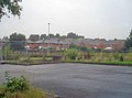
 Bus turning circle, Park Road, Bestwood village - geograph.org.uk - 3504618.jpg 1,024 × 768; 145 KB
-
 Car park entrance, Bestwood Country Park - geograph.org.uk - 3504622.jpg 1,024 × 768; 161 KB
-
 Carnwood Road - geograph.org.uk - 1205294.jpg 640 × 479; 101 KB
-
 Chiltern Close, Nottingham - geograph.org.uk - 1763725.jpg 800 × 480; 75 KB
-
 Chippenham Road - geograph.org.uk - 1206661.jpg 640 × 479; 67 KB
-
 City of Nottingham boundary marker - geograph.org.uk - 2004940.jpg 854 × 1,280; 401 KB
-
 Clock Tower Business Centre, Bestwood - geograph.org.uk - 3886299.jpg 3,960 × 2,172; 5.19 MB
-

-
 Clump of trees - geograph.org.uk - 1952962.jpg 1,280 × 854; 267 KB
-
 Colliers Path, Bestwood Country Park - geograph.org.uk - 5337778.jpg 1,024 × 768; 346 KB
-

-
 Cycle path towards Bulwell - geograph.org.uk - 1829184.jpg 640 × 480; 139 KB
-
 Cycle Route 6 milepost, Bestwood Country Park - geograph.org.uk - 3238461.jpg 4,000 × 3,000; 4.63 MB
-
 Deer Park Drive - geograph.org.uk - 2005101.jpg 1,280 × 854; 241 KB
-
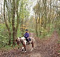
 Donkey sanctuary^ - geograph.org.uk - 1952856.jpg 1,280 × 854; 314 KB
-
 Double subway - geograph.org.uk - 2004912.jpg 1,280 × 854; 228 KB
-

-
 Duke's Cottages - geograph.org.uk - 5350795.jpg 4,320 × 3,240; 2.93 MB
-
 Eastern end of Sunrise Avenue, Killarney Park - geograph.org.uk - 5349673.jpg 1,024 × 768; 184 KB
-
 Edwards Lane at Arnold Road junction - geograph.org.uk - 5652400.jpg 1,024 × 683; 190 KB
-

-
 Entrance to Bestwood Country Park - geograph.org.uk - 2004823.jpg 1,280 × 854; 326 KB
-
 Entrance to Forest Farm - geograph.org.uk - 1952951.jpg 1,280 × 854; 387 KB
-
 Entrance to Sunrise Hill - geograph.org.uk - 1205302.jpg 640 × 479; 152 KB
-
 Evedon Walk - geograph.org.uk - 2005112.jpg 1,280 × 844; 364 KB
-
 Exit from Bestwood Country Park - geograph.org.uk - 2004826.jpg 844 × 1,280; 267 KB
-
 Field stable - geograph.org.uk - 1952859.jpg 1,280 × 854; 390 KB
-
 Fields alongside the A60 - geograph.org.uk - 1952975.jpg 1,280 × 854; 364 KB
-
 Footpath in Bestwood Country Park - geograph.org.uk - 5616279.jpg 1,024 × 683; 174 KB
-

-

-
 Former Bestwood Pumping Station, Redhill, Notts. - geograph.org.uk - 4838964.jpg 2,898 × 2,845; 1.84 MB
-
 Former Bestwood Pumping Station, Redhill, Notts. - geograph.org.uk - 4839005.jpg 2,611 × 3,103; 1.49 MB
-
 Former Bestwood Pumping Station, Redhill, Notts. - geograph.org.uk - 4839075.jpg 2,816 × 3,095; 1.92 MB
-
 Former Bestwood Pumping Station, Redhill, Notts. - geograph.org.uk - 4840130.jpg 1,712 × 2,743; 1.1 MB
-
 Former Pumping Station Vicinity, Redhill, Notts. - geograph.org.uk - 4839036.jpg 2,966 × 2,960; 1.83 MB
-
 Former track of the Great Northern Leen Valley Line - geograph.org.uk - 2506055.jpg 1,024 × 768; 1.27 MB
-
 Goosedale Lane near Hilltop Farm - geograph.org.uk - 5349719.jpg 1,024 × 768; 254 KB
-
 Goosedale Lane near Sunnyside Farm - geograph.org.uk - 5349716.jpg 1,024 × 768; 184 KB
-
 Goosedale Sports Club - geograph.org.uk - 1952802.jpg 1,280 × 854; 205 KB
-
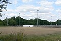 Goosedale Sports Club - geograph.org.uk - 1952807.jpg 1,280 × 854; 217 KB
-
 Hawthorne Primary School - geograph.org.uk - 652072.jpg 640 × 427; 275 KB
-
 Hilltop Farm - geograph.org.uk - 1952824.jpg 1,280 × 854; 404 KB
-
 Hilltop Farm - geograph.org.uk - 1952834.jpg 1,280 × 854; 321 KB
-
 Horsham Drive, Top Valley - geograph.org.uk - 3648348.jpg 1,024 × 768; 124 KB
-
 Houses at the north end of Stevenholme Crescent - geograph.org.uk - 5641954.jpg 1,024 × 683; 147 KB
-
 Hundred Acre Farm - geograph.org.uk - 1952865.jpg 1,280 × 854; 273 KB
-
 Information board - geograph.org.uk - 2004832.jpg 1,280 × 854; 370 KB
-
 Irrigation near Hilltop Farm - geograph.org.uk - 1952814.jpg 1,280 × 854; 375 KB
-
 Killarney Park - geograph.org.uk - 1952871.jpg 1,280 × 828; 261 KB
-
 Killarney Park postbox Ref NG5 41 - geograph.org.uk - 1952877.jpg 1,280 × 854; 382 KB
-
 Kyle View - geograph.org.uk - 2005120.jpg 1,280 × 854; 202 KB
-
 Kyle View shops - geograph.org.uk - 2005119.jpg 1,280 × 854; 274 KB
-
 Lakeside Restaurant - geograph.org.uk - 1952913.jpg 1,280 × 854; 403 KB
-
 Lamin's Lane, Redhill, Notts. - geograph.org.uk - 4840159.jpg 3,129 × 2,431; 1.38 MB
-
 Lamin's Lane, Redhill, Notts. - geograph.org.uk - 4840187.jpg 3,503 × 2,776; 1.87 MB
-
 Lamin's Lane, Redhill, Notts. - geograph.org.uk - 4840230.jpg 4,032 × 3,024; 2.74 MB
-
 Lamin's Lane, Redhill, Notts. - geograph.org.uk - 4840259.jpg 4,032 × 3,024; 2.62 MB
-
 Lamins Lane bus stop, A60 Mansfield Road - geograph.org.uk - 5540975.jpg 1,024 × 768; 276 KB
-
 Landscape off Moor Road - geograph.org.uk - 1952787.jpg 1,280 × 854; 278 KB
-

-
 Lane to Goosedale Farm - geograph.org.uk - 1952798.jpg 1,280 × 854; 287 KB
-
 Lane to Hilltop Farm - geograph.org.uk - 1952818.jpg 1,280 × 854; 325 KB
-
 Leen Valley Walk, Bestwood, Notts. - geograph.org.uk - 3824532.jpg 3,951 × 2,860; 2.1 MB
-
 Leen Valley Walk, Bestwood, Notts. - geograph.org.uk - 3824540.jpg 3,784 × 2,660; 1.76 MB
-
 Leen Valley Walk, Bestwood, Notts. - geograph.org.uk - 3824547.jpg 3,198 × 2,399; 1.47 MB
-
 Little Lime Lane, north of Arnold - geograph.org.uk - 5540966.jpg 1,024 × 768; 279 KB
-
 Little Oakwood Drive, Rise Park, Nottingham - geograph.org.uk - 3824554.jpg 3,024 × 4,032; 2.25 MB
-
 Lock-up garages - geograph.org.uk - 2005106.jpg 1,280 × 854; 351 KB
-
 Lytham Gardens - geograph.org.uk - 2004929.jpg 1,280 × 854; 342 KB
-
 Lytham Gardens - geograph.org.uk - 2005130.jpg 1,280 × 854; 325 KB
-
 Lytham Gardens postbox ref, NG5 73 - geograph.org.uk - 2005125.jpg 1,280 × 854; 325 KB
-

-
 Millennium milepost fingers - geograph.org.uk - 5368699.jpg 1,280 × 853; 455 KB
-
 Mini-roundabout, Bestwood Park drive - geograph.org.uk - 1829137.jpg 640 × 451; 60 KB
-
 Moor Road at Bestwood - geograph.org.uk - 3886051.jpg 4,000 × 2,248; 5.76 MB
-
 Near Hilltop Farm - geograph.org.uk - 1952844.jpg 1,280 × 854; 326 KB
-
 New Farm vicinity, NG5, Notts. - geograph.org.uk - 3850336.jpg 4,032 × 3,024; 2.61 MB
-
 New Farm vicinity, Redhill NG5, Notts. - geograph.org.uk - 3850326.jpg 3,007 × 2,182; 1.31 MB
-
 New Farm, Redhill, NG5, Notts. - geograph.org.uk - 3850422.jpg 3,119 × 2,191; 1.26 MB
-
 New Farm, Redhill, NG5, Notts. - geograph.org.uk - 3850517.jpg 3,110 × 2,299; 1.44 MB
-
 North end of Chippenham Road - geograph.org.uk - 3035203.jpg 1,024 × 768; 125 KB
-
 North end of Squires Drive, Killarney Park - geograph.org.uk - 5349712.jpg 1,024 × 768; 280 KB
-

-
 Nos. 3 ^ 5 Landcroft Crescent - geograph.org.uk - 5652404.jpg 1,024 × 683; 151 KB
-
 Nottingham - NG5 (Bestwood Country Park) - geograph.org.uk - 2948636.jpg 640 × 480; 153 KB
-
 Nottingham - NG5 (Bestwood Country Park) - geograph.org.uk - 2948653.jpg 640 × 480; 128 KB
-
 Nottingham - NG5 (Bestwood Country Park) - geograph.org.uk - 2948664.jpg 640 × 480; 115 KB
-
 Nottingham - NG5 (Bestwood Country Park) - geograph.org.uk - 2948681.jpg 640 × 480; 138 KB
-
 Nottingham - NG6 (Bestwood Village) - geograph.org.uk - 2948822.jpg 640 × 480; 80 KB
-
 Nottingham - NG6 (Bestwood Village) - geograph.org.uk - 2948863.jpg 640 × 480; 118 KB
-
 Nottingham - NG6 (Bestwood) - geograph.org.uk - 2948692.jpg 640 × 480; 127 KB
-
 Nottingham - NG6 (Bestwood) - geograph.org.uk - 2948705.jpg 640 × 480; 99 KB
-
 Nottingham - NG6 (Bestwood) - geograph.org.uk - 2948751.jpg 640 × 480; 104 KB
-
 Nottingham - NG6 (Bestwood) - geograph.org.uk - 2948782.jpg 640 × 480; 75 KB
-
 Nottingham, NG6 - Bestwood - geograph.org.uk - 3234423.jpg 2,708 × 2,758; 1.22 MB
-
 Oxclose Lane (B6004) - geograph.org.uk - 1830347.jpg 640 × 480; 83 KB
-
 Oxclose Lane Police Station - geograph.org.uk - 1830345.jpg 640 × 433; 47 KB
-
 Oxclose Lane Police Station - geograph.org.uk - 4682196.jpg 1,024 × 768; 184 KB
-
 Paddocks near Twelve Acre Farm - geograph.org.uk - 1952827.jpg 1,280 × 854; 235 KB
-
 Park Road - geograph.org.uk - 652059.jpg 640 × 427; 257 KB
-
 Park Road, Bestwood Village - geograph.org.uk - 1829195.jpg 640 × 480; 79 KB
-
 Path through Bestwood Country Park - geograph.org.uk - 1434892.jpg 640 × 480; 70 KB


_-_geograph.org.uk_-_5350843.jpg)
_-_geograph.org.uk_-_5351898.jpg)
_-_geograph.org.uk_-_5351909.jpg)
_-_geograph.org.uk_-_5351921.jpg)
_-_geograph.org.uk_-_5351929.jpg)


_-_geograph.org.uk_-_2948636.jpg)
_-_geograph.org.uk_-_2948653.jpg)
_-_geograph.org.uk_-_2948664.jpg)
_-_geograph.org.uk_-_2948681.jpg)
_-_geograph.org.uk_-_2948822.jpg)
_-_geograph.org.uk_-_2948863.jpg)
_-_geograph.org.uk_-_2948692.jpg)
_-_geograph.org.uk_-_2948705.jpg)
_-_geograph.org.uk_-_2948751.jpg)
_-_geograph.org.uk_-_2948782.jpg)

_-_geograph.org.uk_-_1830347.jpg)


