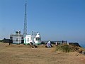
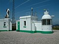
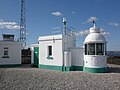
Category:Berry Head Lighthouse
Jump to navigation
Jump to search
| Object location | | View all coordinates using: OpenStreetMap |
|---|
English: Berry Head Lighthouse
Polski: Latarnia morska Berry Head
lighthouse, England  .jpg) | |||||
| Upload media | |||||
| Instance of | |||||
|---|---|---|---|---|---|
| Location |
| ||||
| Located in or next to body of water | |||||
| Operator | |||||
| Inception |
| ||||
| Significant event |
| ||||
| Height |
| ||||
 | |||||
Media in category "Berry Head Lighthouse"
The following 21 files are in this category, out of 21 total.
-
 Berry Head - lighthouse - geograph.org.uk - 3081090.jpg 640 × 480; 63 KB
-
 Berry Head - panoramio (2).jpg 2,288 × 1,712; 858 KB
-
 Berry Head - road to lighthouse - geograph.org.uk - 893451.jpg 640 × 441; 47 KB
-
 Berry Head lighthouse - geograph.org.uk - 1098417.jpg 640 × 429; 39 KB
-
 Berry Head lighthouse - geograph.org.uk - 1505498.jpg 640 × 603; 95 KB
-
 Berry Head lighthouse - geograph.org.uk - 1776553.jpg 640 × 480; 47 KB
-
 Berry Head lighthouse - geograph.org.uk - 3099361.jpg 640 × 480; 111 KB
-
 Berry Head Lighthouse - geograph.org.uk - 413627.jpg 640 × 480; 77 KB
-
 Berry Head Lighthouse - geograph.org.uk - 905106.jpg 640 × 359; 48 KB
-

-
 Berry Head Lighthouse at Night (1).jpg 4,772 × 3,579; 521 KB
-
 Berry Head Lighthouse at Night (2).jpg 5,152 × 3,864; 771 KB
-
 Berry Head lighthouse.jpg 4,080 × 2,544; 1.93 MB
-
 Berry Head Lighthouse.jpg 6,861 × 2,332; 2.7 MB
-
 Berry Head, lookout-type building - geograph.org.uk - 1464928.jpg 640 × 480; 70 KB
-
 Berry Head, the lighthouse - geograph.org.uk - 1464940.jpg 640 × 480; 63 KB
-
 Brixham - Berry Head Lighthouse (geograph 6672340).jpg 4,000 × 6,000; 5.5 MB
-
 Lighthouse at Berry Head, Brixham - geograph.org.uk - 2765235.jpg 640 × 480; 68 KB
-
 Lighthouse on Berry Head - geograph.org.uk - 2510755.jpg 3,872 × 2,592; 3.2 MB
-
 Lighthouse, Berry Head - geograph.org.uk - 1753072.jpg 1,600 × 1,200; 405 KB
-
 The lighthouse at Berry Head - geograph.org.uk - 41907.jpg 640 × 480; 89 KB

.jpg)


.jpg)


.jpg)


