Category:Bentley, Hampshire
Jump to navigation
Jump to search
village and civil parish in East Hampshire, England, UK  | |||||
| Upload media | |||||
| Instance of | |||||
|---|---|---|---|---|---|
| Location | East Hampshire, Hampshire, South East England, England | ||||
 | |||||
Deutsch: Bentley ist ein Ort und eine Gemeinde im Distrikt East Hampshire in der englischen Grafschaft Hampshire. Bentley hat 1.019 Einwohner (2001).
English: Bentley is a village and civil parish in the East Hampshire district of Hampshire, England.
Subcategories
This category has the following 8 subcategories, out of 8 total.
Media in category "Bentley, Hampshire"
The following 200 files are in this category, out of 270 total.
(previous page) (next page)-
 15 15 - geograph.org.uk - 1889995.jpg 2,560 × 1,920; 1.74 MB
-
 A grassy field corner - geograph.org.uk - 4572422.jpg 640 × 480; 152 KB
-
 A31 near Bentley - geograph.org.uk - 4956681.jpg 2,000 × 1,333; 2.72 MB
-
 Alice Holt Forest - geograph.org.uk - 383144.jpg 640 × 480; 164 KB
-
 Barley Pound Junction - geograph.org.uk - 2157890.jpg 2,560 × 1,920; 2.41 MB
-
 Bean Crop in Spring Flower - geograph.org.uk - 1890168.jpg 1,920 × 2,560; 1.84 MB
-
 Bentley Hall - geograph.org.uk - 1886092.jpg 2,560 × 1,920; 1.77 MB
-
 Bentley Milestone - geograph.org.uk - 1890263.jpg 1,920 × 2,560; 1.71 MB
-
 Bentley Mill on Gravel Hill Road (1) - geograph.org.uk - 2285805.jpg 800 × 600; 105 KB
-
 Bentley Mill on Gravel Hill Road (2) - geograph.org.uk - 2285817.jpg 800 × 600; 141 KB
-
 Bentley Primary School - geograph.org.uk - 1890242.jpg 2,560 × 1,920; 1.91 MB
-
 Bentley sign-1.jpg 320 × 240; 36 KB
-
 Bentley Thanks Careful Drivers - geograph.org.uk - 1890337.jpg 2,560 × 1,920; 1.73 MB
-
 Bentley Village Church - geograph.org.uk - 5560592.jpg 4,608 × 3,456; 3.17 MB
-
 Bentley Village Pond - geograph.org.uk - 1890306.jpg 1,920 × 2,560; 1.81 MB
-
 Bentley, Hampshire - geograph.org.uk - 13381.jpg 640 × 480; 94 KB
-
 Blossom at Pax Hill Care Home - geograph.org.uk - 2313685.jpg 800 × 672; 190 KB
-
 BritishCassiniGridMilitaryMap.jpg 4,150 × 2,443; 4.65 MB
-

-
 Bury Court Farm, Bentley Hampshire - geograph.org.uk - 3426058.jpg 800 × 533; 138 KB
-
 Cautionary Sign - geograph.org.uk - 1890367.jpg 1,920 × 2,560; 1.69 MB
-
 Cereal Crop by Bentley - geograph.org.uk - 1890040.jpg 2,560 × 1,920; 1.77 MB
-
 Cheek by Jowl - geograph.org.uk - 1890358.jpg 2,560 × 1,920; 1.94 MB
-
 Cheeks Farm - geograph.org.uk - 4900741.jpg 3,264 × 1,840; 2.11 MB
-
 Cheeks Farm near Bentley - geograph.org.uk - 4959913.jpg 2,000 × 1,333; 2.74 MB
-
 Church Cottage, Bentley - geograph.org.uk - 1890190.jpg 2,560 × 1,920; 1.78 MB
-
 Church Lane, Bentley - geograph.org.uk - 1890224.jpg 2,560 × 1,920; 1.93 MB
-
 Churchyard, Bentley - geograph.org.uk - 4180457.jpg 640 × 480; 352 KB
-
 Coldfrey Farm - geograph.org.uk - 3479265.jpg 640 × 427; 95 KB
-
 Coldrey Farm - geograph.org.uk - 3479269.jpg 640 × 427; 91 KB
-
 Coldrey Lodge - geograph.org.uk - 1890013.jpg 2,560 × 1,920; 1.83 MB
-
 Converted House - Hole Lane - geograph.org.uk - 4900712.jpg 3,264 × 1,840; 1.98 MB
-
 Cottage at the corner of Church Lane, Bentley - geograph.org.uk - 4085332.jpg 4,320 × 3,240; 4.11 MB
-
 Cottages near bus stop in Bentley - geograph.org.uk - 2312043.jpg 600 × 800; 84 KB
-

-
 Country lane by Bury Court - geograph.org.uk - 2714051.jpg 640 × 420; 41 KB
-
 Country lane south of Glade Farm - geograph.org.uk - 2714054.jpg 800 × 507; 57 KB
-
 Country lane south of Glade Farm - geograph.org.uk - 2714055.jpg 640 × 480; 76 KB
-
 Countryside near Dippenhall - geograph.org.uk - 4961721.jpg 2,000 × 1,333; 2.19 MB
-
 Countryside near Dippenhall - geograph.org.uk - 4962328.jpg 2,000 × 1,333; 2.66 MB
-
 Crock's Farm Sheep Field - geograph.org.uk - 4900707.jpg 3,264 × 1,840; 2.19 MB
-
 Crondall Road meets the A31 - geograph.org.uk - 2714078.jpg 640 × 441; 59 KB
-
 Crondall Road, Bentley - geograph.org.uk - 4959872.jpg 2,000 × 1,333; 3.11 MB
-
 Crondall Road, Bentley - geograph.org.uk - 4960038.jpg 2,000 × 1,333; 3 MB
-
 Crondall Road, Bentley - geograph.org.uk - 4960060.jpg 2,000 × 1,333; 2.85 MB
-
 Crossroads and pylons near Glade Farm - geograph.org.uk - 4084278.jpg 3,767 × 2,850; 3.7 MB
-
 Crossroads in Bentley - geograph.org.uk - 2312061.jpg 800 × 600; 79 KB
-
 Crossroads with bus shelter in the rain - geograph.org.uk - 2285866.jpg 800 × 652; 146 KB
-
 Dilapidated wooden shed - geograph.org.uk - 630447.jpg 640 × 477; 117 KB
-
-
 Direction Sign at Alice Holt Forest - geograph.org.uk - 1431916.jpg 640 × 480; 120 KB
-
 Disused pit north of Pax Hill Care Home - geograph.org.uk - 2313713.jpg 800 × 600; 136 KB
-
 Don't Go There^ - geograph.org.uk - 1890232.jpg 2,560 × 1,920; 1.98 MB
-
 Eastward view along Main Road, Bentley, Hampshire (May 2021).JPG 3,600 × 2,600; 1.83 MB
-
 Entering Bentley from the east - geograph.org.uk - 1890347.jpg 2,560 × 1,920; 2.02 MB
-
 Entering Redcap Copse - geograph.org.uk - 621921.jpg 640 × 477; 134 KB
-

-
 Entrance, Alice Holt Research Station - geograph.org.uk - 383269.jpg 640 × 428; 190 KB
-
 Fallen oak - geograph.org.uk - 2316849.jpg 2,272 × 1,704; 2.99 MB
-
 Farm track near Glade Farm - geograph.org.uk - 2312078.jpg 800 × 600; 77 KB
-
 Farmland near Bury Court - geograph.org.uk - 4084291.jpg 4,320 × 3,240; 4.89 MB
-
 Farmland, Bentley - geograph.org.uk - 2123846.jpg 640 × 480; 125 KB
-
 Farmland, Bentley - geograph.org.uk - 2123944.jpg 640 × 480; 153 KB
-
 Farmland, Bentley - geograph.org.uk - 282170.jpg 640 × 480; 150 KB
-
 Farmyard at Bury Court, Bentley - geograph.org.uk - 3425993.jpg 800 × 533; 107 KB
-
 Field beside Lawn's Copse - geograph.org.uk - 4961200.jpg 2,000 × 1,333; 3.68 MB
-
 Field beside the A31 near Bentley - geograph.org.uk - 5350052.jpg 640 × 427; 93 KB
-
 Field by Hole Lane - geograph.org.uk - 3479241.jpg 640 × 427; 63 KB
-
 Field by the A31, Bentley - geograph.org.uk - 4959868.jpg 2,000 × 1,333; 2.86 MB
-
 Field by Wallfield Copse - geograph.org.uk - 2313580.jpg 800 × 600; 180 KB
-
 Field near Pax Hill - geograph.org.uk - 3468406.jpg 640 × 427; 83 KB
-
 Field near Pax Hill Care Home - geograph.org.uk - 3479273.jpg 640 × 427; 64 KB
-
 Field of all trades in Bentley - geograph.org.uk - 2312058.jpg 800 × 600; 99 KB
-
 Field of wheat - geograph.org.uk - 4572546.jpg 640 × 480; 107 KB
-
 Field off the Crondall Road - geograph.org.uk - 4962311.jpg 2,000 × 1,333; 3.05 MB
-
 Fields near Cheeks Farm - geograph.org.uk - 4959908.jpg 2,000 × 1,333; 2.16 MB
-
 Fields near Hill Farm - geograph.org.uk - 4900738.jpg 3,264 × 1,840; 2.25 MB
-
 Foot bridge over road, Bentley - geograph.org.uk - 4084304.jpg 4,320 × 3,240; 4.51 MB
-
 Footbridge over A31 at Bentley - geograph.org.uk - 2312051.jpg 800 × 600; 115 KB
-
 Footbridge over the A31 - geograph.org.uk - 630467.jpg 640 × 467; 79 KB
-
 Footbridge over the A31, Bentley - geograph.org.uk - 5022265.jpg 2,188 × 1,637; 1.03 MB
-
 Footpath junction on St Swithun's Way - geograph.org.uk - 2313674.jpg 800 × 600; 195 KB
-
 Footpath near Bentley - geograph.org.uk - 4900714.jpg 3,264 × 1,840; 2.46 MB
-
 Footpath near Coldrey Farm - geograph.org.uk - 3479296.jpg 640 × 427; 171 KB
-
 Footpath near Isington Mill - geograph.org.uk - 1886333.jpg 2,560 × 1,920; 1.93 MB
-
 Footpath near Jenkyn Place - geograph.org.uk - 4900710.jpg 3,264 × 1,840; 2.4 MB
-
 Footpath near The Hanger - geograph.org.uk - 2313711.jpg 600 × 800; 121 KB
-
 Footpath reaches road south of Crondall - geograph.org.uk - 2292911.jpg 800 × 600; 145 KB
-
 Footpath south to Bury Court - geograph.org.uk - 2312068.jpg 800 × 600; 111 KB
-
 Footpath to Bentley station - geograph.org.uk - 621911.jpg 640 × 477; 145 KB
-
 Footpath towards Blackacre Cottage - geograph.org.uk - 3479278.jpg 640 × 427; 85 KB
-
 Footpath unaffected by new Solar Farm - geograph.org.uk - 4900801.jpg 3,264 × 1,840; 3.23 MB
-

-
 Glade Farm north of Bentley - geograph.org.uk - 2312072.jpg 800 × 504; 95 KB
-
 Grover's Farm, Dippenhall - geograph.org.uk - 4961727.jpg 2,000 × 1,333; 2.68 MB
-
 Hedgerow near Cheeks Farm - geograph.org.uk - 4956710.jpg 2,000 × 1,333; 2.73 MB
-
 Hidden lake - geograph.org.uk - 2316838.jpg 2,272 × 1,704; 3.74 MB
-
 Hill Farm Lane junction - geograph.org.uk - 4956114.jpg 2,000 × 1,333; 2.87 MB
-
 Hill Farm Lane, Bentley - geograph.org.uk - 4962304.jpg 2,000 × 1,333; 2.74 MB
-
 Hilltop Tree by Bentley - geograph.org.uk - 1890111.jpg 2,560 × 1,920; 1.69 MB
-
 Historic Coldrey Farm - geograph.org.uk - 4900695.jpg 3,264 × 1,840; 3.68 MB
-
 Hole Lane - geograph.org.uk - 1978438.jpg 640 × 429; 40 KB
-
 Hole Lane near Bentley - geograph.org.uk - 5032960.jpg 2,048 × 1,536; 987 KB
-
 Hole Lane, Bentley - geograph.org.uk - 1890211.jpg 2,560 × 1,920; 1.69 MB
-
 Hole Lane, Bentley, Hampshire.jpg 320 × 228; 29 KB
-
 Horses in a field off the St Swithun’s Way - geograph.org.uk - 5560597.jpg 4,608 × 3,456; 5.8 MB
-
 House at Kimbers Farm - geograph.org.uk - 2292909.jpg 800 × 600; 129 KB
-
 House near Bury Court - geograph.org.uk - 2312065.jpg 600 × 800; 87 KB
-
 House on corner - Bury Court - geograph.org.uk - 2714049.jpg 640 × 439; 48 KB
-
 Houses on Hole Lane - geograph.org.uk - 4180543.jpg 640 × 480; 346 KB
-
 Houses, East Green - geograph.org.uk - 4572394.jpg 640 × 480; 120 KB
-
 How Now Brown Cow - geograph.org.uk - 1890383.jpg 2,560 × 1,920; 1.8 MB
-
 Jenkyn Place - geograph.org.uk - 1890202.jpg 2,560 × 1,920; 1.9 MB
-
 Jenkyn Place Cottages - geograph.org.uk - 1890196.jpg 2,560 × 1,920; 1.86 MB
-
 Jenkyn Place Footbridge over Hole Lane, Bentley, Hampshire (May 2021) (1).JPG 2,600 × 3,200; 1.58 MB
-
 Jenkyn Place Footbridge over Hole Lane, Bentley, Hampshire (May 2021) (2).JPG 2,600 × 3,200; 1.56 MB
-
 Jenkyn Place, Bentley.jpg 4,032 × 3,024; 4.04 MB
-
 Junction of lanes near Dippenhall - geograph.org.uk - 4081769.jpg 4,320 × 2,738; 5.05 MB
-
 Junction on the A31, Bentley - geograph.org.uk - 5022266.jpg 2,087 × 1,564; 929 KB
-
 Lane between Bury Court ^ Glade Farm - geograph.org.uk - 2714052.jpg 640 × 451; 45 KB
-
 Large Fields - geograph.org.uk - 4900739.jpg 3,264 × 1,840; 2.04 MB
-
 Lay-by beside the A31 near Bentley - geograph.org.uk - 5350054.jpg 640 × 427; 88 KB
-
 Lay-by on the A31 - geograph.org.uk - 4961188.jpg 2,000 × 1,333; 3.11 MB
-
 Lodge Pond, Alice Holt Forest - geograph.org.uk - 15121.jpg 640 × 426; 82 KB
-
 Looking east across lake to The Hanger - geograph.org.uk - 2313709.jpg 800 × 600; 233 KB
-
 Looking west across field to The Hanger - geograph.org.uk - 2313694.jpg 800 × 600; 153 KB
-
 Marsh House Hill, Bentley - geograph.org.uk - 4956685.jpg 2,000 × 1,333; 3.41 MB
-

-
 North section of boundary wall east of Jenkyn Place, Bentley.jpg 3,024 × 4,032; 5 MB
-
 Northbrook Park Coach House - geograph.org.uk - 3323383.jpg 5,025 × 1,925; 1.65 MB
-
 Northbrook Park House - geograph.org.uk - 3323377.jpg 2,796 × 2,062; 625 KB
-
 Northbrook Park House - geograph.org.uk - 3323381.jpg 2,820 × 2,096; 1.33 MB
-
 Northbrook Park Mews - geograph.org.uk - 3323391.jpg 2,848 × 2,134; 1.29 MB
-
 Northbrook Park Nun's Garden - geograph.org.uk - 3323390.jpg 640 × 480; 108 KB
-
 Northbrook Park Walled Garden - geograph.org.uk - 3323385.jpg 5,673 × 1,850; 2.71 MB
-
 Northbrook Park Walled Garden - geograph.org.uk - 3323389.jpg 5,690 × 2,280; 3.15 MB
-
 Oilseed rape near Bentley - geograph.org.uk - 1332403.jpg 640 × 427; 73 KB
-
 Old Cottage in Bentley - geograph.org.uk - 1890239.jpg 2,560 × 1,920; 1.79 MB
-
 Old Cottage in Bentley - geograph.org.uk - 1890321.jpg 2,560 × 1,920; 1.93 MB
-
 Old Cottages - East Green - geograph.org.uk - 4900717.jpg 3,264 × 1,840; 3.09 MB
-

-
 Old Farnham Lane - geograph.org.uk - 4961743.jpg 2,000 × 1,333; 3.62 MB
-
 Old Farnham Lane, Bentley - geograph.org.uk - 4959879.jpg 2,000 × 1,333; 2.92 MB
-
 Old Oasts at Bentley - geograph.org.uk - 1890183.jpg 2,560 × 1,920; 1.84 MB
-
 Old yews leading to St Mary's Church - geograph.org.uk - 2318026.jpg 2,272 × 1,704; 2.7 MB
-
 On the Moove - geograph.org.uk - 1890374.jpg 2,560 × 1,920; 1.92 MB
-
 Paddock by Pax Hill - geograph.org.uk - 1890130.jpg 2,560 × 1,920; 1.96 MB
-
 Paddocks East of Pax Hill - geograph.org.uk - 1890143.jpg 2,560 × 1,920; 1.73 MB
-
 Pasture North of Isington - geograph.org.uk - 1890006.jpg 2,560 × 1,920; 1.89 MB
-
 Path into Wallfield Copse - geograph.org.uk - 4900722.jpg 3,264 × 1,840; 4.23 MB
-
 Path near Broad Flood, Bentley - geograph.org.uk - 3238638.jpg 640 × 427; 120 KB
-
 Path through Field - geograph.org.uk - 4900701.jpg 3,264 × 1,840; 2.41 MB
-
 Path through the solar farm - geograph.org.uk - 4956693.jpg 2,000 × 1,333; 3.26 MB
-
 Pax Hill - geograph.org.uk - 1890122.jpg 2,560 × 1,920; 1.71 MB
-
 Pax Hill Care Home - geograph.org.uk - 3479272.jpg 640 × 480; 118 KB
-
 Pax Hill Nursing Home - geograph.org.uk - 4900705.jpg 3,264 × 1,840; 3.08 MB
-
 Paxhill new building and bicycle - geograph.org.uk - 2316839.jpg 2,272 × 1,704; 3.22 MB
-
 Plank bridge near Wallfield Copse - geograph.org.uk - 5560602.jpg 4,608 × 3,456; 5.79 MB
-
 Pond by tree and building at Hill Farm - geograph.org.uk - 2292895.jpg 800 × 600; 177 KB
-
 Pond near Broadhatch House - geograph.org.uk - 2316847.jpg 2,272 × 1,704; 2.12 MB
-
 Postbox by Bentley Church - geograph.org.uk - 2569922.jpg 640 × 480; 121 KB
-
 Pussy willow buds against the sky - geograph.org.uk - 2313701.jpg 600 × 800; 146 KB
-
 Railway Course, by Bentley - geograph.org.uk - 1886131.jpg 2,560 × 1,920; 1.78 MB
-
 Rectory Lane in Bentley - geograph.org.uk - 2312048.jpg 600 × 800; 183 KB
-
 Red Lion House, Bentley - geograph.org.uk - 1890271.jpg 2,560 × 1,920; 2 MB
-
 Renewable Power Farm - Solar Panals - geograph.org.uk - 4900746.jpg 3,264 × 1,840; 2.81 MB
-
 Road junction at Barley Pound - geograph.org.uk - 2292917.jpg 800 × 600; 106 KB
-
 Road junction south of Crondall - geograph.org.uk - 2292905.jpg 800 × 600; 95 KB
-
 Road to Pax Hill - geograph.org.uk - 4900703.jpg 3,264 × 1,840; 2.57 MB
-
 Rural Road to Bentley - geograph.org.uk - 4900720.jpg 3,264 × 1,840; 3.21 MB
-
 Saint Swithun's Way - Near Bentley - geograph.org.uk - 4900708.jpg 3,264 × 1,840; 2.17 MB
-
 Saint Swithun's Way - Near Bentley - geograph.org.uk - 4900716.jpg 3,264 × 1,840; 2.21 MB
-
-
 Sharp bend in Crondall Road - geograph.org.uk - 4961205.jpg 2,000 × 1,333; 2.71 MB
-
 Sign - Saint Swithun's Way - geograph.org.uk - 4900806.jpg 3,264 × 1,840; 2.87 MB
-
 Sign for Pax Hill Nursing Home - geograph.org.uk - 5560580.jpg 4,608 × 3,456; 5.26 MB
-
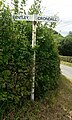
 Signpost on Crondall Road - geograph.org.uk - 2292898.jpg 800 × 600; 134 KB
-
 Small Tributary of the River Wey - geograph.org.uk - 4900699.jpg 3,264 × 1,840; 3.18 MB
-
 Small wood on hill north of Bentley - geograph.org.uk - 4574869.jpg 640 × 480; 141 KB
-
 Solar farm near Bentley - geograph.org.uk - 4956691.jpg 2,000 × 1,333; 2.22 MB
-
 Solar Farm near Gully Copse - geograph.org.uk - 4956689.jpg 2,000 × 1,333; 3.05 MB
-
 Solar Farm near Gully Copse - geograph.org.uk - 4959925.jpg 2,000 × 1,333; 2.25 MB
-
 South section of boundary wall east of Jenkyn Place, Bentley.jpg 4,032 × 3,024; 5.4 MB
-
 Spring in Bentley - geograph.org.uk - 1890253.jpg 2,560 × 1,920; 1.78 MB
-
 St Mary the Virgin, Bentley - geograph.org.uk - 4085347.jpg 4,320 × 3,240; 4.62 MB
-
 St Swithun's Way in Wallfield Copse (1) - geograph.org.uk - 2313577.jpg 800 × 600; 209 KB
-
 St Swithun's Way in Wallfield Copse (2) - geograph.org.uk - 2313594.jpg 800 × 600; 241 KB
-
 St Swithun's Way in Wallfield Copse (3) - geograph.org.uk - 2313599.jpg 600 × 800; 244 KB
-
 St Swithun's Way near Bentley - geograph.org.uk - 4960069.jpg 2,000 × 1,330; 3.44 MB
-
 St Swithun's Way near Bentley - geograph.org.uk - 4960075.jpg 2,000 × 1,333; 2.97 MB
-
 St Swithun's Way, Signpost - geograph.org.uk - 3323392.jpg 2,752 × 2,002; 1.39 MB
-
 Stile near Pax Hill Care Home - geograph.org.uk - 2313689.jpg 800 × 600; 169 KB
-
 Straw stacks - geograph.org.uk - 4180496.jpg 640 × 480; 384 KB
-
 The A31 - geograph.org.uk - 282172.jpg 640 × 480; 128 KB
-
 The A31 at the Hampshire-Surrey border - geograph.org.uk - 2285948.jpg 800 × 579; 103 KB
-
 The A31 Bentley bypass - geograph.org.uk - 2285782.jpg 800 × 600; 74 KB
-
 The A31 east of Bentley - geograph.org.uk - 5022269.jpg 2,242 × 1,642; 1.08 MB
-

-
 The A31, Lower Froyle - geograph.org.uk - 5022275.jpg 2,304 × 1,728; 941 KB
-
 The A31, Lower Froyle - geograph.org.uk - 5023423.jpg 2,304 × 1,728; 941 KB


_-_geograph.org.uk_-_2285805.jpg)
_-_geograph.org.uk_-_2285817.jpg)


.JPG)


_(1).JPG)
_(2).JPG)


_(May_2021).JPG)


_-_geograph.org.uk_-_2313577.jpg)
_-_geograph.org.uk_-_2313594.jpg)
_-_geograph.org.uk_-_2313599.jpg)


