Category:Bengali-language maps of India
Jump to navigation
Jump to search
Media in category "Bengali-language maps of India"
The following 24 files are in this category, out of 24 total.
-
 ArunachalDistrictMapBengali.png 1,053 × 745; 159 KB
-
 Barasat kalipuja guidemap-2018.jpg 4,000 × 2,000; 2.39 MB
-
 India-states-numbered-bn.png 1,594 × 1,868; 605 KB
-
 India-states-numbered-bn.svg 1,594 × 1,868; 320 KB
-
 Indian states and union territories-bn.svg 512 × 593; 1.87 MB
-
 Kolkata Map 1690-bn.jpg 749 × 1,020; 195 KB
-
 Kolkata Metro Line 2 - কলকাতা মেট্রো লাইন ২.png 1,637 × 765; 2.09 MB
-
 Language region maps of India bn.svg 1,594 × 1,870; 336 KB
-
 Mumbai Bengali map.svg 744 × 1,052; 776 KB
-
 Mumbai Bengali map1.png 745 × 1,053; 205 KB
-
 NE Autonomous divisions of India bn.svg 489 × 341; 562 KB
-
 Partition of India 1947-bn.svg 1,189 × 1,170; 231 KB
-
 Rayalaseema- Andhra Pradesh in Bengali.png 800 × 692; 148 KB
-
 Tripura map in Bengali.svg 744 × 1,052; 285 KB
-
 Tripura-Map-BPY.svg 416 × 599; 32 KB
-
 West Bengal Wikivoyage map bn.png 2,631 × 4,013; 1.54 MB
-
 WestBengalDistricts numbered-bpy.png 1,589 × 2,115; 429 KB
-
 Zonal Councils-bn.svg 437 × 512; 257 KB
-
 ঝাড়খণ্ডের প্রশাসনিক বিভাগের মানচিত্র.svg 829 × 617; 407 KB
-
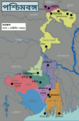
 পশ্চিমবঙ্গের বিভাগীয় মানচিত্র.jpg 424 × 600; 73 KB
-
 বিহারজেলা.png 1,049 × 747; 202 KB
-
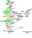
 ভারতীয় উপমহাদেশ.svg 566 × 558; 280 KB
-
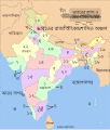
 ভারতের ভাষা অঞ্চলের মানচিত্র.svg 512 × 583; 305 KB
-
 হলদিয়া-ফারাক্কা জলপথ.png 206 × 742; 213 KB


