Category:Belchford
Jump to navigation
Jump to search
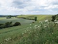
English: Belchford is a small village of about 200 inhabitants situated in the East Lindsey district of Lincolnshire, England, about 11 km (7 miles) north of Horncastle and just to the east of the A153 road.
village in the United Kingdom  | |||||
| Upload media | |||||
| Instance of | |||||
|---|---|---|---|---|---|
| Location | East Lindsey, Lincolnshire, East Midlands, England | ||||
 | |||||
Subcategories
This category has the following 7 subcategories, out of 7 total.
- Fields in Belchford (40 F)
- Hedges in Belchford (19 F)
- Roads in Belchford (18 F)
- Ruins in Belchford (1 F)
P
T
Media in category "Belchford"
The following 140 files are in this category, out of 140 total.
-
 Along the ridge of Bluestone Heath road - geograph.org.uk - 1933428.jpg 3,648 × 2,736; 2.12 MB
-
 Approaching Belchford on the Viking Way - geograph.org.uk - 402369.jpg 640 × 427; 107 KB
-

-
 Bales along the Bridleway - geograph.org.uk - 1072583.jpg 640 × 427; 141 KB
-
 Belchford - Main Road - geograph.org.uk - 1937412.jpg 640 × 480; 74 KB
-
 Belchford Hill - geograph.org.uk - 3892708.jpg 1,024 × 683; 96 KB
-
 Belchford Hill - geograph.org.uk - 3892869.jpg 640 × 427; 41 KB
-

-
 Belchford Methodist Chapel - geograph.org.uk - 241854.jpg 640 × 427; 104 KB
-
 Belchford Pumpkins - geograph.org.uk - 3652065.jpg 640 × 427; 82 KB
-

-
 Bridge over the River Waring - geograph.org.uk - 4395950.jpg 1,024 × 768; 244 KB
-
 Bridge over the River Waring - geograph.org.uk - 4398514.jpg 1,024 × 768; 294 KB
-

-
 Bridge Repairs - geograph.org.uk - 1072523.jpg 640 × 427; 130 KB
-
 Bridleway approaching Main Road near Belchford - geograph.org.uk - 4392280.jpg 1,024 × 768; 179 KB
-
 Bridleway between two ploughed fields - geograph.org.uk - 4398516.jpg 1,024 × 768; 163 KB
-
 Bridleway crossing the River Waring - geograph.org.uk - 4398518.jpg 1,024 × 768; 164 KB
-

-

-

-
 Church of St Peter and St Paul, Belchford - geograph.org.uk - 6214408.jpg 1,024 × 683; 222 KB
-
 Cliff face off Furlong Lane - geograph.org.uk - 3893284.jpg 640 × 427; 38 KB
-
 Cottage in Dams Lane, Belchford - geograph.org.uk - 3652067.jpg 640 × 427; 63 KB
-

-
 Dams Farm, from the Viking Way - geograph.org.uk - 3652044.jpg 640 × 427; 70 KB
-

-
 Earthworks at Oxcombe, aerial 2018 - geograph.org.uk - 5981526.jpg 640 × 427; 67 KB
-
 Eastfield Farm - geograph.org.uk - 4376760.jpg 2,000 × 1,333; 1.16 MB
-

-
 Farm hardstanding near South Wold - geograph.org.uk - 3911746.jpg 640 × 427; 36 KB
-

-

-
 Flush bracket bench mark by Flint Hill - geograph.org.uk - 1932738.jpg 3,648 × 2,736; 2.18 MB
-
 Footbridge on the Viking Way - geograph.org.uk - 686303.jpg 640 × 427; 172 KB
-
 Footpath to Fulletby - geograph.org.uk - 3068650.jpg 1,504 × 2,256; 2.95 MB
-
 Give Way to the A153 at South Wold - geograph.org.uk - 5755904.jpg 4,000 × 3,000; 2.09 MB
-
 Headwall and drain outflow in the trees - geograph.org.uk - 3892729.jpg 427 × 640; 128 KB
-
 Heath road a view over rural Lincs - geograph.org.uk - 2628063.jpg 640 × 416; 74 KB
-

-

-

-
 Hunt horse out for exercise - geograph.org.uk - 3651541.jpg 533 × 800; 92 KB
-

-
 Juicetrump Hill - geograph.org.uk - 4371838.jpg 2,000 × 1,333; 1,000 KB
-
 Juicetrump Hill - geograph.org.uk - 4782496.jpg 2,000 × 1,500; 914 KB
-

-

-
 Large Balestack - geograph.org.uk - 244348.jpg 640 × 427; 79 KB
-
 Lumps and bumps by Wood Farm - geograph.org.uk - 3792858.jpg 640 × 427; 56 KB
-
 Manor Farm, Belchford - geograph.org.uk - 4398534.jpg 1,024 × 768; 116 KB
-
 Narrow Lane, Belchford - geograph.org.uk - 1072550.jpg 427 × 640; 173 KB
-
 On the side of Belchford Wood - geograph.org.uk - 2619460.jpg 4,000 × 3,000; 2.87 MB
-
 Optical illusion house in Belchford - geograph.org.uk - 3924626.jpg 1,024 × 683; 135 KB
-
 Ordnance Survey Cut Mark - geograph.org.uk - 5481731.jpg 640 × 436; 106 KB
-
 Ordnance Survey Cut Mark - geograph.org.uk - 5756011.jpg 4,000 × 3,000; 4.91 MB
-
 Oxcombe, aerial 2018 - geograph.org.uk - 5981516.jpg 427 × 640; 66 KB
-
 Park Hill, near Juicetrump Hill - geograph.org.uk - 3792716.jpg 640 × 427; 66 KB
-
 Pub and Post Office, Belchford - geograph.org.uk - 43826.jpg 589 × 640; 103 KB
-
 Restricted byway by Flint Hill - geograph.org.uk - 1932741.jpg 3,648 × 2,736; 2.21 MB
-
 Restricted byway by Flint Hill - geograph.org.uk - 1932746.jpg 3,648 × 2,736; 2.25 MB
-

-

-
 River Lymn and a Roman Road - geograph.org.uk - 3892797.jpg 1,024 × 683; 313 KB
-
 Road to Belchford at East Farm - geograph.org.uk - 5755906.jpg 4,000 × 3,000; 2.9 MB
-
 Roadside view between Belchford and Fulletby - geograph.org.uk - 6210749.jpg 1,024 × 683; 348 KB
-
 Roman road at Flint Hill - geograph.org.uk - 3091319.jpg 1,024 × 768; 278 KB
-
 Rosin Hill - geograph.org.uk - 4028141.jpg 1,024 × 683; 318 KB
-
 Rosin Hill - geograph.org.uk - 4028147.jpg 1,024 × 683; 270 KB
-

-

-

-
 Ruins of Glebe Farm - geograph.org.uk - 3892809.jpg 640 × 427; 30 KB
-

-
 Sandy Lane - geograph.org.uk - 4398536.jpg 1,024 × 768; 260 KB
-
 Sandy Lane near Belchford - geograph.org.uk - 4378385.jpg 2,000 × 1,333; 1.17 MB
-

-

-
 Sign by the bridleway to Belchford - geograph.org.uk - 3792874.jpg 640 × 427; 82 KB
-
 South Wold Kennels, building - geograph.org.uk - 2199472.jpg 480 × 640; 110 KB
-
 South Wold Kennels, flush bracket S0663 - geograph.org.uk - 2199489.jpg 480 × 640; 137 KB
-
 Stained Hill - geograph.org.uk - 3892717.jpg 1,024 × 683; 95 KB
-
 Start of restricted byway on Flint Hill - geograph.org.uk - 1932749.jpg 3,648 × 2,736; 2.26 MB
-
 The bridleway beckons - geograph.org.uk - 3792879.jpg 640 × 427; 40 KB
-
 The church of St Peter and St Paul in Belchford - geograph.org.uk - 5755902.jpg 4,000 × 3,000; 3.42 MB
-
 The descent from Flint Hill - geograph.org.uk - 3091327.jpg 1,024 × 768; 177 KB
-
 The Oxcombe Estate, aerial 2014 - geograph.org.uk - 3800301.jpg 640 × 427; 43 KB
-
 The Oxcombe Estate, aerial 2015 - geograph.org.uk - 4650559.jpg 640 × 427; 48 KB
-
 The River Waring near Belchford - geograph.org.uk - 4395947.jpg 1,024 × 768; 237 KB
-
 The Road to Glebe Hill - geograph.org.uk - 1072567.jpg 427 × 640; 115 KB
-
 The Viking Way - geograph.org.uk - 4378196.jpg 2,000 × 1,333; 1.24 MB
-
 The Viking Way - geograph.org.uk - 4378201.jpg 2,000 × 1,333; 1.3 MB
-
 The Viking Way - geograph.org.uk - 4378445.jpg 2,000 × 1,333; 1.46 MB
-
 The Viking Way leading towards Belchford - geograph.org.uk - 2619479.jpg 4,000 × 3,000; 2.91 MB
-
 The Viking Way leaving Belchford - geograph.org.uk - 4395945.jpg 1,024 × 768; 202 KB
-
 The Viking Way south of Belchford - geograph.org.uk - 2619498.jpg 4,000 × 3,000; 2.84 MB
-
 Tree plantation alongside the bridleway - geograph.org.uk - 4371154.jpg 2,000 × 1,333; 1.11 MB
-
 Tree-lined bridleway to Tetford - geograph.org.uk - 3892764.jpg 640 × 427; 72 KB
-
 Triangulation Pillar by a restricted byway - geograph.org.uk - 1932730.jpg 3,648 × 2,736; 2.28 MB
-
 Unusual step, into the churchyard - geograph.org.uk - 3893010.jpg 640 × 427; 101 KB
-
 Uphill view towards Fulletby - geograph.org.uk - 6210744.jpg 1,024 × 683; 242 KB
-

-
 View ENE from bridleway to Scamblesby - geograph.org.uk - 4378376.jpg 2,000 × 1,500; 1.44 MB
-
 View from Bluestone Heath Road - geograph.org.uk - 3261839.jpg 1,280 × 856; 397 KB
-
 View over the valley of the River Waring - geograph.org.uk - 4396140.jpg 1,024 × 768; 214 KB
-
 View to Juicetrump Hill - geograph.org.uk - 2619476.jpg 4,000 × 3,000; 2.88 MB
-
 View towards Fulletby - geograph.org.uk - 4398531.jpg 1,024 × 768; 170 KB
-
 View towards Juicetrump Hill - geograph.org.uk - 4392284.jpg 1,024 × 768; 142 KB
-
 View towards Manor Farm - geograph.org.uk - 4378404.jpg 2,000 × 1,333; 1.1 MB
-
 View towards Stained Hill - geograph.org.uk - 4396146.jpg 1,024 × 768; 156 KB
-
 View west along the south side of Bluestone Heath Road - geograph.org.uk - 4368443.jpg 2,000 × 1,333; 1,012 KB
-

-
 Viking Way footpath - geograph.org.uk - 4371782.jpg 2,000 × 1,333; 1.06 MB
-
 Warning signs by the Viking Way - geograph.org.uk - 4782505.jpg 750 × 1,000; 560 KB
-
 Wheat harvesting in the Lincolnshire Wolds - geograph.org.uk - 2619515.jpg 4,000 × 3,000; 2.95 MB
-
 Wolds escarpment from Belchford Hill - geograph.org.uk - 3892964.jpg 640 × 427; 53 KB
-
 Wolds escarpment from Wood Farm - geograph.org.uk - 3792869.jpg 640 × 427; 56 KB
-

-
 Yew Tree Cottage, Belchford - geograph.org.uk - 4395504.jpg 1,024 × 768; 176 KB
-
 Abandoned Chalk Quarry - geograph.org.uk - 245951.jpg 640 × 427; 108 KB
-
 Belchford - geograph.org.uk - 402393.jpg 640 × 427; 106 KB
-
 Belchford from the south - geograph.org.uk - 402360.jpg 640 × 428; 91 KB
-
 Church View - geograph.org.uk - 603817.jpg 640 × 427; 93 KB
-
 Covert north of Oslear's Lane - geograph.org.uk - 723627.jpg 640 × 480; 113 KB
-
 Field-edge Ditch - geograph.org.uk - 686178.jpg 640 × 427; 157 KB
-
 Gaumer Hill - geograph.org.uk - 521468.jpg 640 × 480; 110 KB
-
 Glebe Hill, Belchford - geograph.org.uk - 44513.jpg 640 × 480; 72 KB
-
 Grassland - geograph.org.uk - 402008.jpg 640 × 427; 116 KB
-
 Hilltop slope - geograph.org.uk - 402344.jpg 640 × 427; 72 KB
-
 Horse Chestnut tree bursting its buds - geograph.org.uk - 402377.jpg 640 × 428; 129 KB
-
 Ings Farm - geograph.org.uk - 245933.jpg 640 × 427; 104 KB
-
 Juicetrump Hill - geograph.org.uk - 43853.jpg 640 × 480; 77 KB
-
 Looking uphill to Manor Farm - geograph.org.uk - 154606.jpg 640 × 427; 85 KB
-
 Red Stripe - geograph.org.uk - 466118.jpg 640 × 427; 56 KB
-
 The edge of a conifer plantation - geograph.org.uk - 401998.jpg 640 × 427; 118 KB
-
 The River Waring - geograph.org.uk - 401958.jpg 640 × 427; 168 KB
-

-
 Upper Glebe Farm - geograph.org.uk - 402017.jpg 640 × 427; 104 KB
-
 View from Belchford Hill - geograph.org.uk - 466106.jpg 640 × 427; 51 KB
-
 What are you looking at^ - geograph.org.uk - 402384.jpg 640 × 426; 122 KB


_-_geograph.org.uk_-_3825965.jpg)


_-_geograph.org.uk_-_3792848.jpg)


