Category:Bednall
Jump to navigation
Jump to search
English: Bednall is a village in Staffordshire, England. The village lies somewhat remote from main roads, in dairy-farming countryside some 2.5 miles southeast of Stafford, 2 miles east of M6 junction 13 and Acton Trussell, about a mile west of the A34 Cannock to Stafford road and about 1 mile southeast of Brocton.
village in United Kingdom  | |||||
| Upload media | |||||
| Instance of | |||||
|---|---|---|---|---|---|
| Location | Acton Trussell and Bednall, South Staffordshire, Staffordshire, West Midlands, England | ||||
 | |||||
Subcategories
This category has only the following subcategory.
A
- All Saints' Church, Bednall (6 F)
Media in category "Bednall"
The following 43 files are in this category, out of 43 total.
-
 Acton Hill Farm - geograph.org.uk - 90212.jpg 640 × 480; 84 KB
-
 Bednall Head Farm - geograph.org.uk - 2432529.jpg 640 × 428; 53 KB
-
 Bednall sign.JPG 651 × 1,010; 206 KB
-
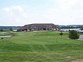 Clubhouse, The Chase Golf Course - geograph.org.uk - 555428.jpg 640 × 480; 57 KB
-
 Deer spotted near to Freda's Grave - geograph.org.uk - 174946.jpg 640 × 480; 138 KB
-
 Farm on the edge of Bednall - geograph.org.uk - 2804668.jpg 3,872 × 2,592; 4.18 MB
-
 Fence and gate of Quarry extension - geograph.org.uk - 324198.jpg 640 × 480; 103 KB
-
 Fork In The Road, Bednall - geograph.org.uk - 2432219.jpg 640 × 428; 69 KB
-
 Near Springslade Lodge - geograph.org.uk - 838104.jpg 640 × 480; 100 KB
-
 Parking for the Bednall Belt - geograph.org.uk - 3669377.jpg 1,600 × 1,200; 500 KB
-
 Pumping station, Bednall - geograph.org.uk - 4933006.jpg 1,024 × 683; 288 KB
-
 Staffordshire Way Near Bednall - geograph.org.uk - 2136280.jpg 1,496 × 1,122; 972 KB
-
 Staffordshire Way Near Bednall - geograph.org.uk - 2136284.jpg 1,496 × 1,122; 897 KB
-
 Track Off Common Lane, Bednall. - geograph.org.uk - 2432179.jpg 640 × 428; 75 KB
-
 Anson's Bank, Cannock Chase - geograph.org.uk - 838070.jpg 640 × 480; 113 KB
-
 Anson's Bank, Cannock Chase - geograph.org.uk - 838082.jpg 640 × 480; 99 KB
-
 Anson's Bank, Cannock Chase - geograph.org.uk - 838088.jpg 640 × 480; 138 KB
-
 Beep^ - geograph.org.uk - 56507.jpg 458 × 610; 85 KB
-

-
 Country lane near Bednall - geograph.org.uk - 85200.jpg 640 × 480; 118 KB
-
 Entrance to Hazelstrine Lane on A34 - geograph.org.uk - 346463.jpg 640 × 480; 143 KB
-
 Gateway Near Bednall - geograph.org.uk - 272380.jpg 640 × 480; 78 KB
-
 German War Cemetery, Cannock Chase - geograph.org.uk - 56500.jpg 610 × 458; 92 KB
-
 Gipsy Green - geograph.org.uk - 270524.jpg 640 × 480; 85 KB
-
 Glacial Boulder, Cannock Chase - geograph.org.uk - 57546.jpg 640 × 480; 155 KB
-
 Hazelstrine Bridge - No. 96 - geograph.org.uk - 346443.jpg 640 × 480; 113 KB
-
 Hazelstrine Lane by Stafford Boat club - geograph.org.uk - 346450.jpg 640 × 480; 177 KB
-
 Junction of A34 and Sawpit Lane - geograph.org.uk - 85198.jpg 640 × 480; 105 KB
-
 Map of Cannock Chase - geograph.org.uk - 57540.jpg 640 × 480; 171 KB
-
 Near Bednall - geograph.org.uk - 174752.jpg 640 × 427; 100 KB
-
 Near Bednall - geograph.org.uk - 270529.jpg 640 × 480; 102 KB
-
 Newtown from the 7 stars - geograph.org.uk - 90218.jpg 640 × 480; 78 KB
-
 Old Croft Road - geograph.org.uk - 85195.jpg 640 × 480; 105 KB
-
 Open Land - geograph.org.uk - 174756.jpg 640 × 427; 103 KB
-
 Ploughed Field, Near Bednall - geograph.org.uk - 272377.jpg 640 × 480; 77 KB
-

-

-

-
 Road to Warren Hill and Badger Slade Wood - geograph.org.uk - 324214.jpg 640 × 480; 103 KB
-
 Seven Stars at Brocton - geograph.org.uk - 90221.jpg 640 × 480; 122 KB
-
 Springslade Lodge - geograph.org.uk - 57536.jpg 640 × 480; 142 KB
-
 Stafford Boat Club - geograph.org.uk - 302869.jpg 640 × 480; 96 KB
-


