Category:Bawburgh
Jump to navigation
Jump to search
English: Bawburgh ( or /ˈbɔbərə/) is a village and civil parish in the South Norfolk district of Norfolk, England, about 5 miles west of Norwich city centre. According to the 2001 census it had a population of 466. Bawburgh is very close to the relatively-new Norfolk & Norwich Hospital and the Bowthorpe Estate.
Norsk bokmål: Bawburgh er en landsby og et verdslig sogn i Norfolk i England. Den ligger omkring åtte km vest for Norwich, i nærheten av Norfolk & Norwich Hospital.
village and civil parish in Norfolk, UK  | |||||
| Upload media | |||||
| Instance of | |||||
|---|---|---|---|---|---|
| Location | South Norfolk, Norfolk, East of England, England | ||||
| Population |
| ||||
| Area |
| ||||
 | |||||
Subcategories
This category has the following 4 subcategories, out of 4 total.
B
- Bawburgh War Memorial (1 F)
- Bridges in Bawburgh (2 F)
C
Media in category "Bawburgh"
The following 200 files are in this category, out of 280 total.
(previous page) (next page)-
 17th century summerhouse - geograph.org.uk - 5325889.jpg 594 × 640; 484 KB
-
 A covered water tank - geograph.org.uk - 4896538.jpg 640 × 458; 416 KB
-
 A field of wheat - geograph.org.uk - 3193895.jpg 640 × 430; 67 KB
-
 A large field of wheat - geograph.org.uk - 3193905.jpg 640 × 430; 58 KB
-
 A selection of trophies in the trophy room - geograph.org.uk - 3016425.jpg 2,560 × 1,920; 1.09 MB
-
 A47 - geograph.org.uk - 4361902.jpg 640 × 426; 52 KB
-
 A47 - geograph.org.uk - 4371048.jpg 640 × 426; 38 KB
-
 A47 - geograph.org.uk - 4373391.jpg 640 × 426; 29 KB
-
 A47 at the Bawburgh bridge - geograph.org.uk - 4281377.jpg 838 × 480; 104 KB
-
 A47 Norwich Bypass near Little Melton - geograph.org.uk - 4726579.jpg 640 × 480; 375 KB
-
 A47, northbound - geograph.org.uk - 4361880.jpg 640 × 426; 44 KB
-
 A47, northbound - geograph.org.uk - 4361884.jpg 640 × 426; 47 KB
-
 A47, northbound - geograph.org.uk - 4361895.jpg 640 × 426; 44 KB
-
 A47, Norwich bypass - geograph.org.uk - 2595466.jpg 640 × 430; 75 KB
-
 A47, Norwich bypass - geograph.org.uk - 3368438.jpg 640 × 430; 67 KB
-
 A47, Norwich bypass - geograph.org.uk - 3803191.jpg 640 × 416; 53 KB
-
 A47, Norwich Bypass - geograph.org.uk - 4373396.jpg 640 × 426; 34 KB
-
 A47, Norwich Bypass - geograph.org.uk - 4373398.jpg 640 × 426; 42 KB
-
 A47, Southbound - geograph.org.uk - 4373395.jpg 640 × 426; 31 KB
-
 An early Land Rover - geograph.org.uk - 3016474.jpg 2,560 × 1,920; 1.03 MB
-
 Approaching Bawburgh - geograph.org.uk - 3195769.jpg 640 × 430; 62 KB
-
 Approaching the B1108 Watton Road Crossroads on New Road - geograph.org.uk - 1898038.jpg 3,072 × 2,304; 1.53 MB
-
 Awards presentation - geograph.org.uk - 3016402.jpg 2,560 × 1,920; 1.06 MB
-
 B ^ B, New Rd - geograph.org.uk - 3202603.jpg 640 × 430; 73 KB
-
 B1108 - geograph.org.uk - 4335116.jpg 640 × 430; 57 KB
-
 B1108 - geograph.org.uk - 4335120.jpg 640 × 430; 49 KB
-
 B1108, Watton Rd - geograph.org.uk - 4335107.jpg 640 × 430; 61 KB
-
 Bandstand at the Royal Norfolk Showground - geograph.org.uk - 3016430.jpg 2,560 × 1,920; 1.09 MB
-
 Barn in a field - geograph.org.uk - 3195762.jpg 640 × 430; 47 KB
-
 Barred windows - geograph.org.uk - 4896402.jpg 640 × 569; 487 KB
-
 Bawburgh 031858 ddf5ad4a-by-Katy-Walters.jpg 480 × 640; 109 KB
-
 Bawburgh Bridge - geograph.org.uk - 4331442.jpg 640 × 430; 87 KB
-
 Bawburgh Bridge - geograph.org.uk - 5790575.jpg 6,181 × 4,125; 5.77 MB
-
 Bawburgh Bridge - geograph.org.uk - 5790580.jpg 6,373 × 4,252; 7.36 MB
-
 Bawburgh Golf Club - geograph.org.uk - 4325084.jpg 640 × 430; 85 KB
-
 Bawburgh Methodist Chapel - geograph.org.uk - 1896286.jpg 2,304 × 3,072; 1.39 MB
-
 Bawburgh Methodist Chapel - geograph.org.uk - 3195863.jpg 640 × 407; 72 KB
-
 Bawburgh Rd - geograph.org.uk - 4325085.jpg 640 × 430; 85 KB
-
 Bawburgh Rd, Hart's Lane junction - geograph.org.uk - 4325086.jpg 640 × 430; 63 KB
-
 Bawburgh Road, Bawburgh - geograph.org.uk - 6001706.jpg 4,608 × 3,456; 6.31 MB
-
 Bawburgh Village Hall - geograph.org.uk - 1897990.jpg 3,072 × 2,304; 1.31 MB
-
 Bawburgh Village Hall - geograph.org.uk - 1898012.jpg 3,072 × 2,304; 1.34 MB
-
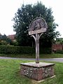
 Bawburgh Village Sign - geograph.org.uk - 1898024.jpg 3,072 × 2,304; 1.33 MB
-
 Bawburgh Village sign - geograph.org.uk - 3195869.jpg 640 × 430; 52 KB
-
 Bawburgh, King's Head PH, Hart's Lane - geograph.org.uk - 5790570.jpg 6,116 × 4,082; 4.04 MB
-

-
 Bawburgh, St. Mary and St. Walstans' Church - geograph.org.uk - 5790669.jpg 7,360 × 4,912; 7.42 MB
-
 Bawburgh, St. Mary and St. Walstans' Church - geograph.org.uk - 5790674.jpg 6,319 × 4,217; 7.46 MB
-
 Bawburgh, St. Mary and St. Walstans' Church - geograph.org.uk - 5790676.jpg 5,795 × 3,867; 4.4 MB
-
 Bawburgh, St. Mary and St. Walstans' Church - geograph.org.uk - 5790680.jpg 3,975 × 2,653; 2.84 MB
-

-

-
 Bawburgh, St. Mary and St. Walstans' Church, South doorway - geograph.org.uk - 5790689.jpg 3,944 × 5,909; 2.55 MB
-

-
 Bawburgh, St. Mary and St. Walstans' Church, Western aspect - geograph.org.uk - 5790695.jpg 3,346 × 5,014; 2.83 MB
-
 Bawburgh, The River Yare - geograph.org.uk - 5790583.jpg 6,205 × 4,141; 6.59 MB
-
 Bawburgh, The River Yare - geograph.org.uk - 5790587.jpg 7,174 × 4,787; 7.14 MB
-
 Blacksmiths Cottage - geograph.org.uk - 4331435.jpg 640 × 430; 104 KB
-
 Blacksmiths Cottage - geograph.org.uk - 4331467.jpg 640 × 430; 83 KB
-
 Bridge Foot and Bridge Foot Cottage - geograph.org.uk - 3200650.jpg 640 × 430; 57 KB
-
 Bridge over the River Yare, Bawburgh - geograph.org.uk - 1897967.jpg 3,072 × 2,304; 1.46 MB
-
 Bridge over the Yare - geograph.org.uk - 1994765.jpg 640 × 480; 82 KB
-
 Bridgefoot Cottage - geograph.org.uk - 4331441.jpg 640 × 430; 84 KB
-

-
 Bungalow by Tree Tops - geograph.org.uk - 5325908.jpg 640 × 484; 302 KB
-
 Bunker and communications mast - geograph.org.uk - 4896520.jpg 608 × 640; 449 KB
-

-
 Chapel View - geograph.org.uk - 3195865.jpg 640 × 430; 78 KB
-
 Childs House - geograph.org.uk - 3195861.jpg 640 × 430; 58 KB
-
 Chrysanthemum display - geograph.org.uk - 3016791.jpg 2,560 × 1,920; 1.07 MB
-
 Church Cottage - geograph.org.uk - 3195800.jpg 640 × 430; 92 KB
-
 Church Farm - geograph.org.uk - 675619.jpg 480 × 640; 155 KB
-
 Church Farmhouse - geograph.org.uk - 3195809.jpg 640 × 430; 70 KB
-
 Church St - geograph.org.uk - 3200637.jpg 640 × 430; 49 KB
-
 Church Street, Bawburgh ^ Bawburgh Village Sign - geograph.org.uk - 1897940.jpg 3,072 × 2,304; 1.27 MB
-
 Church Street, Bawburgh ^ Bawburgh Village Sign - geograph.org.uk - 1898046.jpg 3,072 × 2,304; 1.35 MB
-
 Churchyard, Bawburgh - geograph.org.uk - 3195823.jpg 640 × 430; 104 KB
-
 Clink Hills - geograph.org.uk - 5325861.jpg 640 × 480; 374 KB
-
 Commentary box and stands at the Royal Norfolk Show ground - geograph.org.uk - 3016440.jpg 2,560 × 1,920; 1,019 KB
-
 Communications mast beside the A47 road - geograph.org.uk - 4896426.jpg 530 × 640; 243 KB
-
 Cottage in Bawburgh - geograph.org.uk - 4331438.jpg 640 × 430; 80 KB
-
 Cottage, Bawburgh - geograph.org.uk - 3200655.jpg 640 × 430; 62 KB
-
 Countdown To The Off - geograph.org.uk - 5740786.jpg 2,104 × 1,184; 682 KB
-
 Crop field by Algarsthorpe Farm - geograph.org.uk - 4858476.jpg 640 × 360; 287 KB
-
 Crop fields by Bawburgh - geograph.org.uk - 4858413.jpg 640 × 360; 240 KB
-
 Crop fields north of Bawburgh - geograph.org.uk - 5325879.jpg 635 × 640; 264 KB
-
 Crops south of New Rd - geograph.org.uk - 3202609.jpg 640 × 430; 102 KB
-
 Crops south of New Rd - geograph.org.uk - 3202611.jpg 640 × 430; 78 KB
-
 Daffodils and bird feeders - geograph.org.uk - 4856069.jpg 640 × 480; 523 KB
-
 Daffodils at GreenAcres - geograph.org.uk - 4858534.jpg 640 × 360; 379 KB
-
 Derelict Building off the B1108 Watton Road - geograph.org.uk - 3412312.jpg 3,072 × 2,304; 1.32 MB
-
 Derelict Building off the B1108 Watton Road - geograph.org.uk - 3412314.jpg 3,072 × 2,304; 1.33 MB
-
 Disused building north of Watton Road - geograph.org.uk - 4896400.jpg 640 × 480; 298 KB
-
 Disused electricity substation - geograph.org.uk - 4896565.jpg 640 × 590; 564 KB
-
 Disused generator shed - geograph.org.uk - 4896409.jpg 501 × 640; 402 KB
-
 Disused military building - geograph.org.uk - 4896406.jpg 640 × 521; 314 KB
-
 Disused military installation connected with radar - geograph.org.uk - 6001748.jpg 2,232 × 1,674; 1.68 MB
-
 Electricity substation (detail) - geograph.org.uk - 4896571.jpg 639 × 545; 365 KB
-
 Emergency water supply - geograph.org.uk - 4896546.jpg 640 × 496; 430 KB
-
 Entering Bawburgh on Long Lane - geograph.org.uk - 3417690.jpg 3,072 × 2,304; 1.21 MB
-
 Exhibition Hall and Reception area, Royal Norfolk Showground - geograph.org.uk - 3016122.jpg 2,560 × 1,920; 1.04 MB
-
 Farm building, Watton Rd - geograph.org.uk - 3193876.jpg 640 × 430; 42 KB
-

-
 Farmland by New Rd - geograph.org.uk - 3202590.jpg 640 × 430; 79 KB
-
 Farmland north of Watton Rd - geograph.org.uk - 3193884.jpg 640 × 430; 44 KB
-
 Field above Bawburgh - geograph.org.uk - 77097.jpg 640 × 480; 66 KB
-
 Field in the Yare valley - geograph.org.uk - 3200665.jpg 640 × 430; 72 KB
-
 Fields and marshes, Bawburgh - Easton - geograph.org.uk - 77107.jpg 640 × 480; 69 KB
-
 Flint built cottage, Bawburgh - geograph.org.uk - 3200653.jpg 640 × 430; 60 KB
-
 Flush bracket no S5280 - geograph.org.uk - 3016153.jpg 1,920 × 2,560; 1.06 MB
-
 Footpath heading north - geograph.org.uk - 3193914.jpg 640 × 430; 47 KB
-
 Footpath north off Watton Rd - geograph.org.uk - 3193887.jpg 640 × 430; 49 KB
-
 Footpath to Bawburgh - geograph.org.uk - 3193898.jpg 640 × 430; 57 KB
-
 Footpath to Bawburgh - geograph.org.uk - 3193906.jpg 640 × 430; 70 KB
-
 Footpath to Bawburgh - geograph.org.uk - 3193912.jpg 640 × 430; 64 KB
-
 Forge Cottage - geograph.org.uk - 3195868.jpg 640 × 430; 92 KB
-
 Former electricity substation - geograph.org.uk - 4896567.jpg 640 × 595; 634 KB
-
 Former Post Office Postbox, New Road, Bawburgh - geograph.org.uk - 1898203.jpg 2,304 × 3,072; 1.53 MB
-

-
 Fun Fair at the show - geograph.org.uk - 3016800.jpg 2,560 × 1,920; 1,023 KB
-
 Gated track to fishing lakes - geograph.org.uk - 5325867.jpg 640 × 473; 311 KB
-
 Gone to seed - geograph.org.uk - 3193889.jpg 640 × 430; 51 KB
-
 Grain dispensers - geograph.org.uk - 3200660.jpg 640 × 430; 54 KB
-

-
 Green sheeting for privacy - geograph.org.uk - 4896458.jpg 640 × 480; 434 KB
-
 Guardroom disguised as a bungalow - geograph.org.uk - 4896491.jpg 640 × 561; 548 KB
-
 Hall Farm folly or slipper chapel in Garden House grounds - geograph.org.uk - 6001739.jpg 2,994 × 3,324; 6.61 MB
-
 Hardstanding beside Bawburgh Road - geograph.org.uk - 6001707.jpg 4,608 × 3,456; 5.81 MB
-
 Hart's Lane - geograph.org.uk - 4325087.jpg 640 × 430; 82 KB
-
 Hart's Lane - geograph.org.uk - 4325088.jpg 640 × 430; 75 KB
-
 Hart's Lane - geograph.org.uk - 4325090.jpg 640 × 430; 64 KB
-
 Hart's Lane - geograph.org.uk - 4331414.jpg 640 × 430; 80 KB
-
 Hart's Lane, Bawburgh - geograph.org.uk - 3417682.jpg 3,072 × 2,304; 1.52 MB
-
 Hart's Lane, Bawburgh - geograph.org.uk - 6001723.jpg 4,608 × 3,456; 6.36 MB
-
 Hart's Lane, Bawburgh - geograph.org.uk - 6001724.jpg 4,608 × 3,456; 5.81 MB
-
 Hart's Lane,Bawburgh - geograph.org.uk - 3417656.jpg 3,072 × 2,304; 1.3 MB
-
 Harts Lane - geograph.org.uk - 3200648.jpg 640 × 430; 49 KB
-
 Harts Lane sign - geograph.org.uk - 3417643.jpg 3,072 × 2,304; 1.55 MB
-
 He travelled, educated and loved - geograph.org.uk - 4861801.jpg 573 × 640; 560 KB
-
 Hedge by a crop of oilseed rape - geograph.org.uk - 3193892.jpg 640 × 430; 104 KB
-
 Highland cows, Easton - geograph.org.uk - 77110.jpg 640 × 480; 119 KB
-
 Hockering Lane - geograph.org.uk - 3200639.jpg 640 × 430; 45 KB
-
 Hockering Lane, Bawburgh - geograph.org.uk - 1897943.jpg 3,072 × 2,304; 1.18 MB
-
 House on Church St - geograph.org.uk - 3195858.jpg 640 × 430; 63 KB
-
 House on New Rd - geograph.org.uk - 3200670.jpg 640 × 430; 40 KB
-
 House on New Rd - geograph.org.uk - 3202583.jpg 640 × 430; 55 KB
-
 In the Shade - geograph.org.uk - 3016448.jpg 2,560 × 1,920; 1,020 KB
-

-
-
 King's Head - geograph.org.uk - 4331453.jpg 640 × 430; 68 KB
-
 King's Head at Bawburgh - geograph.org.uk - 2075686.jpg 640 × 481; 64 KB
-
 King's Head at Bawburgh, Norfolk - geograph.org.uk - 1994745.jpg 640 × 480; 59 KB
-
 Kings Head Public House, Hart's Lane, Bawburgh - geograph.org.uk - 1897983.jpg 3,072 × 2,304; 1.36 MB
-
 Lane to Bawburgh - geograph.org.uk - 3195760.jpg 640 × 430; 56 KB
-
 Layby on the Norwich Bypass (A47) - geograph.org.uk - 4726546.jpg 640 × 427; 398 KB
-
 Livestock and exhibition buildings - geograph.org.uk - 3016397.jpg 640 × 480; 86 KB
-

-
 Lodge Farm Barns Business Centre - geograph.org.uk - 3202607.jpg 640 × 430; 54 KB
-
 Long Lane sign - geograph.org.uk - 3417644.jpg 3,072 × 2,304; 1.65 MB
-
 Long Lane, Bawburgh - geograph.org.uk - 3417662.jpg 3,072 × 2,304; 1.25 MB
-
 Marlingford Road approaching Valley Farm - geograph.org.uk - 5325896.jpg 640 × 530; 445 KB
-
 Marlingford Road sign - geograph.org.uk - 3417640.jpg 3,072 × 2,304; 1.68 MB
-
 Marlingford Road, Bawburgh - geograph.org.uk - 3417634.jpg 3,072 × 2,304; 1.23 MB
-
 Massey Ferguson 1200 - geograph.org.uk - 3016787.jpg 2,560 × 1,920; 1.1 MB
-

-
 Military buildings north of Watton Road - geograph.org.uk - 4896395.jpg 640 × 584; 311 KB
-

-
 Millstone, Bawburgh - geograph.org.uk - 77106.jpg 640 × 480; 108 KB
-
 Muck spreaders and ploughs - geograph.org.uk - 3016385.jpg 2,560 × 1,920; 1.09 MB
-
 Mushroom growing on dead tree - geograph.org.uk - 4858550.jpg 640 × 576; 530 KB
-
 Mushrooms growing on dead tree - geograph.org.uk - 4858552.jpg 388 × 640; 347 KB
-
 New grave at GreenAcres - geograph.org.uk - 4858548.jpg 640 × 360; 390 KB
-
 New houses in Bawburgh - geograph.org.uk - 4331454.jpg 640 × 430; 63 KB
-
 New Rd - geograph.org.uk - 3200658.jpg 640 × 430; 43 KB
-
 New Rd - geograph.org.uk - 3200662.jpg 640 × 430; 67 KB
-
 New Rd - geograph.org.uk - 3200668.jpg 640 × 430; 51 KB
-
 New Rd - geograph.org.uk - 3202598.jpg 640 × 430; 56 KB
-
 New Rd - geograph.org.uk - 3202601.jpg 640 × 430; 58 KB
-
 New Rd - geograph.org.uk - 3202615.jpg 640 × 430; 91 KB
-

-

-
 New Road Bridge - geograph.org.uk - 1898050.jpg 3,072 × 2,304; 1.28 MB
-
 Norfolk Showground, almost empty after an event - geograph.org.uk - 6302017.jpg 4,032 × 2,268; 2.95 MB
-
 Norwich Bypass (A47) - geograph.org.uk - 4726577.jpg 640 × 427; 377 KB
-
 Norwich Bypass - geograph.org.uk - 4373402.jpg 640 × 426; 44 KB
-
 Oilseed rape - geograph.org.uk - 3193918.jpg 640 × 430; 68 KB
-
 Oilseed rape, gone to seed - geograph.org.uk - 3193909.jpg 640 × 430; 47 KB
-
 Old electricity substation - geograph.org.uk - 4896572.jpg 640 × 480; 396 KB
-
 Old electricity substation - geograph.org.uk - 4896573.jpg 640 × 480; 427 KB
-
 On Church St - geograph.org.uk - 3195860.jpg 640 × 430; 42 KB
-
 Oversized doughnuts and pastries - geograph.org.uk - 3016790.jpg 2,560 × 1,920; 1.02 MB
-

-
 Poplars growing beside Marlingford Road - geograph.org.uk - 5325901.jpg 640 × 480; 389 KB
-
 Ripening wheat - geograph.org.uk - 3193923.jpg 640 × 430; 73 KB
-

-
 River Yare - geograph.org.uk - 3200644.jpg 640 × 430; 66 KB
-
 River Yare - geograph.org.uk - 4331449.jpg 640 × 430; 103 KB
-
 River Yare at Bawburgh - geograph.org.uk - 4331445.jpg 640 × 430; 107 KB
-
 River Yare from Bawburgh Bridge - geograph.org.uk - 4331447.jpg 640 × 430; 102 KB
-
 River Yare, Bawburgh - geograph.org.uk - 1897974.jpg 2,304 × 3,072; 1.39 MB


_-_geograph.org.uk_-_4896571.jpg)


_-_geograph.org.uk_-_4726546.jpg)


_-_geograph.org.uk_-_3202586.jpg)
_-_geograph.org.uk_-_3202587.jpg)

_-_geograph.org.uk_-_4726577.jpg)


