Category:Baulking
Jump to navigation
Jump to search
village and civil parish in Vale of White Horse district, Oxfordshire, England  | |||||
| Upload media | |||||
| Instance of | |||||
|---|---|---|---|---|---|
| Location | Vale of White Horse, Oxfordshire, South East England, England | ||||
| Area |
| ||||
 | |||||
English: Baulking is a village and civil parish in the Vale of White Horse district of the English county of Oxfordshire. In 1974 it was transferred from Berkshire. According to the 2001 census it had a population of 53. It is about six miles from Wantage, and is located just north of the Great Western Main Line and also close to the site of the former Uffington railway station.
Subcategories
This category has only the following subcategory.
N
Media in category "Baulking"
The following 110 files are in this category, out of 110 total.
-
 An Old Pump at Baulking - geograph.org.uk - 2283399.jpg 3,524 × 2,404; 1.13 MB
-
 Approach to Baulking - geograph.org.uk - 2283484.jpg 3,560 × 2,472; 784 KB
-
 Footpath and stile - geograph.org.uk - 307316.jpg 640 × 480; 100 KB
-
 Baulking Bridge - geograph.org.uk - 1539476.jpg 640 × 452; 58 KB
-
 Baulking church - geograph.org.uk - 3984586.jpg 640 × 428; 102 KB
-
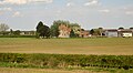
 Baulking Grange Farm - geograph.org.uk - 3237266.jpg 640 × 297; 24 KB
-
 Baulking Grange Farm - geograph.org.uk - 5171263.jpg 2,430 × 1,725; 656 KB
-
 Baulking Grange Farm - geograph.org.uk - 5362806.jpg 640 × 426; 42 KB
-
 Baulking Grange Farm - geograph.org.uk - 5362809.jpg 640 × 352; 43 KB
-
 Baulking Grange Farm - geograph.org.uk - 5646427.jpg 640 × 426; 38 KB
-
 Baulking Grange Farm - geograph.org.uk - 5646428.jpg 640 × 426; 37 KB
-
 Baulking K6 telephone kiosk.jpg 1,024 × 683; 372 KB
-
 Baulking Lake 1 - geograph.org.uk - 2283444.jpg 3,888 × 2,592; 1.12 MB
-
 Baulking Lake 2 - geograph.org.uk - 2283459.jpg 3,888 × 2,592; 1.07 MB
-
 Baulking Lake 3 - geograph.org.uk - 2286841.jpg 3,716 × 2,420; 1.95 MB
-
 Baulking Lane - geograph.org.uk - 58577.jpg 640 × 480; 153 KB
-
 Baulking Pit or Lake - geograph.org.uk - 6318265.jpg 4,608 × 3,456; 5.61 MB
-
 Baulking, the Paddington-Bristol main-line - geograph.org.uk - 6206001.jpg 1,024 × 761; 205 KB
-
 Benchmark on Baulking Lane culvert - geograph.org.uk - 2830208.jpg 1,024 × 683; 202 KB
-

-
 Colliers Barn - geograph.org.uk - 5258736.jpg 640 × 426; 46 KB
-

-
 Culvert taking stream under Baulking Lane - geograph.org.uk - 2830255.jpg 1,024 × 683; 349 KB
-
 Evening Light, Oldfield Farm - geograph.org.uk - 4259248.jpg 1,600 × 1,067; 348 KB
-

-
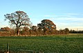
 Farmland, Baulking - geograph.org.uk - 2678371.jpg 640 × 480; 184 KB
-
 Farmland, Baulking - geograph.org.uk - 2678401.jpg 640 × 480; 130 KB
-
 Farmland, Baulking - geograph.org.uk - 2678408.jpg 640 × 480; 134 KB
-
 Farmland, Baulking - geograph.org.uk - 2678443.jpg 640 × 480; 112 KB
-
 Farmland, Baulking - geograph.org.uk - 6080536.jpg 1,024 × 768; 281 KB
-
 Farmland, Sparsholt - geograph.org.uk - 2678479.jpg 640 × 480; 145 KB
-
 Field near Baulking - geograph.org.uk - 3237338.jpg 640 × 247; 37 KB
-
 Field near Baulking - geograph.org.uk - 5362818.jpg 640 × 426; 44 KB
-
 Footpath through rape, Baulking - geograph.org.uk - 6080537.jpg 1,024 × 768; 248 KB
-
 Footpath towards Stanford in the Vale - geograph.org.uk - 2829586.jpg 683 × 1,024; 253 KB
-
 Gate to Baulking Hill - geograph.org.uk - 2284843.jpg 3,888 × 2,592; 1.49 MB
-
 Gates and Grid - geograph.org.uk - 2299811.jpg 1,600 × 1,032; 304 KB
-
 General Railway Pictures 2010 215.jpg 4,000 × 3,000; 826 KB
-
 General Railway Pictures 2010 216.jpg 4,000 × 3,000; 1,019 KB
-
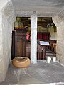
 Inside St. Nicholas, Baulking (1) - geograph.org.uk - 4099617.jpg 640 × 480; 43 KB
-
 Inside St. Nicholas, Baulking (10) - geograph.org.uk - 4099630.jpg 480 × 640; 50 KB
-
 Inside St. Nicholas, Baulking (11) - geograph.org.uk - 4099632.jpg 640 × 480; 58 KB
-
 Inside St. Nicholas, Baulking (12) - geograph.org.uk - 4099634.jpg 480 × 640; 50 KB
-
 Inside St. Nicholas, Baulking (13) - geograph.org.uk - 4099635.jpg 480 × 640; 48 KB
-
 Inside St. Nicholas, Baulking (14) - geograph.org.uk - 4099636.jpg 480 × 640; 56 KB
-
 Inside St. Nicholas, Baulking (15) - geograph.org.uk - 4099658.jpg 480 × 640; 54 KB
-
 Inside St. Nicholas, Baulking (16) - geograph.org.uk - 4099660.jpg 640 × 393; 50 KB
-
 Inside St. Nicholas, Baulking (17) - geograph.org.uk - 4099661.jpg 479 × 640; 60 KB
-
 Inside St. Nicholas, Baulking (17) - geograph.org.uk - 4099662.jpg 480 × 640; 62 KB
-
 Inside St. Nicholas, Baulking (18) - geograph.org.uk - 4099663.jpg 472 × 640; 41 KB
-
 Inside St. Nicholas, Baulking (19) - geograph.org.uk - 4099666.jpg 480 × 640; 50 KB
-
 Inside St. Nicholas, Baulking (2) - geograph.org.uk - 4099619.jpg 640 × 480; 60 KB
-
 Inside St. Nicholas, Baulking (20) - geograph.org.uk - 4099668.jpg 472 × 640; 60 KB
-
 Inside St. Nicholas, Baulking (21) - geograph.org.uk - 4099671.jpg 480 × 640; 38 KB
-
 Inside St. Nicholas, Baulking (22) - geograph.org.uk - 4099673.jpg 640 × 480; 59 KB
-
 Inside St. Nicholas, Baulking (23) - geograph.org.uk - 4099674.jpg 468 × 640; 50 KB
-
 Inside St. Nicholas, Baulking (24) - geograph.org.uk - 4099676.jpg 640 × 466; 64 KB
-
 Inside St. Nicholas, Baulking (25) - geograph.org.uk - 4099677.jpg 480 × 640; 43 KB
-
 Inside St. Nicholas, Baulking (25) - geograph.org.uk - 4099679.jpg 490 × 640; 52 KB
-
 Inside St. Nicholas, Baulking (26) - geograph.org.uk - 4099681.jpg 480 × 640; 51 KB
-
 Inside St. Nicholas, Baulking (27) - geograph.org.uk - 4099683.jpg 640 × 448; 53 KB
-
 Inside St. Nicholas, Baulking (28) - geograph.org.uk - 4099684.jpg 640 × 480; 49 KB
-
 Inside St. Nicholas, Baulking (3) - geograph.org.uk - 4099620.jpg 640 × 480; 38 KB
-
 Inside St. Nicholas, Baulking (4) - geograph.org.uk - 4099622.jpg 476 × 640; 55 KB
-
 Inside St. Nicholas, Baulking (5) - geograph.org.uk - 4099623.jpg 640 × 480; 80 KB
-
 Inside St. Nicholas, Baulking (6) - geograph.org.uk - 4099624.jpg 480 × 640; 44 KB
-
 Inside St. Nicholas, Baulking (7) - geograph.org.uk - 4099625.jpg 640 × 467; 58 KB
-
 Inside St. Nicholas, Baulking (8) - geograph.org.uk - 4099626.jpg 461 × 640; 45 KB
-
 Inside St. Nicholas, Baulking (9) - geograph.org.uk - 4099628.jpg 480 × 640; 51 KB
-
 Isolated tree - geograph.org.uk - 5362821.jpg 640 × 344; 48 KB
-
 James Cottage and Painters Cottage, Cottage Lane, Baulking - geograph.org.uk - 6318980.jpg 4,608 × 3,456; 7.41 MB
-
 Junction of footpaths near Oldfield Farm - geograph.org.uk - 2829577.jpg 1,024 × 683; 173 KB
-

-
 Meadow and Oak Tree - geograph.org.uk - 5171268.jpg 2,441 × 1,885; 763 KB
-
 Near Colliers Farm - geograph.org.uk - 5258731.jpg 640 × 426; 57 KB
-
 No Works, No Traffic - geograph.org.uk - 2283353.jpg 3,888 × 2,592; 1.53 MB
-
 Northern Pond, Baulking - geograph.org.uk - 2283413.jpg 3,692 × 2,592; 1.65 MB
-
 Old Field Meadow - geograph.org.uk - 4259254.jpg 1,600 × 1,013; 363 KB
-
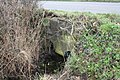
 Old fullers earth works - geograph.org.uk - 346351.jpg 640 × 480; 75 KB
-
 Oldfield Farm - geograph.org.uk - 58578.jpg 640 × 480; 145 KB
-
 Outbuildings - geograph.org.uk - 5021201.jpg 640 × 426; 41 KB
-
 Pasture - geograph.org.uk - 5362803.jpg 640 × 426; 44 KB
-
 Phone Box and Church, Baulking - geograph.org.uk - 2283418.jpg 1,886 × 1,404; 641 KB
-

-
 Public bridleway towards Baulking Hill - geograph.org.uk - 6318969.jpg 4,608 × 3,456; 7.17 MB
-
 Railway bridge with depth gauge - geograph.org.uk - 3984321.jpg 640 × 480; 135 KB
-
 Rosey Cottage and Poppy Cottage, Baulking Lane - geograph.org.uk - 2830349.jpg 1,024 × 683; 192 KB
-

-
 Southern Pond, Baulking - geograph.org.uk - 2283407.jpg 3,460 × 2,444; 1.47 MB
-
 St Nicholas' Church, Baulking - geograph.org.uk - 6318138.jpg 4,500 × 3,375; 2.07 MB
-
 St Nicholas's, Baulking - geograph.org.uk - 2678364.jpg 640 × 480; 146 KB
-
 St Nicholas, Baulking, March 2014 - geograph.org.uk - 3895674.jpg 640 × 480; 109 KB
-

-
 St. Nicholas, Baulking, churchyard (b) - geograph.org.uk - 4099688.jpg 640 × 480; 106 KB
-

-

-
 St. Nicholas, Baulking, churchyard (d) - geograph.org.uk - 4099691.jpg 640 × 480; 147 KB
-

-
 Standalone gate beside Baulking Lane - geograph.org.uk - 2830131.jpg 1,024 × 683; 272 KB
-
 The Green, Baulking - geograph.org.uk - 307322.jpg 640 × 480; 64 KB
-

-
 The old Goose Green at Baulking - geograph.org.uk - 2684195.jpg 640 × 427; 46 KB
-
 The Old School, Baulking - geograph.org.uk - 6318127.jpg 4,608 × 3,456; 6.14 MB
-
 Track to Baulking Grange Farm - geograph.org.uk - 6205909.jpg 787 × 1,024; 300 KB
-
 Two trees in a field of rape - geograph.org.uk - 5646434.jpg 640 × 426; 60 KB
-
 Vale of White Horse - geograph.org.uk - 5612654.jpg 3,264 × 2,448; 5.04 MB
-
-
 Lockeys - geograph.org.uk - 307324.jpg 640 × 480; 75 KB
-
 Road and rail in parallel - geograph.org.uk - 307312.jpg 640 × 480; 69 KB
-
 Stone house by Church Farm - geograph.org.uk - 307320.jpg 640 × 480; 71 KB


_-_geograph.org.uk_-_4099617.jpg)
_-_geograph.org.uk_-_4099630.jpg)
_-_geograph.org.uk_-_4099632.jpg)
_-_geograph.org.uk_-_4099634.jpg)
_-_geograph.org.uk_-_4099635.jpg)
_-_geograph.org.uk_-_4099636.jpg)
_-_geograph.org.uk_-_4099658.jpg)
_-_geograph.org.uk_-_4099660.jpg)
_-_geograph.org.uk_-_4099661.jpg)
_-_geograph.org.uk_-_4099662.jpg)
_-_geograph.org.uk_-_4099663.jpg)
_-_geograph.org.uk_-_4099666.jpg)
_-_geograph.org.uk_-_4099619.jpg)
_-_geograph.org.uk_-_4099668.jpg)
_-_geograph.org.uk_-_4099671.jpg)
_-_geograph.org.uk_-_4099673.jpg)
_-_geograph.org.uk_-_4099674.jpg)
_-_geograph.org.uk_-_4099676.jpg)
_-_geograph.org.uk_-_4099677.jpg)
_-_geograph.org.uk_-_4099679.jpg)
_-_geograph.org.uk_-_4099681.jpg)
_-_geograph.org.uk_-_4099683.jpg)
_-_geograph.org.uk_-_4099684.jpg)
_-_geograph.org.uk_-_4099620.jpg)
_-_geograph.org.uk_-_4099622.jpg)
_-_geograph.org.uk_-_4099623.jpg)
_-_geograph.org.uk_-_4099624.jpg)
_-_geograph.org.uk_-_4099625.jpg)
_-_geograph.org.uk_-_4099626.jpg)
_-_geograph.org.uk_-_4099628.jpg)


_-_geograph.org.uk_-_4099686.jpg)
_-_geograph.org.uk_-_4099688.jpg)
_-_geograph.org.uk_-_4099689.jpg)
_-_geograph.org.uk_-_4099690.jpg)
_-_geograph.org.uk_-_4099691.jpg)
_-_geograph.org.uk_-_4099693.jpg)


