Category:Bauernhof Waldbauer, Unterland
Jump to navigation
Jump to search
| Object location | | View all coordinates using: OpenStreetMap |
|---|
human settlement in Austria  | |||||
| Upload media | |||||
| Instance of | |||||
|---|---|---|---|---|---|
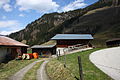
| Location | Rauris, Zell am See District, Salzburg, Austria | ||||
| Street address |
| ||||
| Heritage designation | |||||
 | |||||
Deutsch: Bauernhof (Anlage), Waldbauer
Media in category "Bauernhof Waldbauer, Unterland"
The following 18 files are in this category, out of 18 total.
-
 Rauris Bauernhof Waldbauer.jpg 960 × 720; 221 KB
-
 Waldbauer raurisertal7462.JPG 2,592 × 3,888; 6.09 MB
-
 Waldbauer raurisertal7463.JPG 2,592 × 3,888; 4.99 MB
-
 Waldbauer raurisertal7464.JPG 2,592 × 3,888; 4 MB
-
 Waldbauer raurisertal7465.JPG 2,592 × 3,888; 5.61 MB
-
 Waldbauer raurisertal7467.JPG 3,888 × 2,592; 6.65 MB
-
 Waldbauer raurisertal7469.JPG 3,888 × 2,592; 5.66 MB
-
 Waldbauer raurisertal7470.JPG 2,592 × 3,888; 6.08 MB
-
 Waldbauer raurisertal7471.JPG 2,592 × 3,888; 3.11 MB
-
 Waldbauer raurisertal7472.JPG 2,592 × 3,888; 3.43 MB
-
 Waldbauer raurisertal7473.JPG 2,592 × 3,888; 3.94 MB
-
 Waldbauer raurisertal7474.JPG 2,592 × 3,888; 3.67 MB
-
 Waldbauer raurisertal7475.JPG 2,592 × 3,888; 4.73 MB
-
 Waldbauer raurisertal7476.JPG 2,592 × 3,888; 4.61 MB
-
 Waldbauer raurisertal7477.JPG 2,592 × 3,888; 4.85 MB
-
 Waldbauer raurisertal7478.JPG 2,592 × 3,888; 7.08 MB
-
 Waldbauer raurisertal7479.JPG 2,592 × 3,888; 5.32 MB
-
 Waldbauer raurisertal7480.JPG 2,592 × 3,888; 5.04 MB


