Category:Baston
Jump to navigation
Jump to search
English: Baston is a parish on the edge of The Fens and in the administrative district of South Kesteven, Lincolnshire, England. Like most fen-edge parishes, it was laid out more than a thousand years ago, in an elongated form, so as to afford the produce of a variety of habitats for the villagers. The village itself lies along the road between King Street, a road built in the second century, and Baston Fen which is on the margin of the much bigger, Deeping Fen. Until the nineteenth century, the heart of Deeping Fen was a common fen on which all the surrounding villages had rights of turbary, fowling, pasture and so on.
village in Lincolnshire  | |||||
| Upload media | |||||
| Instance of | |||||
|---|---|---|---|---|---|
| Location | South Kesteven, Lincolnshire, East Midlands, England | ||||
 | |||||
Subcategories
This category has the following 8 subcategories, out of 8 total.
A
B
- Baston Fen Nature Reserve (13 F)
- Baston village sign (8 F)
H
- Hudson's Mill, Baston (5 F)
J
T
- Thetford, Lincolnshire (4 F)
Media in category "Baston"
The following 200 files are in this category, out of 231 total.
(previous page) (next page)-
 12 Church Street, Baston (geograph 6989012).jpg 1,024 × 739; 135 KB
-
 A barn on Baston Outgang Road - geograph.org.uk - 3091052.jpg 800 × 600; 233 KB
-
 A crop of new houses - geograph.org.uk - 6168652.jpg 640 × 480; 60 KB
-
 A handful of Fords - geograph.org.uk - 5019938.jpg 5,400 × 3,600; 7.71 MB
-
 A local company - geograph.org.uk - 5019897.jpg 5,800 × 3,867; 7.53 MB
-

-
 A very large car - geograph.org.uk - 5019913.jpg 5,800 × 3,867; 7.96 MB
-
 A15 approaching Waterside Garden Centre - geograph.org.uk - 5208410.jpg 1,600 × 1,057; 303 KB
-
 A15 at N Meadow Road - geograph.org.uk - 5132567.jpg 640 × 480; 56 KB
-
 A15 Deeping road - geograph.org.uk - 5208399.jpg 4,928 × 3,264; 3.41 MB
-
 A15 Deeping Road looking north - geograph.org.uk - 5132555.jpg 640 × 480; 47 KB
-
 A15 heading north - geograph.org.uk - 3846118.jpg 640 × 480; 95 KB
-
 A15 heading north - geograph.org.uk - 3846124.jpg 640 × 480; 66 KB
-
 A15 leaving Baston - geograph.org.uk - 3846120.jpg 640 × 480; 91 KB
-
 Advertising sign at Baston, near Bourne, Lincolnshire - geograph.org.uk - 4409848.jpg 1,769 × 1,193; 834 KB
-
 Albion Lorry - geograph.org.uk - 4059374.jpg 4,896 × 3,672; 7.22 MB
-
 Along the Roman Road - geograph.org.uk - 4059390.jpg 4,896 × 3,672; 6.83 MB
-
 Arable field - geograph.org.uk - 6168643.jpg 640 × 480; 59 KB
-
 Arable field - geograph.org.uk - 6168644.jpg 640 × 480; 47 KB
-
 Barley and Wires - geograph.org.uk - 5860321.jpg 6,032 × 4,014; 5.5 MB
-
 Baston car show 2014 - geograph.org.uk - 4059384.jpg 4,896 × 3,672; 6.9 MB
-
 Baston Gravel Works, aerial 2016 - geograph.org.uk - 5012588.jpg 1,024 × 683; 113 KB
-
 Baston Outgang Road - geograph.org.uk - 1229998.jpg 640 × 479; 69 KB
-
 Baston Outgang Road - geograph.org.uk - 1377542.jpg 640 × 480; 37 KB
-
 Baston Outgang Road - geograph.org.uk - 2857868.jpg 1,024 × 768; 269 KB
-
 Baston Outgang Road - geograph.org.uk - 3845127.jpg 640 × 480; 94 KB
-
 Baston Outgang Road - geograph.org.uk - 3845132.jpg 640 × 480; 56 KB
-
 Baston Outgang Road - geograph.org.uk - 3845138.jpg 640 × 480; 87 KB
-
 Baston Outgang Road - geograph.org.uk - 3845142.jpg 640 × 480; 51 KB
-
 Baston Outgang Road - geograph.org.uk - 3959150.jpg 4,000 × 3,000; 3.92 MB
-
 Baston Outgang Road - geograph.org.uk - 5577389.jpg 640 × 480; 49 KB
-
 Battle Formation Swans - geograph.org.uk - 437432.jpg 640 × 477; 81 KB
-
 Bird on the roof at Baston, near Bourne, Lincolnshire (geograph 4540119).jpg 1,784 × 1,180; 725 KB
-
 Black Drove - geograph.org.uk - 2436875.jpg 640 × 477; 48 KB
-
 Black Drove - geograph.org.uk - 3845117.jpg 640 × 480; 56 KB
-
 Black Drove northwards - geograph.org.uk - 2160897.jpg 640 × 458; 68 KB
-
 Black Drove southwards - geograph.org.uk - 2160898.jpg 640 × 392; 60 KB
-
 Black Drove turns into Counter Drain Drove - geograph.org.uk - 4031568.jpg 1,600 × 1,180; 388 KB
-
 BMWs on display - geograph.org.uk - 5019842.jpg 5,600 × 3,733; 7.75 MB
-
 Bourne Lions Bus - geograph.org.uk - 5019854.jpg 6,000 × 4,000; 7.43 MB
-
 Bright yellow gates - geograph.org.uk - 2436861.jpg 640 × 480; 76 KB
-
 Building work at Black Drove Farm - geograph.org.uk - 4031397.jpg 1,600 × 1,336; 835 KB
-
 Building work at Black Drove Farm - geograph.org.uk - 4031446.jpg 1,600 × 1,261; 591 KB
-
 Bushes by North Meadow Road, Baston - geograph.org.uk - 6193422.jpg 1,920 × 1,280; 1.14 MB
-
 C ^ F Wind turbine off Black Drove - geograph.org.uk - 3835764.jpg 4,320 × 3,240; 4.75 MB
-
 Car parking - geograph.org.uk - 4059379.jpg 4,896 × 3,672; 7.18 MB
-
-
 Chapel Motors - geograph.org.uk - 705506.jpg 640 × 427; 72 KB
-
 Church Street - geograph.org.uk - 6168659.jpg 640 × 480; 83 KB
-
 Cichorium intybus - flower - geograph.org.uk - 4059312.jpg 4,896 × 3,672; 6.44 MB
-
 Cichorium intybus - leaves - geograph.org.uk - 4059315.jpg 4,896 × 3,672; 6.64 MB
-
 Cichorium intybus - plant - geograph.org.uk - 4059304.jpg 4,896 × 3,672; 6.83 MB
-
 Communication mast - geograph.org.uk - 6168650.jpg 640 × 480; 55 KB
-
 Conveyor and lift at Baston Quarry - geograph.org.uk - 3865574.jpg 4,320 × 3,240; 5.48 MB
-

-
 Conveyor system, Baston Pits - geograph.org.uk - 1373371.jpg 640 × 480; 102 KB
-
 Country road - geograph.org.uk - 5577402.jpg 640 × 480; 39 KB
-
 Crop at Thetford Farm - geograph.org.uk - 4059296.jpg 4,896 × 3,672; 6.58 MB
-
 Crop field near Baston - geograph.org.uk - 3846123.jpg 640 × 480; 101 KB
-
 Crop field off Black Drove - geograph.org.uk - 3844433.jpg 640 × 480; 87 KB
-

-
 Crop field, Deeping Fen Farm - geograph.org.uk - 3845120.jpg 640 × 480; 81 KB
-
 Cross Road - geograph.org.uk - 1229995.jpg 480 × 640; 76 KB
-
 Cross Road - geograph.org.uk - 3845148.jpg 640 × 480; 87 KB
-
 Deeping 2 - geograph.org.uk - 2868505.jpg 768 × 1,024; 333 KB
-
 Deeping Fen Farm - geograph.org.uk - 2857889.jpg 1,024 × 768; 209 KB
-
 Deeping Fen Farm - geograph.org.uk - 3091056.jpg 800 × 600; 182 KB
-
 Deeping Fen Farm - geograph.org.uk - 3845121.jpg 640 × 480; 75 KB
-
 Deeping Fen Farm, Black Drove - geograph.org.uk - 3835772.jpg 4,320 × 3,240; 5.46 MB
-
 Deeping Road, Baston - geograph.org.uk - 5653755.jpg 2,034 × 1,526; 1.18 MB
-
 Deeping Road, Baston - geograph.org.uk - 5654966.jpg 2,222 × 1,614; 922 KB
-
 Deeping Road, Baston - geograph.org.uk - 6193424.jpg 1,920 × 1,280; 1.61 MB
-
 Deeping Road, Baston - geograph.org.uk - 6193425.jpg 1,856 × 1,178; 1.19 MB
-
 Defunct Pylon - geograph.org.uk - 5860299.jpg 4,014 × 6,032; 3.93 MB
-
 Derelict farm buildings along Baston Outgang Road - geograph.org.uk - 4030121.jpg 1,600 × 1,184; 544 KB
-
 Derelict pub on Baston Outgang Road - geograph.org.uk - 2692265.jpg 4,000 × 3,000; 4.15 MB
-
 Dilapidated farm building - geograph.org.uk - 3845129.jpg 640 × 480; 65 KB
-
 Discapacidad.jpg 3,872 × 2,592; 4.45 MB
-
 Disused mill - geograph.org.uk - 6168647.jpg 640 × 480; 58 KB
-
 Ditch alongside Greatford Road, Baston - geograph.org.uk - 3448031.jpg 4,000 × 3,000; 4.29 MB
-
 Drain along Baston Outgang Road - geograph.org.uk - 4030067.jpg 1,600 × 1,234; 414 KB
-
 Drain running south alongside Black Drove - geograph.org.uk - 4031556.jpg 1,502 × 1,600; 856 KB
-
 Electric silhouettes - geograph.org.uk - 5860305.jpg 6,032 × 4,014; 4.68 MB
-
 Electrical scrap - geograph.org.uk - 5860313.jpg 4,815 × 3,114; 6.24 MB
-
 Embryo River Glen - geograph.org.uk - 437449.jpg 640 × 477; 84 KB
-
 Entering Baston - geograph.org.uk - 3090982.jpg 800 × 600; 261 KB
-
 Entering Baston on the A15 - geograph.org.uk - 2239992.jpg 800 × 600; 267 KB
-
 Entrance drive to Shillingthorpe Park - geograph.org.uk - 487326.jpg 640 × 477; 124 KB
-
 Entrance to Baston Fen Farm - geograph.org.uk - 4030081.jpg 1,600 × 1,084; 369 KB
-
 Entrance to Home Farm caravanning and camping site - geograph.org.uk - 4030115.jpg 1,600 × 1,200; 384 KB
-
 Entrance to the show field - geograph.org.uk - 5019861.jpg 5,200 × 3,467; 7.83 MB
-
 Farm building along Baston Outgang Road - geograph.org.uk - 4031416.jpg 1,600 × 1,200; 500 KB
-
 Farm building on Baston Outgang Road - geograph.org.uk - 3845124.jpg 640 × 480; 50 KB
-
 Farm Gate And Track - geograph.org.uk - 649749.jpg 640 × 480; 95 KB
-
-

-
 Farmland with skip, South Meadow - geograph.org.uk - 3845141.jpg 640 × 480; 55 KB
-
 Farmland, Gurteen Farm - geograph.org.uk - 3845131.jpg 640 × 480; 75 KB
-

-
 Fenland Field - geograph.org.uk - 5860323.jpg 6,032 × 4,014; 5.54 MB
-
 Fenland Track - geograph.org.uk - 2857857.jpg 1,024 × 768; 256 KB
-
 Field in Baston - geograph.org.uk - 6193423.jpg 1,872 × 1,204; 1.47 MB
-
 Field of oilseed rape alongside Baston Outgang Road - geograph.org.uk - 3959144.jpg 4,000 × 3,000; 4.14 MB
-
 Flooded gravel pit, South Meadow - geograph.org.uk - 3845136.jpg 640 × 480; 55 KB
-
 Footbridge and path off Hack's Drove, Baston - geograph.org.uk - 3863077.jpg 4,320 × 3,240; 5.98 MB
-
 Footpath seen from Hack's Drove - geograph.org.uk - 3959135.jpg 4,000 × 3,000; 4.34 MB
-

-

-
 Former gravel pit on Baston Outgang - geograph.org.uk - 5855862.jpg 9,193 × 3,112; 7.27 MB
-
 Former gravel pits in Baston Outgang - geograph.org.uk - 5855855.jpg 10,000 × 3,568; 7.59 MB
-
 Former New Inn as seen from Cross Road - geograph.org.uk - 2692273.jpg 4,000 × 3,000; 4.29 MB
-
 Former New Inn at Baston Outang Road - geograph.org.uk - 2692271.jpg 4,000 × 3,000; 4.33 MB
-
 Former road bridge at Kate's Bridge, Lincolnshire - geograph.org.uk - 3861880.jpg 4,320 × 3,240; 6.05 MB
-
 Gravel Drain - geograph.org.uk - 1229996.jpg 640 × 478; 74 KB
-
 Gravel Works - geograph.org.uk - 2857810.jpg 1,024 × 768; 180 KB
-
-
 Graveyard - geograph.org.uk - 6168656.jpg 640 × 480; 116 KB
-
 Greatford Road towards the A15 - geograph.org.uk - 3090991.jpg 800 × 600; 236 KB
-
 Greatford Road, Baston - geograph.org.uk - 3448035.jpg 4,000 × 3,000; 4.05 MB
-
 Greatford Road- King Street Junction - geograph.org.uk - 997269.jpg 640 × 480; 58 KB
-
 Heading east along Baston Outgang Road - geograph.org.uk - 4030103.jpg 1,600 × 1,137; 316 KB
-
 Heading north along Cross Road - geograph.org.uk - 4020099.jpg 1,600 × 1,104; 537 KB
-
 Heading north along Cross Road - geograph.org.uk - 4030023.jpg 1,600 × 1,180; 380 KB
-
 House off Main Street, Baston - geograph.org.uk - 3846117.jpg 640 × 480; 75 KB
-
 Junction of the A15 and King Street - geograph.org.uk - 3172749.jpg 4,000 × 3,000; 4.24 MB
-
 Kate's Bridge over the River Glen - geograph.org.uk - 404317.jpg 640 × 480; 59 KB
-

-
 King Street - geograph.org.uk - 6168670.jpg 640 × 480; 82 KB
-
 King Street - geograph.org.uk - 6168732.jpg 640 × 480; 69 KB
-
 King Street Drain - geograph.org.uk - 3090971.jpg 800 × 600; 301 KB
-
 King Street Drain - geograph.org.uk - 3846107.jpg 640 × 480; 102 KB
-
 King Street Drain - geograph.org.uk - 3846112.jpg 640 × 428; 81 KB
-

-
 King Street Roman Road - geograph.org.uk - 3846111.jpg 640 × 480; 72 KB
-
 King Street Roman Road - geograph.org.uk - 3846114.jpg 640 × 480; 82 KB
-
 Looking along Black Drove - geograph.org.uk - 3959157.jpg 4,000 × 3,000; 4.3 MB
-
 Looking along Hack's Drove - geograph.org.uk - 3959129.jpg 4,000 × 3,000; 4.1 MB
-
 Looking into the Counter Drain - geograph.org.uk - 2857936.jpg 1,024 × 768; 292 KB
-
 Looking north along Black Drove - geograph.org.uk - 4031430.jpg 1,600 × 1,200; 571 KB
-
 Lotus Elise - geograph.org.uk - 5019922.jpg 5,800 × 3,867; 7.68 MB
-
 Main Road, Baston - geograph.org.uk - 1230005.jpg 640 × 480; 113 KB
-
 Main Street, Baston - geograph.org.uk - 3846116.jpg 640 × 480; 95 KB
-
 Maltby Drive - geograph.org.uk - 6168665.jpg 640 × 480; 76 KB
-
 Marca medikal.jpg 200 × 150; 12 KB
-
 Milestone - geograph.org.uk - 2868511.jpg 1,024 × 768; 298 KB
-
 Mountain haulage - geograph.org.uk - 5856313.jpg 6,032 × 4,014; 4.08 MB
-
 New double pole route - geograph.org.uk - 5860301.jpg 4,014 × 6,032; 4.3 MB
-
 North Meadow Road - geograph.org.uk - 2451189.jpg 640 × 480; 57 KB
-
 North Meadow Road - geograph.org.uk - 3959121.jpg 4,000 × 3,000; 4.44 MB
-
 North Meadow Road seen from Main Street, Baston - geograph.org.uk - 3959117.jpg 4,000 × 3,000; 4.04 MB
-
 North Meadow Road, Baston - geograph.org.uk - 6193421.jpg 1,920 × 1,280; 1.7 MB
-
 Oil seed rape crop at Baston Fen - geograph.org.uk - 4031406.jpg 1,600 × 1,200; 699 KB
-
 Old line and new - geograph.org.uk - 5860330.jpg 6,032 × 4,014; 5.92 MB
-
 On the bank of The River Glen - geograph.org.uk - 3861741.jpg 4,320 × 3,240; 5.69 MB
-
 On the edge of The River Glen - geograph.org.uk - 3861735.jpg 4,320 × 3,240; 5.52 MB
-
 Outgang Road, Baston - geograph.org.uk - 1230000.jpg 640 × 480; 65 KB
-

-
 Panorama of Baston Car Show - geograph.org.uk - 5019283.jpg 5,072 × 1,088; 1.98 MB
-
 Parkland - geograph.org.uk - 4059458.jpg 4,896 × 3,672; 7.05 MB
-
 Parkland - geograph.org.uk - 4059463.jpg 4,896 × 3,672; 6.47 MB
-
 People having fun - geograph.org.uk - 5019949.jpg 5,800 × 3,867; 7.78 MB
-
 Pigs - geograph.org.uk - 5019313.jpg 2,409 × 1,139; 1.23 MB
-
 Playing field, Baston - geograph.org.uk - 3846119.jpg 640 × 480; 78 KB
-
 Poppies at Baston, near Bourne, Lincolnshire - geograph.org.uk - 4331098.jpg 2,160 × 1,440; 1.5 MB
-
 Poppies, Baston, Lincolnshire - geograph.org.uk - 302205.jpg 640 × 426; 178 KB
-
 Power lines and track - geograph.org.uk - 3835755.jpg 4,320 × 3,240; 5.33 MB
-
 Powerline and Pylon - geograph.org.uk - 5860298.jpg 4,014 × 6,032; 4.64 MB
-
 Prewar Austin - geograph.org.uk - 5019931.jpg 5,400 × 3,600; 7.92 MB
-
 Ready for anything - geograph.org.uk - 5019907.jpg 5,800 × 3,867; 7.7 MB
-

-
 Remains of Hudson's Mill - geograph.org.uk - 997254.jpg 640 × 480; 55 KB
-
 River Glen - geograph.org.uk - 2450981.jpg 640 × 480; 53 KB
-
 River Glen and Disused Barn - geograph.org.uk - 437388.jpg 640 × 477; 87 KB
-
 River Glen near Thurlby - geograph.org.uk - 103644.jpg 640 × 386; 50 KB
-
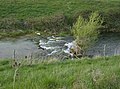 River Glen Rapids - geograph.org.uk - 437435.jpg 640 × 477; 121 KB
-
 Road junction - geograph.org.uk - 5367804.jpg 640 × 480; 34 KB
-

-
 Sand and Gravel Extraction in Progress - geograph.org.uk - 2857837.jpg 1,024 × 768; 185 KB
-
 Signs of summer near Bourne, Lincolnshire - geograph.org.uk - 4582766.jpg 2,160 × 1,440; 644 KB
-
 Sunflowers along Baston Outgang Road - geograph.org.uk - 3091040.jpg 800 × 600; 246 KB
-
 Sunflowers in the fen near Bourne, Lincolnshire - geograph.org.uk - 4355876.jpg 1,769 × 1,251; 466 KB
-
 Thatched cottage - geograph.org.uk - 4181666.jpg 4,896 × 3,672; 6.77 MB
-
 The Baskerville - geograph.org.uk - 4181664.jpg 4,896 × 3,672; 6.55 MB
-
 The Baskerville's Hotel and Restaurant - geograph.org.uk - 623676.jpg 629 × 465; 143 KB
-
 The Baskervilles Hotel - geograph.org.uk - 3091018.jpg 800 × 600; 256 KB
-
 The Baskervilles Hotel - geograph.org.uk - 3091019.jpg 600 × 800; 200 KB
-
 The corner of Black Drove and Baston Outgang Road - geograph.org.uk - 3959158.jpg 4,000 × 3,000; 4.24 MB
-
 The Counter Drain - geograph.org.uk - 2857924.jpg 1,024 × 768; 285 KB
-
 The cricket Square - geograph.org.uk - 5019872.jpg 6,000 × 4,000; 7.26 MB
-
 The entrance to Manor Pit Quarry - geograph.org.uk - 3091028.jpg 800 × 600; 215 KB
-
 The former New Inn public house - geograph.org.uk - 4030042.jpg 1,600 × 1,200; 682 KB
-
 The main street at Baston, near Bourne. Lincolnshire - geograph.org.uk - 4656648.jpg 1,768 × 1,195; 776 KB
-
 The manor house at Baston, near Bourne, Lincolnshire - geograph.org.uk - 4478669.jpg 2,111 × 1,384; 832 KB
-
 The Mill at Mill Farm near Langtoff - geograph.org.uk - 2805288.jpg 800 × 600; 82 KB
-
 The Old Forge - geograph.org.uk - 705501.jpg 640 × 427; 63 KB
-
 The old New Inn at Baston, near Bourne, Lincolnshire - geograph.org.uk - 4651108.jpg 1,761 × 1,184; 973 KB
-
 The River Glen and Kate's Bridge Farm - geograph.org.uk - 3861887.jpg 4,320 × 3,240; 5.79 MB
-
 The River Glen near Kate's Bridge - geograph.org.uk - 3861961.jpg 4,320 × 3,240; 5.76 MB
-
 The Spinning Wheel - geograph.org.uk - 623653.jpg 629 × 461; 106 KB
-
 The Spinning Wheel - geograph.org.uk - 705503.jpg 640 × 427; 49 KB
.jpg)


.jpg)


_-_geograph.org.uk_-_307194.jpg)
_-_geograph.org.uk_-_3846109.jpg)


_near_junction_with_lane_to_Greatford_-_geograph.org.uk_-_131547.jpg)


