Category:Bartholomäuskirche (Oberschützen)
Jump to navigation
Jump to search
| Object location | | View all coordinates using: OpenStreetMap |
|---|
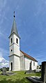
church building in Oberschützen, Austria  | |||||
| Upload media | |||||
| Instance of | |||||
|---|---|---|---|---|---|
| Named after | |||||
| Location | Oberschützen, Oberwart District, Burgenland, Austria | ||||
| Street address |
| ||||
| Heritage designation | |||||
 | |||||
Media in category "Bartholomäuskirche (Oberschützen)"
The following 18 files are in this category, out of 18 total.
-
 AT Oberschuetzen St Bartholomeus Friedhofskapelle 2022 P1012100.JPG 2,199 × 3,001; 1.21 MB
-
 AT Oberschützen Bartholomäuskirche S PanoramaCrop.jpg 8,024 × 2,927; 3.01 MB
-
 AT Oberschützen Batholomäuskirche N Panorama Crop.jpg 10,414 × 3,838; 4.39 MB
-
 Filialkirche hl Bartholomäus Oberschützen 01.jpg 5,591 × 3,728; 5.97 MB
-
 Filialkirche hl Bartholomäus Oberschützen 02.jpg 4,985 × 3,324; 4.81 MB
-
 Filialkirche hl Bartholomäus Oberschützen 03.jpg 5,288 × 3,526; 4.64 MB
-
 Katholische Friedhofskirche in Oberschützen.jpg 1,200 × 1,600; 81 KB
-
 Oberschützen - r.k. Filialkirche hl. Bartolomäus (01).jpg 3,000 × 2,000; 1.69 MB
-
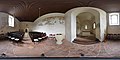 Oe Oberschuetzen Bartholom 360 180 In 2017.jpg 19,072 × 9,536; 39.25 MB
-
 Oe Oberschuetzen Bartholom GS 3 2017.jpg 3,666 × 5,946; 4.45 MB
-
 Oe Oberschuetzen Bartholom GS Eleonora.jpg 3,132 × 4,980; 2.4 MB
-
 OE Oberschuetzen Bartholomeus 360 180 2017.jpg 19,132 × 9,566; 42.31 MB
-
 Oe Oberschuetzen Bartholomeus Out 1.JPG 6,000 × 4,000; 8.84 MB
-
 Oe Oberschuetzen Bartholomeus Outsde.JPG 6,000 × 4,000; 2.89 MB
-
 WTSB Oberschützen Friedhof Bartholomäuskirche 01.jpg 3,619 × 2,714; 7.03 MB
-
 WTSB Oberschützen Friedhof Bartholomäuskirche 02.jpg 3,250 × 2,438; 4.62 MB
-
 WTSB Oberschützen Friedhof Bartholomäuskirche 03.jpg 1,044 × 1,856; 1.13 MB
-
 WTSB Oberschützen Friedhof Bartholomäuskirche 04.jpg 3,238 × 2,428; 4.78 MB


.jpg)


