Category:Barrow upon Trent
Jump to navigation
Jump to search
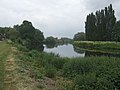
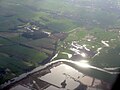
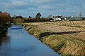
English: Barrow upon Trent is a village and civil parish in the South Derbyshire district of Derbyshire, England. The village is south of Derby, and between the River Trent (to the south) and the Trent and Mersey Canal (to the north).
village and civil parish in South Derbyshire District, Derbyshire, England  | |||||
| Upload media | |||||
| Instance of | |||||
|---|---|---|---|---|---|
| Location | South Derbyshire, Derbyshire, East Midlands, England | ||||
 | |||||
Subcategories
This category has the following 6 subcategories, out of 6 total.
A
B
W
Media in category "Barrow upon Trent"
The following 164 files are in this category, out of 164 total.
-
 "The Row" in Barrow-upon-Trent - geograph.org.uk - 5734762.jpg 5,126 × 3,568; 4 MB
-
 17 Twyford Road, Barrow-upon-Trent - geograph.org.uk - 5702249.jpg 1,280 × 960; 412 KB
-
 A bridge over the A50 - geograph.org.uk - 5483792.jpg 2,000 × 1,333; 1.85 MB
-
 A cottage under renovation - geograph.org.uk - 5483850.jpg 2,000 × 1,333; 2.86 MB
-
 A narrow country lane - geograph.org.uk - 5483789.jpg 2,000 × 1,333; 2.04 MB
-
 A paddle, a pint and some sober reflection! - geograph.org.uk - 3635617.jpg 1,280 × 1,280; 1.8 MB
-

-
 A50 at Barrow Hill - geograph.org.uk - 2340168.jpg 640 × 480; 56 KB
-
 A50 bridge - geograph.org.uk - 5483856.jpg 2,000 × 1,333; 1.88 MB
-
 A50 bridge over Deep Dale Lane - geograph.org.uk - 3200136.jpg 640 × 480; 41 KB
-

-
 A50 lay-by eastbound - geograph.org.uk - 3596541.jpg 640 × 480; 65 KB
-
 A50 Layby near Barrow Upon Trent - geograph.org.uk - 4239164.jpg 640 × 480; 209 KB
-
 A50 nears Lowes Lane overbridge - geograph.org.uk - 3596571.jpg 640 × 480; 48 KB
-
 A5132 heading west - geograph.org.uk - 3200098.jpg 640 × 480; 35 KB
-

-
 Animal pound - geograph.org.uk - 1890336.jpg 640 × 480; 299 KB
-
 Ashlea Farm - geograph.org.uk - 3856091.jpg 1,938 × 1,058; 1.11 MB
-
 Barrow on Trent - geograph.org.uk - 5483872.jpg 2,000 × 1,333; 1.85 MB
-
 Barrow on Trent Cottages.JPG 2,553 × 1,770; 1.1 MB
-
 Barrow on Trent Scene by George Turner.jpg 600 × 333; 51 KB
-
 Barrow Upon Trent, The Grange - geograph.org.uk - 4174788.jpg 640 × 480; 262 KB
-
 Barrow Upon Trent, The Old School House - geograph.org.uk - 4174574.jpg 640 × 480; 286 KB
-
 Barrow Upon Trent, The Row - geograph.org.uk - 4174767.jpg 640 × 427; 239 KB
-
 Barrow-on-Trent Railway Line - geograph.org.uk - 6376390.jpg 1,200 × 803; 1.18 MB
-
 BarrowCottage1.JPG 1,033 × 941; 466 KB
-
 Bench mark, Twyford Road, Barrow-upon-Trent - geograph.org.uk - 5702241.jpg 1,280 × 1,280; 752 KB
-
 Canalside pasture near Barrow upon Trent - geograph.org.uk - 6005704.jpg 1,440 × 810; 1.11 MB
-
 Canalside pasture near Barrow upon Trent - geograph.org.uk - 6005706.jpg 1,280 × 960; 1.16 MB
-
 Cat up a tree in Barrow upon Trent - geograph.org.uk - 5734759.jpg 4,931 × 3,744; 2.89 MB
-

-

-
 Children on a Bridge near Barrow on Trent.jpg 512 × 331; 44 KB
-

-
 Coronation Oven - geograph.org.uk - 1899434.jpg 640 × 480; 211 KB
-
 Cottage terrace - geograph.org.uk - 5483878.jpg 2,000 × 1,333; 2.05 MB
-
 Country lane - geograph.org.uk - 5483863.jpg 2,000 × 1,333; 1.64 MB
-

-
 Datestone, Bethel Chapel, Barrow-upon-Trent - geograph.org.uk - 5701674.jpg 1,280 × 951; 448 KB
-
 Deblenfield Bridge - geograph.org.uk - 1267579.jpg 640 × 480; 86 KB
-
 Deblenfield Bridge over the railway - geograph.org.uk - 3961840.jpg 1,600 × 1,200; 516 KB
-
 Deep Dale Bridge - geograph.org.uk - 2996444.jpg 1,200 × 804; 1.29 MB
-
 Deep Dale Bridge - geograph.org.uk - 3858482.jpg 1,150 × 771; 1.24 MB
-
 Deep Dale Lane - geograph.org.uk - 3200134.jpg 640 × 480; 58 KB
-
 Derbyshire UK parish map highlighting Barrow upon Trent.svg 888 × 1,308; 2.35 MB
-
 Door in the churchyard wall - geograph.org.uk - 4900258.jpg 3,264 × 2,448; 3.14 MB
-
 East Midlands Self Storage - geograph.org.uk - 5483805.jpg 2,000 × 1,333; 1.99 MB
-
 Eastbound coal empties - geograph.org.uk - 3835609.jpg 640 × 499; 97 KB
-
 Entrance to Hill Farm camp site - geograph.org.uk - 3961853.jpg 1,600 × 1,200; 702 KB
-
 Farmland by the A50 - geograph.org.uk - 3431746.jpg 1,008 × 540; 87 KB
-
 Farmland near Barrow upon Trent - geograph.org.uk - 3200093.jpg 640 × 480; 71 KB
-
 Farmland off Deep Dale Lane - geograph.org.uk - 3200133.jpg 640 × 480; 73 KB
-
 Farmland, Barrow Hill - geograph.org.uk - 3200119.jpg 640 × 480; 59 KB
-

-

-
 Footpath Sign at Barrow Bridge - geograph.org.uk - 2792038.jpg 900 × 1,200; 174 KB
-
 Former Village School, Barrow upon Trent.jpg 1,280 × 912; 344 KB
-
 Former village school, Barrow-upon-Trent - geograph.org.uk - 5702236.jpg 1,280 × 960; 436 KB
-
 Former village school, Barrow-upon-Trent - geograph.org.uk - 5702237.jpg 1,280 × 960; 446 KB
-
 Gate on the path to The Old Forge - geograph.org.uk - 4452112.jpg 1,200 × 900; 300 KB
-
 Green Lane - geograph.org.uk - 5074969.jpg 1,280 × 960; 492 KB
-
 Hill Farm - geograph.org.uk - 679404.jpg 640 × 450; 62 KB
-
 House just west of Barrow Bridge - geograph.org.uk - 3961845.jpg 1,600 × 1,200; 650 KB
-
 House on Church Lane, Barrow upon Trent - geograph.org.uk - 4900251.jpg 3,264 × 2,448; 4.45 MB
-
 Island on the Trent - geograph.org.uk - 387685.jpg 640 × 480; 74 KB
-
 Lane near Hill Farm - geograph.org.uk - 5702271.jpg 1,280 × 960; 335 KB
-
 Layby on the A50 - geograph.org.uk - 3431749.jpg 1,024 × 683; 171 KB
-
 Layby on the A50 - geograph.org.uk - 3856094.jpg 3,636 × 1,433; 2.39 MB
-
 Littlecroft, Barrow upon Trent.jpg 1,280 × 960; 372 KB
-
 Lodge Cottage - geograph.org.uk - 1897112.jpg 640 × 480; 207 KB
-
 Lodge Cottage, Barrow-upon-Trent - geograph.org.uk - 5701666.jpg 1,280 × 960; 280 KB
-

-
 Lowes Lane - geograph.org.uk - 1928122.jpg 1,200 × 900; 219 KB
-
 Meander on the Trent - geograph.org.uk - 4902290.jpg 3,264 × 2,448; 3.53 MB
-
 Merrybower Cottages - geograph.org.uk - 2800077.jpg 1,200 × 900; 159 KB
-
 Merrybower Farm - geograph.org.uk - 5445946.jpg 2,000 × 1,333; 2.85 MB
-
 Methodist Chapel, Barrow upon Trent.jpg 1,280 × 903; 497 KB
-
 Missing bridge on the Trent and Mersey - geograph.org.uk - 1741203.jpg 1,200 × 900; 196 KB
-
 Moor Lane - geograph.org.uk - 5483817.jpg 2,000 × 1,333; 2.25 MB
-
 Moor Lane diversion - geograph.org.uk - 679399.jpg 640 × 429; 64 KB
-
 Moor Lane near Hill Farm - geograph.org.uk - 5702273.jpg 1,280 × 960; 358 KB
-
 More fields - geograph.org.uk - 5445926.jpg 2,000 × 1,333; 2.04 MB
-
 Motorists take care! - geograph.org.uk - 5131736.jpg 800 × 600; 108 KB
-

-
 Near to Barrow on Trent - geograph.org.uk - 71399.jpg 640 × 427; 98 KB
-
 Near to Barrow on Trent - geograph.org.uk - 71401.jpg 640 × 427; 106 KB
-
 Near to barrow on Trent - geograph.org.uk - 71403.jpg 640 × 427; 115 KB
-

-
 Old Trackway - geograph.org.uk - 2698259.jpg 1,200 × 900; 270 KB
-
 Parsonage House - geograph.org.uk - 2698251.jpg 1,200 × 900; 213 KB
-
 Poplars beside the Trent in winter - geograph.org.uk - 375220.jpg 640 × 480; 93 KB
-
 Poplars by River Trent, Barrow on Trent - geograph.org.uk - 2261825.jpg 1,280 × 914; 477 KB
-
 Poppies on the field edge - geograph.org.uk - 5445939.jpg 2,000 × 1,333; 2.32 MB
-
 Power Lines crossing the Trent - geograph.org.uk - 685343.jpg 495 × 640; 80 KB
-
 Pub Entrance Sign on Deep Dale Lane - geograph.org.uk - 3868426.jpg 3,822 × 2,746; 1.46 MB
-
 Pub moorings north of Barrow upon Trent, Derbyshire - geograph.org.uk - 6005844.jpg 1,440 × 960; 1.38 MB
-
 Ragley Boat Stop north of Barrow upon Trent - geograph.org.uk - 6005849.jpg 1,280 × 853; 1.17 MB
-
 Ragley Boat Stop sign near Barrow upon Trent - geograph.org.uk - 6005845.jpg 960 × 1,280; 1.61 MB
-

-

-
 Reflected clouds - geograph.org.uk - 5702277.jpg 1,094 × 1,280; 330 KB
-
 Replacement footbridge - geograph.org.uk - 5467264.jpg 1,280 × 960; 564 KB
-
-
 River Trent near Ingleby - geograph.org.uk - 5615831.jpg 640 × 360; 50 KB
-
 River Trent upstream at Barrow-on-Trent - geograph.org.uk - 1890307.jpg 640 × 480; 261 KB
-
 Riverside houses, Barrow upon Trent - geograph.org.uk - 679474.jpg 640 × 429; 95 KB
-
 Road towards Sinfin - geograph.org.uk - 3200125.jpg 640 × 480; 80 KB
-
 Sand and gravel pit - geograph.org.uk - 387677.jpg 640 × 480; 62 KB
-
 Sewage pumping station at Barrow upon Trent - geograph.org.uk - 4900244.jpg 3,264 × 2,448; 2.59 MB
-
 Shooting Club entrance - geograph.org.uk - 5483839.jpg 2,000 × 1,333; 2.02 MB
-

-
 Snowy Canal - geograph.org.uk - 2792028.jpg 1,200 × 900; 119 KB
-
 St Wilfrid's, Barrow upon Trent.jpg 1,280 × 913; 457 KB
-
 Stile on the path to The Old Forge - geograph.org.uk - 3056824.jpg 900 × 1,200; 290 KB
-
 Swarkestone Quarry - geograph.org.uk - 2698289.jpg 1,200 × 900; 155 KB
-
 The A50 - geograph.org.uk - 5483787.jpg 2,000 × 1,333; 2.15 MB
-
 The Clay pigeon shoot - geograph.org.uk - 5483831.jpg 2,000 × 1,333; 2.1 MB
-
 The entrance to Greeanacres Nature Reserve - geograph.org.uk - 5074964.jpg 1,280 × 960; 610 KB
-
 The footpath from Ingleby - geograph.org.uk - 386723.jpg 640 × 480; 99 KB
-
 The Grange - geograph.org.uk - 2698239.jpg 1,200 × 900; 163 KB
-
 The Grange - geograph.org.uk - 5483883.jpg 2,000 × 1,333; 1.86 MB
-
 The Grange in Barrow upon Trent - geograph.org.uk - 4292338.jpg 4,000 × 3,000; 2.06 MB
-
 The Grange, Barrow upon Trent - geograph.org.uk - 3200105.jpg 640 × 398; 45 KB
-
 The Grange, Barrow Upon Trent - geograph.org.uk - 4174778.jpg 640 × 480; 257 KB
-
 The Grange, Barrow upon Trent.jpg 1,280 × 904; 386 KB
-
 The pinfold, Barrow-upon-Trent - geograph.org.uk - 5701678.jpg 1,280 × 960; 542 KB
-
 The Ragley Boat Stop - geograph.org.uk - 3575963.jpg 640 × 480; 261 KB
-
 The Ragley Boat Stop - geograph.org.uk - 4617612.jpg 800 × 626; 159 KB
-
 The River Trent - geograph.org.uk - 5578206.jpg 2,000 × 1,333; 1.83 MB
-
 The River Trent at Barrow upon Trent - geograph.org.uk - 3868392.jpg 3,998 × 2,996; 1.79 MB
-
 The River Trent at Barrow upon Trent - geograph.org.uk - 4901384.jpg 3,264 × 2,448; 3.06 MB
-
 The River Trent from Ingleby - geograph.org.uk - 5578179.jpg 2,000 × 1,333; 2.01 MB
-
 The River Trent from near Ingleby - geograph.org.uk - 3179141.jpg 3,264 × 2,448; 3.34 MB
-
 The Row, Twyford Road, Barrow-upon-Trent - geograph.org.uk - 5702226.jpg 1,280 × 876; 310 KB
-
 The top of Moor Lane - geograph.org.uk - 5483822.jpg 2,000 × 1,333; 2.64 MB
-
 The Trent and Mersey Canal - geograph.org.uk - 3200116.jpg 1,600 × 1,200; 221 KB
-
 The Trent and Mersey Canal - geograph.org.uk - 3200121.jpg 640 × 484; 88 KB
-
 The Trent and Mersey Canal - geograph.org.uk - 3868403.jpg 3,996 × 2,994; 2.12 MB
-

-
 The Trent Valley - geograph.org.uk - 4901373.jpg 3,264 × 2,448; 2.23 MB
-
 Tractor marks - geograph.org.uk - 5483809.jpg 2,000 × 1,333; 2.94 MB
-
 Trent & Mersey Canal northwest of Swarkestone - geograph.org.uk - 3961861.jpg 1,600 × 1,200; 514 KB
-
 Trent & Mersey Canal south of Hill Farm - geograph.org.uk - 3961858.jpg 1,600 × 1,200; 589 KB
-
 Trent & Mersey heron - geograph.org.uk - 2189852.jpg 758 × 1,024; 243 KB
-
 Trent and Mersey Canal - geograph.org.uk - 3575954.jpg 640 × 480; 257 KB
-
 Trent and Mersey Canal east of Stenson, Derbyshire - geograph.org.uk - 6005859.jpg 960 × 1,280; 1.49 MB
-
 Trent and Mersey Canal east of Stenson, Derbyshire - geograph.org.uk - 6005861.jpg 1,280 × 960; 1.77 MB
-
 Trent and Mersey Canal east of Stenson, Derbyshire - geograph.org.uk - 6005864.jpg 1,600 × 900; 1.39 MB
-
 Trent and Mersey Canal east of Stenson, Derbyshire - geograph.org.uk - 6005884.jpg 1,440 × 960; 1.76 MB
-
-

-

-

-
 Twyford Road (A5132), Barrow Upon Trent - geograph.org.uk - 4174784.jpg 640 × 480; 305 KB
-
 Twyford Road, Barrow upon Trent - geograph.org.uk - 679434.jpg 640 × 429; 54 KB
-
 Westbound A50, Layby near Swarkestone - geograph.org.uk - 4239160.jpg 640 × 427; 208 KB
-

-
 What a beauty! - geograph.org.uk - 2189804.jpg 677 × 848; 213 KB
-
 Wheat field - geograph.org.uk - 5445917.jpg 2,000 × 1,333; 2.32 MB
-
 Wheat fields - geograph.org.uk - 5445932.jpg 2,000 × 1,333; 2.17 MB
-
 Willington, Derbyshire - geograph.org.uk - 6284352.jpg 1,280 × 1,041; 391 KB
-
 Willows at Barrow upon Trent - geograph.org.uk - 4900247.jpg 3,264 × 2,448; 3.81 MB
-
 Wobbly bridge - geograph.org.uk - 1267587.jpg 640 × 480; 144 KB
-
 “The Row”, Twyford Road, Barrow-upon-Trent - geograph.org.uk - 5701670.jpg 1,280 × 877; 237 KB


,_Barrow_Upon_Trent_-_geograph.org.uk_-_4174784.jpg)


