Category:Barr, South Ayrshire
Jump to navigation
Jump to search
English: Barr is a picturesque village in the southwest of Ayrshire, about eight miles from Girvan.
village in South Ayrshire, Scotland, UK | |||||
| Upload media | |||||
| Instance of | |||||
|---|---|---|---|---|---|
| Location |
| ||||
 | |||||
Subcategories
This category has only the following subcategory.
M
Media in category "Barr, South Ayrshire"
The following 70 files are in this category, out of 70 total.
-
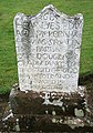 A Covenanter's grave - geograph.org.uk - 1000782.jpg 449 × 640; 138 KB
-
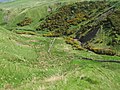
 A grass track on Chanque - geograph.org.uk - 420321.jpg 480 × 640; 101 KB
-
 A Lovely Rotting Log - geograph.org.uk - 998345.jpg 640 × 426; 142 KB
-
 A putting green at Barr - geograph.org.uk - 1004938.jpg 640 × 427; 124 KB
-
 Albany Burn - geograph.org.uk - 440819.jpg 640 × 480; 175 KB
-
 Barr Church - geograph.org.uk - 330960.jpg 640 × 480; 76 KB
-
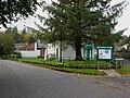 Barr Community Centre - geograph.org.uk - 262983.jpg 640 × 480; 82 KB
-
 Beside Laggan Burn - geograph.org.uk - 400185.jpg 640 × 480; 152 KB
-
 Big Digger - geograph.org.uk - 577517.jpg 640 × 434; 91 KB
-

-
 Cairn Hill - geograph.org.uk - 440843.jpg 640 × 480; 161 KB
-
 Cairn Hill slopes - geograph.org.uk - 440841.jpg 640 × 480; 179 KB
-
 Changue Forest - geograph.org.uk - 400187.jpg 640 × 480; 160 KB
-
 Changue Forest Tracks - geograph.org.uk - 400186.jpg 640 × 466; 163 KB
-
 Chanque - geograph.org.uk - 419334.jpg 640 × 480; 114 KB
-
 Clear Fell - geograph.org.uk - 400188.jpg 640 × 480; 125 KB
-
 Early morning in Changue Forest - geograph.org.uk - 333920.jpg 480 × 640; 78 KB
-
 Fell Hill top - geograph.org.uk - 440831.jpg 640 × 480; 157 KB
-
 Forest edge to Dinmurchie Loch - geograph.org.uk - 440828.jpg 640 × 480; 147 KB
-
 Forest Track - geograph.org.uk - 400183.jpg 480 × 640; 171 KB
-
 Forest Track - geograph.org.uk - 577545.jpg 640 × 480; 98 KB
-
 Forest Track - geograph.org.uk - 577555.jpg 640 × 480; 110 KB
-
 Forest trails in Changue Forest - geograph.org.uk - 333915.jpg 640 × 480; 95 KB
-
 Greensides - geograph.org.uk - 440813.jpg 640 × 480; 170 KB
-
 Haggis Hill - geograph.org.uk - 419249.jpg 640 × 480; 108 KB
-
 Heavy dew on the cobwebs - geograph.org.uk - 333924.jpg 480 × 640; 72 KB
-
 High Changue - geograph.org.uk - 628359.jpg 640 × 480; 97 KB
-
 Laggamonr Burn - geograph.org.uk - 440817.jpg 640 × 480; 181 KB
-
 Lead Mine Burn - geograph.org.uk - 440845.jpg 640 × 480; 174 KB
-
 Loch Scalloch - geograph.org.uk - 440821.jpg 640 × 480; 162 KB
-
 Loch Scalloch - geograph.org.uk - 440823.jpg 640 × 480; 186 KB
-
 Looking Up The Stinchar Valley - geograph.org.uk - 378963.jpg 640 × 460; 124 KB
-
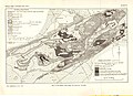 MacGregor Midland Valley Scotland Plate 4.jpg 3,959 × 2,866; 1.44 MB
-
 Mid Hill trig point - geograph.org.uk - 440824.jpg 640 × 480; 185 KB
-
 Milkhouse burn - geograph.org.uk - 440815.jpg 640 × 480; 144 KB
-
 Milton Burn - geograph.org.uk - 416902.jpg 480 × 640; 159 KB
-
 Moorland Stream - geograph.org.uk - 697444.jpg 452 × 640; 118 KB
-
 Mull of Miljoan - geograph.org.uk - 577548.jpg 450 × 600; 68 KB
-
 Nick of the Balloch (north side) - geograph.org.uk - 263383.jpg 640 × 480; 74 KB
-
 No Escape From Turbines - geograph.org.uk - 577546.jpg 640 × 480; 99 KB
-
 On The Barr To Loch Doon Cycle Track - geograph.org.uk - 1236657.jpg 399 × 600; 80 KB
-
 Path to Barr - geograph.org.uk - 440826.jpg 640 × 480; 140 KB
-
 Pinbreck Hill - geograph.org.uk - 419341.jpg 640 × 480; 109 KB
-
 Pinmullan Burn and South Balloch - geograph.org.uk - 263372.jpg 640 × 480; 73 KB
-
 Polytrichum - Flickr - S. Rae.jpg 5,472 × 3,648; 8.14 MB
-
 River Stinchar - geograph.org.uk - 378879.jpg 640 × 480; 198 KB
-
 River Stinchar - geograph.org.uk - 378968.jpg 480 × 640; 213 KB
-
 Rough grazing hillside - geograph.org.uk - 419338.jpg 640 × 480; 103 KB
-
 Ruin near Dinmurchie Loch - geograph.org.uk - 440835.jpg 640 × 480; 164 KB
-

-

-
 South Balloch - geograph.org.uk - 378884.jpg 640 × 480; 120 KB
-
 Stinchar Valley Farmland - geograph.org.uk - 378965.jpg 640 × 480; 101 KB
-
 The Interconnector at Changue Hill - geograph.org.uk - 400196.jpg 480 × 640; 150 KB
-
 The road to High Changue - geograph.org.uk - 628356.jpg 640 × 480; 124 KB
-
 Towards Corphin - geograph.org.uk - 416917.jpg 640 × 480; 114 KB
-
 Towards Fell Hill - geograph.org.uk - 440830.jpg 640 × 480; 154 KB
-

-
 Water of Gregg - geograph.org.uk - 400179.jpg 480 × 640; 202 KB
-
 Water of Gregg - geograph.org.uk - 400181.jpg 477 × 640; 176 KB
-
 Barns at Nether Barr - geograph.org.uk - 333910.jpg 640 × 480; 77 KB
-
 Barr from the west - geograph.org.uk - 269596.jpg 640 × 480; 83 KB
-
 Barr village - geograph.org.uk - 262982.jpg 640 × 480; 56 KB
-
 Clashgalloch Schoolhouse - geograph.org.uk - 263371.jpg 640 × 480; 74 KB
-
 In urgent need of roof repairs^ - geograph.org.uk - 263363.jpg 640 × 480; 79 KB
-
 Knockfen, near Barr - geograph.org.uk - 263368.jpg 640 × 480; 72 KB
-
 River Stinchar near Clashgalloch - geograph.org.uk - 333934.jpg 640 × 480; 97 KB
-
 Small side valley near Barr - geograph.org.uk - 263365.jpg 640 × 480; 100 KB
-
 Tups with curly horns - geograph.org.uk - 263369.jpg 640 × 480; 72 KB
-
 Tups without horns - geograph.org.uk - 263366.jpg 640 × 480; 75 KB


_-_geograph.org.uk_-_263383.jpg)


