Category:Barnham, West Sussex
Jump to navigation
Jump to search
village in West Sussex, United Kingdom  | |||||
| Upload media | |||||
| Instance of |
| ||||
|---|---|---|---|---|---|
| Location | Barnham and Eastergate, Arun, West Sussex, South East England, England | ||||
| Area |
| ||||
| Said to be the same as | Barnham (Wikimedia duplicated page, civil parish) | ||||
 | |||||
Subcategories
This category has the following 5 subcategories, out of 5 total.
B
- Barnham Court, West Sussex (8 F)
- Barnham Methodist Church (6 F)
S
Media in category "Barnham, West Sussex"
The following 112 files are in this category, out of 112 total.
-
 "Island" at entrance to Church Lane - geograph.org.uk - 577338.jpg 480 × 640; 135 KB
-
 A rare bus heads for Bognor - geograph.org.uk - 577341.jpg 640 × 480; 74 KB
-
 Alleyway leading to footpath junction - geograph.org.uk - 576687.jpg 640 × 480; 135 KB
-
 Approach road to Windmill Court Barnham - geograph.org.uk - 3158739.jpg 3,264 × 2,448; 3.49 MB
-

-
 Barnham Central - geograph.org.uk - 2859201.jpg 768 × 1,024; 232 KB
-
 Barnham MMB 01 West Coastway Line 377148.jpg 4,182 × 1,815; 2.27 MB
-
 Barnham Post Office - geograph.org.uk - 577250.jpg 640 × 480; 94 KB
-
 Barnham Road, Barnham - geograph.org.uk - 2779817.jpg 640 × 428; 109 KB
-
 Barnham signalling centre.jpg 3,059 × 2,639; 1.46 MB
-
 Church Lane and Hill Lane - geograph.org.uk - 1443735.jpg 640 × 427; 103 KB
-

-

-
 Drain near Lidsey - geograph.org.uk - 138657.jpg 640 × 479; 197 KB
-

-

-
 Entering Barnham - geograph.org.uk - 2779775.jpg 640 × 428; 143 KB
-
 Entrance to Barnham Court Farm - geograph.org.uk - 844455.jpg 640 × 480; 93 KB
-
 Entrance to footpath towards railway line - geograph.org.uk - 598647.jpg 640 × 480; 100 KB
-
 Farmland to the west of the "dog leg" - geograph.org.uk - 844505.jpg 640 × 480; 78 KB
-

-

-

-
 Footpath joins Lake Lane in Barnham - geograph.org.uk - 2861669.jpg 1,024 × 768; 340 KB
-

-
 Footpath sign at the "dog leg" - geograph.org.uk - 844492.jpg 640 × 480; 112 KB
-
 Footpath to the canal - geograph.org.uk - 1443762.jpg 640 × 427; 98 KB
-

-

-
 Hikers passing Barnham Court Farm - geograph.org.uk - 844485.jpg 640 × 480; 72 KB
-
 Hollinsworth Swing Bridge - geograph.org.uk - 1294155.jpg 640 × 424; 133 KB
-
 Junction of B2233 and "The Square" - geograph.org.uk - 577237.jpg 640 × 480; 77 KB
-
 Looking towards Barnham Junction - geograph.org.uk - 576852.jpg 640 × 480; 68 KB
-

-
 Lush vegetation alongside Barnham Rife - geograph.org.uk - 844571.jpg 640 × 480; 144 KB
-
 Minstrel's Barn, Church Lane - geograph.org.uk - 1443729.jpg 640 × 427; 106 KB
-
 MurlArBnhm.JPG 3,072 × 2,304; 2.69 MB
-
 Murrell Arms Barnham - geograph.org.uk - 3101587.jpg 3,264 × 2,448; 3.15 MB
-
 Pivot stone at Hollinsworth Swing Bridge - geograph.org.uk - 844477.jpg 640 × 480; 149 KB
-
 Playing field at St Philip Howard - geograph.org.uk - 576756.jpg 640 × 480; 59 KB
-

-
 Post box at Elm Grove, Barnham - geograph.org.uk - 577159.jpg 640 × 480; 74 KB
-

-
 Reeds by Barnham Rife - geograph.org.uk - 844601.jpg 640 × 480; 129 KB
-

-
 Shops and business units by Barnham Windmill - geograph.org.uk - 3101653.jpg 3,264 × 2,448; 3.91 MB
-

-

-

-

-
 Temporary pool near Barnham Rife - geograph.org.uk - 844589.jpg 480 × 640; 145 KB
-
 Terraced row at Elm Grove, Barnham - geograph.org.uk - 577064.jpg 640 × 480; 109 KB
-
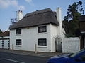 Thatched cottage on B2233 at Barnham - geograph.org.uk - 577217.jpg 640 × 480; 81 KB
-
 The Barnham Bridge Inn - geograph.org.uk - 2925512.jpg 2,048 × 1,536; 663 KB
-
 The sign at "The Murrell Arms" - geograph.org.uk - 2861665.jpg 768 × 1,024; 127 KB
-
 Track to Barnham - geograph.org.uk - 2958203.jpg 640 × 480; 88 KB
-
 Under Barnham railway bridge - geograph.org.uk - 2779793.jpg 640 × 428; 95 KB
-
 Unusual memorial seat in Barnham - geograph.org.uk - 2861656.jpg 1,024 × 934; 334 KB
-
 View across farmland south of Barnham - geograph.org.uk - 844591.jpg 640 × 480; 86 KB
-

-

-

-

-

-
 A wonderful day in the country - geograph.org.uk - 844631.jpg 480 × 640; 114 KB
-

-
 An unusual church - geograph.org.uk - 577349.jpg 640 × 480; 79 KB
-
 Barnham Bridge Inn - geograph.org.uk - 577275.jpg 640 × 480; 92 KB
-
 Barnham Primary School - geograph.org.uk - 577152.jpg 640 × 480; 74 KB
-
 Barnham Rife - geograph.org.uk - 844614.jpg 480 × 640; 114 KB
-
 Barnham signal Box - geograph.org.uk - 32955.jpg 640 × 472; 75 KB
-
 Beware of the rife - geograph.org.uk - 844615.jpg 640 × 480; 166 KB
-

-
 Church Farm, Barnham - geograph.org.uk - 598643.jpg 640 × 480; 95 KB
-
 Corner of Marshall Close and Church Lane - geograph.org.uk - 577326.jpg 640 × 480; 103 KB
-
 Eastern edge of the square - geograph.org.uk - 577289.jpg 640 × 480; 66 KB
-
 Elmdale Flats, Barnham - geograph.org.uk - 576710.jpg 640 × 480; 98 KB
-

-
 Estate agent on B22333 - geograph.org.uk - 577353.jpg 640 × 480; 93 KB
-

-

-

-

-
 Green space at Woodside - geograph.org.uk - 577080.jpg 640 × 480; 114 KB
-

-
 Hill Lane, Barnham - geograph.org.uk - 598640.jpg 640 × 480; 117 KB
-
 Lidsey Lodge Farm - geograph.org.uk - 22653.jpg 640 × 480; 54 KB
-

-
 Looking down Church Lane - geograph.org.uk - 598682.jpg 640 × 480; 57 KB
-

-

-
 Murrell Arms, Barnham - geograph.org.uk - 598610.jpg 640 × 480; 52 KB
-

-
 Playground at St Philip Howard - geograph.org.uk - 576738.jpg 640 × 480; 73 KB
-

-
 Railway maintenance depot at Barnham - geograph.org.uk - 577357.jpg 640 × 480; 75 KB
-

-
 Siding to east of Barnham - geograph.org.uk - 576820.jpg 640 × 480; 80 KB
-

-
 Skye Cluan Close - geograph.org.uk - 577037.jpg 640 × 480; 65 KB
-
 Southern edge of grid square - geograph.org.uk - 576951.jpg 640 × 480; 103 KB
-
 Speed humps on Private Road - geograph.org.uk - 577069.jpg 640 × 480; 88 KB
-

-
 Steps up to crossing near Barnham - geograph.org.uk - 576784.jpg 640 × 480; 82 KB
-

-
 Stile by field - geograph.org.uk - 598653.jpg 640 × 480; 89 KB
-

-

-
 Tilebarn Farm - geograph.org.uk - 138577.jpg 640 × 479; 136 KB
-

-
 Yapton Road, Barnham - geograph.org.uk - 138560.jpg 479 × 640; 100 KB
-
 Yapton Road, Barnham - geograph.org.uk - 438688.jpg 640 × 480; 218 KB


_-_geograph.org.uk_-_2861659.jpg)
_-_geograph.org.uk_-_2861661.jpg)


