Category:Barnby, North Yorkshire
Jump to navigation
Jump to search
civil parish in North Yorkshire, UK   | |||||
| Upload media | |||||
| Instance of | |||||
|---|---|---|---|---|---|
| Location | Scarborough, North Yorkshire, Yorkshire and the Humber, England | ||||
 | |||||
Media in category "Barnby, North Yorkshire"
The following 179 files are in this category, out of 179 total.
-
 A dip on the Cleveland Way - geograph.org.uk - 5811261.jpg 640 × 480; 257 KB
-
 A tricky bit of the Cleveland Way - geograph.org.uk - 5811028.jpg 640 × 480; 345 KB
-
 A174 at East Barnby Lane junction - geograph.org.uk - 4734086.jpg 640 × 481; 30 KB
-

-
 Across the fields towards Kettleness - geograph.org.uk - 4211676.jpg 4,320 × 2,160; 1.75 MB
-
 Across the stream - geograph.org.uk - 5597824.jpg 4,320 × 3,240; 3.48 MB
-
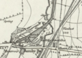 Barnby Basin.png 1,652 × 1,166; 2.38 MB
-
 Barnby Dales - geograph.org.uk - 2760331.jpg 640 × 427; 224 KB
-
 Barnby Dales Farm (1) - geograph.org.uk - 5596999.jpg 4,320 × 3,240; 4.1 MB
-
 Barnby Dales Farm (2) - geograph.org.uk - 5597002.jpg 4,320 × 3,240; 2.7 MB
-
 Barnby Dales Farm (3) - geograph.org.uk - 5597004.jpg 4,320 × 3,240; 2.74 MB
-
 Barnby Tofts (1) (geograph 5597828).jpg 4,320 × 3,240; 4.25 MB
-
 Barnby Tofts (2) - geograph.org.uk - 5597832.jpg 4,320 × 3,240; 3.69 MB
-
 Barnby Tofts Farm with Runswick Bay beyond - geograph.org.uk - 3440717.jpg 4,000 × 3,000; 2.41 MB
-
 Barnby, North Yorkshire UK parish locator map.svg 1,425 × 1,037; 4.3 MB
-
 Beach rock formation - geograph.org.uk - 3145627.jpg 1,600 × 1,200; 795 KB
-
 Bench on the Cleveland Way - geograph.org.uk - 5811245.jpg 640 × 480; 360 KB
-
 Bend in the path - geograph.org.uk - 5597825.jpg 4,320 × 3,240; 4.44 MB
-
 Bend in the track - geograph.org.uk - 5598908.jpg 4,320 × 3,240; 4.26 MB
-
 Blue cabin on the beach - geograph.org.uk - 5811013.jpg 640 × 480; 266 KB
-
 Bog house farm from footpath - geograph.org.uk - 2587905.jpg 3,264 × 2,448; 2.99 MB
-
 Bridge across Claymoor Beck - geograph.org.uk - 5595082.jpg 3,024 × 5,376; 3.2 MB
-
 Bridge over disused railway line - geograph.org.uk - 2019588.jpg 640 × 480; 95 KB
-
 Bridge over old railway line - geograph.org.uk - 4211319.jpg 4,320 × 3,240; 3.95 MB
-
 Bridge over the dismantled railway at High Cliff - geograph.org.uk - 5906667.jpg 1,600 × 1,200; 625 KB
-
 Bridge over the old railway line - geograph.org.uk - 4211330.jpg 4,320 × 3,240; 4.09 MB
-
 Bridleway East Barnby - geograph.org.uk - 3440729.jpg 4,000 × 3,000; 3.34 MB
-
 Bridleway near West Barnby - geograph.org.uk - 5381607.jpg 2,048 × 1,536; 1.71 MB
-
 Broom House Lane heading east - geograph.org.uk - 2482033.jpg 1,600 × 1,200; 531 KB
-
 Bull by stile at Barnby Tofts Farm - geograph.org.uk - 3440711.jpg 4,000 × 3,000; 2.68 MB
-

-
 Bus shelters on the A174 - geograph.org.uk - 690109.jpg 640 × 480; 131 KB
-
 Bus shelters on the A174 - geograph.org.uk - 881541.jpg 640 × 365; 47 KB
-
 Catbeck Hill and Hill Stones - geograph.org.uk - 6236146.jpg 800 × 555; 116 KB
-
 Cattle at Westfields Farm - geograph.org.uk - 4211301.jpg 4,320 × 2,160; 2.16 MB
-
 Change sides - geograph.org.uk - 5596992.jpg 4,320 × 3,240; 3.42 MB
-
 Claymoor Beck running into Runswick Bay - geograph.org.uk - 5909255.jpg 5,184 × 3,456; 5.52 MB
-
 Cleveland Way above Runswick Bay - geograph.org.uk - 5811228.jpg 640 × 480; 322 KB
-
 Cleveland Way approaching Kettleness - geograph.org.uk - 5811258.jpg 640 × 480; 272 KB
-
 Cleveland Way as it leaves Runswick Bay - geograph.org.uk - 6237444.jpg 4,000 × 3,000; 4.97 MB
-
 Cleveland Way at Claymoor End - geograph.org.uk - 6237448.jpg 4,000 × 3,000; 4.52 MB
-
 Cleveland Way descending off High Cliff - geograph.org.uk - 5909317.jpg 5,184 × 3,456; 5.77 MB
-
 Cleveland Way heading East towards Kettleness - geograph.org.uk - 5909358.jpg 5,184 × 3,456; 5.77 MB
-
 Cliff scenery above Runswick Bay - geograph.org.uk - 4548784.jpg 640 × 350; 41 KB
-
 Cliffs beside Kettleness Farm - geograph.org.uk - 5597629.jpg 5,376 × 3,024; 2.54 MB
-
 Cliffs, stones and sea - geograph.org.uk - 5596298.jpg 4,320 × 3,240; 3.94 MB
-
 Conglomerate with big pebbles - geograph.org.uk - 3145640.jpg 640 × 480; 127 KB
-
 Disused Railway between Runswick Bay and Kettleness - geograph.org.uk - 5909371.jpg 5,184 × 3,456; 7.7 MB
-

-
 Disused Railway Line near Runswick Bay - geograph.org.uk - 2011145.jpg 640 × 480; 107 KB
-

-
 Double Ford at East Barnby - geograph.org.uk - 3804937.jpg 3,872 × 2,592; 4.67 MB
-
 Eastern end of Runswick Bay - geograph.org.uk - 6229496.jpg 800 × 512; 58 KB
-
 England Coast Path - geograph.org.uk - 6007764.jpg 3,612 × 5,420; 5.37 MB
-
 Farmland near Greenhills Farm - geograph.org.uk - 6229549.jpg 800 × 476; 94 KB
-
 Farmland near Westfields Farm - geograph.org.uk - 2610174.jpg 640 × 499; 32 KB
-
 Farmland next to Goldsborough Lane - geograph.org.uk - 6237019.jpg 800 × 530; 137 KB
-
 Field edge path (1) - geograph.org.uk - 5597826.jpg 4,320 × 3,240; 3.86 MB
-
 Field footpath into East Barnby - geograph.org.uk - 3440721.jpg 4,000 × 3,000; 2.63 MB
-
 Flood debris by the ford - geograph.org.uk - 3661716.jpg 1,024 × 768; 642 KB
-
 Follow the field edge - geograph.org.uk - 5597834.jpg 4,320 × 3,240; 2.88 MB
-
 Footbridge over Claymoor Beck - geograph.org.uk - 5537709.jpg 1,024 × 768; 250 KB
-
 Footbridge over the Disused Whitby to Saltburn Railway - geograph.org.uk - 5909301.jpg 5,184 × 3,456; 5.41 MB
-
 Footpath below Westfields Farm - geograph.org.uk - 4211309.jpg 4,320 × 3,240; 3 MB
-
 Footpath leading to High Cliff - geograph.org.uk - 5909307.jpg 5,184 × 3,456; 5.69 MB
-
 Ford at Barnby Beck with flood debris - geograph.org.uk - 3661722.jpg 1,024 × 768; 737 KB
-
 Ford at Calf Hill Crag Wood, East Barnby - geograph.org.uk - 3805096.jpg 3,872 × 2,592; 4.64 MB
-
 Ford on the Barnby Beck - geograph.org.uk - 3804941.jpg 3,872 × 2,592; 4.85 MB
-
 Ford over Row Beck - geograph.org.uk - 564233.jpg 640 × 479; 127 KB
-
 Four ways to go (1) - geograph.org.uk - 5597835.jpg 4,320 × 3,240; 3.04 MB
-
 Four ways to go (2) - geograph.org.uk - 5597837.jpg 4,320 × 3,240; 4.95 MB
-
 Four ways to go (3) - geograph.org.uk - 5597838.jpg 3,793 × 2,845; 3.03 MB
-
 Four ways to go (4) - geograph.org.uk - 5597841.jpg 4,320 × 3,240; 4.33 MB
-
 Goldsborough Lane heading north - geograph.org.uk - 2610172.jpg 1,600 × 1,200; 176 KB
-
 Goldsborough Lane towards Goldsborough - geograph.org.uk - 6237021.jpg 800 × 546; 139 KB
-
 Heading south towards East Barnby - geograph.org.uk - 4114047.jpg 640 × 385; 40 KB
-
 Hob Holes - geograph.org.uk - 4548781.jpg 640 × 480; 67 KB
-
 Hob Holes - geograph.org.uk - 5811025.jpg 640 × 480; 298 KB
-
 Hob Holes holes - geograph.org.uk - 1811793.jpg 640 × 421; 93 KB
-
 I shall ignore you - geograph.org.uk - 3440707.jpg 4,000 × 3,000; 3.64 MB
-
 Into open fields - geograph.org.uk - 5596985.jpg 4,320 × 3,240; 3.65 MB
-
 Kettle Ness - geograph.org.uk - 5811272.jpg 640 × 480; 230 KB
-
 Kettle Ness, aerial 2018 (2) - geograph.org.uk - 5909742.jpg 800 × 533; 85 KB
-
 Kettleness Farm - geograph.org.uk - 5597167.jpg 5,376 × 3,024; 2.77 MB
-
 Left or right (1) - geograph.org.uk - 5597829.jpg 4,320 × 3,240; 3.41 MB
-
 Left or right (2) - geograph.org.uk - 5597830.jpg 3,193 × 3,193; 2.35 MB
-
-

-
 Looking towards Northfields Farm - geograph.org.uk - 4877143.jpg 640 × 480; 89 KB
-
 Looking towards Runswick Bay from path near Kettleness Farm - geograph.org.uk - 5597623.jpg 5,376 × 3,024; 3.09 MB
-
 Medieval Field System - geograph.org.uk - 3440701.jpg 4,000 × 3,000; 2.44 MB
-
 Minor road towards East Barnby - geograph.org.uk - 2482035.jpg 1,600 × 1,200; 703 KB
-
 Old Mile Post - geograph.org.uk - 1330461.jpg 640 × 480; 111 KB
-
 Old rail track west of Kettleness - geograph.org.uk - 4211378.jpg 4,320 × 3,240; 3.6 MB
-
 Old railway wagon - geograph.org.uk - 5598902.jpg 4,320 × 3,240; 4.05 MB
-
 On Runswick Sands - geograph.org.uk - 6287335.jpg 4,837 × 3,473; 3.74 MB
-
 Once were trains (1) - geograph.org.uk - 5597809.jpg 3,240 × 4,320; 4.09 MB
-
 Once were trains (2) - geograph.org.uk - 5597810.jpg 3,240 × 4,320; 4.67 MB
-
 Once were trains (3) - geograph.org.uk - 5597811.jpg 4,320 × 3,240; 3.48 MB
-
 Once were trains (4) - geograph.org.uk - 5597813.jpg 4,320 × 3,240; 3.17 MB
-
 Over the stile - geograph.org.uk - 5597827.jpg 4,320 × 3,240; 4.61 MB
-
 Overgrown path - geograph.org.uk - 5597843.jpg 4,320 × 3,240; 4.34 MB
-
 Path junction - geograph.org.uk - 5596842.jpg 4,320 × 3,240; 4.55 MB
-
 Path meets the road - geograph.org.uk - 5598919.jpg 4,320 × 3,240; 3.79 MB
-
 Path to Brockrigg - geograph.org.uk - 5597831.jpg 4,320 × 3,240; 3.09 MB
-
 Path to Scaw Hill (2) - geograph.org.uk - 5596894.jpg 4,320 × 3,240; 4.6 MB
-
 Path to Scaw Hill (3) - geograph.org.uk - 5596895.jpg 4,320 × 3,240; 2.55 MB
-
 Path to Scaw Hill (4) - geograph.org.uk - 5596977.jpg 3,240 × 4,320; 4.7 MB
-
 Path to Scaw Hill (5) - geograph.org.uk - 5596982.jpg 4,320 × 3,240; 5.02 MB
-
 Path to Scaw Hill (6) - geograph.org.uk - 5596990.jpg 4,320 × 3,240; 3.83 MB
-
 Path to Scaw Hill (7) - geograph.org.uk - 5596995.jpg 4,320 × 3,240; 2.95 MB
-
 Potato Hill trig point - geograph.org.uk - 689596.jpg 640 × 480; 120 KB
-
 Private track into the Mulgrave estate. - geograph.org.uk - 6219422.jpg 1,024 × 768; 286 KB
-
 Private track near Widgey Toft - geograph.org.uk - 5906673.jpg 1,600 × 1,200; 784 KB
-
 Railway trackbed at Kettleness Mines - geograph.org.uk - 5906664.jpg 1,600 × 1,200; 436 KB
-
 Recently cleared footpath - geograph.org.uk - 3250740.jpg 1,024 × 768; 259 KB
-
 Resting at the side of the field - geograph.org.uk - 5598910.jpg 4,320 × 3,240; 4.7 MB
-
 Ruin on Goldsborough Lane - geograph.org.uk - 5031880.jpg 640 × 480; 119 KB
-
 Ruined building along Goldsborough Lane - geograph.org.uk - 6237023.jpg 800 × 523; 136 KB
-
 Runswick Bay - geograph.org.uk - 2621358.jpg 640 × 426; 202 KB
-
 Runswick Bay - geograph.org.uk - 2760334.jpg 640 × 436; 204 KB
-
 Runswick Bay - geograph.org.uk - 5638049.jpg 1,600 × 1,022; 311 KB
-
 Runswick Bay - geograph.org.uk - 6267170.jpg 1,024 × 641; 467 KB
-
 Runswick Bay - geograph.org.uk - 6371611.jpg 640 × 360; 47 KB
-
 Runswick Bay Beach and Sailing Club - geograph.org.uk - 6229493.jpg 800 × 594; 74 KB
-
 Runswick Bay Sailing Club - geograph.org.uk - 2610199.jpg 1,600 × 1,200; 356 KB
-
 Runswick Sands (1) - geograph.org.uk - 5596861.jpg 4,320 × 3,240; 2.81 MB
-
 Runswick Sands - geograph.org.uk - 2589394.jpg 640 × 480; 66 KB
-
 Runswick Sands at low tide - geograph.org.uk - 3859086.jpg 3,264 × 2,448; 2.98 MB
-
 Sea, cliffs and shadow - geograph.org.uk - 5596158.jpg 4,320 × 3,240; 3.79 MB
-
 Spiny resident - geograph.org.uk - 5597011.jpg 4,320 × 3,240; 4.35 MB
-
 Standing stone in field East Barnby - geograph.org.uk - 3440736.jpg 3,000 × 4,000; 2.8 MB
-
 Steps on the Cleveland Way - geograph.org.uk - 5811235.jpg 480 × 640; 292 KB
-
 Stone enclosure - geograph.org.uk - 6286889.jpg 640 × 427; 102 KB
-
 The Cleveland Way (1) - geograph.org.uk - 5596157.jpg 4,320 × 3,240; 3.34 MB
-
 The Cleveland Way (10) - geograph.org.uk - 5596855.jpg 4,320 × 3,240; 3.61 MB
-
 The Cleveland Way (11) - geograph.org.uk - 5596858.jpg 4,320 × 3,240; 4.02 MB
-
 The Cleveland Way (2) - geograph.org.uk - 5596160.jpg 4,320 × 3,240; 4.24 MB
-
 The Cleveland Way (3) - geograph.org.uk - 5596278.jpg 4,320 × 3,240; 3.55 MB
-
 The Cleveland Way (4) - geograph.org.uk - 5596280.jpg 4,320 × 3,240; 3.57 MB
-
 The Cleveland Way (5) - geograph.org.uk - 5596282.jpg 4,320 × 3,240; 3.66 MB
-
 The Cleveland Way (6) - geograph.org.uk - 5596839.jpg 4,320 × 3,240; 4.09 MB
-
 The Cleveland Way (7) - geograph.org.uk - 5596847.jpg 4,320 × 3,240; 4.8 MB
-
 The Cleveland Way (9) - geograph.org.uk - 5596854.jpg 3,240 × 4,320; 3.53 MB
-
 The coastal path west of Kettleness - geograph.org.uk - 6288145.jpg 5,184 × 3,888; 6.09 MB
-
 The old chapel, East Barnby - geograph.org.uk - 689666.jpg 640 × 480; 175 KB
-
 The top of the ascent - geograph.org.uk - 5596984.jpg 4,320 × 3,240; 4.13 MB
-
 There is a lot of it about - geograph.org.uk - 5598903.jpg 4,320 × 3,240; 5.01 MB
-
 There is a lot of it about - geograph.org.uk - 5598916.jpg 4,320 × 3,240; 3.74 MB
-
 Three ways to go (1) - geograph.org.uk - 5597817.jpg 4,320 × 3,240; 4.19 MB
-
 Three ways to go (1) - geograph.org.uk - 5598898.jpg 4,320 × 3,240; 3.22 MB
-
 Three ways to go (1) - geograph.org.uk - 5598904.jpg 4,320 × 3,240; 4.52 MB
-
 Three ways to go (2) - geograph.org.uk - 5597821.jpg 4,320 × 3,240; 4.19 MB
-
 Three ways to go (2) - geograph.org.uk - 5598899.jpg 4,320 × 3,240; 4.75 MB
-
 Three ways to go (2) - geograph.org.uk - 5598905.jpg 4,320 × 3,240; 3.69 MB
-
 Three ways to go (3) - geograph.org.uk - 5597822.jpg 4,320 × 3,240; 3.63 MB
-
 Three ways to go (3) - geograph.org.uk - 5598900.jpg 4,320 × 3,240; 3.49 MB
-
 Three ways to go (3) - geograph.org.uk - 5598907.jpg 4,320 × 3,240; 5.27 MB
-
 Towards the minor road - geograph.org.uk - 5598915.jpg 4,080 × 3,061; 3.62 MB
-
 Towards the stream - geograph.org.uk - 5597823.jpg 4,320 × 3,240; 5.05 MB
-
 Track and Footpath from Westfields Farm - geograph.org.uk - 3434390.jpg 4,000 × 3,000; 2.78 MB
-
 Track past the farm - geograph.org.uk - 5598901.jpg 4,320 × 3,240; 3 MB
-
 Track to Potato Hill - geograph.org.uk - 2610173.jpg 640 × 480; 41 KB
-
 Trig point of Potato Hill - geograph.org.uk - 4186697.jpg 1,500 × 957; 1.77 MB
-
 Trig Point on Potato Hill @197m asl - geograph.org.uk - 4037434.jpg 1,595 × 3,893; 1.93 MB
-
 Up the field with Runswick Bay in the distance - geograph.org.uk - 3440692.jpg 4,000 × 3,000; 2.52 MB
-
 Up the hill to Westfields Farm - geograph.org.uk - 3434378.jpg 4,000 × 3,000; 2.16 MB
-
 View across Runswick Bay - geograph.org.uk - 2128630.jpg 3,072 × 2,304; 1.91 MB
-
 View at High Cliff - geograph.org.uk - 4211342.jpg 4,320 × 3,240; 3.47 MB
-
 View over Runswick Bay - geograph.org.uk - 5353794.jpg 640 × 427; 77 KB
-
 View to Runswick Bay - geograph.org.uk - 4211356.jpg 4,320 × 2,334; 2.13 MB
-
 Wade's Stone (geograph 5598909).jpg 4,320 × 3,240; 3.25 MB
-
 West along the A174 - geograph.org.uk - 6229551.jpg 800 × 617; 122 KB
-
 West Barnby Lane toward High Farm on right - geograph.org.uk - 3440744.jpg 4,000 × 3,000; 2.84 MB
-
 Westfields Farm - geograph.org.uk - 5597808.jpg 4,320 × 3,240; 2.8 MB
-
 Whitby 5 1-2 - geograph.org.uk - 1330448.jpg 480 × 640; 104 KB
-
 Woodland beside Broom House Lane - geograph.org.uk - 2482034.jpg 1,600 × 1,200; 752 KB
-
 Dismantled Railway, Widgey Toft - geograph.org.uk - 89279.jpg 640 × 480; 60 KB
-
 On the beach at Hill Stones - geograph.org.uk - 129171.jpg 640 × 480; 78 KB


_-_geograph.org.uk_-_5596999.jpg)
_-_geograph.org.uk_-_5597002.jpg)
_-_geograph.org.uk_-_5597004.jpg)
_(geograph_5597828).jpg)
_-_geograph.org.uk_-_5597832.jpg)


_-_geograph.org.uk_-_5597826.jpg)


_-_geograph.org.uk_-_5597835.jpg)
_-_geograph.org.uk_-_5597837.jpg)
_-_geograph.org.uk_-_5597838.jpg)
_-_geograph.org.uk_-_5597841.jpg)


_-_geograph.org.uk_-_5909742.jpg)

_-_geograph.org.uk_-_5597829.jpg)
_-_geograph.org.uk_-_5597830.jpg)


_-_geograph.org.uk_-_5597809.jpg)
_-_geograph.org.uk_-_5597810.jpg)
_-_geograph.org.uk_-_5597811.jpg)
_-_geograph.org.uk_-_5597813.jpg)


_-_geograph.org.uk_-_5596894.jpg)
_-_geograph.org.uk_-_5596895.jpg)
_-_geograph.org.uk_-_5596977.jpg)
_-_geograph.org.uk_-_5596982.jpg)
_-_geograph.org.uk_-_5596990.jpg)
_-_geograph.org.uk_-_5596995.jpg)


_-_geograph.org.uk_-_5596861.jpg)


_-_geograph.org.uk_-_5596157.jpg)
_-_geograph.org.uk_-_5596855.jpg)
_-_geograph.org.uk_-_5596858.jpg)
_-_geograph.org.uk_-_5596160.jpg)
_-_geograph.org.uk_-_5596278.jpg)
_-_geograph.org.uk_-_5596280.jpg)
_-_geograph.org.uk_-_5596282.jpg)
_-_geograph.org.uk_-_5596839.jpg)
_-_geograph.org.uk_-_5596847.jpg)
_-_geograph.org.uk_-_5596854.jpg)


_-_geograph.org.uk_-_5597817.jpg)
_-_geograph.org.uk_-_5598898.jpg)
_-_geograph.org.uk_-_5598904.jpg)
_-_geograph.org.uk_-_5597821.jpg)
_-_geograph.org.uk_-_5598899.jpg)
_-_geograph.org.uk_-_5598905.jpg)
_-_geograph.org.uk_-_5597822.jpg)
_-_geograph.org.uk_-_5598900.jpg)
_-_geograph.org.uk_-_5598907.jpg)


.jpg)


