Category:Bargeddie
Jump to navigation
Jump to search
village in North Lanarkshire, Scotland, UK | |||||
| Upload media | |||||
| Instance of | |||||
|---|---|---|---|---|---|
| Location |
| ||||
| Population |
| ||||
 | |||||
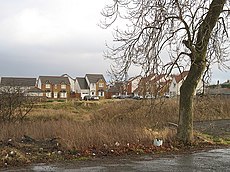
English: Bargeddie is a small town near Glasgow, Scotland, located east of the junction of the M73 and M8 motorways, situated 2 miles (3 km) west of Coatbridge town centre. Despite the decline of the coal, brickworks and steel industries the population has now grown to around 3,500 people; an aging population with precious few amenities to serve the young community.
Simple English: Bargeddie is a small town in North Lanarkshire, Scotland, located east of the junction of the M73 and M8 motorways, situated 2 miles (3 km) west of Coatbridge town centre. A location in the same area is named in Timothy Pont's map of 1595, but it appears to be originally spelt as Balgedy.
Subcategories
This category has the following 6 subcategories, out of 6 total.
B
- Baillieston Interchange (16 F)
- Bargeddie Parish Church (6 F)
- Bargeddie railway bridge (2 F)
- Bargeddie railway station (4 F)
- Bredisholm (9 F)
Media in category "Bargeddie"
The following 10 files are in this category, out of 10 total.
-
A8 near Coatbridge - geograph.org.uk - 724340.jpg 640 × 480; 47 KB
-
Approaching the Baillieston Interchange (geograph 3644729).jpg 3,264 × 2,448; 2.95 MB
-
Disused road, Bargeddie - geograph.org.uk - 1125050.jpg 640 × 480; 112 KB
-
Four Bridges - geograph.org.uk - 1482898.jpg 640 × 480; 108 KB
-
Langmuir Inn - geograph.org.uk - 87393.jpg 640 × 480; 95 KB
-
Line of Drumpeller railway - geograph.org.uk - 1815555.jpg 1,024 × 768; 859 KB
-
New housing, Bargeddie - geograph.org.uk - 1125069.jpg 640 × 480; 127 KB
-
Rail Bridge over A8 - geograph.org.uk - 1955900.jpg 1,961 × 1,160; 534 KB
-
Railway bridge at Bargeddie (geograph 7117315).jpg 1,024 × 683; 287 KB


