Category:Balnacoil
Jump to navigation
Jump to search
human settlement in Highland, Scotland, UK | |||||
| Upload media | |||||
| Instance of | |||||
|---|---|---|---|---|---|
| Location |
| ||||
 | |||||
English: Balnacoil , is a small crofting village, lying in the strath of Brora, one miles west of Loch Brora, in the east county of Sutherland, in Highland, Scotland. The River Brora, which rises in Ben Armine, runs through Balnacoil, draining into the loch.
Nederlands: Balnacoil ( Schots-Gaelisch: Baile na Coille) is een dorp in de Schotse Lieutenancy Sutherland in de council Highland in de buurt van Brora.
Media in category "Balnacoil"
The following 36 files are in this category, out of 36 total.
-
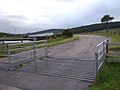 A cattle grid at Balnacoil - geograph.org.uk - 484976.jpg 640 × 480; 79 KB
-
 A line of pylons heading north - geograph.org.uk - 1335656.jpg 640 × 480; 49 KB
-
 Access to a tree-bounded paddock - geograph.org.uk - 484859.jpg 640 × 480; 55 KB
-
 Balnacoil Bridge - geograph.org.uk - 483736.jpg 640 × 480; 70 KB
-
 Balnacoil Hill - geograph.org.uk - 484984.jpg 640 × 480; 83 KB
-
 Balnacoil Lodge - geograph.org.uk - 484883.jpg 640 × 480; 98 KB
-
 Balnacoil Lodge - geograph.org.uk - 901682.jpg 640 × 394; 83 KB
-
 Balnacoil road - geograph.org.uk - 484881.jpg 640 × 480; 70 KB
-
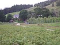
 Balnacoil, Strath Brora - geograph.org.uk - 854068.jpg 640 × 480; 85 KB
-

-
 County Council of Sutherland plaque - geograph.org.uk - 485012.jpg 640 × 480; 65 KB
-
 Disused turbine house at Ascoile. - geograph.org.uk - 1221745.jpg 640 × 480; 197 KB
-
 Downstream Allt a'Mhuilinn - geograph.org.uk - 484863.jpg 640 × 480; 87 KB
-
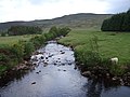
 Downstream River Brora - geograph.org.uk - 484876.jpg 640 × 480; 77 KB
-

-

-
 Point farm - geograph.org.uk - 485016.jpg 640 × 413; 58 KB
-
 Point Farm - geograph.org.uk - 901676.jpg 640 × 480; 82 KB
-
 River dam on the Gordonbush Estate. - geograph.org.uk - 1221736.jpg 640 × 480; 172 KB
-
 Roadside sheep near Balnacoil - geograph.org.uk - 1771346.jpg 640 × 480; 243 KB
-
 Shetland pony near Balnacoil - geograph.org.uk - 1771340.jpg 640 × 480; 165 KB
-
 Slopes of Balnacoil Hill - geograph.org.uk - 854066.jpg 640 × 480; 66 KB
-
 Strath Brora road - geograph.org.uk - 901657.jpg 640 × 480; 92 KB
-
 Track to Ascoile - NC8211 - geograph.org.uk - 484870.jpg 640 × 480; 105 KB
-
 Track to Balnacoil - geograph.org.uk - 774977.jpg 640 × 480; 113 KB
-
 Unfenced road up Strath Brora - geograph.org.uk - 485041.jpg 640 × 480; 66 KB
-
 Upstream Allt a'Mhuilinn - geograph.org.uk - 484866.jpg 640 × 480; 112 KB
-
 Upstream Black Water - geograph.org.uk - 485007.jpg 640 × 480; 84 KB
-
 Upstream River Brora - geograph.org.uk - 484880.jpg 640 × 480; 58 KB
-
 View across Black Water to Point - geograph.org.uk - 485010.jpg 640 × 480; 72 KB
-
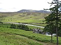
 View across Strath Brora - geograph.org.uk - 484842.jpg 640 × 480; 58 KB
-
 White pony near Balnacoil - geograph.org.uk - 1771336.jpg 640 × 479; 215 KB
-
 Woodland, Balnacoil - geograph.org.uk - 1087107.jpg 640 × 480; 90 KB
-
 Woodland, Balnacoil - geograph.org.uk - 854166.jpg 640 × 480; 126 KB
-
 Woods near Balnacoil - geograph.org.uk - 1111282.jpg 640 × 480; 112 KB
-


