Category:Balmashanner Hill
Jump to navigation
Jump to search
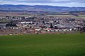
Balmashanner Hill is a mile (1.6 km) south of the centre of Forfar.
Subcategories
This category has only the following subcategory.
B
- Balmashanner Hill War Memorial (14 F)
Media in category "Balmashanner Hill"
The following 36 files are in this category, out of 36 total.
-
-
 Balmashanner Climb.jpg 825 × 1,100; 230 KB
-
 Balmashanner Dirt Path.jpg 825 × 1,100; 272 KB
-
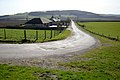
 Balmashanner Farm, near Forfar - geograph.org.uk - 941038.jpg 640 × 426; 55 KB
-
 Balmashanner Mound.jpg 1,100 × 825; 214 KB
-
 Balmashanner O2 Mast.jpg 825 × 1,100; 136 KB
-
 Balmashanner Plants.jpg 1,100 × 825; 261 KB
-
 Balmashanner Quarry.jpg 1,100 × 825; 285 KB
-
 Bummie Hole.jpg 1,100 × 825; 205 KB
-
 Bummie Path.jpg 1,100 × 825; 280 KB
-
 Bummie Plants.jpg 1,100 × 825; 263 KB
-
 Bummie Shelter.jpg 1,100 × 825; 219 KB
-
 Bummie Tree.jpg 825 × 1,100; 285 KB
-
 Disused Slate Quarry - geograph.org.uk - 1279570.jpg 640 × 427; 121 KB
-
 Gate To Balmashanner Quarry.jpg 1,100 × 825; 304 KB
-
 Gorse edged track near Balmashanner - geograph.org.uk - 402706.jpg 640 × 480; 142 KB
-
 Leanne Vandalizes Cliffs.jpg 1,100 × 825; 172 KB
-
 Lour Road Sign.jpg 825 × 1,100; 218 KB
-

-
 Path To Top.jpg 825 × 1,100; 165 KB
-
 Pathway Through Quarries.jpg 1,100 × 825; 140 KB
-
 Picturesque Balmashanner Cliff.jpg 1,000 × 750; 165 KB
-
 Quarry Pathway.jpg 1,100 × 825; 171 KB
-

-
 Signpost depicting Disused Quarry - geograph.org.uk - 1279560.jpg 640 × 426; 115 KB
-
 Spear Thistle, Balmashanner Hill, Angus, Scotland.jpg 825 × 1,100; 202 KB
-
 Spray Painted Cliff.jpg 1,100 × 825; 279 KB
-
 Thistle Up Balmashanner.jpg 1,100 × 825; 276 KB
-
 Through Path At Balmashanner.jpg 825 × 1,100; 130 KB
-
 View of Balmashanner Farmhouse - geograph.org.uk - 1216536.jpg 640 × 426; 132 KB
-
-

-

-
 Witches Gravestone.jpg 1,100 × 825; 176 KB
-
-
 South Leckaway Farm, Forfar - geograph.org.uk - 654529.jpg 640 × 425; 85 KB


