Category:Balintore, Angus
Jump to navigation
Jump to search

village in Angus, Scotland, UK  | |||||
| Upload media | |||||
| Instance of | |||||
|---|---|---|---|---|---|
| Location |
| ||||
 | |||||
Subcategories
This category has the following 3 subcategories, out of 3 total.
Media in category "Balintore, Angus"
The following 51 files are in this category, out of 51 total.
-
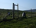
 A battered gate - geograph.org.uk - 604807.jpg 640 × 480; 70 KB
-
 A storm brewing - geograph.org.uk - 1123278.jpg 427 × 640; 187 KB
-
 Abbot's Cross, Strone Hill - geograph.org.uk - 1123262.jpg 640 × 427; 243 KB
-
 Auldallan - geograph.org.uk - 606371.jpg 640 × 480; 112 KB
-

-
 Barnton, Kirkton of Kingoldrum - geograph.org.uk - 1437476.jpg 640 × 426; 60 KB
-
 Baron's Hill - geograph.org.uk - 606400.jpg 640 × 480; 74 KB
-
 Cattle, Westerton - geograph.org.uk - 604560.jpg 640 × 480; 122 KB
-
 Fields near Greenmyre - geograph.org.uk - 489017.jpg 640 × 425; 90 KB
-
 Fields, Balintore - geograph.org.uk - 604565.jpg 640 × 480; 72 KB
-
 Foxgloves - geograph.org.uk - 488991.jpg 425 × 640; 167 KB
-
 Gairlaw - geograph.org.uk - 605660.jpg 640 × 480; 75 KB
-
 Gate above Auldallan - geograph.org.uk - 606355.jpg 640 × 480; 98 KB
-

-
 Langhillock Wood - geograph.org.uk - 603653.jpg 640 × 480; 82 KB
-
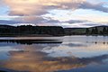
 Loch of Lintrathen - geograph.org.uk - 651259.jpg 640 × 426; 74 KB
-
 Loch of Lintrathen - geograph.org.uk - 651261.jpg 640 × 426; 39 KB
-
 Mile Hill - geograph.org.uk - 603699.jpg 640 × 480; 89 KB
-
 Mile Hill - geograph.org.uk - 605650.jpg 640 × 480; 89 KB
-
 Mounth road sign - geograph.org.uk - 603711.jpg 640 × 480; 91 KB
-
 Old gate posts - geograph.org.uk - 606341.jpg 640 × 480; 120 KB
-

-

-
 The Carrach - geograph.org.uk - 605695.jpg 640 × 480; 42 KB
-
 Tracks, Kinclune - geograph.org.uk - 606323.jpg 640 × 480; 90 KB
-
 Wheatfield, Kirkton of Kingoldrum - geograph.org.uk - 1437486.jpg 640 × 426; 80 KB
-
 Balintore - geograph.org.uk - 294573.jpg 640 × 470; 224 KB
-
 Brankam Hill from near Purgavie - geograph.org.uk - 362918.jpg 640 × 480; 85 KB
-
 Burn of Auldallan at Auldallan - geograph.org.uk - 362847.jpg 480 × 640; 143 KB
-
 Burn of Dairy - geograph.org.uk - 184637.jpg 640 × 480; 180 KB
-
 Burn of Quaichly - geograph.org.uk - 184633.jpg 640 × 489; 205 KB
-
 Houses at Purgavie - geograph.org.uk - 362907.jpg 640 × 480; 97 KB
-
 Inzion under darkening skies - geograph.org.uk - 362899.jpg 640 × 480; 58 KB
-
 New forestry plantation - geograph.org.uk - 184757.jpg 640 × 489; 115 KB
-
 Northern slopes of Mile Hill - geograph.org.uk - 604605.jpg 640 × 480; 75 KB
-
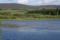 NW corner of Loch of Lintrathen - geograph.org.uk - 515157.jpg 640 × 426; 109 KB
-
 Pheasant feeding station - geograph.org.uk - 184640.jpg 640 × 480; 173 KB
-
 Ploughed field near Purgavie - geograph.org.uk - 362981.jpg 640 × 480; 63 KB
-
 Road beside the Quharity Burn - geograph.org.uk - 604582.jpg 640 × 480; 74 KB
-
 Road by Backwater reservoir - geograph.org.uk - 184606.jpg 640 × 489; 126 KB
-
 Shed at Knowehead of Auldallan - geograph.org.uk - 362860.jpg 640 × 480; 70 KB
-
 Sheep grazing at Braes of Coul - geograph.org.uk - 362883.jpg 640 × 480; 71 KB
-
 Sheep grazing below The Carrach - geograph.org.uk - 362936.jpg 640 × 480; 86 KB
-

-
 Stunted oak - geograph.org.uk - 606335.jpg 480 × 640; 103 KB
-
 The glen of the Burn of Corogle - geograph.org.uk - 361543.jpg 640 × 480; 75 KB
-
 The road to Auldallan and Balintore - geograph.org.uk - 362828.jpg 640 × 480; 77 KB
-
 The Welton roadend - geograph.org.uk - 362991.jpg 640 × 480; 79 KB
-
 Wester Coul roadend - geograph.org.uk - 362891.jpg 640 × 480; 72 KB
-
 Westerton - geograph.org.uk - 184754.jpg 640 × 480; 95 KB
-
 Workshop for Carpenter Oak and Woodland - geograph.org.uk - 158313.jpg 640 × 475; 110 KB


