Category:Bahnhof Nenningen
Jump to navigation
Jump to search
| Object location | | View all coordinates using: OpenStreetMap |
|---|

 | |||||
| Upload media | |||||
| Instance of | |||||
|---|---|---|---|---|---|
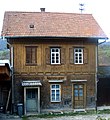
| Location | Lauterstein, Göppingen, Stuttgart Government Region, Baden-Württemberg, Germany | ||||
| Street address |
| ||||
| Connecting line |
| ||||
 | |||||
Media in category "Bahnhof Nenningen"
The following 6 files are in this category, out of 6 total.
-
 Bahnhof Nenningen 1.jpg 2,522 × 2,458; 755 KB
-
 Bahnhof Nenningen 2.jpg 2,647 × 1,753; 578 KB
-
 Bahnhof Nenningen 3.jpg 2,400 × 1,800; 682 KB
-
 Bahnhof Nenningen 4.jpg 2,627 × 2,037; 3.64 MB
-
 Bahnhof Nenningen.jpg 906 × 991; 488 KB
-
 Nenningen-Bahnhof.jpg 2,520 × 1,514; 2.05 MB


