Category:Bagijnetoren (Delft)
Jump to navigation
Jump to search
| Object location | | View all coordinates using: OpenStreetMap |
|---|
 | |||||
| Upload media | |||||
| Instance of | |||||
|---|---|---|---|---|---|
| Location | Delft, South Holland, Netherlands | ||||
| Located on street |
| ||||
| Heritage designation |
| ||||
| Inception |
| ||||
 | |||||
|
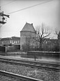
This is a category about rijksmonument number 12157
|
| Address |
|
Media in category "Bagijnetoren (Delft)"
The following 23 files are in this category, out of 23 total.
-
 Bagijnetoren - Delft.jpg 2,812 × 2,016; 1.49 MB
-
 Bagijnetoren anno 2007.jpg 2,304 × 3,072; 2.92 MB
-
 Bagjijnetoren2011.JPG 4,608 × 3,072; 5.15 MB
-
-
 Delft - 2013 - panoramio (902).jpg 2,048 × 1,536; 403 KB
-
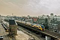 Delft VIRM 8734 als IC 2238 naar Amsterdam Centraal (16004081644).jpg 6,016 × 4,000; 17.96 MB
-
 Delft WaltorenBagijnetorenPhoenixstraat 20230809 ZichtVanafSpoorsingel versie2.jpg 4,026 × 3,019; 3.44 MB
-
 Delft WaltorenBagijnetorenPhoenixstraat 20230809 ZichtVanafSpoorsingel.jpg 2,838 × 3,548; 2.42 MB
-
 Delft, de Bagijnetoren RM12157 IMG 0508 2024-04-07 13.13.jpg 3,648 × 5,376; 12.99 MB
-

-
 Locatiekaart Bagijnetoren.jpg 250 × 187; 17 KB
-
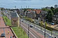
 Spoorsingel Delft 2020.jpg 4,000 × 3,000; 5.29 MB
-
 View from De Roos mill Delft 2018 4.jpg 3,264 × 4,928; 7.76 MB
-
 View from De Roos mill Delft 2018 5.jpg 4,928 × 3,264; 8.22 MB
-
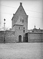
 Waltoren - Delft - 20403120 - RCE.jpg 958 × 1,200; 199 KB
-

-
 Waltoren Phoenixstraat 41 - Delft - 20048570 - RCE.jpg 1,200 × 803; 174 KB
-
 Waltoren Phoenixstraat 41 - Delft - 20048571 - RCE.jpg 807 × 1,200; 190 KB
-
 Waltoren Phoenixstraat 41 - Delft - 20048572 - RCE.jpg 815 × 1,200; 244 KB
-
-

-
 Waltoren, aanzicht - Delft - 20048562 - RCE.jpg 958 × 1,200; 188 KB
-
 Waltoren, aanzicht - Delft - 20048563 - RCE.jpg 958 × 1,200; 196 KB


.jpg)
.jpg)


