Category:Bagendon
Jump to navigation
Jump to search
village and civil parish in Gloucestershire, United Kingdom  | |||||
| Upload media | |||||
| Instance of | |||||
|---|---|---|---|---|---|
| Location | Cotswold, Gloucestershire, South West England, England | ||||
 | |||||
English: Bagendon is a village and civil parish in the Cotswold district of Gloucestershire, England, about four miles north of Cirencester. According to the 2001 census it had a population of 265.
Main Wikipedia article: Bagendon.

Subcategories
This category has the following 2 subcategories, out of 2 total.
B
- Bagendon War Memorial (2 F)
S
- St Margaret's church, Bagendon (11 F)
Media in category "Bagendon"
The following 113 files are in this category, out of 113 total.
-
 A field of cabbages - geograph.org.uk - 4749475.jpg 800 × 531; 120 KB
-

-
 A417 - half-mile to Quarry Junction - geograph.org.uk - 2089632.jpg 640 × 480; 47 KB
-
 A417 - River Churn viaduct - geograph.org.uk - 2089608.jpg 640 × 480; 62 KB
-
 A417 bridge over River Churn and A435 - geograph.org.uk - 3274908.jpg 1,024 × 768; 444 KB
-
 A417 bridge over the A435 - geograph.org.uk - 6318752.jpg 640 × 480; 88 KB
-
 A417 in cutting near Trinity Farm - geograph.org.uk - 5526897.jpg 640 × 375; 44 KB
-

-
 A417 near Pewets Copse - geograph.org.uk - 4240929.jpg 640 × 480; 43 KB
-
 A417 runs through a rock cutting - geograph.org.uk - 3675827.jpg 1,600 × 984; 207 KB
-
 A435 Cheltenham Road - geograph.org.uk - 3049318.jpg 1,024 × 634; 153 KB
-
 A435 junction with Welsh Way - geograph.org.uk - 2894785.jpg 3,648 × 2,736; 1.56 MB
-
 A435, Perrott's Brook - geograph.org.uk - 6318747.jpg 800 × 600; 150 KB
-
 Approaching the A435 at Perrots Brook - geograph.org.uk - 1288610.jpg 640 × 427; 114 KB
-
 Approaching the church - geograph.org.uk - 1551104.jpg 640 × 480; 122 KB
-
 Arable field near Woodmancote - geograph.org.uk - 4749471.jpg 800 × 531; 147 KB
-
 Bagendon from the north-west - geograph.org.uk - 5352690.jpg 640 × 360; 60 KB
-
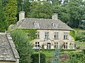
 Bagendon House - geograph.org.uk - 5352731.jpg 360 × 640; 47 KB
-
 Bagendon junction - geograph.org.uk - 1551048.jpg 640 × 459; 77 KB
-
 Bagendon Manor.jpg 4,000 × 3,000; 2.22 MB
-
 Bagendon War Memorial - geograph.org.uk - 4747721.jpg 680 × 1,024; 277 KB
-
 Bagendon War Memorial - geograph.org.uk - 4747722.jpg 531 × 800; 86 KB
-
 Bagendon War Memorial - geograph.org.uk - 4747724.jpg 800 × 531; 142 KB
-
 Burcombe Lane - geograph.org.uk - 4262156.jpg 800 × 531; 126 KB
-
 Burcombe Lane approaching Woodmancote - geograph.org.uk - 4264050.jpg 800 × 531; 146 KB
-

-
 Bus stop on the A435, Perrott's Brook - geograph.org.uk - 6318734.jpg 800 × 600; 127 KB
-
 Cheltenham Road (A435) - geograph.org.uk - 6318758.jpg 800 × 600; 104 KB
-
 Cirencester Bypass (A417) - geograph.org.uk - 3410856.jpg 640 × 480; 388 KB
-
 Club house, Cirencester Golf Club - geograph.org.uk - 6318754.jpg 800 × 519; 75 KB
-
 Cottages in Woodmancote - geograph.org.uk - 4264054.jpg 800 × 531; 109 KB
-
 Country road in Bagendon - geograph.org.uk - 4748672.jpg 800 × 531; 132 KB
-
 Country road to Bagendon - geograph.org.uk - 4747705.jpg 531 × 800; 195 KB
-
 Cutham Lane - geograph.org.uk - 1551251.jpg 640 × 480; 143 KB
-
 Cutham Lane, Perrott's Brook - geograph.org.uk - 6318742.jpg 800 × 600; 136 KB
-
 Cutting for Baunton by-pass - geograph.org.uk - 3274904.jpg 1,024 × 768; 434 KB
-
 Earthworks - geograph.org.uk - 1551669.jpg 640 × 480; 135 KB
-
 Electricity pylon - geograph.org.uk - 4748681.jpg 531 × 800; 82 KB
-
 Elizabeth II postbox on Cheltenham Road, Baunton - geograph.org.uk - 6319739.jpg 3,888 × 5,184; 3.93 MB
-

-
 Entrance to Manor Farm - geograph.org.uk - 4747717.jpg 800 × 531; 137 KB
-
 Fairview, Bagendon.jpg 4,000 × 3,000; 1.82 MB
-
 Farm buildings at Bagendon - geograph.org.uk - 4747716.jpg 800 × 531; 125 KB
-
 Farmland at Bagendon - geograph.org.uk - 4748675.jpg 800 × 531; 116 KB
-
 Farmland near Bagendon - geograph.org.uk - 4747707.jpg 800 × 531; 129 KB
-
 Farmland near Moor Wood Farm - geograph.org.uk - 4749479.jpg 1,024 × 680; 281 KB
-
 Farmland to the south of Woodmancote - geograph.org.uk - 4749469.jpg 1,024 × 680; 315 KB
-
 Field gate - geograph.org.uk - 4748677.jpg 800 × 531; 134 KB
-
 Field in Bagendon - geograph.org.uk - 4747712.jpg 800 × 531; 107 KB
-
 Ford at Halfpenny Hill - geograph.org.uk - 3683988.jpg 3,872 × 2,592; 1.3 MB
-
 Halfpenny Hill - geograph.org.uk - 1559613.jpg 640 × 480; 41 KB
-
 Hares Antiques, Bagendon - geograph.org.uk - 4747468.jpg 800 × 531; 104 KB
-
 Hares Antiques, Bagendon - geograph.org.uk - 4747469.jpg 800 × 531; 107 KB
-
 Heading towards Woodmancote - geograph.org.uk - 1288780.jpg 640 × 427; 59 KB
-
 House at Bagendon - geograph.org.uk - 1288668.jpg 640 × 427; 119 KB
-
 House on Cheltenham Road, Baunton - geograph.org.uk - 6319740.jpg 800 × 450; 114 KB
-
 House on the A435, Perrott's Brook - geograph.org.uk - 6318737.jpg 800 × 600; 76 KB
-
 Houses on the A435 - geograph.org.uk - 6318751.jpg 800 × 600; 112 KB
-
 Houses on the A435, Perrott's Brook - geograph.org.uk - 6318744.jpg 800 × 485; 74 KB
-
 Houses on Welsh Way, Perrott's Brook - geograph.org.uk - 6318741.jpg 800 × 600; 106 KB
-
 Junction in Bagendon - geograph.org.uk - 1288720.jpg 640 × 427; 60 KB
-
 Junction on the A435 - geograph.org.uk - 1288565.jpg 640 × 427; 61 KB
-
 K6 telephone kiosk in Bagendon.jpg 4,000 × 3,000; 1.42 MB
-
 Marchants' Downs - geograph.org.uk - 4749473.jpg 800 × 531; 117 KB
-
 No through road - geograph.org.uk - 1551163.jpg 640 × 480; 177 KB
-
 Old Cottage - geograph.org.uk - 1551133.jpg 640 × 541; 127 KB
-
 Old gate catch - geograph.org.uk - 1551126.jpg 570 × 640; 157 KB
-
 Old road to Bagendon - geograph.org.uk - 1553897.jpg 640 × 480; 136 KB
-
 Old Water Wheel in Bagendon - geograph.org.uk - 115126.jpg 640 × 480; 129 KB
-
 Public bridleway to Oysterwell - geograph.org.uk - 1551076.jpg 640 × 480; 65 KB
-
 Pylons crossing a Cotswold landscape - geograph.org.uk - 4748680.jpg 800 × 531; 72 KB
-
 Road approaching Bagendon - geograph.org.uk - 4747710.jpg 800 × 531; 191 KB
-
 Road in Bagendon - geograph.org.uk - 4748671.jpg 800 × 531; 123 KB
-
 Road through Bagendon - geograph.org.uk - 1288736.jpg 640 × 427; 76 KB
-
 Road through Bagendon - geograph.org.uk - 1448540.jpg 640 × 427; 71 KB
-
 Road to Upper End - geograph.org.uk - 1448527.jpg 640 × 427; 124 KB
-
 Road to Woodmancote - geograph.org.uk - 4749470.jpg 800 × 531; 117 KB
-
 Roadside cottage in Bagendon - geograph.org.uk - 1288704.jpg 640 × 427; 104 KB
-
 Roadsign and Bagendon War Memorial - geograph.org.uk - 4747726.jpg 531 × 800; 143 KB
-
 Sheep in a field of rough grazing - geograph.org.uk - 4748674.jpg 800 × 531; 130 KB
-
 St Margaret's Church - Bagendon, Gloucestershire - geograph.org.uk - 5891632.jpg 1,024 × 655; 208 KB
-

-
 St Margaret, Bagendon - Capital - geograph.org.uk - 3508087.jpg 1,000 × 737; 134 KB
-
 St Margaret, Bagendon - Font - geograph.org.uk - 3508085.jpg 615 × 1,000; 142 KB
-
 St Margaret, Bagendon - Porch detail - geograph.org.uk - 3508088.jpg 1,000 × 667; 275 KB
-
 St Margaret, Bagendon - Stained glass window - geograph.org.uk - 3508074.jpg 724 × 1,000; 293 KB
-
 St Margaret, Bagendon - Stained glass window - geograph.org.uk - 3508075.jpg 699 × 1,000; 255 KB
-
 St Margaret, Bagendon - Stained glass window - geograph.org.uk - 3508076.jpg 715 × 1,000; 254 KB
-
 St Margaret, Bagendon - Stained glass window - geograph.org.uk - 3508077.jpg 664 × 1,000; 219 KB
-
 St Margaret, Bagendon - Stained glass window - geograph.org.uk - 3508079.jpg 728 × 1,000; 268 KB
-
 St Margaret, Bagendon - Wall monument - geograph.org.uk - 3508080.jpg 681 × 1,000; 121 KB
-
 St Margaret, Bagendon - Wall monument - geograph.org.uk - 3508084.jpg 1,000 × 796; 138 KB
-
 Stone pump house^ - geograph.org.uk - 1551094.jpg 640 × 480; 101 KB
-
 Stream running under the road - geograph.org.uk - 1551139.jpg 640 × 480; 148 KB
-
 Thatch Cottage, Bagendon 01.jpg 4,000 × 3,000; 4.74 MB
-
 Thatch Cottage, Bagendon 02.jpg 4,000 × 3,000; 4.85 MB
-
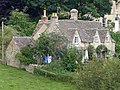
 Thatched cottage in Bagendon - geograph.org.uk - 1288683.jpg 640 × 427; 97 KB
-
 The lane through Bagendon - geograph.org.uk - 5352653.jpg 640 × 360; 59 KB
-
 The lane to Perrott's Brook - geograph.org.uk - 5089047.jpg 2,592 × 1,944; 2.3 MB
-
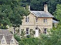
 The Old Rectory, Bagendon - geograph.org.uk - 4747728.jpg 800 × 531; 191 KB
-
 The Old Rectory, Bagendon.jpg 4,000 × 3,000; 1.77 MB
-
 The Old School - geograph.org.uk - 1551155.jpg 640 × 480; 133 KB
-
 Turning to Bagendon - geograph.org.uk - 1288650.jpg 640 × 427; 67 KB
-
 Upper End, Bagendon - geograph.org.uk - 1448516.jpg 640 × 427; 66 KB
-
 Upper End, Bagendon - geograph.org.uk - 5352709.jpg 640 × 360; 34 KB
-
 Upper End, Bagendon - geograph.org.uk - 5352736.jpg 640 × 360; 68 KB
-
 War memorial and junction, Bagendon - geograph.org.uk - 4748669.jpg 1,024 × 680; 353 KB
-
 War Memorial at junction - geograph.org.uk - 1551120.jpg 640 × 511; 88 KB
-
 Welsh Way 'Y' junction - geograph.org.uk - 2894850.jpg 3,268 × 2,474; 1.94 MB
-
 Where's the grass gone^ - geograph.org.uk - 5216001.jpg 4,000 × 3,000; 2 MB
-

-
 Country lane near Bagendon House. - geograph.org.uk - 286466.jpg 640 × 427; 121 KB
-
 The lane to Peewits Hill - geograph.org.uk - 296529.jpg 640 × 427; 123 KB


_-_geograph.org.uk_-_6318758.jpg)
_-_geograph.org.uk_-_3410856.jpg)


