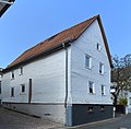
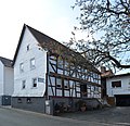
Category:Backhausgasse 10 (Anspach)
Jump to navigation
Jump to search
| Object location | | View all coordinates using: OpenStreetMap |
|---|
This is the category of the Hessian Kulturdenkmal (cultural monument) with the ID 100278 (Wikidata)
|
| Upload media | |||||
| Instance of | |||||
|---|---|---|---|---|---|
| Location | Neu-Anspach, Hochtaunuskreis, Darmstadt Government Region, Hesse, Germany | ||||
| Heritage designation | |||||
 | |||||
Media in category "Backhausgasse 10 (Anspach)"
The following 3 files are in this category, out of 3 total.
-
 Anspach, Backhausgasse 10 (1).jpg 4,880 × 4,792; 16.49 MB
-
 Anspach, Backhausgasse 10, Front.JPG 3,023 × 4,359; 5.63 MB
-
 Anspach, Backhausgasse 10.jpg 4,896 × 4,736; 16.26 MB
.jpg)

