Category:B7068 road (Scotland)
Jump to navigation
Jump to search
road in Scotland | |||||
| Upload media | |||||
| Instance of |
| ||||
|---|---|---|---|---|---|
| Location | Scotland | ||||
| Transport network |
| ||||
| |||||
Media in category "B7068 road (Scotland)"
The following 13 files are in this category, out of 13 total.
-
 A bridge on the B7068 - geograph.org.uk - 734069.jpg 479 × 629; 144 KB
-
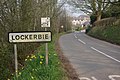 Approaching Lockerbie - geograph.org.uk - 380877.jpg 640 × 428; 120 KB
-
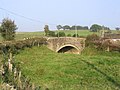
 Bridge over the Bloch Burn on the B7068 - geograph.org.uk - 261421.jpg 640 × 480; 109 KB
-
 Fallford Bridge over the Kirtle Water - geograph.org.uk - 261566.jpg 640 × 480; 72 KB
-
 House by the B7068 from Collin Bridge - geograph.org.uk - 261425.jpg 640 × 458; 51 KB
-
 Lockerbie - geograph.org.uk - 155245.jpg 640 × 480; 54 KB
-

-
 Road Bridge over the Wauchope Water - geograph.org.uk - 261597.jpg 640 × 480; 103 KB
-
 Telephone box, Lockerbie - geograph.org.uk - 1531860.jpg 640 × 480; 118 KB
-
 The B7068 - geograph.org.uk - 379717.jpg 640 × 480; 121 KB
-
 The B7068 near Crawthat - geograph.org.uk - 734064.jpg 635 × 472; 136 KB
-
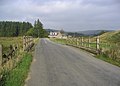
 The B7068 near Dunnabie - geograph.org.uk - 261440.jpg 640 × 480; 68 KB
-
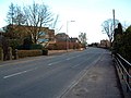
 Tundergarth Road, Lockerbie - geograph.org.uk - 380569.jpg 640 × 428; 96 KB


