Category:B269 road (England)
Jump to navigation
Jump to search

road in England | |||||
| Upload media | |||||
| Instance of |
| ||||
|---|---|---|---|---|---|
| Location | England | ||||
| Transport network |
| ||||
| |||||
Subcategories
This category has only the following subcategory.
L
- Limpsfield Road, Sanderstead (10 F)
Media in category "B269 road (England)"
The following 16 files are in this category, out of 16 total.
-
 B269 Titsey Road - geograph.org.uk - 50256.jpg 640 × 482; 62 KB
-
 B269, Main Rd, Crockham Hill - geograph.org.uk - 1501199.jpg 640 × 430; 148 KB
-
-
 Corner of Detillens Lane, Limpsfield (geograph 3485720).jpg 1,024 × 768; 290 KB
-
 Former Nonconformist Chapel, High Street, Limpsfield (NHLE Code 1029760).JPG 1,600 × 1,600; 471 KB
-
 High Street, Limpsfield, Surrey - geograph.org.uk - 1133991.jpg 640 × 482; 81 KB
-
 High Street, Limpsfield, Surrey - geograph.org.uk - 1134400.jpg 640 × 480; 103 KB
-

-

-
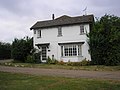
 Kent Hatch House - geograph.org.uk - 1755854.jpg 3,072 × 2,304; 1.7 MB
-
 Kent Hatch Road enters Surrey - geograph.org.uk - 1755851.jpg 3,072 × 2,304; 2.85 MB
-
 St Andrew's Church, Kent Hatch Road, Limpsfield Chart.JPG 2,500 × 1,800; 835 KB
-

-
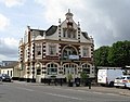 The 'Red Deer', South Croydon - geograph.org.uk - 1410094.jpg 571 × 447; 174 KB
-
 B269 north of Crockham Hill - geograph.org.uk - 1501704.jpg 640 × 430; 117 KB
-


.jpg)
.JPG)


