Category:B158 road (England)
Jump to navigation
Jump to search
road in England | |||||
| Upload media | |||||
| Instance of |
| ||||
|---|---|---|---|---|---|
| Location | England | ||||
| Transport network |
| ||||
| |||||
Subcategories
This category has the following 2 subcategories, out of 2 total.
F
- Fleet Road, Hampstead (8 F)
H
- Hornsmill Viaduct (4 F)
Media in category "B158 road (England)"
The following 13 files are in this category, out of 13 total.
-
 Essendon, B158 High Road - geograph.org.uk - 724041.jpg 640 × 480; 72 KB
-

-

-
 Grubbs Lane - geograph.org.uk - 141036.jpg 640 × 480; 119 KB
-
 Hertford Baptist Church - geograph.org.uk - 1303395.jpg 640 × 480; 70 KB
-
 Hertford, B158 Lower Hatfield Road - geograph.org.uk - 723906.jpg 640 × 480; 96 KB
-
-
 Junction of High Road and Cucumber Lane - geograph.org.uk - 1330713.jpg 640 × 480; 157 KB
-
 Kentish Lane - geograph.org.uk - 140110.jpg 640 × 480; 104 KB
-
 Part of the B158 known as Port Hill - geograph.org.uk - 1303480.jpg 640 × 480; 69 KB
-
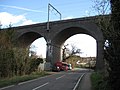
 Railway viaduct crossing Lower Hatfield Rd (1964).JPG 1,781 × 1,781; 1.01 MB
-
 The Harts Horns - geograph.org.uk - 196566.jpg 640 × 480; 121 KB
-


.JPG)

