Category:Azimuthal equidistant projection
Jump to navigation
Jump to search
English: This map-projection-related category exists in the following hierarchy:
- Category:Map projections
- Category:Maps by projection
- Category:Azimuthal equidistant projection – media related to the Azimuthal equidistant projection other than maps
- Category:Maps with azimuthal equidistant projection (“Category:azimuthal equidistant projections”) – maps made using the Azimuthal equidistant projection
azimuthal map projection  | |||||
| Upload media | |||||
| Instance of |
| ||||
|---|---|---|---|---|---|
| |||||
Subcategories
This category has only the following subcategory.
A
Media in category "Azimuthal equidistant projection"
The following 18 files are in this category, out of 18 total.
-
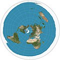 Azimuthal equidistant projection SW.jpg 2,058 × 2,058; 975 KB
-
 Usgs map azimuthal equidistant.PNG 487 × 162; 46 KB
-
 USGS map azimuthal tall.gif 290 × 335; 32 KB
-
 Azimuthal Equidistant 90.jpg 1,024 × 1,024; 280 KB
-
 Azimuthal Equidistant Berlin.jpg 1,024 × 1,024; 296 KB
-
 Azimuthal Equidistant Canberra.jpg 4,096 × 4,096; 3.23 MB
-
 Azimuthal Equidistant N0E0.jpg 4,096 × 4,096; 3.23 MB
-
 Azimuthal Equidistant N90.jpg 4,096 × 4,096; 2.9 MB
-
 Azimuthal equidistant projection south SW.jpg 2,058 × 2,058; 1.17 MB
-
 Azimuthal Equidistant S90.jpg 4,096 × 4,096; 3.16 MB
-
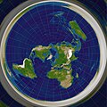
 Blue Marble 2002 Azimuthal Highres.png 10,800 × 10,800; 74.54 MB
-
 Cambridge azimuthal equidistant.png 1,024 × 1,024; 857 KB
-
 Global shield.png 401 × 401; 40 KB
-
 Gott-Goldberg-Vanderbei Projection.png 2,058 × 1,037; 2.73 MB
-
 PeterW zt 5.png 7,680 × 4,320; 172 KB
-
 PeterW zt ani equidistant701 periodic.gif 7,680 × 4,320; 681 KB
-
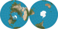
 Proyección Acimutal Equidistante Antártico.jpg 997 × 1,000; 684 KB
-
 Valeriepieris circle azimuthal equidistant.png 1,024 × 1,024; 1.21 MB


