Category:Aylsham
Jump to navigation
Jump to search
market town on the River Bure in north Norfolk, England  | |||||
| Upload media | |||||
| Instance of | |||||
|---|---|---|---|---|---|
| Location | Broadland, Norfolk, East of England, England | ||||
| Population |
| ||||
| Area |
| ||||
| Said to be the same as | Aylsham (Wikimedia duplicated page, civil parish) | ||||
 | |||||
Subcategories
This category has the following 16 subcategories, out of 16 total.
- History of Aylsham (3 F)
A
- Aylsham Show (19 F)
B
- Bridges in Aylsham (12 F)
- James Bulwer (1 P, 98 F)
- River Bure at Aylsham (7 F)
C
G
- Graffiti in Aylsham (5 F)
M
N
S
- Signs in Aylsham (8 F)
T
Media in category "Aylsham"
The following 200 files are in this category, out of 561 total.
(previous page) (next page)-

-
 A corner of Aylsham Market Place - geograph.org.uk - 2455323.jpg 2,592 × 3,888; 3.18 MB
-
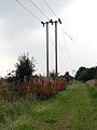
 A frosty track - geograph.org.uk - 1077702.jpg 480 × 640; 165 KB
-
 A gap in the hedgerow - geograph.org.uk - 1293721.jpg 640 × 480; 112 KB
-
 A long fence - geograph.org.uk - 639272.jpg 480 × 640; 107 KB
-
 A narrow path - geograph.org.uk - 1293267.jpg 480 × 640; 148 KB
-
 A shaded path - geograph.org.uk - 1293732.jpg 640 × 480; 128 KB
-
 A simple wooden seat - geograph.org.uk - 984089.jpg 640 × 480; 152 KB
-
 A stunning field of Purple Allium flowers - geograph.org.uk - 3600068.jpg 3,264 × 2,448; 2.62 MB
-
 A sunny day in early May - geograph.org.uk - 1293372.jpg 640 × 480; 148 KB
-
 A track called Green Lane - geograph.org.uk - 1293689.jpg 480 × 640; 147 KB
-

-
 Abel Heath - The National Trust - geograph.org.uk - 4177788.jpg 4,320 × 3,240; 6.17 MB
-
 Access to Mill Road - geograph.org.uk - 1293834.jpg 480 × 640; 151 KB
-
 Adorned with a red heart - detail - geograph.org.uk - 984268.jpg 480 × 640; 144 KB
-
 Adorned with a red heart - geograph.org.uk - 984261.jpg 450 × 640; 90 KB
-
 Alleyway past back gardens - geograph.org.uk - 1293822.jpg 480 × 640; 146 KB
-
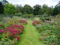
 Allotment gardens - geograph.org.uk - 1290709.jpg 640 × 480; 129 KB
-
 Allotment gardens in early May - geograph.org.uk - 1290704.jpg 640 × 480; 143 KB
-
 Allotments adjacent to Aylsham Cemetery - geograph.org.uk - 5294472.jpg 640 × 528; 339 KB
-
 Allotments adjoining Aylsham Cemetery - geograph.org.uk - 5294463.jpg 640 × 585; 408 KB
-
 Allotments adjoining Aylsham Cemetery - geograph.org.uk - 5294465.jpg 640 × 480; 356 KB
-
 Allotments beside the railway track - geograph.org.uk - 1290702.jpg 640 × 480; 119 KB
-
 Allotments west of Aylsham Cemetery - geograph.org.uk - 5294469.jpg 640 × 480; 347 KB
-
 An interesting gate at Heydon Road farm - geograph.org.uk - 4600339.jpg 640 × 480; 166 KB
-
 Apple trees - geograph.org.uk - 984194.jpg 640 × 480; 196 KB
-
 Apple trees and fieldfares, Drabblegate - geograph.org.uk - 1093275.jpg 640 × 480; 134 KB
-
 Approaching Aylsham - geograph.org.uk - 2455233.jpg 2,592 × 3,888; 3.3 MB
-
 Approaching Aylsham station - geograph.org.uk - 2455234.jpg 3,888 × 2,592; 4.45 MB
-
 Approaching Aylsham station - geograph.org.uk - 2455240.jpg 3,888 × 2,592; 3.4 MB
-
 Approaching the A140 - geograph.org.uk - 2455228.jpg 2,592 × 3,888; 2.79 MB
-
 Approaching the level crossing near Spratt's Green Farm - geograph.org.uk - 2454701.jpg 2,592 × 3,888; 3.45 MB
-
 Approaching Tuttington Road - geograph.org.uk - 1077690.jpg 640 × 480; 144 KB
-
 Auction car park - geograph.org.uk - 5210244.jpg 480 × 640; 56 KB
-
 Old School Chapel in Banningham Road - geograph.org.uk - 539643.jpg 480 × 640; 91 KB
-
 Aylsham - information board - geograph.org.uk - 2455342.jpg 2,592 × 3,888; 3.7 MB
-
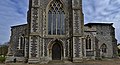
 Aylsham - St Michaels Church - geograph.org.uk - 3286408.jpg 1,024 × 768; 168 KB
-
 Aylsham Cawston Rd Mill.jpg 480 × 640; 88 KB
-
 Aylsham Church - geograph.org.uk - 6264304.jpg 4,608 × 3,456; 4.44 MB
-
 Aylsham Hospital (closed) south facade - geograph.org.uk - 5620768.jpg 3,456 × 2,592; 3.82 MB
-
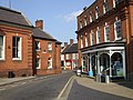
 Aylsham Market Place - geograph.org.uk - 3286393.jpg 1,024 × 768; 160 KB
-
 Aylsham Market Place - geograph.org.uk - 3657816.jpg 800 × 452; 233 KB
-
 Aylsham Market Place - geograph.org.uk - 3914835.jpg 640 × 480; 53 KB
-
 Aylsham Plant Hire - geograph.org.uk - 3680908.jpg 640 × 428; 103 KB
-
 Aylsham Post Office - geograph.org.uk - 519180.jpg 434 × 628; 51 KB
-
 Aylsham Railway Station - geograph.org.uk - 4573482.jpg 2,912 × 2,181; 2.09 MB
-
 Aylsham Railway Station - geograph.org.uk - 4573510.jpg 3,072 × 2,304; 1.76 MB
-
 Aylsham Railway Station Platform - geograph.org.uk - 4573500.jpg 3,072 × 2,304; 1.93 MB
-
 Aylsham Railway Station Platform - geograph.org.uk - 4573508.jpg 3,072 × 2,304; 1.92 MB
-
 Aylsham Railway Station Platform - geograph.org.uk - 4573512.jpg 3,072 × 2,304; 1.81 MB
-
 Aylsham Railway Station Platform - geograph.org.uk - 4573553.jpg 2,304 × 3,072; 2.28 MB
-
 Aylsham Railway Station sign - geograph.org.uk - 4573517.jpg 2,304 × 3,072; 2.79 MB
-
 Aylsham St Michael's church - geograph.org.uk - 2207448.jpg 700 × 525; 183 KB
-
 Aylsham station, Bure Valley Railway - geograph.org.uk - 3680894.jpg 640 × 480; 120 KB
-
 Aylsham to Wroxham Railway sign - geograph.org.uk - 4573471.jpg 2,291 × 3,046; 3.01 MB
-
 Aylsham town centre - geograph.org.uk - 5210549.jpg 480 × 640; 45 KB
-
-
 Aylsham, St Michael's Church - geograph.org.uk - 4482356.jpg 4,053 × 2,689; 5.6 MB
-
 Aylsham, St Michael's Church - geograph.org.uk - 4482382.jpg 5,227 × 2,994; 7.58 MB
-
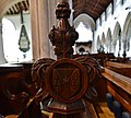
 Aylsham, St Michael's Church, Poppy head - geograph.org.uk - 4482434.jpg 3,638 × 2,383; 3.76 MB
-
 Aylsham, St Michael's Church, Poppy head - geograph.org.uk - 4482436.jpg 3,678 × 2,456; 4.24 MB
-
 Aylsham, St Michael's Church, Poppy head - geograph.org.uk - 4482440.jpg 3,576 × 2,286; 3.42 MB
-
 Aylsham, St Michael's Church, Poppy head - geograph.org.uk - 4482442.jpg 3,576 × 3,207; 3.97 MB
-
 Aylsham, St Michael's Church, Stained glass window - geograph.org.uk - 4482426.jpg 3,662 × 2,787; 5.53 MB
-
 Aylsham, St Michael's Church, Stained glass window - geograph.org.uk - 4482429.jpg 3,678 × 2,455; 4.07 MB
-

-
 Aylsham, St Michael's Church, The 15th century font - geograph.org.uk - 4482389.jpg 5,520 × 3,680; 7.65 MB
-
 Aylsham, St Michael's Church, The 15th century font - geograph.org.uk - 4482394.jpg 3,678 × 2,456; 4.3 MB
-
 Aylsham, St Michael's Church, The 15th century font - geograph.org.uk - 4482402.jpg 5,406 × 3,502; 6.99 MB
-
 Aylsham, St Michael's Church, The 15th century font - geograph.org.uk - 4482407.jpg 5,416 × 3,516; 7.52 MB
-
 Aylsham, St Michael's Church, The 15th century font - geograph.org.uk - 4482411.jpg 3,680 × 3,456; 5.34 MB
-
 Aylsham, St Michael's Church, The 15th century porch - geograph.org.uk - 4482380.jpg 4,005 × 2,640; 6.42 MB
-
 Aylsham, St Michael's Church, The Nave - geograph.org.uk - 4482412.jpg 5,520 × 3,680; 7.42 MB
-
 Aylsham, St Michael's Church, The Nave - geograph.org.uk - 4482420.jpg 3,678 × 2,456; 4.12 MB
-
 Aylsham, St Michael's Church, The Nave - geograph.org.uk - 4482430.jpg 5,227 × 3,070; 7.1 MB
-
 Aylsham, St Michael's Church, The Nave and Clerestory - geograph.org.uk - 4482416.jpg 5,512 × 3,670; 7.63 MB
-
 Aylsham, St Michael's Church, The Nave from the South Aisle - geograph.org.uk - 4482417.jpg 4,669 × 3,050; 6.14 MB
-
 Aylsham, St Michael's Church, The tower - geograph.org.uk - 4482361.jpg 3,678 × 2,456; 5.42 MB
-
 Aylsham, St Michael's Church, The tower - geograph.org.uk - 4482371.jpg 4,398 × 2,375; 5.92 MB
-
 Aylsham, St Michael's Church, The tower - geograph.org.uk - 4482373.jpg 3,592 × 2,316; 5.21 MB
-

-
 Aylsham1.JPG 2,304 × 1,728; 1.31 MB
-
 Barn at the Old Mill - geograph.org.uk - 885449.jpg 640 × 480; 196 KB
-
 Bees actively gathering food from Purple Allium plants - geograph.org.uk - 3600074.jpg 2,448 × 3,264; 1.65 MB
-
 Bend in Bolwick Lane - geograph.org.uk - 5294394.jpg 640 × 480; 475 KB
-
 Bend in Tuttington Road - geograph.org.uk - 4156762.jpg 640 × 480; 151 KB
-
 Black Boys Inn, Aylsham - geograph.org.uk - 2270251.jpg 640 × 480; 146 KB
-
 Black Boys Inn, Market Place, Aylsham - geograph.org.uk - 5978542.jpg 1,600 × 1,064; 628 KB
-
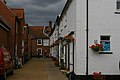
 Blofield's Loke, Aylsham - geograph.org.uk - 1407050.jpg 640 × 487; 135 KB
-
 Blofield's Loke, Aylsham - geograph.org.uk - 4135253.jpg 1,600 × 1,064; 340 KB
-
 Blueloo.jpg 1,728 × 2,304; 1.66 MB
-
 Bolwick Hall, Marsham - geograph.org.uk - 2711446.jpg 1,200 × 1,600; 680 KB
-
 Bolwick Lane approaching Bolwick Hall - geograph.org.uk - 5294390.jpg 640 × 480; 324 KB
-

-
 Bolwick Lane past Hall Farm - geograph.org.uk - 5294392.jpg 640 × 480; 309 KB
-
 Bordering onto the churchyard - geograph.org.uk - 622514.jpg 640 × 480; 66 KB
-
 Bread Source, Aylsham - geograph.org.uk - 3657820.jpg 800 × 600; 306 KB
-
 Brick, flint and wickerwork - geograph.org.uk - 881978.jpg 480 × 640; 194 KB
-
 Bridge over the canal - geograph.org.uk - 885804.jpg 640 × 480; 163 KB
-
 Bridge over the Marriott's Way - geograph.org.uk - 1189115.jpg 640 × 480; 136 KB
-
 Budgens Supermarket in Aylsham - geograph.org.uk - 4764338.jpg 640 × 480; 53 KB
-
 Bure Meadows development, Aylsham - geograph.org.uk - 5515100.jpg 1,600 × 1,200; 198 KB
-
 Bure Meadows marketing suite - geograph.org.uk - 5515105.jpg 1,600 × 1,200; 228 KB
-
 Bure Valley Path and Railway - geograph.org.uk - 2451646.jpg 3,888 × 2,592; 3.93 MB
-
 Bure Valley Railway level crossing - geograph.org.uk - 2451653.jpg 3,888 × 2,592; 3.02 MB
-

-
 Chip shop fire on Red Lion Street - geograph.org.uk - 6335761.jpg 5,312 × 2,988; 5.29 MB
-
 Christmas lights - geograph.org.uk - 632478.jpg 462 × 639; 49 KB
-
 Church Farm, Banningham - geograph.org.uk - 2329731.jpg 760 × 570; 166 KB
-
 Clarke's store under renovation - geograph.org.uk - 6260498.jpg 4,444 × 2,500; 7.52 MB
-
 Clover family headstone, Aylsham, Norfolk.jpg 1,080 × 1,440; 769 KB
-
 Commercial grain silos - geograph.org.uk - 885469.jpg 640 × 480; 133 KB
-
 Construction area, Bure Meadows - geograph.org.uk - 5515112.jpg 1,600 × 1,200; 164 KB
-
 Copeman Road, Aylsham - geograph.org.uk - 3816256.jpg 640 × 480; 46 KB
-
 Cottage by the Cromer Road - geograph.org.uk - 3657900.jpg 800 × 600; 306 KB
-
 Cottages in Mill Row - geograph.org.uk - 881944.jpg 640 × 480; 135 KB
-
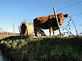 Cow and calf in Stonegate, Aylsham - geograph.org.uk - 5608213.jpg 3,456 × 2,592; 3.9 MB
-
 Cow parsley flowering in abundance - geograph.org.uk - 1293694.jpg 640 × 480; 150 KB
-
 Cow parsley on the Marriotts Way - geograph.org.uk - 1293338.jpg 640 × 480; 128 KB
-
 Cromer Road - geograph.org.uk - 622522.jpg 480 × 640; 113 KB
-
 Cromer Road approaching Lodge Farm - geograph.org.uk - 539752.jpg 640 × 480; 109 KB
-
 Culverted drain - geograph.org.uk - 1290648.jpg 480 × 640; 153 KB
-
 Date stone on bridge - geograph.org.uk - 885809.jpg 640 × 480; 135 KB
-
 Derelict building in Sankence Lane - geograph.org.uk - 5608209.jpg 3,456 × 2,592; 3.93 MB
-
 Disused railway bridge over Cawston Road - geograph.org.uk - 1293258.jpg 640 × 480; 109 KB
-
 Disused railway bridge over Cawston Road - geograph.org.uk - 1293272.jpg 640 × 473; 138 KB
-
 Drabblegate - geograph.org.uk - 3680943.jpg 640 × 480; 211 KB
-
 Drabblegate Common - geograph.org.uk - 1093241.jpg 640 × 268; 42 KB
-
 Drabblegate past Bure River Cottage - geograph.org.uk - 539662.jpg 640 × 480; 92 KB
-
 Driveway to Manor Farm - geograph.org.uk - 687152.jpg 480 × 640; 173 KB
-
 Duckers Funeral Services - geograph.org.uk - 883824.jpg 640 × 480; 193 KB
-
 Dunkirk, NR11 6SU - geograph.org.uk - 6120477.jpg 3,456 × 2,592; 3.96 MB
-
 E.T. Daniell - Anchor Inn or Bridge House, Aylsham.jpg 1,280 × 891; 318 KB
-
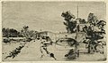 E.T. Daniell - Landscape with Bridge, Millgate, Aylsham.jpg 1,280 × 753; 202 KB
-
 Electricity sub-station - geograph.org.uk - 1293941.jpg 640 × 480; 114 KB
-

-
 Elizabeth II-reign postbox - geograph.org.uk - 883783.jpg 480 × 640; 190 KB
-
 Emmanuel church - graveyard - geograph.org.uk - 883856.jpg 640 × 480; 169 KB
-
 Entrance to Farm Machinery Dealership - geograph.org.uk - 883779.jpg 640 × 460; 149 KB
-
 Entrance to Tesco's carpark - geograph.org.uk - 1189098.jpg 480 × 640; 128 KB
-
 Entrance to the Bure Valley School - geograph.org.uk - 622385.jpg 638 × 440; 53 KB
-
 Entrance to the former gasworks - geograph.org.uk - 891398.jpg 640 × 467; 147 KB
-
 Entrance to the Weavers Way, Aylsham - geograph.org.uk - 2270263.jpg 640 × 480; 150 KB
-
 Entrance to Weavers' Way off Blickling Road - geograph.org.uk - 4134886.jpg 1,600 × 1,064; 589 KB
-
 Evergreen trees and thick underbrush - geograph.org.uk - 5608207.jpg 3,456 × 2,592; 3.94 MB
-
 Exercising the dogs - geograph.org.uk - 1189143.jpg 594 × 587; 168 KB
-
 Fallen trees - geograph.org.uk - 639276.jpg 480 × 640; 110 KB
-
 Farm building at Church Farm, Banningham - geograph.org.uk - 2329730.jpg 760 × 570; 142 KB
-

-

-
 Farmland between Blickling and Aylsham - geograph.org.uk - 4177779.jpg 4,320 × 3,240; 5.92 MB
-
-
 Field beside the Weavers Way - geograph.org.uk - 984243.jpg 640 × 444; 100 KB
-
 Field north of Bolwick Hall - geograph.org.uk - 5294387.jpg 640 × 480; 390 KB
-
 Fig Tree (Ficus Carica) - geograph.org.uk - 562732.jpg 480 × 640; 79 KB
-
 Fire and Ambulance Station - geograph.org.uk - 622439.jpg 638 × 458; 44 KB
-
 Fire Station on Cawston Road, Aylsham - geograph.org.uk - 5978538.jpg 1,600 × 1,064; 596 KB
-
 Fire Station, Cawston Road, Aylsham - geograph.org.uk - 1042781.jpg 640 × 480; 64 KB
-
-
 Flowering oilseed rape - geograph.org.uk - 1293294.jpg 640 × 480; 125 KB
-
-
 Flush Bracket OSBM S9590, Aylsham, Church - geograph.org.uk - 5076949.jpg 960 × 1,280; 353 KB
-
 Footpath along Cromer Road, Aylsham - geograph.org.uk - 2457359.jpg 2,592 × 3,888; 4.08 MB
-
 Footpath by Bure Valley Railway - geograph.org.uk - 3678455.jpg 640 × 480; 198 KB
-
 Footpath from St Michael's church yard - geograph.org.uk - 2455386.jpg 2,592 × 3,888; 5.69 MB
-

-

-
 Footpath through sheep pasture - geograph.org.uk - 1012449.jpg 640 × 425; 103 KB
-
 Footpath through St Michael's Church yard, Aylsham - geograph.org.uk - 2455397.jpg 3,888 × 2,592; 4.76 MB
-
 Footpath to Aylsham - geograph.org.uk - 1290693.jpg 480 × 640; 88 KB
-
 Footpath towards Ingworth - geograph.org.uk - 3680949.jpg 640 × 480; 158 KB
-
 Former East Norfolk Railway crossing - geograph.org.uk - 1244676.jpg 640 × 480; 88 KB
-
 Former Level Crossing - geograph.org.uk - 1811728.jpg 800 × 531; 84 KB
-
 Former savings bank, Aylsham Market Place - geograph.org.uk - 2455332.jpg 3,888 × 2,592; 3.13 MB
-
 From gasworks to gardens - geograph.org.uk - 891419.jpg 640 × 471; 159 KB
-
 Game bird feeders - geograph.org.uk - 1012520.jpg 480 × 640; 170 KB
-

-
 Gardens at Bolwick Hall, Marsham - geograph.org.uk - 2711451.jpg 1,600 × 1,200; 699 KB
-
 Gasworks - now disused - geograph.org.uk - 891409.jpg 640 × 480; 152 KB
-
 Gate at drain - geograph.org.uk - 1290646.jpg 480 × 640; 149 KB
-
 Gate of India restaurant, Aylsham Market Place - geograph.org.uk - 4135245.jpg 1,064 × 1,600; 319 KB
-
 Gate on the Marriott's Way - geograph.org.uk - 1189133.jpg 640 × 480; 93 KB
-
 Gate on the Weavers Way - geograph.org.uk - 984139.jpg 640 × 480; 82 KB
-
 Gated entrance to Warren House - geograph.org.uk - 3975513.jpg 640 × 480; 208 KB
-
 Gone to seed - geograph.org.uk - 984097.jpg 480 × 640; 98 KB
-

-
 Grassland between Orchard Lane and Norwich Road - geograph.org.uk - 3600587.jpg 3,264 × 2,448; 2.49 MB
-
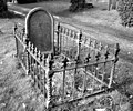 Grave with ornamental railing - geograph.org.uk - 5294457.jpg 640 × 531; 314 KB
-
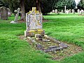
 Graves in Aylsham Cemetery - geograph.org.uk - 5294428.jpg 640 × 564; 506 KB
-
 Graves in Aylsham Cemetery - geograph.org.uk - 5294431.jpg 640 × 539; 507 KB
-
 Graves in Aylsham Cemetery - geograph.org.uk - 5294433.jpg 640 × 480; 459 KB
-
 Graves in Aylsham Cemetery - geograph.org.uk - 5294445.jpg 640 × 480; 433 KB
-
 Graves in Aylsham Cemetery - geograph.org.uk - 5294446.jpg 640 × 538; 445 KB
-
 Graves in Aylsham Cemetery - geograph.org.uk - 5294448.jpg 640 × 480; 470 KB
-
 Graves in Aylsham Cemetery - geograph.org.uk - 5294451.jpg 640 × 595; 343 KB
-
 Graves in Aylsham Cemetery - geograph.org.uk - 5294491.jpg 640 × 582; 453 KB
-
 Gravestone in Aylsham Cemetery - geograph.org.uk - 5294452.jpg 640 × 548; 340 KB
-
 Gravestones in Aylsham Cemetery - geograph.org.uk - 5294414.jpg 640 × 537; 277 KB
-
 Gravestones in Aylsham Cemetery - geograph.org.uk - 5294453.jpg 640 × 612; 588 KB
-
 Gravestones in Aylsham Cemetery - geograph.org.uk - 5294488.jpg 640 × 613; 582 KB


_south_facade_-_geograph.org.uk_-_5620768.jpg)


_-_geograph.org.uk_-_5294397.jpg)


_-_geograph.org.uk_-_562732.jpg)


