Category:Aylesby
Jump to navigation
Jump to search
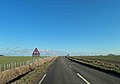
English: Aylesby is a small village and civil parish in North East Lincolnshire, England. The population at the 2001 census was 135. It is situated near the A18 road, west of Grimsby and north of Laceby.
village in the United Kingdom  | |||||
| Upload media | |||||
| Instance of | |||||
|---|---|---|---|---|---|
| Location | North East Lincolnshire, Lincolnshire, Yorkshire and the Humber, England | ||||
 | |||||
Subcategories
This category has the following 2 subcategories, out of 2 total.
L
- St Lawrence, Aylesby (5 F)
Media in category "Aylesby"
The following 148 files are in this category, out of 148 total.
-
 90 degree Bend ahead on the Aylesby Road - geograph.org.uk - 3314461.jpg 1,024 × 768; 121 KB
-
 A White House - geograph.org.uk - 306295.jpg 640 × 480; 100 KB
-

-
 A18 heading south east - geograph.org.uk - 4061248.jpg 640 × 480; 63 KB
-

-
 Access track to a wind turbine - geograph.org.uk - 4961781.jpg 1,024 × 768; 139 KB
-
 Almshouses on Aylesby Road, Aylesby - geograph.org.uk - 5545175.jpg 1,600 × 1,065; 571 KB
-
 Approaching a Plantation on Aylesby Lane - geograph.org.uk - 4961606.jpg 1,024 × 768; 129 KB
-
 Approaching A18 from Aylesby - geograph.org.uk - 3011489.jpg 640 × 459; 76 KB
-

-
 Approaching Laceby Junction - geograph.org.uk - 306281.jpg 640 × 480; 93 KB
-
 Ash tree above a bean field - geograph.org.uk - 4969211.jpg 1,024 × 768; 179 KB
-
 Aylesby farmland - geograph.org.uk - 1186466.jpg 640 × 426; 79 KB
-
 Aylesby Lane - geograph.org.uk - 2124409.jpg 640 × 427; 127 KB
-
 Aylesby Lane - geograph.org.uk - 2124414.jpg 640 × 427; 114 KB
-
 Aylesby Lane - geograph.org.uk - 236326.jpg 640 × 480; 103 KB
-
 Aylesby Lane - geograph.org.uk - 4061278.jpg 640 × 480; 63 KB
-
 Aylesby Lane - geograph.org.uk - 4962077.jpg 1,024 × 768; 200 KB
-
 Aylesby Lane - geograph.org.uk - 4962089.jpg 1,024 × 768; 193 KB
-
 Aylesby Lane after the rain - geograph.org.uk - 3199882.jpg 640 × 427; 126 KB
-
 Aylesby Lane from Aylesby Road - geograph.org.uk - 5545435.jpg 1,600 × 1,065; 778 KB
-
 Aylesby Lane towards Healing - geograph.org.uk - 5545440.jpg 1,600 × 1,065; 662 KB
-
 Aylesby Lane towards Healing - geograph.org.uk - 5545448.jpg 1,600 × 1,065; 521 KB
-
 Aylesby Lane towards Healing - geograph.org.uk - 5545451.jpg 1,600 × 1,065; 556 KB
-
 Aylesby Lane towards Healing - geograph.org.uk - 5545455.jpg 1,600 × 1,065; 582 KB
-
 Aylesby Lane towards Healing - geograph.org.uk - 5545507.jpg 1,600 × 1,065; 578 KB
-
 Aylesby Road - geograph.org.uk - 2124411.jpg 640 × 427; 80 KB
-
 Aylesby Road - geograph.org.uk - 4061282.jpg 640 × 480; 49 KB
-
 Aylesby Road - geograph.org.uk - 4061287.jpg 640 × 480; 53 KB
-
 Aylesby Road, Aylesby - geograph.org.uk - 5545424.jpg 1,600 × 1,065; 629 KB
-
 Barley and Pyewipe Farm - geograph.org.uk - 4961766.jpg 1,024 × 768; 129 KB
-
 Bean field near Pyewipe Farm - geograph.org.uk - 4969331.jpg 1,024 × 768; 216 KB
-
 Bend in Aylesby road - geograph.org.uk - 3011445.jpg 640 × 420; 40 KB
-
 Bend in road near sheep wash - geograph.org.uk - 3011485.jpg 640 × 435; 46 KB
-
 Bridge over Laceby Beck - geograph.org.uk - 4969159.jpg 1,024 × 768; 236 KB
-
 Bridge over Laceby Beck - geograph.org.uk - 4969351.jpg 1,024 × 768; 220 KB
-

-
 Bridge over the River Freshney - geograph.org.uk - 4978333.jpg 640 × 427; 71 KB
-
 Bridleway from Healing approaching Aylesby Road - geograph.org.uk - 4962031.jpg 1,024 × 768; 172 KB
-
 Bridleway to Aylesby Road - geograph.org.uk - 4961772.jpg 1,024 × 768; 200 KB
-
 Bridleway to Healing - geograph.org.uk - 4961615.jpg 1,024 × 768; 165 KB
-
 Bridleway to Healing - geograph.org.uk - 4961785.jpg 1,024 × 768; 155 KB
-
 Bridleway to Pyewipe Farm, Aylesby - geograph.org.uk - 4978301.jpg 640 × 427; 54 KB
-
 Bridleway to the A46 - geograph.org.uk - 4969334.jpg 1,024 × 768; 196 KB
-
 Church Lane at Nooking Lane, Aylesby - geograph.org.uk - 5545107.jpg 1,600 × 957; 565 KB
-
 Church Lane, Aylesby - geograph.org.uk - 5545102.jpg 1,600 × 1,065; 593 KB
-
 Crop field off Aylesby Road - geograph.org.uk - 4061279.jpg 640 × 480; 59 KB
-

-
 Deserted - geograph.org.uk - 306292.jpg 640 × 480; 88 KB
-

-
 Double bends in Aylesby Road - geograph.org.uk - 3011456.jpg 640 × 482; 40 KB
-
 Drain about to enter Laceby Beck - geograph.org.uk - 4969464.jpg 1,024 × 768; 178 KB
-
 East of Aylesby - geograph.org.uk - 788677.jpg 640 × 378; 115 KB
-
 Entering Aylesby - geograph.org.uk - 4061289.jpg 640 × 480; 62 KB
-
 Farm track (bridleway) off the A18 - geograph.org.uk - 4061245.jpg 640 × 480; 87 KB
-

-
 Farmland and woodland - geograph.org.uk - 4061243.jpg 640 × 480; 75 KB
-

-
 Field boundary off Washing Dales Road - geograph.org.uk - 5676221.jpg 1,024 × 768; 195 KB
-
 Field edge and electricity pylons - geograph.org.uk - 4961630.jpg 1,024 × 768; 175 KB
-
 Field edge near Aylesby - geograph.org.uk - 4962084.jpg 1,024 × 768; 213 KB
-
 Field edge with trees - geograph.org.uk - 4961652.jpg 1,024 × 768; 189 KB
-
 Footbridge near Maud Hole Covert - geograph.org.uk - 5545515.jpg 1,600 × 1,066; 1.08 MB
-
 Footpath alongside Laceby Beck - geograph.org.uk - 4969156.jpg 1,024 × 768; 186 KB
-
 Footpath leading to Irby Dales Wood - geograph.org.uk - 1123815.jpg 640 × 480; 76 KB
-
 Footpath off Main Road, Aylesby - geograph.org.uk - 5545148.jpg 1,600 × 1,065; 604 KB
-
 Footpath to Laceby - geograph.org.uk - 2752515.jpg 1,024 × 768; 161 KB
-
 Footpath to Laceby - geograph.org.uk - 4961665.jpg 1,024 × 768; 196 KB
-

-
 Geograph-AylesbyAerial.jpg 640 × 427; 61 KB
-
 Geograph-AylesbyHall.jpg 640 × 427; 122 KB
-

-

-
 Hawthorn clump - geograph.org.uk - 4961744.jpg 1,024 × 768; 244 KB
-
 Housing near Wybers Wood - geograph.org.uk - 4961675.jpg 1,024 × 768; 186 KB
-
 Irby Dales - geograph.org.uk - 2111307.jpg 2,048 × 1,536; 208 KB
-
 Laceby Beck - geograph.org.uk - 2111340.jpg 2,048 × 1,536; 635 KB
-
 Laceby Beck - geograph.org.uk - 4969361.jpg 1,024 × 768; 210 KB
-
 Large layby alongside the busy A18 near Aylesby - geograph.org.uk - 3314451.jpg 1,024 × 768; 310 KB
-
 Lay-by off Barton Street (A18) - geograph.org.uk - 4642137.jpg 640 × 480; 109 KB
-
 Leafy path to Pyewipe Farm - geograph.org.uk - 4978284.jpg 640 × 427; 74 KB
-
 Line of pylons and a corner of a field - geograph.org.uk - 4961735.jpg 1,024 × 768; 163 KB
-
 Looking along the new hedge - geograph.org.uk - 4961750.jpg 1,024 × 768; 213 KB
-
 Looking North towards Wybers Wood - geograph.org.uk - 2020930.jpg 800 × 600; 204 KB
-
 Main Road, Aylesby - geograph.org.uk - 4061270.jpg 640 × 480; 64 KB
-
 Main Road, Aylesby - geograph.org.uk - 5545109.jpg 1,600 × 1,065; 504 KB
-
 Main Road, Aylesby - geograph.org.uk - 5545110.jpg 1,600 × 1,065; 735 KB
-
 Main Road, Aylesby - geograph.org.uk - 5545152.jpg 1,600 × 1,065; 494 KB
-
 Main Road, Aylesby - geograph.org.uk - 5545155.jpg 1,600 × 1,065; 610 KB
-
 Main Road, Aylesby - geograph.org.uk - 5545159.jpg 1,600 × 1,065; 448 KB
-
 McAulay Memorial Homes, entrance - geograph.org.uk - 3199912.jpg 427 × 640; 59 KB
-

-
 Newly planted hedge - geograph.org.uk - 4961730.jpg 1,024 × 768; 293 KB
-
 No expense spared - geograph.org.uk - 2752540.jpg 1,024 × 768; 151 KB
-
 Oilseed rape and pylons - geograph.org.uk - 4961790.jpg 1,024 × 768; 171 KB
-
 Oilseed rape crop - geograph.org.uk - 4061273.jpg 640 × 480; 67 KB
-
 Oilseed rape crop - geograph.org.uk - 4061286.jpg 640 × 480; 66 KB
-
 Path by Laceby Beck - geograph.org.uk - 4969456.jpg 1,024 × 768; 265 KB
-
 Path leading to Aylesby - geograph.org.uk - 5544581.jpg 1,600 × 1,223; 522 KB
-
 Path leading to Aylesby - geograph.org.uk - 5545096.jpg 1,600 × 1,065; 551 KB
-
 Path leading to Aylesby - geograph.org.uk - 5545100.jpg 1,600 × 1,065; 645 KB
-
 Path leading to Great Coates Road - geograph.org.uk - 5545511.jpg 1,600 × 1,065; 590 KB
-
 Path leading to Temple Lane - geograph.org.uk - 5544583.jpg 1,600 × 1,065; 613 KB
-
 Path leading towards Stallingborough Road - geograph.org.uk - 5545519.jpg 1,600 × 1,065; 905 KB
-
 Path towards Wybers Wood - geograph.org.uk - 4978320.jpg 640 × 427; 75 KB
-
 Private access - geograph.org.uk - 2752534.jpg 1,024 × 768; 185 KB
-
 Pyewipe Farm - geograph.org.uk - 236461.jpg 640 × 480; 96 KB
-
 Pyewipe Farm near Grimsby - geograph.org.uk - 2020924.jpg 800 × 600; 203 KB
-
 Pyewipe Wood - geograph.org.uk - 2124421.jpg 640 × 427; 61 KB
-

-
 Road into Aylesby from the east - geograph.org.uk - 3011462.jpg 640 × 474; 105 KB
-

-
 Road through Aylesby - geograph.org.uk - 3011465.jpg 640 × 489; 71 KB
-

-
 Sheepwash Drain - geograph.org.uk - 1186472.jpg 640 × 426; 75 KB
-
 St Lawrence's Church, Aylesby - geograph.org.uk - 5545105.jpg 1,600 × 1,065; 581 KB
-
 The gates to Wybers Wood Sub Station - geograph.org.uk - 2022843.jpg 800 × 600; 366 KB
-
 Three in a row, by Pyewipe Farm - geograph.org.uk - 3199810.jpg 427 × 640; 46 KB
-
 Track at Irby Dales Wood - geograph.org.uk - 6134794.jpg 1,600 × 1,065; 790 KB
-
 Track at Irby Dales Wood - geograph.org.uk - 6134800.jpg 1,600 × 1,065; 811 KB
-
 Track to a plantation - geograph.org.uk - 4961778.jpg 1,024 × 768; 172 KB
-
 Tree Topping - geograph.org.uk - 236460.jpg 640 × 480; 101 KB
-
 View down to the bridge over Laceby Beck - geograph.org.uk - 4969344.jpg 1,024 × 768; 223 KB
-

-
 View to a distant plantation - geograph.org.uk - 4961806.jpg 1,024 × 768; 185 KB
-
 View towards Wybers Wood - geograph.org.uk - 4969467.jpg 1,024 × 768; 300 KB
-
 Warning sign Blind Summit - geograph.org.uk - 3314455.jpg 1,024 × 715; 106 KB
-
 Washing Dales - geograph.org.uk - 3098714.jpg 427 × 640; 92 KB
-
 Washing Dales - geograph.org.uk - 3098722.jpg 640 × 427; 104 KB
-
 Washing Dales Farm - geograph.org.uk - 3098699.jpg 640 × 427; 44 KB
-
 Washing Dales Farm - geograph.org.uk - 3098704.jpg 640 × 427; 89 KB
-
 Washing Dales Lane - geograph.org.uk - 5670504.jpg 1,024 × 768; 153 KB
-
 Washing Dales Lane - geograph.org.uk - 5676206.jpg 1,024 × 768; 178 KB
-
 Washingdales Lane - geograph.org.uk - 3447295.jpg 1,024 × 768; 112 KB
-
 Washingdales Lane near Riby - geograph.org.uk - 3098684.jpg 640 × 427; 71 KB
-
 Washingdales Lane, Reservoir - geograph.org.uk - 3098738.jpg 640 × 427; 52 KB
-

-
 Wind turbine off Aylesby Lane - geograph.org.uk - 5545459.jpg 1,600 × 1,048; 286 KB
-
 Wind turbine off Aylesby Lane - geograph.org.uk - 5545462.jpg 1,600 × 1,065; 357 KB
-

-
 Woodland edge off Washing Dales Lane - geograph.org.uk - 5676268.jpg 1,024 × 768; 178 KB
-
 Arable land north of Aylesby - geograph.org.uk - 599630.jpg 640 × 480; 85 KB
-
 Farmland Near Laceby - geograph.org.uk - 304652.jpg 640 × 480; 98 KB
-
 It's Not Difficult To Swallow - geograph.org.uk - 304648.jpg 640 × 480; 87 KB
-
 Light Traffic, Dark Morning - geograph.org.uk - 306285.jpg 640 × 480; 86 KB
-
 Path to the A18 - geograph.org.uk - 236321.jpg 640 × 480; 107 KB
-
 Sub Station in the Woods - geograph.org.uk - 146144.jpg 480 × 640; 61 KB
-
 The A18 - geograph.org.uk - 306276.jpg 640 × 480; 94 KB


_off_the_A18_-_geograph.org.uk_-_4061245.jpg)


_-_geograph.org.uk_-_4642137.jpg)


