Category:August 2015 in North Yorkshire
Jump to navigation
Jump to search
Ceremonial counties of England: Bedfordshire · Berkshire · Buckinghamshire · Cambridgeshire · Cheshire · Cornwall · Cumbria · Derbyshire · Devon · Dorset · Durham · East Riding of Yorkshire · Essex · Gloucestershire · Greater London · Greater Manchester · Hampshire · Herefordshire · Hertfordshire · Isle of Wight · Kent · Lancashire · Leicestershire · Lincolnshire · Merseyside · Norfolk · North Yorkshire · Northamptonshire · Northumberland · Nottinghamshire · Oxfordshire · Shropshire · Somerset · Staffordshire · Suffolk · Surrey · Tyne and Wear · Warwickshire · West Midlands · West Sussex · West Yorkshire · Worcestershire
City-counties: Bristol ·
Former historic counties:
Other former counties:
City-counties: Bristol ·
Former historic counties:
Other former counties:
Deutsch: Bilder, die im August 2015 in North Yorkshire aufgenommen worden sind. Bitte beachten Sie, dass dies weder das Datum des Uploads noch das Datum des Scannens eines Fotos ist.
English: Images/pictures taken in North Yorkshire during August 2015. Note this is not the date of the upload, nor the date a photo was scanned.
Español: Fotografías o imágenes tomadas en North Yorkshire durante agosto 2015. No es la fecha de subida ni escaneo, sino la fecha en que las fotografías o imágenes se crearon.
Esperanto: Bildoj faritaj en North Yorkshire en aŭgusto 2015. Tio ne estas la dato, kiam la bildoj estis alŝutitaj aŭ skanitaj.
Français : Photographies ou images prises en North Yorkshire durant août 2015. Ce n'est pas la date du téléchargement ou du scan.
Galego: Fotografías ou imaxes tomadas en North Yorkshire durante agosto 2015. Non é a data de subida nin escaneamento, senón a data na que se crearon as fotografías ou imaxes.
Italiano: Fotografie o immagini scattate a North Yorkshire nel agosto 2015. Nota bene: la data non si riferisce né a quella di upload né a quella in cui la foto è stata digitalizzata.
Norsk bokmål: Bilder tatt i North Yorkshire i løpet av august 2015. Merk at dette ikke er datoen for opplasting, eller når et bilde har blitt skannet.
Norsk nynorsk: Bilete teke i North Yorkshire i løpet av august 2015. Merk at dette ikkje er datoen for opplasting, eller når eit bilete har vorte skanna.
Русский: Изображения, сделанные в North Yorkshire в течение август 2015 (не дата загрузки изображения).
Українська: Зображення, зроблені в North Yorkshire протягом серпень 2015. Зауважте, що це не дата завантаження чи дата сканування фотографії.
| August 2014 | ← | August 2015 | → | August 2016 | |||||||
| Jan | Feb | Mar | Apr | May | Jun | Jul | Aug | Sep | Oct | Nov | Dec |
| 16 | 8 | 19 | 144 | 28 | 71 | 10 | 75 | 26 | 33 | 21 | 167 |
|---|---|---|---|---|---|---|---|---|---|---|---|
Subcategories
This category has only the following subcategory.
Y
Media in category "August 2015 in North Yorkshire"
The following 74 files are in this category, out of 74 total.
-
 Kettlewell vue d'en haut 01.JPG 3,648 × 2,736; 3.96 MB
-
 Kettlewell vue d'en haut 02.JPG 3,648 × 2,736; 4.73 MB
-
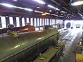
 45428LB02.jpg 3,264 × 2,448; 2.7 MB
-
 Bar counter, public bar, Railway Inn, Spofforth, North Yorkshire (1st August 2015) 001.JPG 5,152 × 3,864; 7.67 MB
-
 Bar counter, public bar, Railway Inn, Spofforth, North Yorkshire (1st August 2015) 002.JPG 3,864 × 5,152; 7.57 MB
-
 Bar counter, public bar, Railway Inn, Spofforth, North Yorkshire (1st August 2015) 003.JPG 5,152 × 3,864; 7.64 MB
-
 Borough Beck, Helmsley, alongside Castlegate - geograph.org.uk - 4636944.jpg 1,600 × 1,064; 374 KB
-
 Bransdale Road approaching the Ouse Gill bridge - geograph.org.uk - 4633881.jpg 1,600 × 1,064; 289 KB
-
 Castle Lane, Little Fryup Dale - geograph.org.uk - 4792855.jpg 1,600 × 1,064; 342 KB
-
 Easingwold railway station (site), Yorkshire (geograph 4630903).jpg 1,600 × 1,200; 372 KB
-
 East Moors, Brown Hill - geograph.org.uk - 4775747.jpg 1,600 × 1,064; 232 KB
-
 East Moors, view across Bonfield Gill to Pockley Moor - geograph.org.uk - 4775750.jpg 1,600 × 1,064; 254 KB
-

-
 East Moors, view along the lane northwards - geograph.org.uk - 4775743.jpg 1,600 × 1,064; 265 KB
-
 Esk Dale from the side of Little Fryup Dale - geograph.org.uk - 4792012.jpg 1,600 × 1,064; 314 KB
-
 Grassington Police Station (geograph 4943355).jpg 2,048 × 1,536; 1.07 MB
-
 Grosmont08LB.jpg 3,264 × 2,448; 717 KB
-
 Hallway, Railway Inn, Spofforth, North Yorkshire (1st August 2015) 001.JPG 5,152 × 3,864; 7.72 MB
-
 Hallway, Railway Inn, Spofforth, North Yorkshire (1st August 2015) 002.JPG 5,152 × 3,864; 7.78 MB
-
 Lane above Bransdale - geograph.org.uk - 4775768.jpg 1,600 × 1,064; 232 KB
-
 Lane along Shaw Ridge - geograph.org.uk - 4775956.jpg 1,600 × 1,064; 232 KB
-
 Lane down into Bransdale, from Shaw Ridge - geograph.org.uk - 4775945.jpg 1,600 × 1,064; 279 KB
-
 Looking into the head of Great Fryup Dale, from New Way - geograph.org.uk - 4814612.jpg 1,600 × 1,064; 309 KB
-
 Looking up Little Fryup Dale - geograph.org.uk - 4792010.jpg 1,600 × 1,064; 316 KB
-
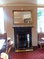
 Lounge, Railway Inn, Spofforth, North Yorkshire (1st August 2015) 001.JPG 5,152 × 3,864; 7.69 MB
-
 Lounge, Railway Inn, Spofforth, North Yorkshire (1st August 2015) 002.JPG 3,864 × 5,152; 7.7 MB
-
 Lounge, Railway Inn, Spofforth, North Yorkshire (1st August 2015) 003.JPG 5,152 × 3,864; 7.76 MB
-
 Lounge, Railway Inn, Spofforth, North Yorkshire (1st August 2015) 004.JPG 5,152 × 3,864; 7.58 MB
-
 New Way, lane at the head of Little Fryup Dale - geograph.org.uk - 4793804.jpg 1,600 × 1,064; 284 KB
-
 Path down Dargate Slack, Dalby Forest - geograph.org.uk - 4784307.jpg 1,600 × 1,064; 516 KB
-
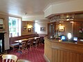
 Public bar, Railway Inn, Spofforth, North Yorkshire (1st August 2015) 001.JPG 5,152 × 3,864; 7.78 MB
-
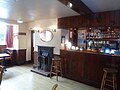 Public bar, Railway Inn, Spofforth, North Yorkshire (1st August 2015) 002.JPG 5,152 × 3,864; 7.71 MB
-
 Public bar, Railway Inn, Spofforth, North Yorkshire (1st August 2015) 003.JPG 5,152 × 3,864; 7.63 MB
-
 Public bar, Railway Inn, Spofforth, North Yorkshire (1st August 2015) 004.JPG 5,152 × 3,864; 7.73 MB
-
 Public bar, Railway Inn, Spofforth, North Yorkshire (1st August 2015) 005.JPG 5,152 × 3,864; 7.56 MB
-
 Public bar, Railway Inn, Spofforth, North Yorkshire (1st August 2015) 006.JPG 4,912 × 1,080; 2 MB
-
 Public bar, Railway Inn, Spofforth, North Yorkshire (1st August 2015) 007.JPG 4,912 × 1,080; 2.15 MB
-
 Public bar, Railway Inn, Spofforth, North Yorkshire (1st August 2015) 008.JPG 5,152 × 3,864; 7.72 MB
-
 Public bar, Railway Inn, Spofforth, North Yorkshire (1st August 2015) 009.JPG 5,152 × 3,864; 7.73 MB
-
 Public bar, Railway Inn, Spofforth, North Yorkshire (1st August 2015) 010.JPG 5,152 × 3,864; 7.65 MB
-
 Public bar, Railway Inn, Spofforth, North Yorkshire (1st August 2015) 011.JPG 4,912 × 1,080; 1.9 MB
-
 Public bar, Railway Inn, Spofforth, North Yorkshire (1st August 2015) 012.JPG 4,912 × 1,080; 2.04 MB
-
 Public bar, Railway Inn, Spofforth, North Yorkshire (1st August 2015) 013.JPG 3,864 × 5,152; 7.83 MB
-
 Public bar, Railway Inn, Spofforth, North Yorkshire (1st August 2015) 014.JPG 5,152 × 3,864; 7.64 MB
-
 Public bar, Railway Inn, Spofforth, North Yorkshire (1st August 2015) 015.JPG 3,864 × 5,152; 7.67 MB
-
 Public bar, Railway Inn, Spofforth, North Yorkshire (1st August 2015) 016.JPG 5,152 × 3,864; 7.77 MB
-
 Public bar, Railway Inn, Spofforth, North Yorkshire (1st August 2015) 017.JPG 4,912 × 1,080; 2.16 MB
-
 Railway Inn from car park, Spofforth, North Yorkshire (1st August 2015).JPG 5,152 × 3,864; 7.83 MB
-
 Road dropping into Westerdale from the Ralph Crosses - geograph.org.uk - 4789252.jpg 1,600 × 1,064; 279 KB
-
 Sign for the Railway Inn in Spofforth, North Yorkshire (1st August 2015).JPG 3,864 × 5,152; 7.59 MB
-
 South end of Rudland Rigg - geograph.org.uk - 4779253.jpg 1,600 × 1,064; 462 KB
-
 Staintondale - geograph-4610020-by-steven-ruffles.jpg 640 × 480; 98 KB
-
 Steam And Clouds.jpg 5,415 × 2,902; 9.34 MB
-
 Street life (20719484499).jpg 3,855 × 2,570; 806 KB
-
 Street life (20726980516).jpg 5,472 × 3,648; 1.77 MB
-
 Stubble field south of Moreby Far Wood - geograph.org.uk - 4629564.jpg 1,600 × 1,064; 318 KB
-
 The Cumbrian Mountain Express Running Early.jpg 5,319 × 2,454; 7.31 MB
-
 Thirn (geograph 4637349).jpg 1,600 × 1,067; 618 KB
-
 Track onto Shaw Ridge - geograph.org.uk - 4775950.jpg 1,600 × 1,064; 404 KB
-
 Track over Lambfold Hill - geograph.org.uk - 4775765.jpg 1,600 × 1,064; 300 KB
-
 Track to the Lidmoor farms - geograph.org.uk - 4776155.jpg 1,600 × 1,064; 278 KB
-
 Track to the Lidmoor farms - geograph.org.uk - 4783214.jpg 1,600 × 1,064; 317 KB
-
 Track up Bransdale below Lidmoor - geograph.org.uk - 4786352.jpg 1,600 × 1,064; 431 KB
-
-
 View across Farndale from Blakey Ridge - geograph.org.uk - 4789246.jpg 1,600 × 1,064; 443 KB
-
 View across Ouse Gill - geograph.org.uk - 4776164.jpg 1,600 × 1,064; 302 KB
-
 View into Bransdale from Shaw Ridge - geograph.org.uk - 4775967.jpg 1,600 × 1,064; 282 KB
-
 View south along Blakey Road towards Stepin Turn - geograph.org.uk - 4789244.jpg 1,600 × 1,064; 316 KB
-
 View towards the North York Moors - geograph.org.uk - 4640089.jpg 1,600 × 1,067; 227 KB
-
 View up Bransdale from below Lidmoor - geograph.org.uk - 4786379.jpg 1,600 × 1,064; 484 KB
-
 View up Bransdale from north of Lambfold Hill - geograph.org.uk - 4775769.jpg 1,600 × 1,064; 261 KB
-
 Westerdale Head, from the Ralph Crosses - geograph.org.uk - 4789415.jpg 1,600 × 1,064; 277 KB
-
 Wider Than My Widest Angle.jpg 5,738 × 2,403; 8.25 MB
-
 York Place, Harrogate - geograph.org.uk - 4595837.jpg 1,024 × 681; 262 KB


_001.JPG)
_002.JPG)
_003.JPG)


,_Yorkshire_(geograph_4630903).jpg)


.jpg)

_001.JPG)
_002.JPG)


_001.JPG)
_002.JPG)
_003.JPG)
_004.JPG)


_001.JPG)
_002.JPG)
_003.JPG)
_004.JPG)
_005.JPG)
_008.JPG)
_009.JPG)
_010.JPG)
_013.JPG)
_014.JPG)
_015.JPG)
_016.JPG)
.JPG)

.JPG)


.jpg)
.jpg)


.jpg)


_006.JPG)
_007.JPG)
_011.JPG)
_012.JPG)
_017.JPG)