Category:August 2009 in County Fermanagh
Jump to navigation
Jump to search
English: Images taken in County Fermanagh, Northern Ireland in this month of 2009 (not the date of the upload).
| Jan | Feb | Mar | Apr | May | Jun | Jul | Aug | Sep | Oct | Nov | Dec | ||
| ← | 14 | 39 | 2 | 59 | 9 | 28 | 24 | 65 | 5 | 0 | 3 | 1 | → |
|---|
Subcategories
This category has only the following subcategory.
F
Media in category "August 2009 in County Fermanagh"
The following 64 files are in this category, out of 64 total.
-
 A last look at Devenish Island - geograph.org.uk - 1428058.jpg 640 × 479; 53 KB
-
 A water pool in Doohatty Glebe - geograph.org.uk - 1453489.jpg 640 × 480; 136 KB
-
 A509 at Derryhenny - geograph.org.uk - 1464149.jpg 640 × 480; 63 KB
-
 Afternoon concert, Enniskillen - geograph.org.uk - 1428087.jpg 640 × 479; 88 KB
-
 Ancient figurehead, Devenish old priory - geograph.org.uk - 1428009.jpg 479 × 640; 125 KB
-
 Approaching Bellanaleck - geograph.org.uk - 1464155.jpg 640 × 480; 54 KB
-
 Asda Enniskillen - geograph.org.uk - 1464222.jpg 640 × 480; 67 KB
-
 Belmore Forest - geograph.org.uk - 1445556.jpg 640 × 480; 69 KB
-
 Belmore Forest - geograph.org.uk - 1445575.jpg 640 × 480; 90 KB
-
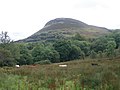 Benaughlin Mountain - geograph.org.uk - 1453570.jpg 640 × 480; 64 KB
-
 Benaughlin Mountain - geograph.org.uk - 1453652.jpg 640 × 480; 49 KB
-
 Cassan Townland - geograph.org.uk - 1464117.jpg 640 × 480; 92 KB
-
 Cattle at a feeder, County Fermanagh.jpg 3,968 × 2,976; 5.4 MB
-
 Church on the hill, Devenish - geograph.org.uk - 1427972.jpg 640 × 479; 40 KB
-
 Church wall, Devenish - geograph.org.uk - 1428041.jpg 640 × 479; 60 KB
-
 Circle of stone, Devenish - geograph.org.uk - 1428027.jpg 640 × 479; 47 KB
-
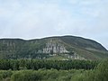
 Cliff Face of Benaughlin - geograph.org.uk - 1453505.jpg 640 × 480; 94 KB
-
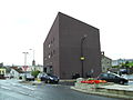
 Clinton Centre - geograph.org.uk - 1464194.jpg 640 × 480; 48 KB
-
 ClintonCentreEnniskillen.jpg 3,648 × 2,736; 2.55 MB
-
 Cross, Devenish Island - geograph.org.uk - 1427996.jpg 479 × 640; 75 KB
-
 Cuilcagh Mountainside - geograph.org.uk - 1453712.jpg 640 × 480; 38 KB
-
 Derelict Cottage In Belmore Forest - geograph.org.uk - 1445615.jpg 640 × 480; 64 KB
-
 Devenish Island - geograph.org.uk - 1428050.jpg 640 × 479; 40 KB
-
 Devenish Island, County Fermanagh - geograph.org.uk - 1428030.jpg 640 × 479; 51 KB
-
 Devenish Monastic Site - geograph.org.uk - 1427953.jpg 640 × 479; 44 KB
-
 DevenishCollegeEnniskillen.JPG 3,648 × 2,736; 2.54 MB
-
 Doohatty Glebe - geograph.org.uk - 1453469.jpg 640 × 480; 91 KB
-
 EastBridgeEnniskillen.JPG 3,648 × 2,736; 2.61 MB
-
 Edenmore Road, Tempo - geograph.org.uk - 1464256.jpg 640 × 480; 72 KB
-
 Firebreak at Belmore - geograph.org.uk - 1445590.jpg 640 × 480; 90 KB
-
 Forest Track in Belmore Forest - geograph.org.uk - 1445629.jpg 640 × 480; 46 KB
-
 Interior, Church - geograph.org.uk - 1427980.jpg 479 × 640; 95 KB
-
 Irvinestown, County Fermanagh - geograph.org.uk - 1445121.jpg 640 × 480; 58 KB
-
 Jetty, Devenish Island - geograph.org.uk - 1428055.jpg 640 × 479; 55 KB
-
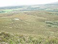 Mountainside at Florencecourt - geograph.org.uk - 1453614.jpg 640 × 480; 97 KB
-
 Museum, Devenish - geograph.org.uk - 1428046.jpg 640 × 479; 48 KB
-
 Near Portora - geograph.org.uk - 1428064.jpg 640 × 479; 67 KB
-
 Priory interior, Devenish Island - geograph.org.uk - 1428014.jpg 479 × 640; 103 KB
-
 Road at Cassan - geograph.org.uk - 1464119.jpg 640 × 480; 78 KB
-
 Road to Whilliter, Cassan - geograph.org.uk - 1464118.jpg 640 × 480; 110 KB
-
 Round Tower, Devenish Island - geograph.org.uk - 1428021.jpg 479 × 640; 58 KB
-
 Round Tower, Devenish Island - geograph.org.uk - 1752211.jpg 2,976 × 3,968; 5.23 MB
-
 Round Tower, Lough Erne - geograph.org.uk - 1427963.jpg 479 × 640; 65 KB
-
 Ruin, Devenish - geograph.org.uk - 1428032.jpg 640 × 479; 59 KB
-
 Ruined church, Devenish - geograph.org.uk - 1427978.jpg 640 × 479; 43 KB
-
 Ruined church, Devenish Island - geograph.org.uk - 1428035.jpg 640 × 479; 55 KB
-
 Sign for Inishmore - geograph.org.uk - 1464144.jpg 640 × 480; 118 KB
-
 Sign for Killesher and Florencecourt - geograph.org.uk - 1464152.jpg 640 × 480; 68 KB
-
 Signs at Corracoash - geograph.org.uk - 1464139.jpg 640 × 480; 106 KB
-
 Small arch and wall, Devenish - geograph.org.uk - 1427983.jpg 640 × 481; 103 KB
-
 Small arch detail, Devenish - geograph.org.uk - 1427988.jpg 479 × 640; 123 KB
-
 St Mary's Priory - geograph.org.uk - 1428017.jpg 640 × 265; 31 KB
-
 St Mary's Priory, Devenish - geograph.org.uk - 1428000.jpg 640 × 321; 28 KB
-
 St Mary's Priory, Devenish - geograph.org.uk - 1428005.jpg 640 × 479; 50 KB
-
 St Molaise's House, Devenish Island - geograph.org.uk - 1427969.jpg 640 × 479; 56 KB
-
 Teampull Mór - geograph.org.uk - 1427967.jpg 640 × 479; 71 KB
-
 The Final Climb - geograph.org.uk - 1453524.jpg 640 × 480; 75 KB
-
 The old Enniskillen Model School - geograph.org.uk - 1464238.jpg 640 × 480; 98 KB
-
 Timber Stack in Belmore Forest - geograph.org.uk - 1445669.jpg 640 × 480; 65 KB
-
 Triangulation Point on Benaughlin - geograph.org.uk - 1453539.jpg 640 × 480; 80 KB
-
 Up Tempo^ - geograph.org.uk - 1464253.jpg 640 × 480; 75 KB
-
 Upper Lough Erne at Carry Bridge - geograph.org.uk - 1464034.jpg 640 × 480; 97 KB
-
 Visiting Devenish Island - geograph.org.uk - 1427991.jpg 640 × 479; 51 KB
-
 Window detail, Devenish - geograph.org.uk - 1428044.jpg 479 × 640; 139 KB


