Category:August 2005 in the East Riding of Yorkshire
Jump to navigation
Jump to search
Ceremonial counties of England: Bedfordshire · Berkshire · Buckinghamshire · Cambridgeshire · Cheshire · Cornwall · Cumbria · Derbyshire · Devon · Dorset · Durham · East Riding of Yorkshire · East Sussex · Essex · Gloucestershire · Greater London · Greater Manchester · Hampshire · Herefordshire · Hertfordshire · Isle of Wight · Kent · Lancashire · Leicestershire · Lincolnshire · Merseyside · Norfolk · North Yorkshire · Northamptonshire · Northumberland · Nottinghamshire · Oxfordshire · Rutland · Shropshire · Somerset · South Yorkshire · Staffordshire · Suffolk · Surrey · Tyne and Wear · Warwickshire · West Midlands · West Sussex · West Yorkshire · Wiltshire · Worcestershire
City-counties: Bristol ·
Former historic counties:
Other former counties:
City-counties: Bristol ·
Former historic counties:
Other former counties:
Deutsch: Bilder, die im August 2005 in the East Riding of Yorkshire aufgenommen worden sind. Bitte beachten Sie, dass dies weder das Datum des Uploads noch das Datum des Scannens eines Fotos ist.
English: Images/pictures taken in the East Riding of Yorkshire during August 2005. Note this is not the date of the upload, nor the date a photo was scanned.
Español: Fotografías o imágenes tomadas en the East Riding of Yorkshire durante agosto 2005. No es la fecha de subida ni escaneo, sino la fecha en que las fotografías o imágenes se crearon.
Esperanto: Bildoj faritaj en the East Riding of Yorkshire en aŭgusto 2005. Tio ne estas la dato, kiam la bildoj estis alŝutitaj aŭ skanitaj.
Français : Photographies ou images prises en the East Riding of Yorkshire durant août 2005. Ce n'est pas la date du téléchargement ou du scan.
Galego: Fotografías ou imaxes tomadas en the East Riding of Yorkshire durante agosto 2005. Non é a data de subida nin escaneamento, senón a data na que se crearon as fotografías ou imaxes.
Italiano: Fotografie o immagini scattate a the East Riding of Yorkshire nel agosto 2005. Nota bene: la data non si riferisce né a quella di upload né a quella in cui la foto è stata digitalizzata.
Norsk bokmål: Bilder tatt i the East Riding of Yorkshire i løpet av august 2005. Merk at dette ikke er datoen for opplasting, eller når et bilde har blitt skannet.
Norsk nynorsk: Bilete teke i the East Riding of Yorkshire i løpet av august 2005. Merk at dette ikkje er datoen for opplasting, eller når eit bilete har vorte skanna.
Русский: Изображения, сделанные в the East Riding of Yorkshire в течение август 2005 (не дата загрузки изображения).
Українська: Зображення, зроблені в the East Riding of Yorkshire протягом серпень 2005. Зауважте, що це не дата завантаження чи дата сканування фотографії.
| August 2004 | ← | August 2005 | → | August 2006 | |||||||
| Jan | Feb | Mar | Apr | May | Jun | Jul | Aug | Sep | Oct | Nov | Dec |
| 23 | 27 | 22 | 43 | 206 | 113 | 137 | 242 | 129 | 235 | 161 | 120 |
|---|---|---|---|---|---|---|---|---|---|---|---|
Media in category "August 2005 in the East Riding of Yorkshire"
The following 200 files are in this category, out of 242 total.
(previous page) (next page)-
 11 Ladygate Beverly East Yorkshire.jpg 2,048 × 3,072; 1.37 MB
-
 11,000V Power Lines - geograph.org.uk - 45483.jpg 640 × 475; 62 KB
-
 South Cave main street - geograph.org.uk - 32942.jpg 640 × 480; 118 KB
-
 A bend in the road - geograph.org.uk - 45513.jpg 640 × 477; 91 KB
-
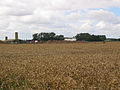
 A grid square of wheat - geograph.org.uk - 37818.jpg 640 × 480; 126 KB
-
 A Swan - geograph.org.uk - 40864.jpg 479 × 640; 125 KB
-
 A164 Road Junction - geograph.org.uk - 46099.jpg 640 × 480; 92 KB
-
 A165 - Farmland - geograph.org.uk - 41137.jpg 640 × 480; 129 KB
-
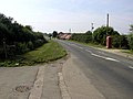
 A614, Woodside, near Market Weighton - geograph.org.uk - 120105.jpg 640 × 480; 113 KB
-
 Agricultural Trailer - geograph.org.uk - 41149.jpg 640 × 480; 134 KB
-
 Aike, East Riding of Yorkshire, England (August 2005).jpg 640 × 480; 103 KB
-
 All Hallows Church, Goodmanham - geograph.org.uk - 120102.jpg 480 × 640; 113 KB
-

-
 All Saints Parish Church, Tunstall - geograph.org.uk - 45860.jpg 640 × 480; 102 KB
-
 Arctic corsair.jpg 640 × 480; 82 KB
-
 Arnold Manor, Arnold.jpg 640 × 480; 124 KB
-
 Bail Wood - geograph.org.uk - 45932.jpg 640 × 480; 132 KB
-
 Balk Hill Water Tower - geograph.org.uk - 40966.jpg 640 × 480; 76 KB
-
 Barff Hill Farm and Trig Pillar - geograph.org.uk - 46014.jpg 640 × 480; 135 KB
-
 Bassymoor - geograph.org.uk - 41171.jpg 640 × 480; 134 KB
-
 Bempton Cliffs - geograph.org.uk - 45067.jpg 640 × 480; 113 KB
-
 Bend in the road - geograph.org.uk - 40972.jpg 640 × 480; 89 KB
-
 Bend in the road - geograph.org.uk - 45489.jpg 640 × 480; 96 KB
-
 Beverley and Barmston Drain - geograph.org.uk - 46030.jpg 480 × 640; 86 KB
-
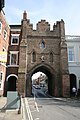 Beverley Bar viewed from North Bar Without.JPG 2,048 × 3,072; 3.19 MB
-
 Beverley Minster from the Westwood.jpg 640 × 480; 122 KB
-
 Beverley Road - Haworth Arms - geograph.org.uk - 39701.jpg 640 × 480; 103 KB
-
 St John the Baptist, Bewholme.jpg 640 × 480; 101 KB
-
 Bewholme - geograph.org.uk - 41155.jpg 640 × 480; 93 KB
-
 Black Swan - Cross Hill - geograph.org.uk - 41141.jpg 640 × 480; 90 KB
-
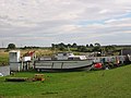 Boat House - River Hull - geograph.org.uk - 46070.jpg 640 × 480; 80 KB
-
 Bonfield Farm - geograph.org.uk - 41165.jpg 640 × 480; 110 KB
-
 Brantingham Wold - geograph.org.uk - 120096.jpg 480 × 640; 96 KB
-
 Bryan Mills Farm - geograph.org.uk - 46001.jpg 640 × 480; 106 KB
-
 Burton Pidsea main road - geograph.org.uk - 45247.jpg 640 × 441; 74 KB
-
 Burton Pidsea Village - geograph.org.uk - 45258.jpg 640 × 480; 65 KB
-
 Burton Pidsea Windmill - geograph.org.uk - 45244.jpg 640 × 480; 130 KB
-
 Byway crossing the A165 - geograph.org.uk - 37805.jpg 640 × 480; 167 KB
-
 Carr House Farm - geograph.org.uk - 41139.jpg 640 × 480; 119 KB
-
 Carr Lane - Drain - geograph.org.uk - 41138.jpg 480 × 640; 137 KB
-
 Catfoss - geograph.org.uk - 34965.jpg 640 × 480; 108 KB
-
 Catfoss Hall - geograph.org.uk - 41181.jpg 640 × 480; 110 KB
-
 Catfoss Lane Industrial Estate - geograph.org.uk - 34947.jpg 640 × 480; 98 KB
-
 Catfoss Lane.jpg 640 × 480; 75 KB
-
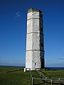 Chalk Tower Flamborough Head 058031.jpg 1,200 × 1,600; 306 KB
-
 Chicken Run - geograph.org.uk - 41153.jpg 640 × 480; 108 KB
-
 Chowder Ness - geograph.org.uk - 46158.jpg 640 × 480; 90 KB
-
 Church Farm - geograph.org.uk - 41148.jpg 640 × 480; 149 KB
-

-
 Coast road to Tunstall - geograph.org.uk - 45850.jpg 640 × 480; 96 KB
-
 Coastal Defence Bunker - geograph.org.uk - 53868.jpg 640 × 480; 114 KB
-
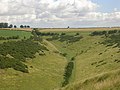
 Comber Dale on the Wolds Way - geograph.org.uk - 120098.jpg 640 × 480; 122 KB
-
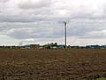
 Communication mast - geograph.org.uk - 45435.jpg 480 × 640; 57 KB
-
 Corn Power - geograph.org.uk - 40935.jpg 640 × 480; 103 KB
-
 Cottage Farm, Routh - geograph.org.uk - 37755.jpg 640 × 480; 96 KB
-
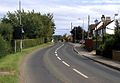
 Cottingham - Level Crossing - geograph.org.uk - 41669.jpg 640 × 480; 144 KB
-
 Cottingham Road, Roundabout - geograph.org.uk - 41665.jpg 640 × 480; 106 KB
-
 Criftins Farm - geograph.org.uk - 35336.jpg 640 × 480; 98 KB
-
 Danthorpe.jpg 640 × 469; 136 KB
-
 Decoy Farm - geograph.org.uk - 45990.jpg 640 × 480; 109 KB
-
 Deep Ditch - Wawne Common - geograph.org.uk - 34890.jpg 480 × 640; 132 KB
-
 Derelict Farmhouse - geograph.org.uk - 41001.jpg 640 × 480; 115 KB
-
 Distant wind farm - geograph.org.uk - 40937.jpg 640 × 480; 114 KB
-
 Ellerby Grange - geograph.org.uk - 37815.jpg 640 × 480; 113 KB
-
 Elstronwick Village - geograph.org.uk - 45474.jpg 640 × 480; 110 KB
-
 End of the road^ - geograph.org.uk - 40983.jpg 640 × 480; 136 KB
-
 Farm - North Frodingham - geograph.org.uk - 41143.jpg 640 × 480; 114 KB
-
 Farm - Tunstall to North End Road - geograph.org.uk - 45871.jpg 640 × 480; 86 KB
-
 Farm at North End - geograph.org.uk - 45874.jpg 640 × 480; 84 KB
-
 Farm at TA2822332771 - geograph.org.uk - 45881.jpg 640 × 480; 87 KB
-
 Farm Buildings - Tunstall - geograph.org.uk - 45853.jpg 640 × 480; 98 KB
-
 Farm near Brandesburton - geograph.org.uk - 41147.jpg 640 × 480; 138 KB
-
 Farm near Skirlaugh - geograph.org.uk - 41188.jpg 640 × 480; 97 KB
-
 Farm road, Grimston - geograph.org.uk - 45920.jpg 640 × 480; 80 KB
-
 Farmhouse - geograph.org.uk - 45514.jpg 640 × 480; 134 KB
-
 Farmland - Bewholme, Seaton Road - geograph.org.uk - 41160.jpg 640 × 480; 127 KB
-
 Farmland - geograph.org.uk - 40976.jpg 640 × 480; 100 KB
-
 Farmland - TA1139 - geograph.org.uk - 34896.jpg 640 × 480; 86 KB
-
 Farmland at TA0432548241 - geograph.org.uk - 46081.jpg 640 × 480; 127 KB
-
 Farmland near Hollym - geograph.org.uk - 45970.jpg 640 × 480; 95 KB
-
 Farmland near Long Riston - geograph.org.uk - 37787.jpg 640 × 480; 119 KB
-
 Farmland near Routh - geograph.org.uk - 37757.jpg 640 × 480; 104 KB
-
 Farmland near Wawne - geograph.org.uk - 34873.jpg 640 × 480; 112 KB
-
 Farmland north of Patrington - geograph.org.uk - 45976.jpg 640 × 480; 100 KB
-
 Fieldhouse Farm - geograph.org.uk - 37812.jpg 640 × 480; 133 KB
-
 Flamborough Head - geograph.org.uk - 53865.jpg 640 × 480; 101 KB
-

-
 Footbridge on the Wolds Way, Nunburnholme - geograph.org.uk - 120110.jpg 640 × 480; 188 KB
-
 Fridaythorpe - geograph.org.uk - 120149.jpg 640 × 480; 116 KB
-
 Frodingham Hall - geograph.org.uk - 45978.jpg 640 × 480; 156 KB
-
 Ganstead East - geograph.org.uk - 39702.jpg 640 × 480; 115 KB
-
 Gargill Close Plantation - geograph.org.uk - 45506.jpg 640 × 480; 75 KB
-
 Glebe Farm - geograph.org.uk - 45852.jpg 640 × 480; 112 KB
-
 Golf Course - geograph.org.uk - 41192.jpg 640 × 480; 110 KB
-
 Great Cowden - geograph.org.uk - 45938.jpg 640 × 480; 77 KB
-
 Great Hatfield 1.jpg 640 × 480; 106 KB
-
 Grimston.jpg 640 × 480; 135 KB
-
 Grovehill Bridge - geograph.org.uk - 37750.jpg 640 × 480; 129 KB
-
 Head of Swindale, on the Wolds Way - geograph.org.uk - 120099.jpg 640 × 480; 99 KB
-
 High Warrendale Farm, near Kilnwick Percy - geograph.org.uk - 120114.jpg 640 × 480; 145 KB
-
 Highthorns Farm - geograph.org.uk - 41144.jpg 640 × 480; 89 KB
-
 Hill Farm, Marton.jpg 640 × 480; 109 KB
-
 Hilston.jpg 640 × 480; 108 KB
-
 Holderness farmland - geograph.org.uk - 40940.jpg 640 × 480; 113 KB
-
 Holderness flat agricultural land - geograph.org.uk - 38755.jpg 640 × 480; 141 KB
-
 Holderness Flatlands - geograph.org.uk - 38751.jpg 640 × 480; 90 KB
-
 Holderness flatlands - geograph.org.uk - 38753.jpg 640 × 480; 124 KB
-
 Holderness Plain - geograph.org.uk - 38752.jpg 640 × 480; 83 KB
-
 Holmpton Cliffs - geograph.org.uk - 40987.jpg 640 × 480; 104 KB
-
 Holmpton Village.jpg 640 × 480; 98 KB
-
 Hornsea - geograph.org.uk - 40853.jpg 640 × 479; 97 KB
-
 Hornsea Freeport Shopping Village 1.jpg 640 × 479; 135 KB
-
 Hornsea Mere - geograph.org.uk - 45942.jpg 640 × 480; 126 KB
-
 Horse Dale - geograph.org.uk - 120147.jpg 640 × 480; 107 KB
-
 Hull Bridge - geograph.org.uk - 37749.jpg 480 × 640; 117 KB
-
 Humber Bridge South Tower base - geograph.org.uk - 115143.jpg 640 × 480; 80 KB
-
 Hunt Hill Farm - geograph.org.uk - 46051.jpg 640 × 480; 107 KB
-
 Kenley House Farm - geograph.org.uk - 34856.jpg 640 × 480; 77 KB
-
 Kilnwick Level Crossing - geograph.org.uk - 46092.jpg 640 × 480; 114 KB
-
 Lay-by on the A165 - geograph.org.uk - 37800.jpg 640 × 480; 98 KB
-
 Little Newsome Farm - geograph.org.uk - 45977.jpg 640 × 480; 134 KB
-
 Lockington Crossing - geograph.org.uk - 46003.jpg 640 × 480; 89 KB
-
 Londesborough Park 01.jpg 640 × 480; 123 KB
-
 Long flat road - geograph.org.uk - 38746.jpg 640 × 480; 64 KB
-
 Long Riston - geograph.org.uk - 35339.jpg 640 × 480; 104 KB
-
 Long, flat road - geograph.org.uk - 38748.jpg 640 × 480; 96 KB
-
 Long, straight, flat road - geograph.org.uk - 38749.jpg 640 × 480; 90 KB
-
 Looking towards Owstwick - geograph.org.uk - 45308.jpg 640 × 480; 98 KB
-
 Lord Mayor's Whins - geograph.org.uk - 34958.jpg 640 × 480; 119 KB
-
 Lowfield Lane - geograph.org.uk - 45523.jpg 640 × 480; 121 KB
-
 Main Road from Newton to Sutton on Derwent - geograph.org.uk - 46211.jpg 640 × 483; 101 KB
-
 Manor House Farm - geograph.org.uk - 41146.jpg 640 × 480; 127 KB
-
 Marker at the beginning of the Wolds Way - geograph.org.uk - 120094.jpg 480 × 640; 125 KB
-
 Marton - geograph.org.uk - 37826.jpg 640 × 480; 81 KB
-
 Meaux Abbey Farm - geograph.org.uk - 37761.jpg 640 × 480; 107 KB
-
 Meteorite Fall Site - geograph.org.uk - 567677.jpg 480 × 640; 88 KB
-
 Mill House Farm - geograph.org.uk - 37841.jpg 640 × 480; 82 KB
-
 Millington Dale - geograph.org.uk - 120123.jpg 640 × 480; 176 KB
-
 Minor Road Junction - geograph.org.uk - 40994.jpg 640 × 480; 94 KB
-
 Minor road scene - geograph.org.uk - 40997.jpg 640 × 480; 113 KB
-
 Minster Way Trail at TA0302045979 - geograph.org.uk - 45986.jpg 640 × 480; 125 KB
-
 Near Danthorpe Hall - geograph.org.uk - 45466.jpg 640 × 480; 98 KB
-
 New Ellerby, Byway - geograph.org.uk - 37838.jpg 640 × 480; 126 KB
-
 New Picnic Area - geograph.org.uk - 41954.jpg 640 × 426; 123 KB
-
 Nunkeeling - geograph.org.uk - 41150.jpg 640 × 480; 137 KB
-
 Old Mill at Garton.jpg 640 × 480; 84 KB
-
 On the Humbleton to Garton road. - geograph.org.uk - 45549.jpg 640 × 480; 86 KB
-
 On the road to Fitling - geograph.org.uk - 45547.jpg 640 × 480; 93 KB
-
 On the road to Welwick - geograph.org.uk - 40914.jpg 640 × 467; 105 KB
-
 On the Wolds Way, near Kilnwick Percy - geograph.org.uk - 120115.jpg 640 × 480; 124 KB
-
 Out Newton middle turbines - geograph.org.uk - 40960.jpg 640 × 480; 68 KB
-
 Out Newton Road - geograph.org.uk - 40949.jpg 640 × 480; 95 KB
-
 Parish Church of St. Nicholas, Hollym - geograph.org.uk - 45972.jpg 640 × 480; 112 KB
-
 Parish Church of St. Peter, Wawne - geograph.org.uk - 34868.jpg 640 × 480; 137 KB
-
 Pasture Dale - geograph.org.uk - 120124.jpg 640 × 480; 137 KB
-
 Pasture House - geograph.org.uk - 35342.jpg 480 × 640; 86 KB
-
 Patrington Haven.jpg 640 × 480; 86 KB
-
 Pond in Walkington.jpg 640 × 480; 169 KB
-

-
 Priory Road - geograph.org.uk - 41681.jpg 640 × 480; 126 KB
-
 Priory Road - Pasture Land - geograph.org.uk - 41679.jpg 640 × 480; 132 KB
-
 Priory Road, Cottingham. - geograph.org.uk - 41673.jpg 640 × 480; 111 KB
-
 Raywell House, Skidby (geograph 3388076).jpg 640 × 422; 161 KB
-
 Redcliff Sand - geograph.org.uk - 136090.jpg 640 × 480; 52 KB
-
 Rich Holderness farmland - geograph.org.uk - 38754.jpg 640 × 480; 95 KB
-
 Riston Grange - geograph.org.uk - 41140.jpg 640 × 480; 137 KB
-
 River Hull at Wawne.jpg 640 × 480; 76 KB
-
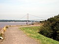
 River Humber west from Humber Bridge - geograph.org.uk - 136091.jpg 640 × 480; 55 KB
-
 Road to High Fosham - geograph.org.uk - 37834.jpg 640 × 480; 84 KB
-
 Road to Scorborough Level Crossing. - geograph.org.uk - 45998.jpg 640 × 480; 96 KB
-
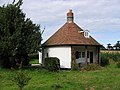 Round house - geograph.org.uk - 41174.jpg 640 × 480; 106 KB
-
 Routh - geograph.org.uk - 37756.jpg 640 × 480; 95 KB
-
 Rowton Farm - geograph.org.uk - 41136.jpg 640 × 480; 129 KB
-
 Seaton Farm - geograph.org.uk - 41161.jpg 640 × 480; 130 KB
-
 Sewerby Cliff Front - geograph.org.uk - 47028.jpg 640 × 480; 83 KB
-
 Sheep Trod Lane - geograph.org.uk - 40927.jpg 640 × 480; 124 KB
-
 Sigglesthorne Road Junction - geograph.org.uk - 41178.jpg 640 × 480; 93 KB
-
 Signpost on the Wolds Way - geograph.org.uk - 120112.jpg 640 × 480; 147 KB
-
 Skeffling main road - geograph.org.uk - 40946.jpg 640 × 480; 128 KB
-
 South Bomar - geograph.org.uk - 45848.jpg 640 × 480; 96 KB
-
 South eastern Holderness view - geograph.org.uk - 38756.jpg 640 × 471; 79 KB
-
 St Elgins Church North Frodingham.jpg 640 × 480; 106 KB
-
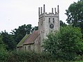
 St Leonards, Scorborough.jpg 480 × 640; 95 KB
-
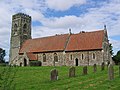
 St Margaret's Church Beswick.jpg 640 × 480; 107 KB
-
 St Mary's Church, Fridaythorpe.jpg 640 × 480; 116 KB
-
 St. Albans, Withernwick - geograph.org.uk - 45962.jpg 640 × 480; 103 KB
-
 Straw Bales - geograph.org.uk - 45539.jpg 640 × 480; 88 KB
-
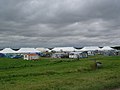 Summer Camp - geograph.org.uk - 53871.jpg 640 × 480; 67 KB
-
 Sutton on Derwent - geograph.org.uk - 46214.jpg 640 × 483; 112 KB
-
 Sutton on Hull - geograph.org.uk - 39178.jpg 480 × 640; 76 KB
-
 Swindale on the Wolds Way - geograph.org.uk - 120100.jpg 640 × 480; 124 KB
-
 Sylvan Dale, near Millington - geograph.org.uk - 120121.jpg 640 × 480; 121 KB
-
 The Alma Public house - geograph.org.uk - 1409402.jpg 640 × 480; 78 KB
-
 The Burton Pidsea to Burstwick road - geograph.org.uk - 46339.jpg 640 × 480; 93 KB
-
 The Burton Pidsea to Roos road - geograph.org.uk - 46344.jpg 640 × 480; 65 KB
-
 The exit from Danes Dyke - geograph.org.uk - 47039.jpg 640 × 480; 71 KB
-
 The Fitling to Owstwick road - geograph.org.uk - 45531.jpg 640 × 480; 88 KB
-
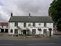 The Green Dragon, Welton - geograph.org.uk - 120095.jpg 640 × 480; 116 KB
-
 The Holmpton to Withernsea road - geograph.org.uk - 40992.jpg 640 × 480; 87 KB
-
 The Land Train, Sewerby to Bridlington - geograph.org.uk - 769468.jpg 640 × 310; 119 KB


.jpg)


.jpg)


